Property Information
mobile view
| Serial Number: 36:093:0022 |
Serial Life: 2007... |
|
|
Total Photos: 3
|
| |
|
|
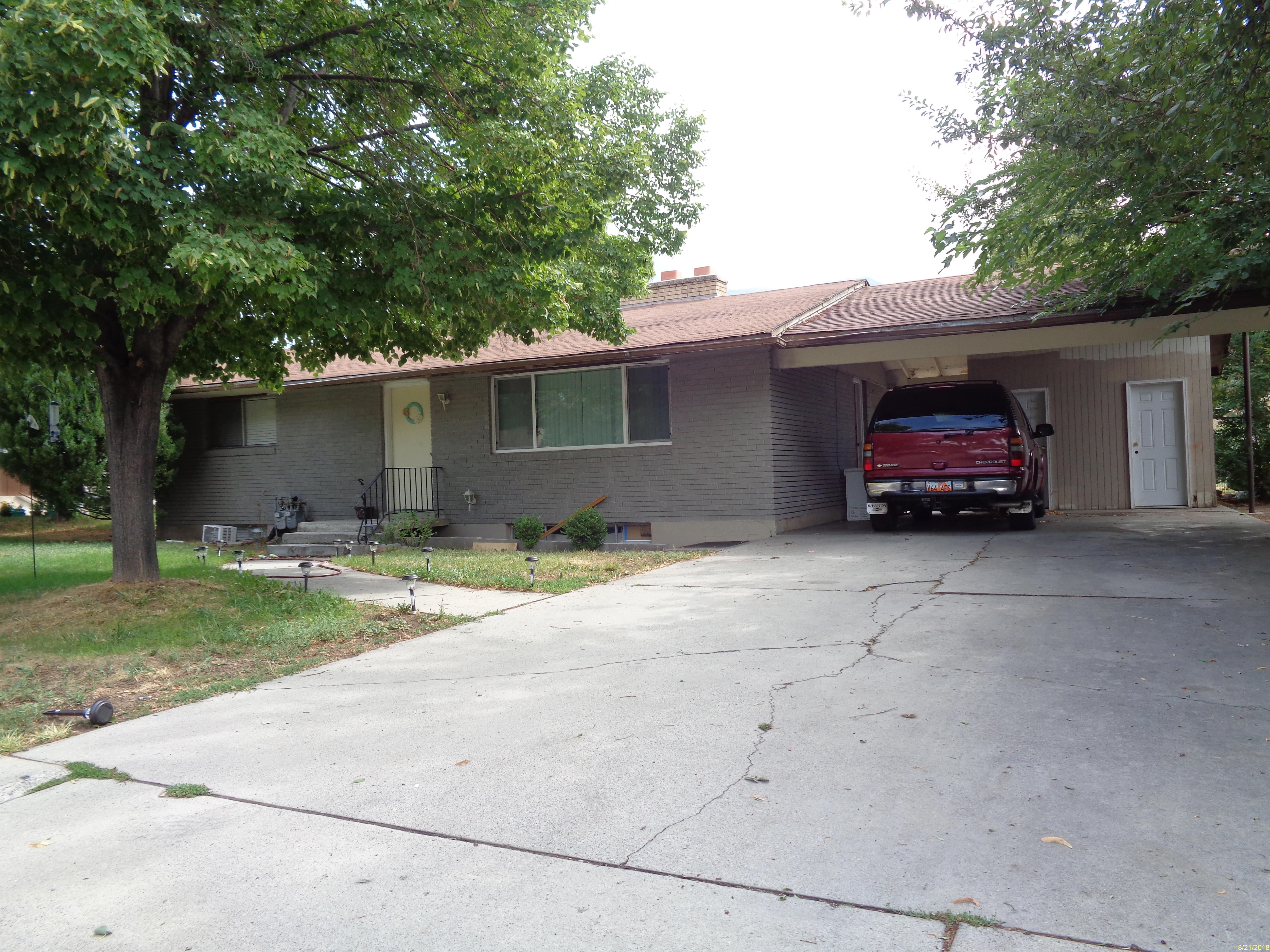
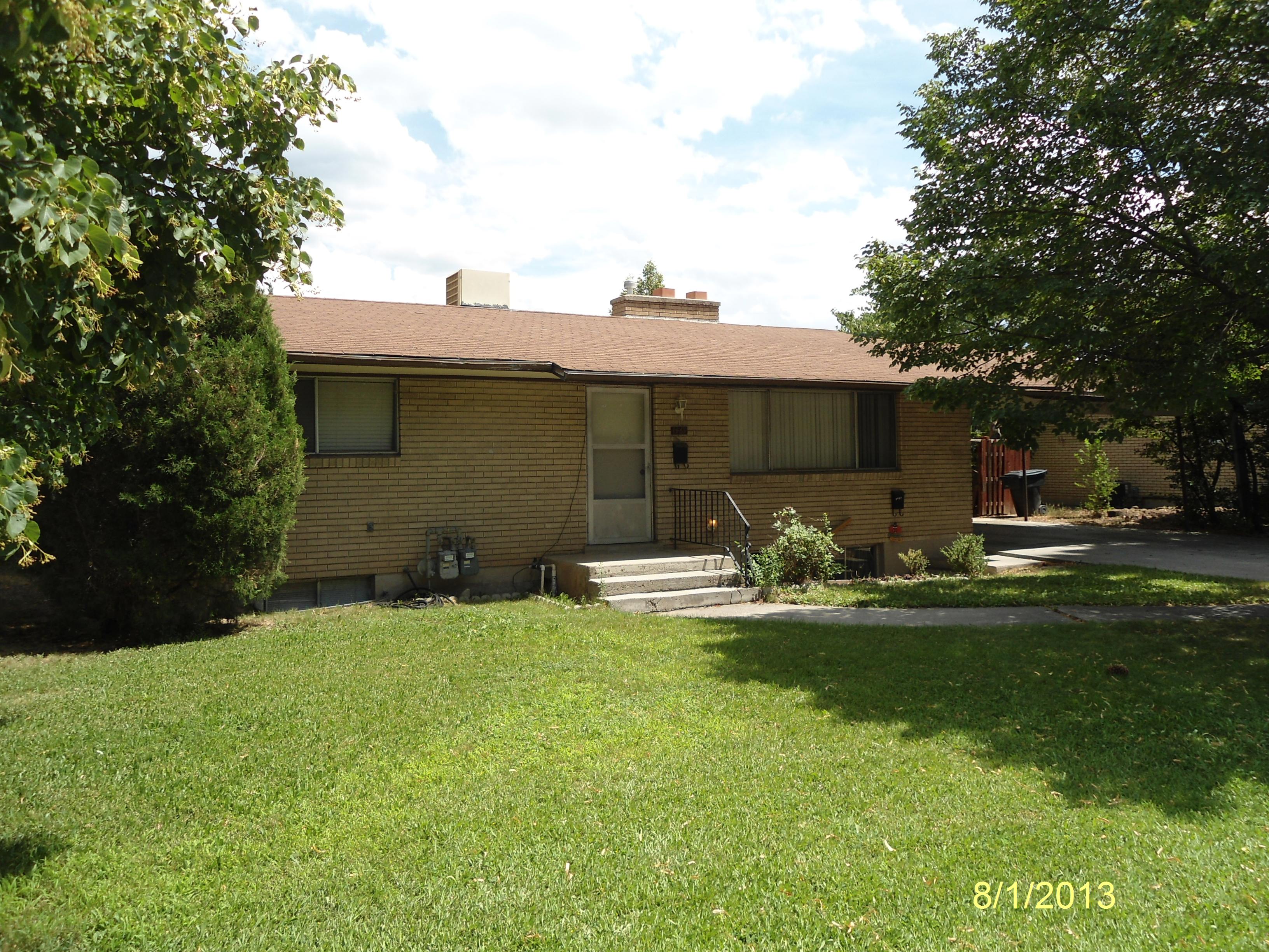
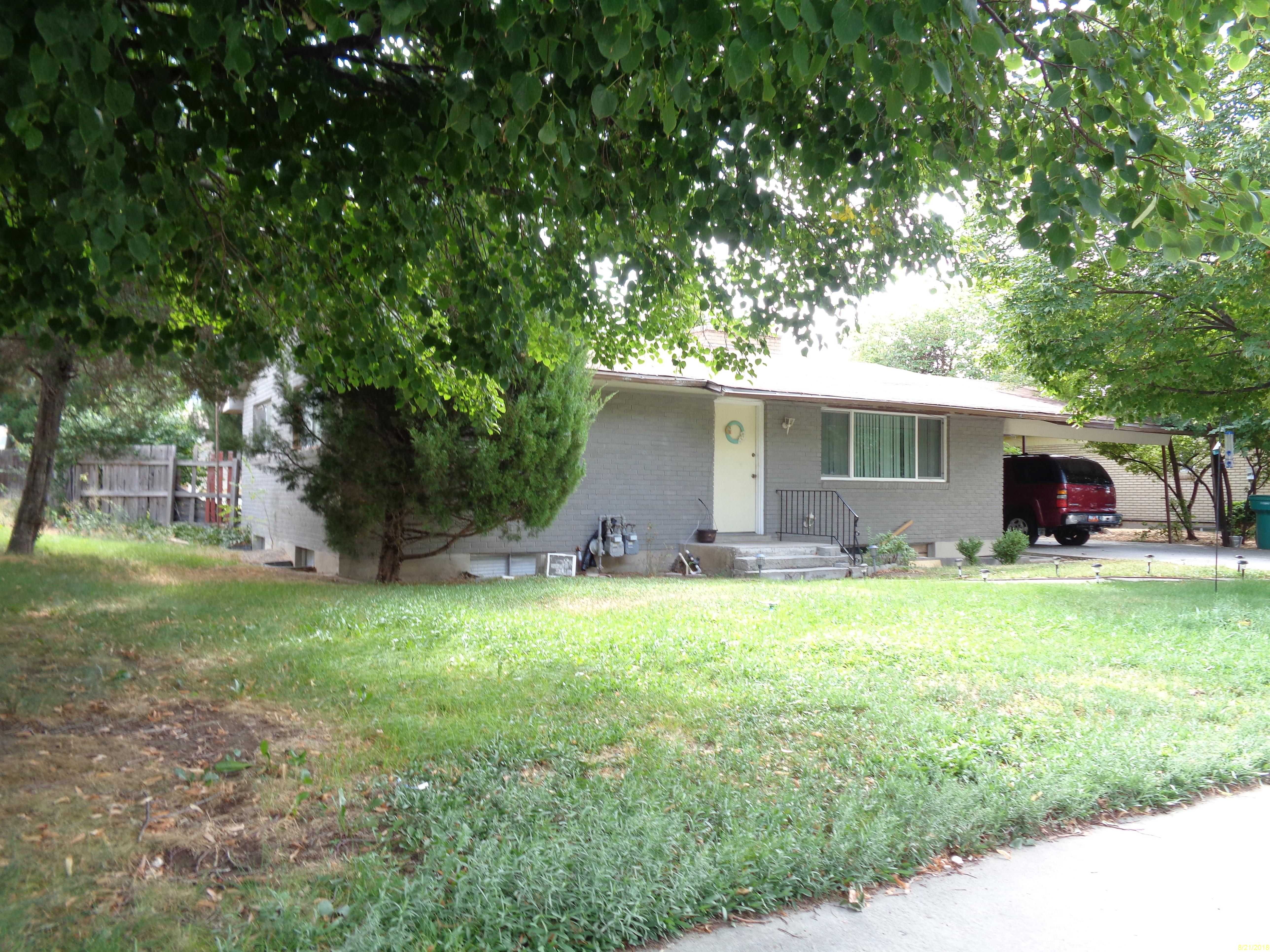
| Property Address: 1469 S 320 EAST - OREM |
|
| Mailing Address: 1008 N 840 E OREM, UT 84058 |
|
| Acreage: 0.210857 |
|
| Last Document:
10267-2006
|
|
| Subdivision Map Filing |
|
| Taxing Description:
LOT 17, PLAT B, CLEON ACRES SUBDV. AREA 0.197 AC. ALSO THE SOUTH 5 FT OF LOT 18, PLAT B, CLEON ACRES SUBDV. AREA 0.014 AC. TOTAL AREA .211 AC.
*Taxing description NOT FOR LEGAL DOCUMENTS
|
|
- Owner Names
- Value History
- Tax History
- Location
- Photos
- Documents
- Aerial Image
| |
----- Real Estate Values ----- |
---Improvements--- |
---Greenbelt--- |
Total |
| Year |
Com |
Res |
Agr |
Tot |
Com |
Res |
Agr |
Tot |
Land |
Homesite |
Tot |
Market Value |
| 2024 |
$0 |
$153,200 |
$0 |
$153,200 |
$0 |
$357,500 |
$0 |
$357,500 |
$0 |
$0 |
$0 |
$510,700 |
| 2023 |
$0 |
$176,900 |
$0 |
$176,900 |
$0 |
$328,700 |
$0 |
$328,700 |
$0 |
$0 |
$0 |
$505,600 |
| 2022 |
$0 |
$168,500 |
$0 |
$168,500 |
$0 |
$313,000 |
$0 |
$313,000 |
$0 |
$0 |
$0 |
$481,500 |
| 2021 |
$0 |
$134,800 |
$0 |
$134,800 |
$0 |
$250,400 |
$0 |
$250,400 |
$0 |
$0 |
$0 |
$385,200 |
| 2020 |
$0 |
$120,400 |
$0 |
$120,400 |
$0 |
$223,600 |
$0 |
$223,600 |
$0 |
$0 |
$0 |
$344,000 |
| 2019 |
$0 |
$127,900 |
$0 |
$127,900 |
$0 |
$192,100 |
$0 |
$192,100 |
$0 |
$0 |
$0 |
$320,000 |
| 2018 |
$0 |
$167,000 |
$0 |
$167,000 |
$0 |
$152,900 |
$0 |
$152,900 |
$0 |
$0 |
$0 |
$319,900 |
| 2017 |
$0 |
$82,400 |
$0 |
$82,400 |
$0 |
$192,300 |
$0 |
$192,300 |
$0 |
$0 |
$0 |
$274,700 |
| 2016 |
$0 |
$68,100 |
$0 |
$68,100 |
$0 |
$158,900 |
$0 |
$158,900 |
$0 |
$0 |
$0 |
$227,000 |
| 2015 |
$0 |
$61,900 |
$0 |
$61,900 |
$0 |
$144,500 |
$0 |
$144,500 |
$0 |
$0 |
$0 |
$206,400 |
| 2014 |
$0 |
$55,200 |
$0 |
$55,200 |
$0 |
$128,800 |
$0 |
$128,800 |
$0 |
$0 |
$0 |
$184,000 |
| 2013 |
$0 |
$73,300 |
$0 |
$73,300 |
$0 |
$80,000 |
$0 |
$80,000 |
$0 |
$0 |
$0 |
$153,300 |
| 2012 |
$0 |
$61,500 |
$0 |
$61,500 |
$0 |
$79,200 |
$0 |
$79,200 |
$0 |
$0 |
$0 |
$140,700 |
| 2011 |
$0 |
$67,000 |
$0 |
$67,000 |
$0 |
$78,000 |
$0 |
$78,000 |
$0 |
$0 |
$0 |
$145,000 |
| 2010 |
$0 |
$72,001 |
$0 |
$72,001 |
$0 |
$82,164 |
$0 |
$82,164 |
$0 |
$0 |
$0 |
$154,165 |
| 2009 |
$0 |
$96,000 |
$0 |
$96,000 |
$0 |
$62,900 |
$0 |
$62,900 |
$0 |
$0 |
$0 |
$158,900 |
| 2008 |
$0 |
$96,000 |
$0 |
$96,000 |
$0 |
$82,500 |
$0 |
$82,500 |
$0 |
$0 |
$0 |
$178,500 |
| 2007 |
$0 |
$100,000 |
$0 |
$100,000 |
$0 |
$85,900 |
$0 |
$85,900 |
$0 |
$0 |
$0 |
$185,900 |
| Year |
General Taxes |
Adjustments |
Net Taxes |
Fees |
Payments |
Tax Balance* |
Balance Due |
Tax District |
| 2025 |
$0.00 |
$0.00 |
$0.00 |
$0.00 |
|
$0.00
|
$0.00 |
090 - OREM CITY |
| 2024 |
$0.00 |
$0.00 |
$0.00 |
$0.00 |
|
$0.00
|
$0.00 |
090 - OREM CITY |
| 2023 |
$2,115.91 |
$0.00 |
$2,115.91 |
$0.00 |
|
$0.00
|
$0.00 |
090 - OREM CITY |
| 2022 |
$2,079.94 |
$0.00 |
$2,079.94 |
$0.00 |
|
$0.00
|
$0.00 |
090 - OREM CITY |
| 2021 |
$1,997.42 |
$0.00 |
$1,997.42 |
$0.00 |
|
$0.00
|
$0.00 |
090 - OREM CITY |
| 2020 |
$1,815.00 |
$0.00 |
$1,815.00 |
$0.00 |
|
$0.00
|
$0.00 |
090 - OREM CITY |
| 2019 |
$1,623.60 |
$0.00 |
$1,623.60 |
$0.00 |
|
$0.00
|
$0.00 |
090 - OREM CITY |
| 2018 |
$1,698.75 |
$0.00 |
$1,698.75 |
$0.00 |
|
$0.00
|
$0.00 |
090 - OREM CITY |
| 2017 |
$1,497.71 |
$0.00 |
$1,497.71 |
$0.00 |
|
$0.00
|
$0.00 |
090 - OREM CITY |
| 2016 |
$1,342.14 |
$0.00 |
$1,342.14 |
$0.00 |
|
$0.00
|
$0.00 |
090 - OREM CITY |
| 2015 |
$1,290.38 |
$0.00 |
$1,290.38 |
$0.00 |
|
$0.00
|
$0.00 |
090 - OREM CITY |
| 2014 |
$1,155.60 |
$0.00 |
$1,155.60 |
$0.00 |
|
$0.00
|
$0.00 |
090 - OREM CITY |
| 2013 |
$1,038.25 |
$0.00 |
$1,038.25 |
$0.00 |
|
$0.00
|
$0.00 |
090 - OREM CITY |
| 2012 |
$972.57 |
$0.00 |
$972.57 |
$0.00 |
|
$0.00
|
$0.00 |
090 - OREM CITY |
| 2011 |
$997.51 |
$0.00 |
$997.51 |
$0.00 |
|
$0.00
|
$0.00 |
090 - OREM CITY |
| 2010 |
$992.90 |
$0.00 |
$992.90 |
$0.00 |
|
$0.00
|
$0.00 |
090 - OREM CITY |
| 2009 |
$948.67 |
$0.00 |
$948.67 |
$0.00 |
|
$0.00
|
$0.00 |
090 - OREM CITY |
| 2008 |
$987.54 |
$0.00 |
$987.54 |
$0.00 |
|
$0.00
|
$0.00 |
090 - OREM CITY |
| 2007 |
$1,016.72 |
$0.00 |
$1,016.72 |
$0.00 |
|
$0.00
|
$0.00 |
090 - OREM CITY |
* Note: Original tax amount (Does not include applicable interest and/or fees).
| Entry # |
Date |
Recorded |
Type |
Party1 (Grantor) |
Party2 (Grantee) |
| 40135-2023 |
06/20/2023 |
06/21/2023 |
D TR |
ROBERTS, DONALD & MELANIE |
SECURITY HOME MORTGAGE LLC |
| 40134-2023 |
06/20/2023 |
06/21/2023 |
SP WD |
ROBERTS, MELANIE R & DONALD F |
ROBERTS, DONALD & MELANIE |
| 22600-2022 |
02/18/2022 |
02/22/2022 |
RSUBTEE |
JPMORGAN CHASE BANK (ET AL) |
ROBERTS, MELANIE R & DONALD S |
| 10267-2006 |
01/27/2006 |
01/27/2006 |
N SPREC |
UTAH COUNTY RECORDER |
WHOM OF INTEREST |
Main Menu Comments or Concerns on Value/Appraisal - Assessor's Office
Documents/Owner/Parcel information - Recorder's Office
Address Change for Tax Notice
This page was created on 5/18/2024 8:44:01 AM |
