Property Information
mobile view
| Serial Number: 12:024:0012 |
Serial Life: 1981... |
|
|
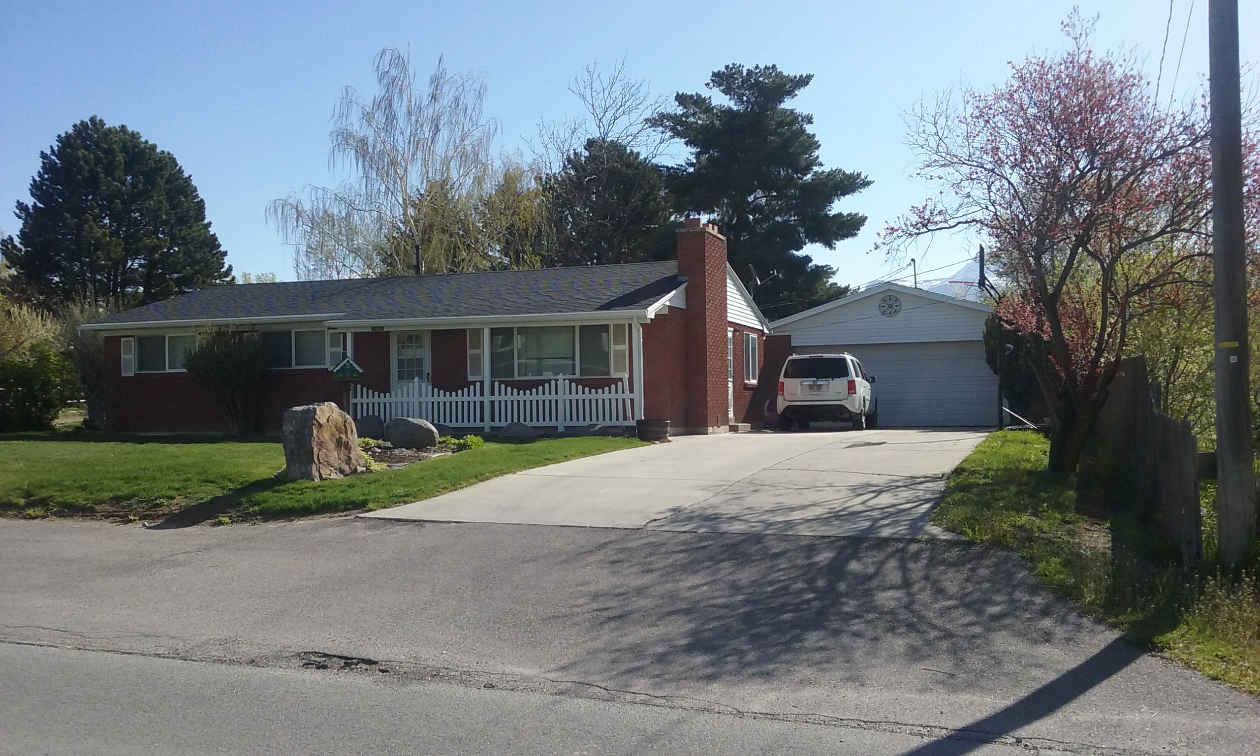 Total Photos: 2
|
| |
|
|
| Property Address: 1950 N 600 WEST - LEHI |
|
| Mailing Address: 1950 N 600 W LEHI, UT 84043-2866 |
|
| Acreage: 0.38 |
|
| Last Document:
99263-2012
|
|
| Subdivision Map Filing |
|
| Taxing Description:
COM. S 11' E ALONG 1/4 SEC LINE 589.85 FT & E 33 FT FROM CEN OF SEC 5, T5S R1E, SLB&M; N 89 43' E 236.50 FT; S 2 44' E 70.08 FT; S 89 43' W 240.30 FT N 21' E 70 FT TO BEG. AREA .38 OF AC.
*Taxing description NOT FOR LEGAL DOCUMENTS
|
|
- Owner Names
- Value History
- Tax History
- Location
- Photos
- Documents
- Aerial Image
| 2021... |
|
DORTON, CHRIS R |
|
| 2021... |
|
DORTON, LACEY J |
|
| 2013-2020 |
|
SMITH, ALISON L |
|
| 2013-2020 |
|
SMITH, TREV R |
|
| 2005-2012 |
|
SMITH, JULIA A |
|
| 2005-2012 |
|
SMITH, RICHARD M |
|
| 2005NV |
|
SMITH, JULIA H |
|
| 2005NV |
|
SMITH, RICHARD M |
|
| 2005NV |
|
SMITH, JULIA H |
|
| 2005NV |
|
SMITH, RICHARD M |
|
| 1983-2004 |
|
SMITH, JULIA H |
|
| 1983-2004 |
|
SMITH, RICHARD M |
|
| 1981-1982 |
|
SMITH, JULIA H |
|
| 1981-1982 |
|
SMITH, RICHARD M |
|
| |
----- Real Estate Values ----- |
---Improvements--- |
---Greenbelt--- |
Total |
| Year |
Com |
Res |
Agr |
Tot |
Com |
Res |
Agr |
Tot |
Land |
Homesite |
Tot |
Market Value |
| 2024 |
$0 |
$241,000 |
$0 |
$241,000 |
$0 |
$274,500 |
$0 |
$274,500 |
$0 |
$0 |
$0 |
$515,500 |
| 2023 |
$0 |
$234,000 |
$0 |
$234,000 |
$0 |
$281,100 |
$0 |
$281,100 |
$0 |
$0 |
$0 |
$515,100 |
| 2022 |
$0 |
$203,500 |
$0 |
$203,500 |
$0 |
$334,200 |
$0 |
$334,200 |
$0 |
$0 |
$0 |
$537,700 |
| 2021 |
$0 |
$127,200 |
$0 |
$127,200 |
$0 |
$272,400 |
$0 |
$272,400 |
$0 |
$0 |
$0 |
$399,600 |
| 2020 |
$0 |
$117,800 |
$0 |
$117,800 |
$0 |
$254,600 |
$0 |
$254,600 |
$0 |
$0 |
$0 |
$372,400 |
| 2019 |
$0 |
$117,800 |
$0 |
$117,800 |
$0 |
$221,400 |
$0 |
$221,400 |
$0 |
$0 |
$0 |
$339,200 |
| 2018 |
$0 |
$102,100 |
$0 |
$102,100 |
$0 |
$197,900 |
$0 |
$197,900 |
$0 |
$0 |
$0 |
$300,000 |
| 2017 |
$0 |
$82,400 |
$0 |
$82,400 |
$0 |
$181,400 |
$0 |
$181,400 |
$0 |
$0 |
$0 |
$263,800 |
| 2016 |
$0 |
$67,300 |
$0 |
$67,300 |
$0 |
$157,700 |
$0 |
$157,700 |
$0 |
$0 |
$0 |
$225,000 |
| 2015 |
$0 |
$67,300 |
$0 |
$67,300 |
$0 |
$137,100 |
$0 |
$137,100 |
$0 |
$0 |
$0 |
$204,400 |
| 2014 |
$0 |
$67,300 |
$0 |
$67,300 |
$0 |
$127,800 |
$0 |
$127,800 |
$0 |
$0 |
$0 |
$195,100 |
| 2013 |
$0 |
$57,600 |
$0 |
$57,600 |
$0 |
$127,800 |
$0 |
$127,800 |
$0 |
$0 |
$0 |
$185,400 |
| 2012 |
$0 |
$50,100 |
$0 |
$50,100 |
$0 |
$118,300 |
$0 |
$118,300 |
$0 |
$0 |
$0 |
$168,400 |
| 2011 |
$0 |
$48,600 |
$0 |
$48,600 |
$0 |
$125,100 |
$0 |
$125,100 |
$0 |
$0 |
$0 |
$173,700 |
| 2010 |
$0 |
$37,400 |
$0 |
$37,400 |
$0 |
$151,068 |
$0 |
$151,068 |
$0 |
$0 |
$0 |
$188,468 |
| 2009 |
$0 |
$37,400 |
$0 |
$37,400 |
$0 |
$164,000 |
$0 |
$164,000 |
$0 |
$0 |
$0 |
$201,400 |
| 2008 |
$0 |
$51,200 |
$0 |
$51,200 |
$0 |
$199,200 |
$0 |
$199,200 |
$0 |
$0 |
$0 |
$250,400 |
| 2007 |
$0 |
$52,800 |
$0 |
$52,800 |
$0 |
$205,400 |
$0 |
$205,400 |
$0 |
$0 |
$0 |
$258,200 |
| 2006 |
$0 |
$56,000 |
$0 |
$56,000 |
$0 |
$100,500 |
$0 |
$100,500 |
$0 |
$0 |
$0 |
$156,500 |
| 2005 |
$0 |
$52,800 |
$0 |
$52,800 |
$0 |
$94,800 |
$0 |
$94,800 |
$0 |
$0 |
$0 |
$147,600 |
| 2004 |
$0 |
$44,742 |
$0 |
$44,742 |
$0 |
$103,070 |
$0 |
$103,070 |
$0 |
$0 |
$0 |
$147,812 |
| 2003 |
$0 |
$44,742 |
$0 |
$44,742 |
$0 |
$103,070 |
$0 |
$103,070 |
$0 |
$0 |
$0 |
$147,812 |
| 2002 |
$0 |
$44,742 |
$0 |
$44,742 |
$0 |
$103,070 |
$0 |
$103,070 |
$0 |
$0 |
$0 |
$147,812 |
| 2001 |
$0 |
$44,742 |
$0 |
$44,742 |
$0 |
$103,070 |
$0 |
$103,070 |
$0 |
$0 |
$0 |
$147,812 |
| 2000 |
$0 |
$41,815 |
$0 |
$41,815 |
$0 |
$92,348 |
$0 |
$92,348 |
$0 |
$0 |
$0 |
$134,163 |
| 1999 |
$0 |
$41,815 |
$0 |
$41,815 |
$0 |
$92,348 |
$0 |
$92,348 |
$0 |
$0 |
$0 |
$134,163 |
| 1998 |
$0 |
$37,004 |
$0 |
$37,004 |
$0 |
$81,724 |
$0 |
$81,724 |
$0 |
$0 |
$0 |
$118,728 |
| 1997 |
$0 |
$37,004 |
$0 |
$37,004 |
$0 |
$81,724 |
$0 |
$81,724 |
$0 |
$0 |
$0 |
$118,728 |
| 1996 |
$0 |
$31,903 |
$0 |
$31,903 |
$0 |
$70,458 |
$0 |
$70,458 |
$0 |
$0 |
$0 |
$102,361 |
| 1995 |
$0 |
$29,003 |
$0 |
$29,003 |
$0 |
$70,458 |
$0 |
$70,458 |
$0 |
$0 |
$0 |
$99,461 |
| 1994 |
$0 |
$16,961 |
$0 |
$16,961 |
$0 |
$56,821 |
$0 |
$56,821 |
$0 |
$0 |
$0 |
$73,782 |
| 1993 |
$0 |
$16,961 |
$0 |
$16,961 |
$0 |
$56,821 |
$0 |
$56,821 |
$0 |
$0 |
$0 |
$73,782 |
| 1992 |
$0 |
$15,561 |
$0 |
$15,561 |
$0 |
$52,129 |
$0 |
$52,129 |
$0 |
$0 |
$0 |
$67,690 |
| 1991 |
$0 |
$13,650 |
$0 |
$13,650 |
$0 |
$44,358 |
$0 |
$44,358 |
$0 |
$0 |
$0 |
$58,008 |
| 1990 |
$0 |
$13,650 |
$0 |
$13,650 |
$0 |
$44,358 |
$0 |
$44,358 |
$0 |
$0 |
$0 |
$58,008 |
| 1989 |
$0 |
$13,650 |
$0 |
$13,650 |
$0 |
$43,645 |
$0 |
$43,645 |
$0 |
$0 |
$0 |
$57,295 |
| 1988 |
$0 |
$13,650 |
$0 |
$13,650 |
$0 |
$45,612 |
$0 |
$45,612 |
$0 |
$0 |
$0 |
$59,262 |
| 1987 |
$0 |
$13,650 |
$0 |
$13,650 |
$0 |
$53,492 |
$0 |
$53,492 |
$0 |
$0 |
$0 |
$67,142 |
| 1986 |
$0 |
$13,650 |
$0 |
$13,650 |
$0 |
$53,493 |
$0 |
$53,493 |
$0 |
$0 |
$0 |
$67,143 |
| 1985 |
$0 |
$13,650 |
$0 |
$13,650 |
$0 |
$53,491 |
$0 |
$53,491 |
$0 |
$0 |
$0 |
$67,141 |
| 1984 |
$0 |
$13,792 |
$0 |
$13,792 |
$0 |
$54,033 |
$0 |
$54,033 |
$0 |
$0 |
$0 |
$67,825 |
| Year |
General Taxes |
Adjustments |
Net Taxes |
Fees |
Payments |
Tax Balance* |
Balance Due |
Tax District |
| 2025 |
$0.00 |
$0.00 |
$0.00 |
$0.00 |
|
$0.00
|
$0.00 |
010 - LEHI CITY |
| 2024 |
$2,422.72 |
$0.00 |
$2,422.72 |
$0.00 |
|
$0.00
|
$0.00 |
010 - LEHI CITY |
| 2023 |
$2,229.61 |
$0.00 |
$2,229.61 |
$0.00 |
|
$0.00
|
$0.00 |
010 - LEHI CITY |
| 2022 |
$2,400.78 |
$0.00 |
$2,400.78 |
$0.00 |
|
$0.00
|
$0.00 |
010 - LEHI CITY |
| 2021 |
$2,145.71 |
$0.00 |
$2,145.71 |
$0.00 |
|
$0.00
|
$0.00 |
010 - LEHI CITY |
| 2020 |
$2,023.01 |
$0.00 |
$2,023.01 |
$0.00 |
|
$0.00
|
$0.00 |
010 - LEHI CITY |
| 2019 |
$1,772.51 |
$0.00 |
$1,772.51 |
$0.00 |
|
$0.00
|
$0.00 |
010 - LEHI CITY |
| 2018 |
$1,658.25 |
$0.00 |
$1,658.25 |
$0.00 |
|
$0.00
|
$0.00 |
010 - LEHI CITY |
| 2017 |
$1,508.50 |
$0.00 |
$1,508.50 |
$0.00 |
|
$0.00
|
$0.00 |
010 - LEHI CITY |
| 2016 |
$1,386.74 |
$0.00 |
$1,386.74 |
$0.00 |
|
$0.00
|
$0.00 |
010 - LEHI CITY |
| 2015 |
$1,327.12 |
$0.00 |
$1,327.12 |
$0.00 |
|
$0.00
|
$0.00 |
010 - LEHI CITY |
| 2014 |
$1,274.25 |
$0.00 |
$1,274.25 |
$0.00 |
|
$0.00
|
$0.00 |
010 - LEHI CITY |
| 2013 |
$1,312.97 |
$0.00 |
$1,312.97 |
$0.00 |
|
$0.00
|
$0.00 |
010 - LEHI CITY |
| 2012 |
$1,225.73 |
$0.00 |
$1,225.73 |
$0.00 |
|
$0.00
|
$0.00 |
010 - LEHI CITY |
| 2011 |
$1,256.29 |
$0.00 |
$1,256.29 |
$0.00 |
|
$0.00
|
$0.00 |
010 - LEHI CITY |
| 2010 |
$1,279.44 |
$0.00 |
$1,279.44 |
$0.00 |
|
$0.00
|
$0.00 |
010 - LEHI CITY |
| 2009 |
$1,214.70 |
$0.00 |
$1,214.70 |
$0.00 |
|
$0.00
|
$0.00 |
010 - LEHI CITY |
| 2008 |
$1,429.40 |
$0.00 |
$1,429.40 |
$0.00 |
|
$0.00
|
$0.00 |
010 - LEHI CITY |
| 2007 |
$1,434.73 |
$0.00 |
$1,434.73 |
$0.00 |
|
$0.00
|
$0.00 |
010 - LEHI CITY |
| 2006 |
$959.31 |
$0.00 |
$959.31 |
$0.00 |
|
$0.00
|
$0.00 |
010 - LEHI CITY |
| 2005 |
$1,021.24 |
$0.00 |
$1,021.24 |
$0.00 |
|
$0.00
|
$0.00 |
010 - LEHI CITY |
| 2004 |
$1,008.41 |
$0.00 |
$1,008.41 |
$0.00 |
|
$0.00
|
$0.00 |
010 - LEHI CITY |
| 2003 |
$995.32 |
$0.00 |
$995.32 |
$0.00 |
|
$0.00
|
$0.00 |
010 - LEHI CITY |
| 2002 |
$910.04 |
$0.00 |
$910.04 |
$0.00 |
|
$0.00
|
$0.00 |
010 - LEHI CITY |
| 2001 |
$905.97 |
$0.00 |
$905.97 |
$0.00 |
|
$0.00
|
$0.00 |
010 - LEHI CITY |
| 2000 |
$834.33 |
$0.00 |
$834.33 |
$0.00 |
|
$0.00
|
$0.00 |
010 - LEHI CITY |
| 1999 |
$803.12 |
$0.00 |
$803.12 |
$0.00 |
|
$0.00
|
$0.00 |
010 - LEHI CITY |
| 1998 |
$683.30 |
$0.00 |
$683.30 |
$0.00 |
|
$0.00
|
$0.00 |
010 - LEHI CITY |
| 1997 |
$676.83 |
$0.00 |
$676.83 |
$0.00 |
|
$0.00
|
$0.00 |
010 - LEHI CITY |
| 1996 |
$547.73 |
$0.00 |
$547.73 |
$0.00 |
|
$0.00
|
$0.00 |
010 - LEHI CITY |
| 1995 |
$594.58 |
$0.00 |
$594.58 |
$0.00 |
|
$0.00
|
$0.00 |
010 - LEHI CITY |
| 1994 |
$704.50 |
$0.00 |
$704.50 |
$0.00 |
|
$0.00
|
$0.00 |
010 - LEHI CITY |
| 1993 |
$627.58 |
$0.00 |
$627.58 |
$0.00 |
|
$0.00
|
$0.00 |
010 - LEHI CITY |
| 1992 |
$572.91 |
$0.00 |
$572.91 |
$0.00 |
|
$0.00
|
$0.00 |
010 - LEHI CITY |
| 1991 |
$520.03 |
$0.00 |
$520.03 |
$0.00 |
|
$0.00
|
$0.00 |
010 - LEHI CITY |
| 1990 |
$505.16 |
$0.00 |
$505.16 |
$0.00 |
|
$0.00
|
$0.00 |
010 - LEHI CITY |
| 1989 |
$514.55 |
$0.00 |
$514.55 |
$0.00 |
|
$0.00
|
$0.00 |
010 - LEHI CITY |
| 1988 |
$532.54 |
$0.00 |
$532.54 |
$0.00 |
|
$0.00
|
$0.00 |
010 - LEHI CITY |
| 1987 |
$600.00 |
$0.00 |
$600.00 |
$0.00 |
|
$0.00
|
$0.00 |
010 - LEHI CITY |
| 1986 |
$593.00 |
$0.00 |
$593.00 |
$0.00 |
|
$0.00
|
$0.00 |
010 - LEHI CITY |
| 1985 |
$599.84 |
$0.00 |
$599.84 |
$0.00 |
|
$0.00
|
$0.00 |
010 - LEHI CITY |
| 1984 |
$591.30 |
$0.00 |
$591.30 |
$0.00 |
|
$0.00
|
$0.00 |
010 - LEHI CITY |
* Note: Original tax amount (Does not include applicable interest and/or fees).
| Entry # |
Date |
Recorded |
Type |
Party1 (Grantor) |
Party2 (Grantee) |
| 124294-2020 |
08/20/2020 |
08/20/2020 |
REC |
MOUNTAIN AMERICA FEDERAL CREDIT UNION TEE |
SMITH, TREV R & ALISON L |
| 72666-2020 |
05/28/2020 |
05/28/2020 |
D TR |
DORTON, CHRIS R & LACEY J |
UNITED WHOLESALE MORTGAGE LLC |
| 72650-2020 |
05/27/2020 |
05/28/2020 |
WD |
SMITH, TREY R & ALISON L |
DORTON, CHRIS R & LACEY J |
| 40555-2020 |
02/21/2020 |
03/30/2020 |
RSUBTEE |
SMITH, RICHARD M TEE (ET AL) |
SMITH, TREV R & ALISON L ` |
| 32697-2020 |
06/03/2020 |
03/13/2020 |
D TR |
SMITH, ALISON L & TREV R |
MOUNTAIN AMERICA FEDERAL CREDIT UNION |
| 99264-2012 |
11/09/2012 |
11/13/2012 |
TR D |
SMITH, TREV R & ALISON L |
SMITH, RICHARD M TEE |
| 99263-2012 |
11/09/2012 |
11/13/2012 |
WD |
SMITH, RICHARD M TEE (ET AL) |
SMITH, TREV R & ALISON L |
| 7441-2012 |
01/05/2011 |
01/31/2012 |
REC |
BANK OF AMERICAN FORK TEE |
SMITH, RAYMOND J & MARCIA ANN |
| 114949-2008 |
10/20/2008 |
10/22/2008 |
CT |
STATE OF UTAH |
WHOM OF INTEREST |
| 107508-2008 |
09/30/2008 |
09/30/2008 |
RESOL |
BOARD OF COUNTY COMMISSIONERS UTAH COUNTY |
WHOM OF INTEREST |
| 127798-2004 |
11/09/2004 |
11/12/2004 |
QCD |
SMITH, RICHARD M & JULIA H |
SMITH, RICHARD M & JULIA A TEE |
| 76846-1995 |
11/06/1995 |
11/08/1995 |
RESOL |
UTAH COUNTY COMMISSIONERS |
WHOM OF INTEREST |
| 32052-1983 |
10/07/1983 |
10/20/1983 |
REL |
DESERET FEDERAL SAVINGS & LOAN ASSOCIATION |
SMITH, RICHARD M & JULIA H |
Main Menu Comments or Concerns on Value/Appraisal - Assessor's Office
Documents/Owner/Parcel information - Recorder's Office
Address Change for Tax Notice
This page was created on 3/9/2025 7:34:54 PM |
