Property Information
mobile view
| Serial Number: 14:048:0127 |
Serial Life: 1983... |
|
|
 Total Photos: 3
|
| |
|
|
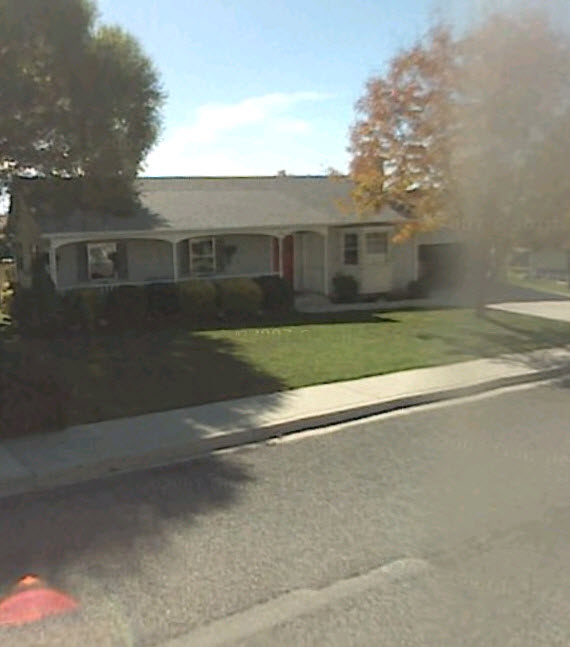
| Property Address: 1060 E 550 SOUTH - PLEASANT GROVE |
|
| Mailing Address: 1060 E 550 S PLEASANT GROVE, UT 84062-3104 |
|
| Acreage: 0.62 |
|
| Last Document:
17964-1983
|
|
| Subdivision Map Filing |
|
| Taxing Description:
COM N 575.63 FT & W 21.65 FT FR E1/4 COR SEC 28, T5S, R2E, SLM; S 76 DEG 46'32"W 112.29 FT; N 13 DEG 15'28"W 95.83 FT; N 76 DEG 16'32"E 134.10 FT; S 30'00"E 98.80 FT TO BEG. AREA .27 ACRE.
*Taxing description NOT FOR LEGAL DOCUMENTS
|
|
- Owner Names
- Value History
- Tax History
- Location
- Photos
- Documents
- Aerial Image
| 2011... |
|
BIESINGER, GERALD G |
|
| 2011... |
|
BIESINGER, MARLENE K |
|
| 1986-2010 |
|
BIESINGER, GERALD G |
|
| 1986-2010 |
|
BIESINGER, MARLENE |
|
| 1985 |
|
HUNSAKER, ELAINE |
|
| 1985NV |
|
HUNSAKER, ELAINE |
|
| 1985NV |
|
HUNSAKER, ELAINE |
|
| 1984 |
|
HUNSAKER, ELAINE |
|
| 1983 |
|
HUNSAKER, ELAINE |
|
| 1983 |
|
LOADER, CAROL |
|
| 1983 |
|
LOADER, DALE N |
|
| 1983 |
|
LOADER, ELVIN E |
|
| 1983 |
|
LOADER, RETTA |
|
| 1983 |
|
LOADER, VIRGINIA |
|
| |
----- Real Estate Values ----- |
---Improvements--- |
---Greenbelt--- |
Total |
| Year |
Com |
Res |
Agr |
Tot |
Com |
Res |
Agr |
Tot |
Land |
Homesite |
Tot |
Market Value |
| 2024 |
$0 |
$206,200 |
$0 |
$206,200 |
$0 |
$298,700 |
$0 |
$298,700 |
$0 |
$0 |
$0 |
$504,900 |
| 2023 |
$0 |
$206,100 |
$0 |
$206,100 |
$0 |
$298,200 |
$0 |
$298,200 |
$0 |
$0 |
$0 |
$504,300 |
| 2022 |
$0 |
$217,400 |
$0 |
$217,400 |
$0 |
$304,400 |
$0 |
$304,400 |
$0 |
$0 |
$0 |
$521,800 |
| 2021 |
$0 |
$155,300 |
$0 |
$155,300 |
$0 |
$222,200 |
$0 |
$222,200 |
$0 |
$0 |
$0 |
$377,500 |
| 2020 |
$0 |
$138,700 |
$0 |
$138,700 |
$0 |
$202,000 |
$0 |
$202,000 |
$0 |
$0 |
$0 |
$340,700 |
| 2019 |
$0 |
$127,500 |
$0 |
$127,500 |
$0 |
$202,000 |
$0 |
$202,000 |
$0 |
$0 |
$0 |
$329,500 |
| 2018 |
$0 |
$123,700 |
$0 |
$123,700 |
$0 |
$202,000 |
$0 |
$202,000 |
$0 |
$0 |
$0 |
$325,700 |
| 2017 |
$0 |
$105,000 |
$0 |
$105,000 |
$0 |
$178,500 |
$0 |
$178,500 |
$0 |
$0 |
$0 |
$283,500 |
| 2016 |
$0 |
$67,500 |
$0 |
$67,500 |
$0 |
$169,900 |
$0 |
$169,900 |
$0 |
$0 |
$0 |
$237,400 |
| 2015 |
$0 |
$67,500 |
$0 |
$67,500 |
$0 |
$160,200 |
$0 |
$160,200 |
$0 |
$0 |
$0 |
$227,700 |
| 2014 |
$0 |
$66,700 |
$0 |
$66,700 |
$0 |
$142,600 |
$0 |
$142,600 |
$0 |
$0 |
$0 |
$209,300 |
| 2013 |
$0 |
$60,100 |
$0 |
$60,100 |
$0 |
$129,700 |
$0 |
$129,700 |
$0 |
$0 |
$0 |
$189,800 |
| 2012 |
$0 |
$47,200 |
$0 |
$47,200 |
$0 |
$149,100 |
$0 |
$149,100 |
$0 |
$0 |
$0 |
$196,300 |
| 2011 |
$0 |
$45,000 |
$0 |
$45,000 |
$0 |
$157,300 |
$0 |
$157,300 |
$0 |
$0 |
$0 |
$202,300 |
| 2010 |
$0 |
$50,000 |
$0 |
$50,000 |
$0 |
$169,447 |
$0 |
$169,447 |
$0 |
$0 |
$0 |
$219,447 |
| 2009 |
$0 |
$81,800 |
$0 |
$81,800 |
$0 |
$145,600 |
$0 |
$145,600 |
$0 |
$0 |
$0 |
$227,400 |
| 2008 |
$0 |
$102,200 |
$0 |
$102,200 |
$0 |
$155,200 |
$0 |
$155,200 |
$0 |
$0 |
$0 |
$257,400 |
| 2007 |
$0 |
$102,200 |
$0 |
$102,200 |
$0 |
$155,200 |
$0 |
$155,200 |
$0 |
$0 |
$0 |
$257,400 |
| 2006 |
$0 |
$36,000 |
$0 |
$36,000 |
$0 |
$186,400 |
$0 |
$186,400 |
$0 |
$0 |
$0 |
$222,400 |
| 2005 |
$0 |
$36,029 |
$0 |
$36,029 |
$0 |
$122,247 |
$0 |
$122,247 |
$0 |
$0 |
$0 |
$158,276 |
| 2004 |
$0 |
$36,029 |
$0 |
$36,029 |
$0 |
$122,247 |
$0 |
$122,247 |
$0 |
$0 |
$0 |
$158,276 |
| 2003 |
$0 |
$36,029 |
$0 |
$36,029 |
$0 |
$122,247 |
$0 |
$122,247 |
$0 |
$0 |
$0 |
$158,276 |
| 2002 |
$0 |
$36,029 |
$0 |
$36,029 |
$0 |
$122,247 |
$0 |
$122,247 |
$0 |
$0 |
$0 |
$158,276 |
| 2001 |
$0 |
$36,029 |
$0 |
$36,029 |
$0 |
$122,247 |
$0 |
$122,247 |
$0 |
$0 |
$0 |
$158,276 |
| 2000 |
$0 |
$33,672 |
$0 |
$33,672 |
$0 |
$112,102 |
$0 |
$112,102 |
$0 |
$0 |
$0 |
$145,774 |
| 1999 |
$0 |
$33,672 |
$0 |
$33,672 |
$0 |
$112,102 |
$0 |
$112,102 |
$0 |
$0 |
$0 |
$145,774 |
| 1998 |
$0 |
$29,798 |
$0 |
$29,798 |
$0 |
$99,205 |
$0 |
$99,205 |
$0 |
$0 |
$0 |
$129,003 |
| 1997 |
$0 |
$29,798 |
$0 |
$29,798 |
$0 |
$99,205 |
$0 |
$99,205 |
$0 |
$0 |
$0 |
$129,003 |
| 1996 |
$0 |
$28,048 |
$0 |
$28,048 |
$0 |
$93,378 |
$0 |
$93,378 |
$0 |
$0 |
$0 |
$121,426 |
| 1995 |
$0 |
$25,498 |
$0 |
$25,498 |
$0 |
$93,378 |
$0 |
$93,378 |
$0 |
$0 |
$0 |
$118,876 |
| 1994 |
$0 |
$14,911 |
$0 |
$14,911 |
$0 |
$75,305 |
$0 |
$75,305 |
$0 |
$0 |
$0 |
$90,216 |
| 1993 |
$0 |
$14,911 |
$0 |
$14,911 |
$0 |
$75,305 |
$0 |
$75,305 |
$0 |
$0 |
$0 |
$90,216 |
| 1992 |
$0 |
$13,680 |
$0 |
$13,680 |
$0 |
$69,087 |
$0 |
$69,087 |
$0 |
$0 |
$0 |
$82,767 |
| 1991 |
$0 |
$12,000 |
$0 |
$12,000 |
$0 |
$54,837 |
$0 |
$54,837 |
$0 |
$0 |
$0 |
$66,837 |
| 1990 |
$0 |
$12,000 |
$0 |
$12,000 |
$0 |
$54,837 |
$0 |
$54,837 |
$0 |
$0 |
$0 |
$66,837 |
| 1989 |
$0 |
$12,000 |
$0 |
$12,000 |
$0 |
$54,837 |
$0 |
$54,837 |
$0 |
$0 |
$0 |
$66,837 |
| 1988 |
$0 |
$12,000 |
$0 |
$12,000 |
$0 |
$55,155 |
$0 |
$55,155 |
$0 |
$0 |
$0 |
$67,155 |
| 1987 |
$0 |
$12,000 |
$0 |
$12,000 |
$0 |
$58,000 |
$0 |
$58,000 |
$0 |
$0 |
$0 |
$70,000 |
| 1986 |
$0 |
$12,000 |
$0 |
$12,000 |
$0 |
$58,001 |
$0 |
$58,001 |
$0 |
$0 |
$0 |
$70,001 |
| 1985 |
$0 |
$0 |
$21,531 |
$21,531 |
$0 |
$0 |
$0 |
$0 |
$0 |
$0 |
$0 |
$21,531 |
| 1984 |
$0 |
$0 |
$21,713 |
$21,713 |
$0 |
$0 |
$0 |
$0 |
$0 |
$0 |
$0 |
$21,713 |
| Year |
General Taxes |
Adjustments |
Net Taxes |
Fees |
Payments |
Tax Balance* |
Balance Due |
Tax District |
| 2025 |
$0.00 |
$0.00 |
$0.00 |
$0.00 |
|
$0.00
|
$0.00 |
070 - PLEASANT GROVE CITY |
| 2024 |
$2,379.57 |
$0.00 |
$2,379.57 |
$0.00 |
|
$0.00
|
$0.00 |
070 - PLEASANT GROVE CITY |
| 2023 |
$2,270.23 |
($52.70) |
$2,217.53 |
$0.00 |
|
$0.00
|
$0.00 |
070 - PLEASANT GROVE CITY |
| 2022 |
$2,360.78 |
$0.00 |
$2,360.78 |
$0.00 |
|
$0.00
|
$0.00 |
070 - PLEASANT GROVE CITY |
| 2021 |
$2,039.50 |
$0.00 |
$2,039.50 |
$0.00 |
|
$0.00
|
$0.00 |
070 - PLEASANT GROVE CITY |
| 2020 |
$1,877.60 |
$0.00 |
$1,877.60 |
$0.00 |
|
$0.00
|
$0.00 |
070 - PLEASANT GROVE CITY |
| 2019 |
$1,755.89 |
$0.00 |
$1,755.89 |
$0.00 |
|
$0.00
|
$0.00 |
070 - PLEASANT GROVE CITY |
| 2018 |
$1,835.60 |
$0.00 |
$1,835.60 |
$0.00 |
|
$0.00
|
$0.00 |
070 - PLEASANT GROVE CITY |
| 2017 |
$1,650.62 |
$0.00 |
$1,650.62 |
$0.00 |
|
$0.00
|
$0.00 |
070 - PLEASANT GROVE CITY |
| 2016 |
$1,431.70 |
$0.00 |
$1,431.70 |
$0.00 |
|
$0.00
|
$0.00 |
070 - PLEASANT GROVE CITY |
| 2015 |
$1,450.10 |
$0.00 |
$1,450.10 |
$0.00 |
|
$0.00
|
$0.00 |
070 - PLEASANT GROVE CITY |
| 2014 |
$1,345.58 |
$0.00 |
$1,345.58 |
$0.00 |
|
$0.00
|
$0.00 |
070 - PLEASANT GROVE CITY |
| 2013 |
$1,322.52 |
$0.00 |
$1,322.52 |
$0.00 |
|
$0.00
|
$0.00 |
070 - PLEASANT GROVE CITY |
| 2012 |
$1,398.25 |
$0.00 |
$1,398.25 |
$0.00 |
|
$0.00
|
$0.00 |
070 - PLEASANT GROVE CITY |
| 2011 |
$1,432.43 |
$0.00 |
$1,432.43 |
$0.00 |
|
$0.00
|
$0.00 |
070 - PLEASANT GROVE CITY |
| 2010 |
$1,453.90 |
$0.00 |
$1,453.90 |
$0.00 |
|
$0.00
|
$0.00 |
070 - PLEASANT GROVE CITY |
| 2009 |
$1,389.65 |
$0.00 |
$1,389.65 |
$0.00 |
|
$0.00
|
$0.00 |
070 - PLEASANT GROVE CITY |
| 2008 |
$1,454.77 |
$0.00 |
$1,454.77 |
$0.00 |
|
$0.00
|
$0.00 |
070 - PLEASANT GROVE CITY |
| 2007 |
$1,397.15 |
$0.00 |
$1,397.15 |
$0.00 |
|
$0.00
|
$0.00 |
070 - PLEASANT GROVE CITY |
| 2006 |
$1,292.07 |
$0.00 |
$1,292.07 |
$0.00 |
|
$0.00
|
$0.00 |
070 - PLEASANT GROVE CITY |
| 2005 |
$1,066.82 |
$0.00 |
$1,066.82 |
$0.00 |
|
$0.00
|
$0.00 |
070 - PLEASANT GROVE CITY |
| 2004 |
$1,080.23 |
$0.00 |
$1,080.23 |
$0.00 |
|
$0.00
|
$0.00 |
070 - PLEASANT GROVE CITY |
| 2003 |
$1,071.26 |
$0.00 |
$1,071.26 |
$0.00 |
|
$0.00
|
$0.00 |
070 - PLEASANT GROVE CITY |
| 2002 |
$989.52 |
$0.00 |
$989.52 |
$0.00 |
|
$0.00
|
$0.00 |
070 - PLEASANT GROVE CITY |
| 2001 |
$976.64 |
$0.00 |
$976.64 |
$0.00 |
|
$0.00
|
$0.00 |
070 - PLEASANT GROVE CITY |
| 2000 |
$934.37 |
$0.00 |
$934.37 |
$0.00 |
|
$0.00
|
$0.00 |
070 - PLEASANT GROVE CITY |
| 1999 |
$944.63 |
$0.00 |
$944.63 |
$0.00 |
|
$0.00
|
$0.00 |
070 - PLEASANT GROVE CITY |
| 1998 |
$819.64 |
$0.00 |
$819.64 |
$0.00 |
|
$0.00
|
$0.00 |
070 - PLEASANT GROVE CITY |
| 1997 |
$790.05 |
$0.00 |
$790.05 |
$0.00 |
|
$0.00
|
$0.00 |
070 - PLEASANT GROVE CITY |
| 1996 |
$734.76 |
$0.00 |
$734.76 |
$0.00 |
|
$0.00
|
$0.00 |
070 - PLEASANT GROVE CITY |
| 1995 |
$809.23 |
$0.00 |
$809.23 |
$0.00 |
|
$0.00
|
$0.00 |
070 - PLEASANT GROVE CITY |
| 1994 |
$930.25 |
$0.00 |
$930.25 |
$0.00 |
|
$0.00
|
$0.00 |
070 - PLEASANT GROVE CITY |
| 1993 |
$794.44 |
$0.00 |
$794.44 |
$0.00 |
|
$0.00
|
$0.00 |
070 - PLEASANT GROVE CITY |
| 1992 |
$729.63 |
$0.00 |
$729.63 |
$0.00 |
|
$0.00
|
$0.00 |
070 - PLEASANT GROVE CITY |
| 1991 |
$623.28 |
$0.00 |
$623.28 |
$0.00 |
|
$0.00
|
$0.00 |
070 - PLEASANT GROVE CITY |
| 1990 |
$600.53 |
$0.00 |
$600.53 |
$0.00 |
|
$0.00
|
$0.00 |
070 - PLEASANT GROVE CITY |
| 1989 |
$609.67 |
$0.00 |
$609.67 |
$0.00 |
|
$0.00
|
$0.00 |
070 - PLEASANT GROVE CITY |
| 1988 |
$621.92 |
$0.00 |
$621.92 |
$0.00 |
|
$0.00
|
$0.00 |
070 - PLEASANT GROVE CITY |
| 1987 |
$639.32 |
$0.00 |
$639.32 |
$0.00 |
|
$0.00
|
$0.00 |
070 - PLEASANT GROVE CITY |
| 1986 |
$626.39 |
$0.00 |
$626.39 |
$0.00 |
|
$0.00
|
$0.00 |
070 - PLEASANT GROVE CITY |
| 1985 |
$259.13 |
$0.00 |
$259.13 |
$0.00 |
|
$0.00
|
$0.00 |
070 - PLEASANT GROVE CITY |
| 1984 |
$256.69 |
$0.00 |
$256.69 |
$0.00 |
|
$0.00
|
$0.00 |
070 - PLEASANT GROVE CITY |
* Note: Original tax amount (Does not include applicable interest and/or fees).
| Entry # |
Date |
Recorded |
Type |
Party1 (Grantor) |
Party2 (Grantee) |
| 62476-2010 |
07/27/2010 |
07/28/2010 |
QCD |
BIESINGER, GERALD G & MARLENE |
BIESINGER, GERALD G & MARLENE K TEE |
| 76846-1995 |
11/06/1995 |
11/08/1995 |
RESOL |
UTAH COUNTY COMMISSIONERS |
WHOM OF INTEREST |
| 13064-1985 |
05/02/1985 |
05/08/1985 |
QCD |
HUNSAKER, ELAINE |
PLEASANT GROVE CITY |
| 12480-1985 |
05/02/1985 |
05/03/1985 |
WD |
HUNSAKER, ELAINE |
BIESINGER, GERALD G & MARLENE |
| 12479-1985 |
05/02/1985 |
05/03/1985 |
WD |
HUNSAKER, ELAINE |
SCHELLENBERG, MARTIN (ET AL) |
| 12543-1984 |
04/27/1984 |
04/27/1984 |
AS |
DESERET BANK |
UTAH HOUSING FINANCE AGENCY |
| 12542-1984 |
04/27/1984 |
04/27/1984 |
D TR |
MARBERGER, BRUNO J & KAREN T |
DESERET BANK |
| 12541-1984 |
04/27/1984 |
04/27/1984 |
WD |
SCHELLENBERG, MARTIN (ET AL) |
MARBERGER, BRUNO J & KAREN T |
| 5485-1984 |
02/22/1984 |
02/22/1984 |
QCD |
LOADER, DALE N |
WEST, WILLIAM G (ET AL) |
| 2319-1984 |
12/30/1983 |
01/24/1984 |
QCD |
LOADER, GRANT |
WEST, WILLIAM G (ET AL) |
| 663-1984 |
01/06/1984 |
01/09/1984 |
WD |
HUSAKER, ELAINE |
SCHELLENBERG, MARTIN (ET AL) |
| 21440-1983 |
06/26/1983 |
07/19/1983 |
QCD |
HUNSAKER, ELAINE |
LOADER, CAROL |
| 17964-1983 |
06/17/1983 |
06/20/1983 |
QCD |
HUNSAKER, ELAINE (ET AL) |
HUNSAKER, ELAINE |
| 15575-1983 |
05/25/1983 |
05/26/1983 |
AF DC |
LOADER, LORETTA SLATER & RETTA AKA |
WHOM OF INTEREST |
| 19398-1982 |
07/28/1982 |
08/06/1982 |
QCD |
LOADER, RETTA |
HUNSAKER, ELAINE (ET AL) |
Main Menu Comments or Concerns on Value/Appraisal - Assessor's Office
Documents/Owner/Parcel information - Recorder's Office
Address Change for Tax Notice
This page was created on 3/29/2025 1:20:36 PM |

