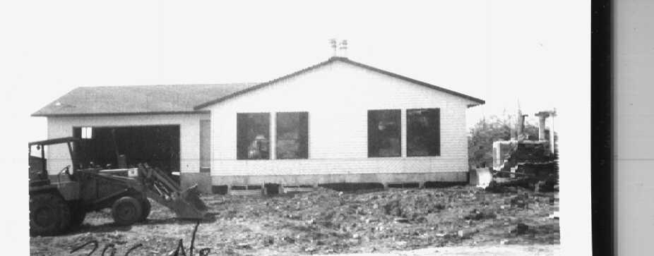
Property Information
mobile view
| Serial Number: 03:062:0051 |
Serial Life: 2008-2013 |
|
|
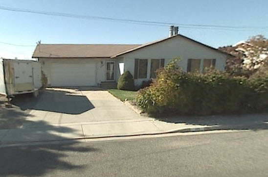
Total Photos: 2
|
| |
|
|
| Property Address: 395 N 700 EAST - PLEASANT GROVE |
|
| Mailing Address: 395 N 700 E PLEASANT GROVE, UT 84062-2447 |
|
| Acreage: 0.223686 |
|
| Last Document:
70028-2010
|
|
| Subdivision Map Filing |
|
| Taxing Description:
COM W 30.3 FT AND S 0 DEG 13 MIN W 449.9 FT FR; COM FR MON IN 500 N & 700 E, PLAT A, PLEASANT GROVE CITY SURVEY; N 89 DEG 28' 13" W 110.94 FT; S 0 DEG 45' 18" W 88.71 FT; N 89 DEG 44' 39" E 110.96 FT; N 0 DEG 33' 0" E 87.18 FT TO BEG. AREA 0.224 AC.
*Taxing description NOT FOR LEGAL DOCUMENTS
|
|
- Owner Names
- Value History
- Tax History
- Location
- Photos
- Documents
- Aerial Image
| |
----- Real Estate Values ----- |
---Improvements--- |
---Greenbelt--- |
Total |
| Year |
Com |
Res |
Agr |
Tot |
Com |
Res |
Agr |
Tot |
Land |
Homesite |
Tot |
Market Value |
| 2013 |
$0 |
$51,000 |
$0 |
$51,000 |
$0 |
$105,700 |
$0 |
$105,700 |
$0 |
$0 |
$0 |
$156,700 |
| 2012 |
$0 |
$48,400 |
$0 |
$48,400 |
$0 |
$109,400 |
$0 |
$109,400 |
$0 |
$0 |
$0 |
$157,800 |
| 2011 |
$0 |
$45,000 |
$0 |
$45,000 |
$0 |
$116,900 |
$0 |
$116,900 |
$0 |
$0 |
$0 |
$161,900 |
| 2010 |
$0 |
$50,000 |
$0 |
$50,000 |
$0 |
$125,580 |
$0 |
$125,580 |
$0 |
$0 |
$0 |
$175,580 |
| 2009 |
$0 |
$77,200 |
$0 |
$77,200 |
$0 |
$103,800 |
$0 |
$103,800 |
$0 |
$0 |
$0 |
$181,000 |
| 2008 |
$0 |
$86,700 |
$0 |
$86,700 |
$0 |
$125,800 |
$0 |
$125,800 |
$0 |
$0 |
$0 |
$212,500 |
| Year |
General Taxes |
Adjustments |
Net Taxes |
Fees |
Payments |
Tax Balance* |
Balance Due |
Tax District |
| 2013 |
$1,091.88 |
$0.00 |
$1,091.88 |
$0.00 |
|
$0.00
|
$0.00 |
070 - PLEASANT GROVE CITY |
| 2012 |
$1,124.02 |
$0.00 |
$1,124.02 |
$0.00 |
|
$0.00
|
$0.00 |
070 - PLEASANT GROVE CITY |
| 2011 |
$1,146.37 |
$0.00 |
$1,146.37 |
$0.00 |
|
$0.00
|
$0.00 |
070 - PLEASANT GROVE CITY |
| 2010 |
$1,163.27 |
$0.00 |
$1,163.27 |
$0.00 |
|
$0.00
|
$0.00 |
070 - PLEASANT GROVE CITY |
| 2009 |
$1,106.10 |
$0.00 |
$1,106.10 |
$0.00 |
|
$0.00
|
$0.00 |
070 - PLEASANT GROVE CITY |
| 2008 |
$1,201.01 |
$0.00 |
$1,201.01 |
$0.00 |
|
$0.00
|
$0.00 |
070 - PLEASANT GROVE CITY |
* Note: Original tax amount (Does not include applicable interest and/or fees).
| Entry # |
Date |
Recorded |
Type |
Party1 (Grantor) |
Party2 (Grantee) |
| 110369-2013 |
11/25/2013 |
12/03/2013 |
BLA |
ALLRED, SHARLENE N & LELAND KAY TEE |
JOHNSTON, MELINDA L |
| 70028-2010 |
08/16/2010 |
08/20/2010 |
WD |
ALLRED, SHARLENE N & LELAND KAY |
ALLRED, SHARLENE N & LELAND KAY TEE |
| 63442-2009 |
06/08/2009 |
06/08/2009 |
REC |
FIRST AMERICAN TITLE INSURANCE AGENCY LLC TEE |
ALLRED, LELAND KAY & SHARLENE N |
| 125591-2007 |
08/25/2007 |
08/27/2007 |
BLA |
JOHNSTON, MELINDA L |
ALLRED, LELAND KAY & SHARLENE N |
Main Menu Comments or Concerns on Value/Appraisal - Assessor's Office
Documents/Owner/Parcel information - Recorder's Office
Address Change for Tax Notice
This page was created on 7/25/2024 7:11:25 AM |