Property Information
mobile view
| Serial Number: 55:857:0109 |
Serial Life: 2019... |
|
|
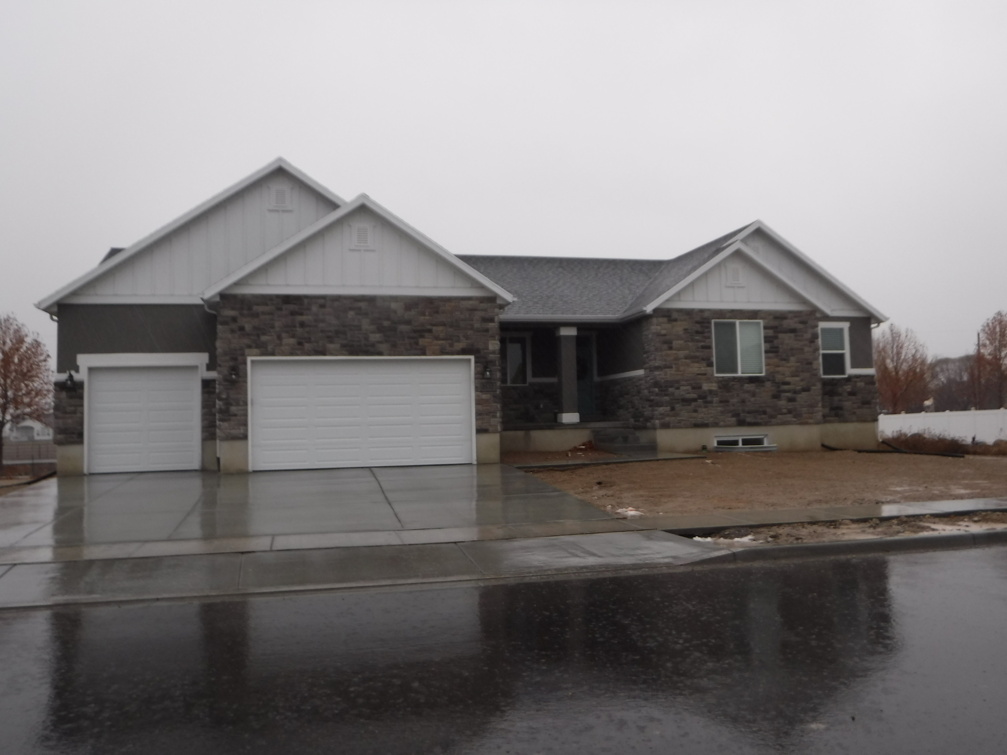
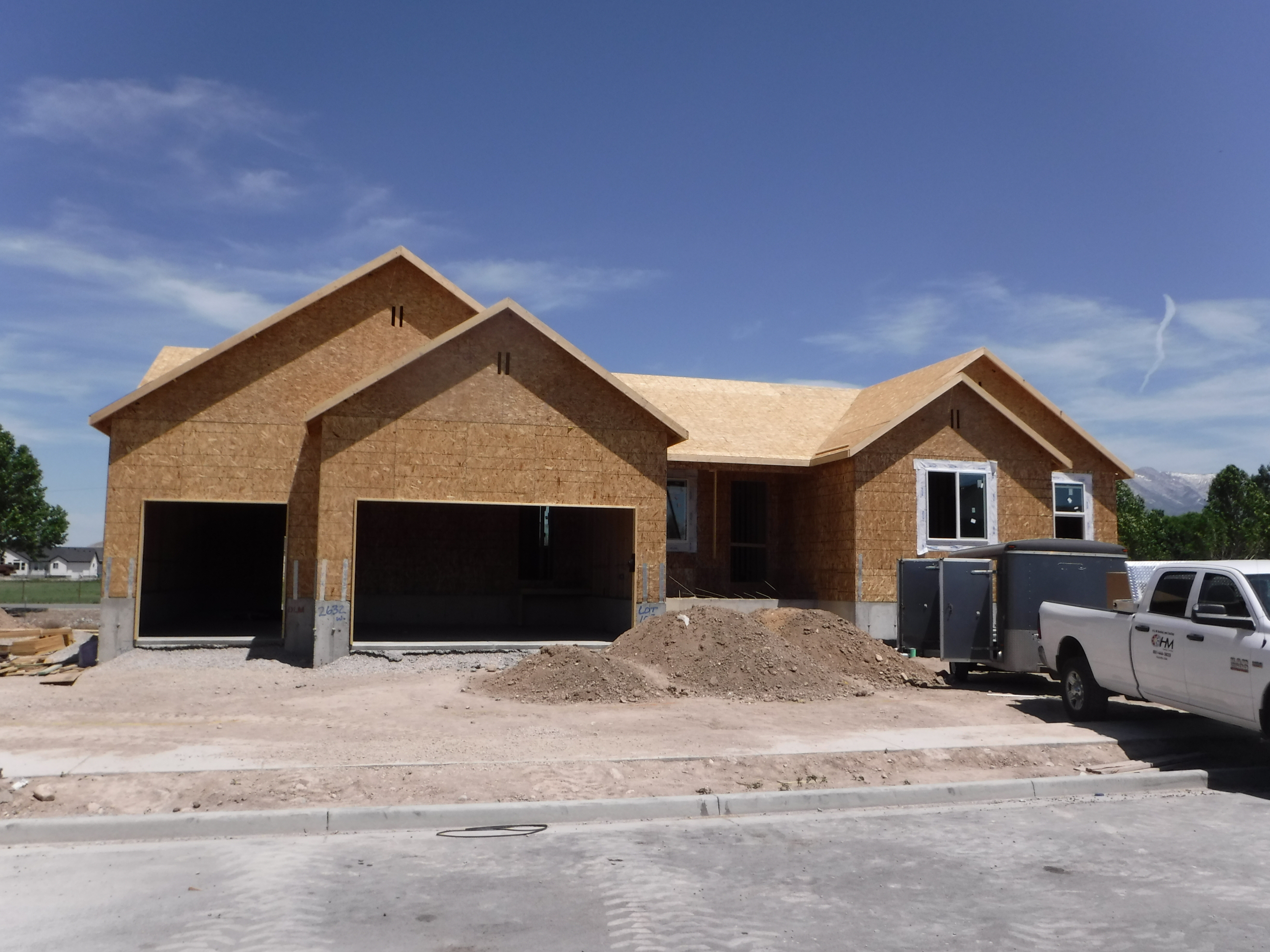
Total Photos: 2
|
| |
|
|
| Property Address: 2632 W 275 NORTH - LEHI |
|
| Mailing Address: 2632 W 275 N LEHI, UT 84043-4317 |
|
| Acreage: 0.324226 |
|
| Last Document:
91100-2021
|
|
| Subdivision Map Filing |
|
| Taxing Description:
LOT 109, PLAT E, WILLOW PARK RIVER SUB AREA 0.324 AC.
*Taxing description NOT FOR LEGAL DOCUMENTS
|
|
- Owner Names
- Value History
- Tax History
- Location
- Photos
- Documents
- Aerial Image
| |
----- Real Estate Values ----- |
---Improvements--- |
---Greenbelt--- |
Total |
| Year |
Com |
Res |
Agr |
Tot |
Com |
Res |
Agr |
Tot |
Land |
Homesite |
Tot |
Market Value |
| 2024 |
$0 |
$302,800 |
$0 |
$302,800 |
$0 |
$391,100 |
$0 |
$391,100 |
$0 |
$0 |
$0 |
$693,900 |
| 2023 |
$0 |
$294,000 |
$0 |
$294,000 |
$0 |
$401,500 |
$0 |
$401,500 |
$0 |
$0 |
$0 |
$695,500 |
| 2022 |
$0 |
$300,000 |
$0 |
$300,000 |
$0 |
$343,700 |
$0 |
$343,700 |
$0 |
$0 |
$0 |
$643,700 |
| 2021 |
$0 |
$187,500 |
$0 |
$187,500 |
$0 |
$280,100 |
$0 |
$280,100 |
$0 |
$0 |
$0 |
$467,600 |
| 2020 |
$0 |
$173,600 |
$0 |
$173,600 |
$0 |
$261,800 |
$0 |
$261,800 |
$0 |
$0 |
$0 |
$435,400 |
| 2019 |
$0 |
$173,600 |
$0 |
$173,600 |
$0 |
$237,500 |
$0 |
$237,500 |
$0 |
$0 |
$0 |
$411,100 |
| Year |
General Taxes |
Adjustments |
Net Taxes |
Fees |
Payments |
Tax Balance* |
Balance Due |
Tax District |
| 2025 |
$0.00 |
$0.00 |
$0.00 |
$0.00 |
|
$0.00
|
$0.00 |
010 - LEHI CITY |
| 2024 |
$0.00 |
$0.00 |
$0.00 |
$0.00 |
|
($2,083.64)
|
($2,083.64) |
010 - LEHI CITY |
| 2023 |
$3,010.47 |
$0.00 |
$3,010.47 |
$0.00 |
|
$0.00
|
$0.00 |
010 - LEHI CITY |
| 2022 |
$2,874.06 |
$0.00 |
$2,874.06 |
$0.00 |
|
$0.00
|
$0.00 |
010 - LEHI CITY |
| 2021 |
$2,510.85 |
$0.00 |
$2,510.85 |
$0.00 |
|
$0.00
|
$0.00 |
010 - LEHI CITY |
| 2020 |
$2,365.25 |
$0.00 |
$2,365.25 |
$0.00 |
|
$0.00
|
$0.00 |
010 - LEHI CITY |
| 2019 |
$2,148.22 |
$0.00 |
$2,148.22 |
$0.00 |
|
$0.00
|
$0.00 |
010 - LEHI CITY |
* Note: Original tax amount (Does not include applicable interest and/or fees).
| Entry # |
Date |
Recorded |
Type |
Party1 (Grantor) |
Party2 (Grantee) |
| 52161-2023 |
07/10/2023 |
08/10/2023 |
REC |
UTAH COMMUNITY CREDIT UNION TEE |
AIME, JASON M (ET AL) |
| 38013-2023 |
06/08/2023 |
06/13/2023 |
WD |
AIME, JASON MICHAEL & DEANN CLARK |
AIME, JASON MICHAEL & DEANN CLARK TEE (ET AL) |
| 38012-2023 |
06/08/2023 |
06/13/2023 |
D TR |
AIME, JASON MICHAEL & DEANN CLARK |
UTAH COMMUNITY CREDIT UNION |
| 38011-2023 |
06/08/2023 |
06/13/2023 |
WD |
AIME, JASON MICHAEL & DEANN CLARK TEE (ET AL) |
AIME, JASON MICHAEL & DEANN CLARK |
| 36510-2023 |
06/06/2023 |
06/06/2023 |
REC |
UTAH COMMUNITY CREDIT UNION TEE |
AIME, JASON M & DEANN |
| 91100-2021 |
05/12/2021 |
05/14/2021 |
QCD |
AIME, JASON M & DEANN |
AIME, JASON MICHAEL & DEANN CLARK TEE (ET AL) |
| 114391-2020 |
07/17/2020 |
08/05/2020 |
REC |
UTAH COMMUNITY CREDIT UNION TEE |
AIME, JASON M & DEANN |
| 73832-2020 |
05/27/2020 |
06/01/2020 |
D TR |
AIME, JASON M & DEANN |
UTAH COMMUNITY CREDIT UNION |
| 98286-2019 |
07/29/2019 |
09/30/2019 |
REC |
UTAH COMMUNITY CREDIT UNION TEE |
AIME, JASON M & DEANN |
| 64915-2019 |
07/10/2019 |
07/15/2019 |
D TR |
AIME, JASON M & DEANN |
UTAH COMMUNITY CREDIT UNION |
| 111354-2018 |
11/16/2018 |
11/21/2018 |
D TR |
AIME, JASON M & DEANN |
UTAH COMMUNITY CREDIT UNION |
| 95072-2018 |
10/01/2018 |
10/03/2018 |
REC |
CENTRAL BANK TEE |
WILLOW PARK DEVELOPMENT INC |
| 23514-2018 |
03/09/2018 |
03/12/2018 |
WD |
WILLOW PARK DEVELOPMENT INC |
AIME, JASON M & DEANN |
| 16449-2018 |
02/12/2018 |
02/20/2018 |
S PLAT |
WILLOW PARK RIVER DEV INC |
WILLOW PARK RIVER PLAT E |
Main Menu Comments or Concerns on Value/Appraisal - Assessor's Office
Documents/Owner/Parcel information - Recorder's Office
Address Change for Tax Notice
This page was created on 7/5/2024 4:19:59 PM |