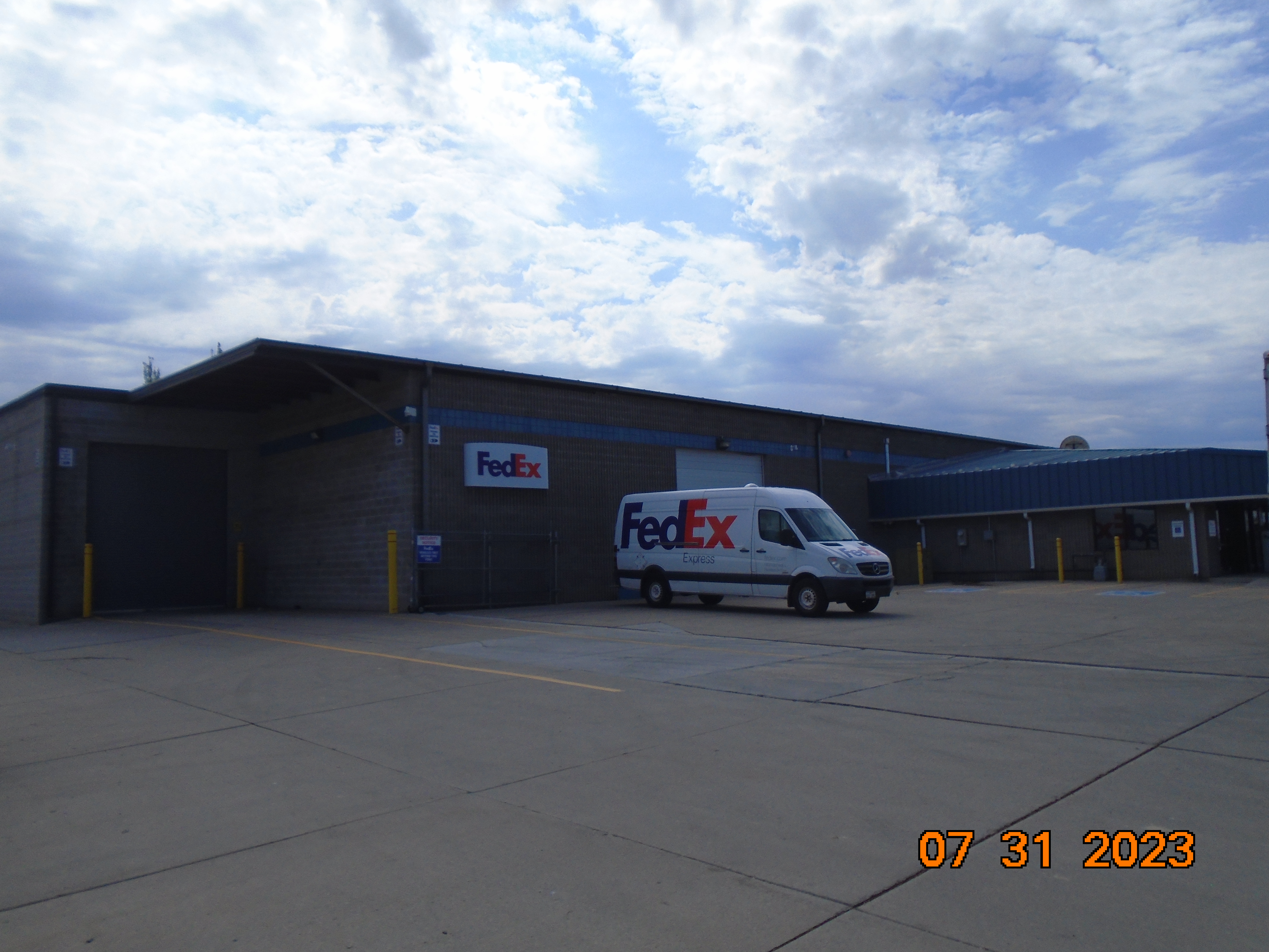
Property Information
mobile view
| Serial Number: 65:368:0001 |
Serial Life: 2013... |
|
|
 Total Photos: 7
|
| |
|
|
| Property Address: 70 N 1200 WEST - OREM
more see "Addrs" tab below..
|
|
| Mailing Address: 10697 N JERLING DR HIGHLAND, UT 84003-9023 |
|
| Acreage: 2.22216 |
|
| Last Document:
37985-2012
|
|
| Subdivision Map Filing |
|
| Taxing Description:
LOT 1, PLAT A, COOPER PLAZA SUB AREA 2.222 AC.
*Taxing description NOT FOR LEGAL DOCUMENTS
|
|
- Owner Names
- Value History
- Tax History
- Location
- Photos
- Documents
- Aerial Image
- Addrs
| |
----- Real Estate Values ----- |
---Improvements--- |
---Greenbelt--- |
Total |
| Year |
Com |
Res |
Agr |
Tot |
Com |
Res |
Agr |
Tot |
Land |
Homesite |
Tot |
Market Value |
| 2024 |
$1,457,700 |
$0 |
$0 |
$1,457,700 |
$1,280,300 |
$0 |
$0 |
$1,280,300 |
$0 |
$0 |
$0 |
$2,738,000 |
| 2023 |
$1,432,700 |
$0 |
$0 |
$1,432,700 |
$1,227,200 |
$0 |
$0 |
$1,227,200 |
$0 |
$0 |
$0 |
$2,659,900 |
| 2022 |
$1,416,000 |
$0 |
$0 |
$1,416,000 |
$1,209,700 |
$0 |
$0 |
$1,209,700 |
$0 |
$0 |
$0 |
$2,625,700 |
| 2021 |
$1,236,100 |
$0 |
$0 |
$1,236,100 |
$1,135,200 |
$0 |
$0 |
$1,135,200 |
$0 |
$0 |
$0 |
$2,371,300 |
| 2020 |
$1,236,100 |
$0 |
$0 |
$1,236,100 |
$1,044,000 |
$0 |
$0 |
$1,044,000 |
$0 |
$0 |
$0 |
$2,280,100 |
| 2019 |
$1,143,200 |
$0 |
$0 |
$1,143,200 |
$1,112,200 |
$0 |
$0 |
$1,112,200 |
$0 |
$0 |
$0 |
$2,255,400 |
| 2018 |
$1,089,000 |
$0 |
$0 |
$1,089,000 |
$956,700 |
$0 |
$0 |
$956,700 |
$0 |
$0 |
$0 |
$2,045,700 |
| 2017 |
$1,037,700 |
$0 |
$0 |
$1,037,700 |
$1,124,400 |
$0 |
$0 |
$1,124,400 |
$0 |
$0 |
$0 |
$2,162,100 |
| 2016 |
$988,300 |
$0 |
$0 |
$988,300 |
$1,159,700 |
$0 |
$0 |
$1,159,700 |
$0 |
$0 |
$0 |
$2,148,000 |
| 2015 |
$924,400 |
$0 |
$0 |
$924,400 |
$1,159,700 |
$0 |
$0 |
$1,159,700 |
$0 |
$0 |
$0 |
$2,084,100 |
| 2014 |
$881,000 |
$0 |
$0 |
$881,000 |
$1,159,700 |
$0 |
$0 |
$1,159,700 |
$0 |
$0 |
$0 |
$2,040,700 |
| 2013 |
$800,900 |
$0 |
$0 |
$800,900 |
$1,159,700 |
$0 |
$0 |
$1,159,700 |
$0 |
$0 |
$0 |
$1,960,600 |
| Year |
General Taxes |
Adjustments |
Net Taxes |
Fees |
Payments |
Tax Balance* |
Balance Due |
Tax District |
| 2025 |
$0.00 |
$0.00 |
$0.00 |
$0.00 |
|
$0.00
|
$0.00 |
090 - OREM CITY |
| 2024 |
$22,391.36 |
$0.00 |
$22,391.36 |
$0.00 |
|
$0.00
|
$0.00 |
090 - OREM CITY |
| 2023 |
$20,239.18 |
$0.00 |
$20,239.18 |
$0.00 |
|
$0.00
|
$0.00 |
090 - OREM CITY |
| 2022 |
$20,622.25 |
$0.00 |
$20,622.25 |
$0.00 |
|
$0.00
|
$0.00 |
090 - OREM CITY |
| 2021 |
$22,356.62 |
$0.00 |
$22,356.62 |
$0.00 |
|
$0.00
|
$0.00 |
090 - OREM CITY |
| 2020 |
$21,873.00 |
$0.00 |
$21,873.00 |
$0.00 |
|
$0.00
|
$0.00 |
090 - OREM CITY |
| 2019 |
$20,806.07 |
$0.00 |
$20,806.07 |
$0.00 |
|
$0.00
|
$0.00 |
090 - OREM CITY |
| 2018 |
$19,751.23 |
$0.00 |
$19,751.23 |
$0.00 |
|
$0.00
|
$0.00 |
090 - OREM CITY |
| 2017 |
$21,432.90 |
$0.00 |
$21,432.90 |
$0.00 |
|
$0.00
|
$0.00 |
090 - OREM CITY |
| 2016 |
$23,091.00 |
$0.00 |
$23,091.00 |
$0.00 |
|
$0.00
|
$0.00 |
090 - OREM CITY |
| 2015 |
$23,689.96 |
$0.00 |
$23,689.96 |
$0.00 |
|
$0.00
|
$0.00 |
090 - OREM CITY |
| 2014 |
$23,302.75 |
$0.00 |
$23,302.75 |
$0.00 |
|
$0.00
|
$0.00 |
090 - OREM CITY |
| 2013 |
$24,142.83 |
$0.00 |
$24,142.83 |
$0.00 |
|
$0.00
|
$0.00 |
090 - OREM CITY |
* Note: Original tax amount (Does not include applicable interest and/or fees).
| Entry # |
Date |
Recorded |
Type |
Party1 (Grantor) |
Party2 (Grantee) |
| 56916-2017 |
06/07/2017 |
06/13/2017 |
REC |
ROCK CANYON BANK TEE |
TWELVE HUNDRED WEST OREM PROPERTIES LC |
| 10323-2016 |
02/08/2016 |
02/08/2016 |
D TR |
TWELVE HUNDRED WEST OREM PROPERTIES L C |
ROCK CANYON BANK |
| 9126-2016 |
02/03/2016 |
02/03/2016 |
R LP |
NORTH OREM COMMERCIAL RENTALS LC (ET AL) |
COOPER, PATTIE C (ET AL) |
| 18423-2015 |
03/06/2015 |
03/06/2015 |
LP |
COOPER, PATTIE C (ET AL) |
NORTH OREM COMMERCIAL RENTALS LC (ET AL) |
| 37985-2012 |
09/07/2011 |
05/07/2012 |
S PLAT |
TWELVE HUNDRED WEST OREM PROPERTIES LC |
COOPER PLAZA PLAT B |
70 N 1200 WEST - OREM
80 N 1200 WEST - OREM
Main Menu Comments or Concerns on Value/Appraisal - Assessor's Office
Documents/Owner/Parcel information - Recorder's Office
Address Change for Tax Notice
This page was created on 1/9/2025 1:28:07 PM |
