Property Information
mobile view
| Serial Number: 10:017:0009 |
Serial Life: 2022... |
|
|
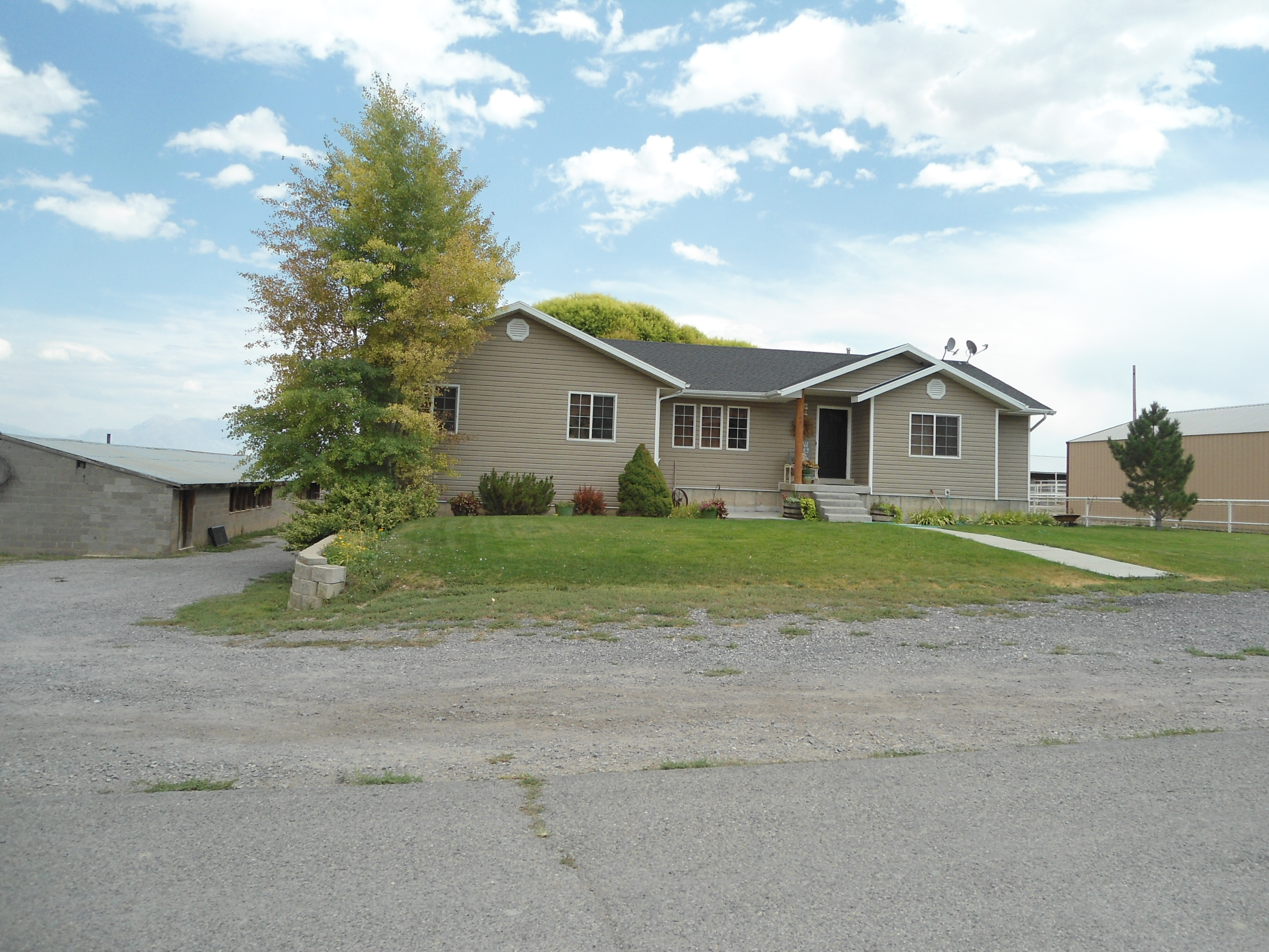 Total Photos: 1
|
| |
|
|
| Property Address: 195 S 100 WEST - CEDAR FORT |
|
| Mailing Address: 195 S 100 W CEDAR FORT, UT 84013-7707 |
|
| Acreage: 1.293693 |
|
| Last Document:
160217-2021
|
|
| Subdivision Map Filing |
|
| Taxing Description:
COM N 174.99 FT & E .65 FT FR SW COR. BLK 3, CEDAR FORT SURVEY; N 0 DEG 12' 43" E 205.5 FT; S 89 DEG 9' 53" E 116.4 FT; S 88 DEG 2' 31" E 157.49 FT; S 0 DEG 5' 12" W 104.25 FT; S 0 DEG 35' 32" W 100.81 FT; N 88 DEG 36' 50" W 23.43 FT; N 9 DEG 49' 9" W .02 FT; N 88 DEG 36' 50" W 249.99 FT TO BEG. AREA 1.294 AC.
*Taxing description NOT FOR LEGAL DOCUMENTS
|
|
- Owner Names
- Value History
- Tax History
- Location
- Photos
- Documents
- Aerial Image
| |
----- Real Estate Values ----- |
---Improvements--- |
---Greenbelt--- |
Total |
| Year |
Com |
Res |
Agr |
Tot |
Com |
Res |
Agr |
Tot |
Land |
Homesite |
Tot |
Market Value |
| 2024 |
$0 |
$160,800 |
$8,100 |
$168,900 |
$0 |
$331,700 |
$47,400 |
$379,100 |
$0 |
$0 |
$0 |
$548,000 |
| 2023 |
$0 |
$160,800 |
$8,100 |
$168,900 |
$0 |
$363,800 |
$43,800 |
$407,600 |
$0 |
$0 |
$0 |
$576,500 |
| 2022 |
$0 |
$166,300 |
$8,400 |
$174,700 |
$0 |
$311,400 |
$46,600 |
$358,000 |
$0 |
$0 |
$0 |
$532,700 |
| Year |
General Taxes |
Adjustments |
Net Taxes |
Fees |
Payments |
Tax Balance* |
Balance Due |
Tax District |
| 2025 |
$0.00 |
$0.00 |
$0.00 |
$0.00 |
|
$0.00
|
$0.00 |
050 - CEDAR FORT CITY |
| 2024 |
$0.00 |
$0.00 |
$0.00 |
$0.00 |
|
$0.00
|
$0.00 |
050 - CEDAR FORT CITY |
| 2023 |
$2,449.39 |
$0.00 |
$2,449.39 |
$0.00 |
|
$0.00
|
$0.00 |
050 - CEDAR FORT CITY |
| 2022 |
$2,349.01 |
$0.00 |
$2,349.01 |
$0.00 |
|
$0.00
|
$0.00 |
050 - CEDAR FORT CITY |
* Note: Original tax amount (Does not include applicable interest and/or fees).
| Entry # |
Date |
Recorded |
Type |
Party1 (Grantor) |
Party2 (Grantee) |
| 174887-2021 |
10/06/2021 |
10/13/2021 |
REC |
MORAN, KEVIN P SUBTEE |
COOK, COLTON G |
| 174886-2021 |
09/24/2021 |
10/13/2021 |
SUB TEE |
MORTGAGE ELECTRONIC REGISTRATION SYSTEMS INC |
MORAN, KEVIN P SUBTEE |
| 173819-2021 |
08/19/2021 |
10/11/2021 |
RSUBTEE |
COOK, GARY D & VONDA B (ET AL) |
COOK, COLTON G |
| 160354-2021 |
09/03/2021 |
09/15/2021 |
D TR |
COOK, NELS W & JEANINE |
UNITED WHOLESALE MORTGAGE LLC |
| 160218-2021 |
09/03/2021 |
09/15/2021 |
WD W |
COOK, COLTON G |
COOK, NELS W & JEANINE |
| 160217-2021 |
09/03/2021 |
09/15/2021 |
C WD |
COOK, COLTON G |
MADSEN, ALICE ANNE & JEREMY DENNIS |
Main Menu Comments or Concerns on Value/Appraisal - Assessor's Office
Documents/Owner/Parcel information - Recorder's Office
Address Change for Tax Notice
This page was created on 9/30/2024 12:28:40 AM |