Property Information
mobile view
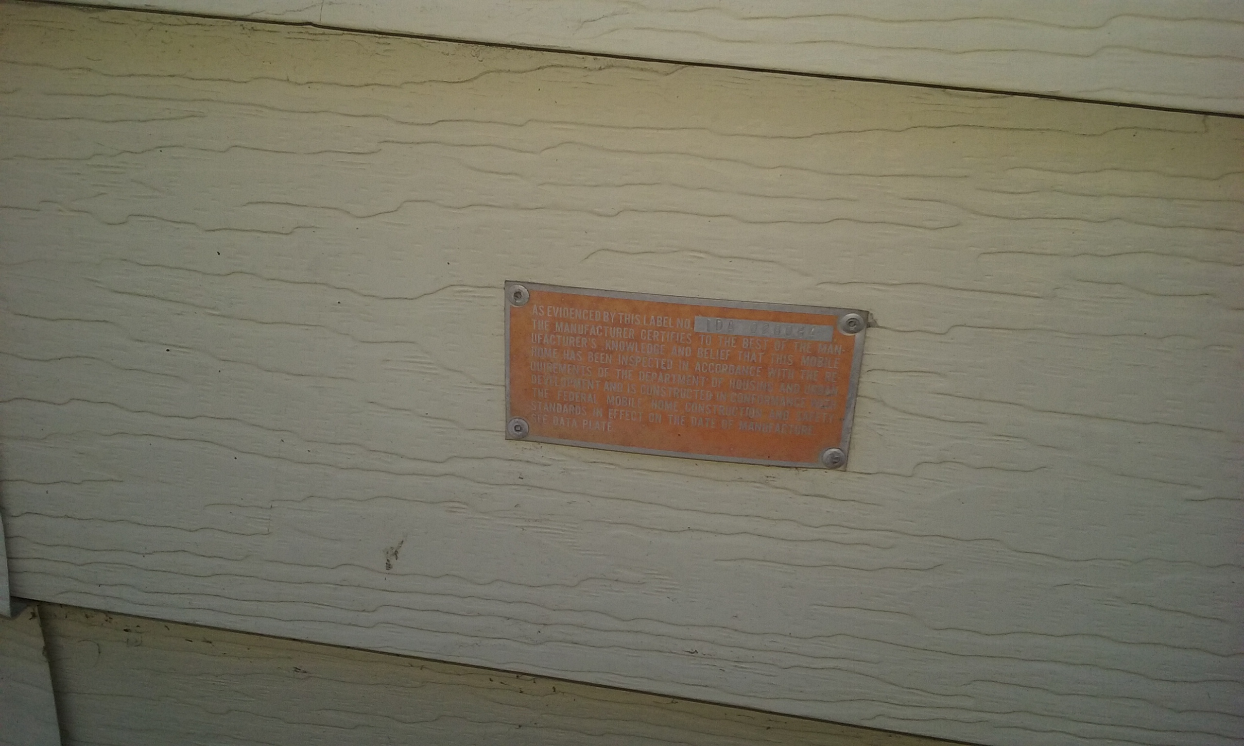
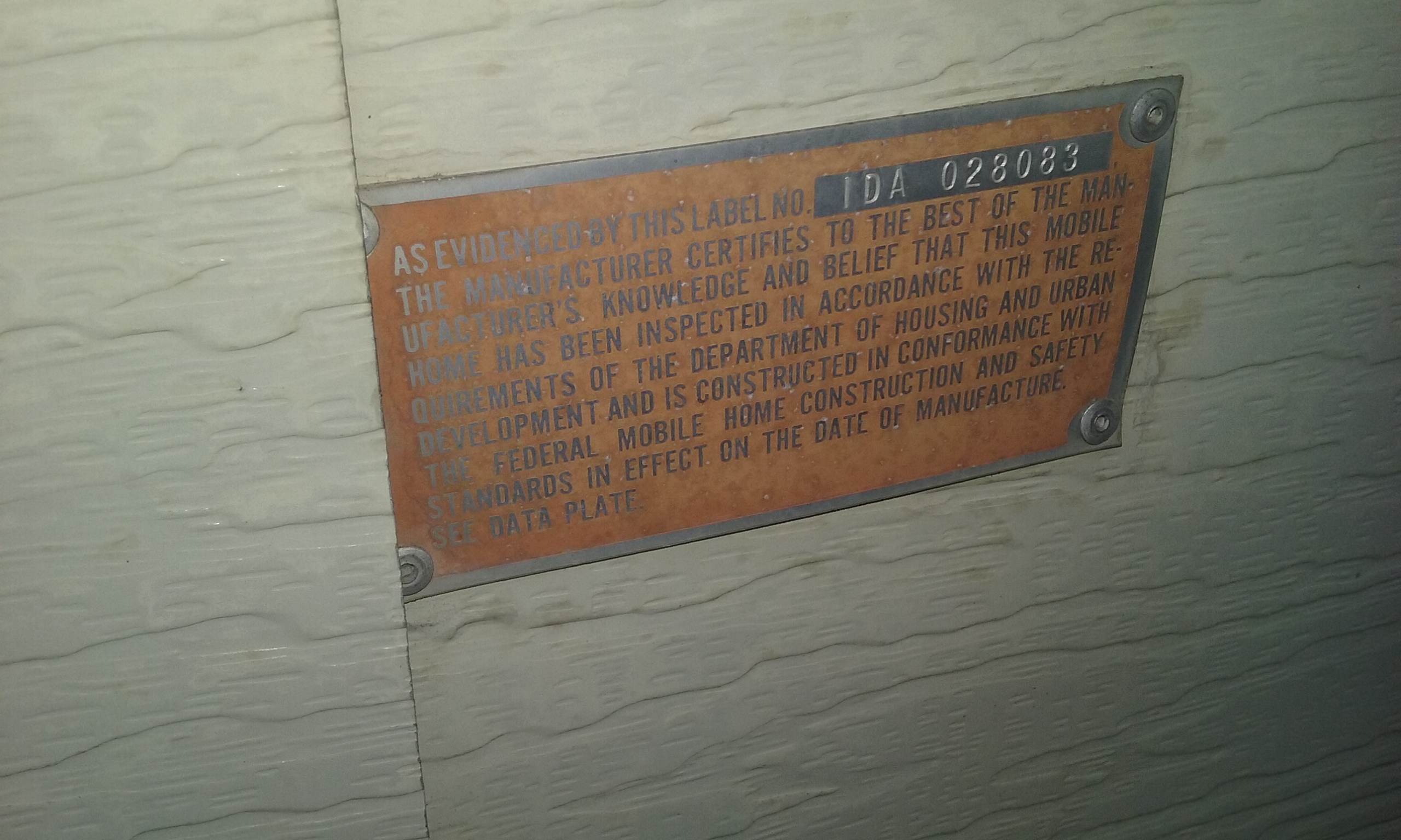
| Serial Number: 11:032:0429 |
Serial Life: 2014-2018 |
|
|
Total Photos: 4
|
| |
|
|
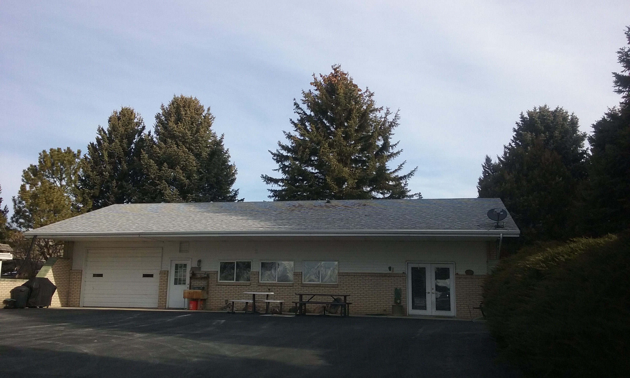
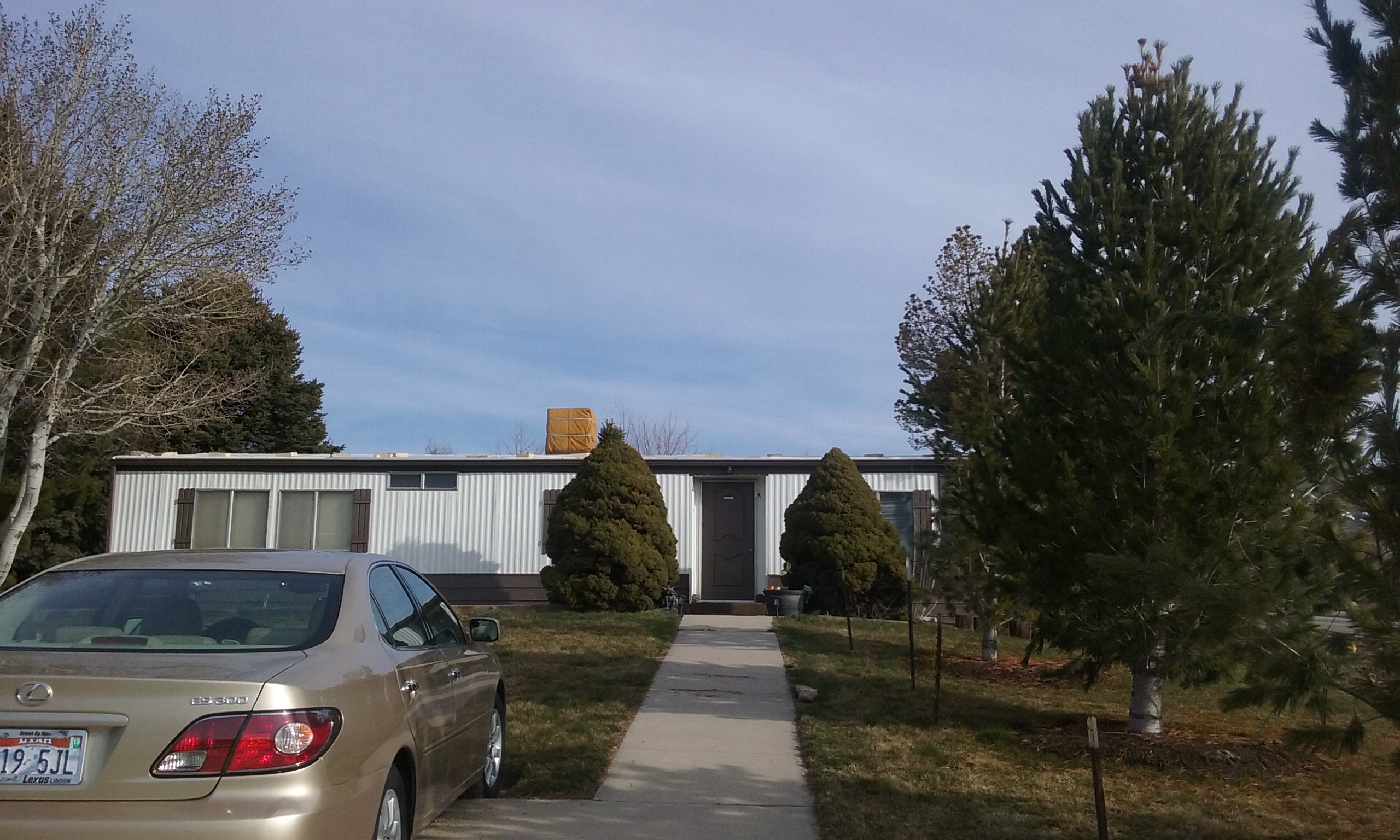
| Property Address: 10887 N 8800 WEST - LEHI DIST |
|
| Mailing Address: 10900 N 8800 W LEHI, UT 84043-9731 |
|
| Acreage: 5.274242 |
|
| Last Document:
57567-2013
|
|
| Subdivision Map Filing |
|
| Taxing Description:
COM N 660 FT & E 1.85 FT FR E 1/4 COR. SEC. 31, T4S, R1E, SLB&M.; S 89 DEG 53' 59" W 35.65 FT; S 0 DEG 9' 34" W 238.44 FT; W 693.92 FT; N 0 DEG 9' 12" E 104.03 FT; E 229.64 FT; N 0 DEG 9' 30" E 325.43 FT; S 89 DEG 54' 0" E 499.94 FT; S 0 DEG 9' 30" W 190.09 FT TO BEG. AREA 5.274 AC.
*Taxing description NOT FOR LEGAL DOCUMENTS
|
|
- Owner Names
- Value History
- Tax History
- Location
- Photos
- Documents
- Aerial Image
| |
----- Real Estate Values ----- |
---Improvements--- |
---Greenbelt--- |
Total |
| Year |
Com |
Res |
Agr |
Tot |
Com |
Res |
Agr |
Tot |
Land |
Homesite |
Tot |
Market Value |
| 2018 |
$0 |
$234,000 |
$245,600 |
$479,600 |
$0 |
$177,600 |
$16,000 |
$193,600 |
$24 |
$55,000 |
$55,024 |
$673,200 |
| 2017 |
$0 |
$210,000 |
$196,500 |
$406,500 |
$0 |
$177,600 |
$16,000 |
$193,600 |
$24 |
$55,000 |
$55,024 |
$600,100 |
| 2016 |
$0 |
$154,000 |
$131,000 |
$285,000 |
$0 |
$169,100 |
$14,000 |
$183,100 |
$24 |
$55,000 |
$55,024 |
$468,100 |
| 2015 |
$0 |
$154,000 |
$131,000 |
$285,000 |
$0 |
$169,100 |
$14,000 |
$183,100 |
$24 |
$55,000 |
$55,024 |
$468,100 |
| 2014 |
$0 |
$154,000 |
$131,000 |
$285,000 |
$0 |
$100,200 |
$0 |
$100,200 |
$25 |
$55,000 |
$55,025 |
$385,200 |
| Year |
General Taxes |
Adjustments |
Net Taxes |
Fees |
Payments |
Tax Balance* |
Balance Due |
Tax District |
| 2018 |
$1,506.33 |
$0.00 |
$1,506.33 |
$0.00 |
|
$0.00
|
$0.00 |
020 - NORTH UT CO WT CONS S/A 6-7-8 |
| 2017 |
$1,547.79 |
$0.00 |
$1,547.79 |
$0.00 |
|
$0.00
|
$0.00 |
020 - NORTH UT CO WT CONS S/A 6-7-8 |
| 2016 |
$1,607.40 |
$0.00 |
$1,607.40 |
$0.00 |
|
$0.00
|
$0.00 |
020 - NORTH UT CO WT CONS S/A 6-7-8 |
| 2015 |
$1,682.08 |
$0.00 |
$1,682.08 |
$0.00 |
|
$0.00
|
$0.00 |
020 - NORTH UT CO WT CONS S/A 6-7-8 |
| 2014 |
$1,051.00 |
$0.00 |
$1,051.00 |
$0.00 |
|
$0.00
|
$0.00 |
020 - NORTH UT CO WT CONS S/A 6-7-8 |
* Note: Original tax amount (Does not include applicable interest and/or fees).
| Entry # |
Date |
Recorded |
Type |
Party1 (Grantor) |
Party2 (Grantee) |
| 71827-2018 |
07/31/2018 |
07/31/2018 |
WD |
JONES, JOYCE ANN TEE (ET AL) |
LEHI CITY |
| 113063-2017 |
11/03/2017 |
11/15/2017 |
FARM |
JONES, JOYCE ANN TEE |
WHOM OF INTEREST |
| 53850-2017 |
06/05/2017 |
06/05/2017 |
WD |
JONES, JOYCE ANN NKA (ET AL) |
JONES, JOYCE ANN TEE (ET AL) |
| 57567-2013 |
03/26/2013 |
06/13/2013 |
A PLAT |
ACES ATHLETICS SOUTH ANNEXATION |
LEHI CITY CORPORATION |
Main Menu Comments or Concerns on Value/Appraisal - Assessor's Office
Documents/Owner/Parcel information - Recorder's Office
Address Change for Tax Notice
This page was created on 7/21/2024 6:24:42 PM |
