Property Information
mobile view
| Serial Number: 12:071:0149 |
Serial Life: 2006-2014 |
|
|
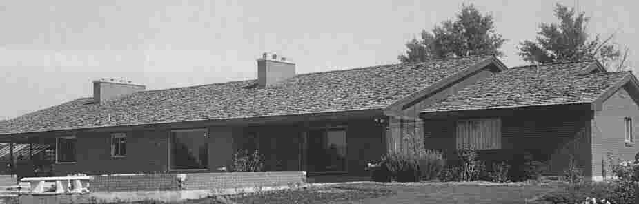
Total Photos: 1
|
| |
|
|
| Property Address: 820 E EVERGREEN DR - AMERICAN FORK
more see "Addrs" tab below..
|
|
| Mailing Address: 820 EVERGREEN DR AMERICAN FORK, UT 84003-2038 |
|
| Acreage: 2.384087 |
|
| Last Document:
112867-2005
|
|
| Subdivision Map Filing |
|
| Taxing Description:
COM S 542.19 FT & W 448.55 FT FR E 1/4 COR. SEC. 13, T5S, R1E, SLB&M.; S 0 DEG 25' 13" E 184.2 FT; S 6 DEG 52' 10" W 39.41 FT; S 0 DEG 25' 13" E 95.68 FT; ALONG A CURVE TO R (CHORD BEARS: S 2 DEG 51' 3" W 6.84 FT, RADIUS = 60 FT); N 89 DEG 6' 0" W 373.83 FT; N 0 DEG 54' 0" E 320 FT; E 250.8 FT; S 149.95 FT; E 112 FT; N 149.95 FT; E 8.96 FT TO BEG. AREA 2.384 AC.
*Taxing description NOT FOR LEGAL DOCUMENTS
|
|
- Owner Names
- Value History
- Tax History
- Location
- Photos
- Documents
- Aerial Image
- Addrs
| 2006-2014 |
|
ANDERSEN, LOIS P |
|
| 2006-2014 |
|
ANDERSEN, LOIS P |
|
| 2006-2014 |
|
BELMONT, JUEL ANDERSEN |
|
| 2006-2014 |
|
KNUDSON, VICKI ANDERSEN |
|
| 2006-2014 |
|
METOS, LINDA ANDERSEN |
|
| 2006NV |
|
BISHOP & DE VINCENT LLC |
|
| 2006NV |
|
ANDERSEN, LOIS P |
|
| 2006NV |
|
ANDERSEN, LOIS P |
|
| 2006NV |
|
BELMONT, JUEL ANDERSEN |
|
| 2006NV |
|
KNUDSON, VICKI ANDERSEN |
|
| 2006NV |
|
METOS, LINDA ANDERSEN |
|
| |
----- Real Estate Values ----- |
---Improvements--- |
---Greenbelt--- |
Total |
| Year |
Com |
Res |
Agr |
Tot |
Com |
Res |
Agr |
Tot |
Land |
Homesite |
Tot |
Market Value |
| 2014 |
$0 |
$85,000 |
$59,600 |
$144,600 |
$0 |
$180,100 |
$0 |
$180,100 |
$0 |
$0 |
$0 |
$324,700 |
| 2013 |
$0 |
$80,000 |
$71,500 |
$151,500 |
$0 |
$156,600 |
$0 |
$156,600 |
$0 |
$0 |
$0 |
$308,100 |
| 2012 |
$0 |
$75,000 |
$55,400 |
$130,400 |
$0 |
$142,400 |
$0 |
$142,400 |
$0 |
$0 |
$0 |
$272,800 |
| 2011 |
$0 |
$75,000 |
$55,400 |
$130,400 |
$0 |
$145,000 |
$0 |
$145,000 |
$0 |
$0 |
$0 |
$275,400 |
| 2010 |
$0 |
$123,000 |
$28,635 |
$151,635 |
$0 |
$442,147 |
$0 |
$442,147 |
$0 |
$0 |
$0 |
$593,782 |
| 2009 |
$0 |
$191,100 |
$98,900 |
$290,000 |
$0 |
$315,900 |
$0 |
$315,900 |
$0 |
$0 |
$0 |
$605,900 |
| 2008 |
$0 |
$195,000 |
$100,900 |
$295,900 |
$0 |
$315,900 |
$0 |
$315,900 |
$0 |
$0 |
$0 |
$611,800 |
| 2007 |
$0 |
$200,000 |
$103,500 |
$303,500 |
$0 |
$324,050 |
$0 |
$324,050 |
$0 |
$0 |
$0 |
$627,550 |
| 2006 |
$0 |
$165,000 |
$55,200 |
$220,200 |
$0 |
$324,050 |
$0 |
$324,050 |
$0 |
$0 |
$0 |
$544,250 |
| Year |
General Taxes |
Adjustments |
Net Taxes |
Fees |
Payments |
Tax Balance* |
Balance Due |
Tax District |
| 2014 |
$2,512.51 |
$0.00 |
$2,512.51 |
$0.00 |
|
$0.00
|
$0.00 |
060 - AMERICAN FORK CITY |
| 2013 |
$2,657.89 |
$0.00 |
$2,657.89 |
$0.00 |
|
$0.00
|
$0.00 |
060 - AMERICAN FORK CITY |
| 2012 |
$2,353.00 |
$0.00 |
$2,353.00 |
$0.00 |
|
$0.00
|
$0.00 |
060 - AMERICAN FORK CITY |
| 2011 |
$2,365.88 |
$0.00 |
$2,365.88 |
$0.00 |
|
$0.00
|
$0.00 |
060 - AMERICAN FORK CITY |
| 2010 |
$4,274.22 |
$0.00 |
$4,274.22 |
$0.00 |
|
$0.00
|
$0.00 |
060 - AMERICAN FORK CITY |
| 2009 |
$4,378.50 |
$0.00 |
$4,378.50 |
$0.00 |
|
$0.00
|
$0.00 |
060 - AMERICAN FORK CITY |
| 2008 |
$4,161.13 |
$0.00 |
$4,161.13 |
$0.00 |
|
$0.00
|
$0.00 |
060 - AMERICAN FORK CITY |
| 2007 |
$4,102.96 |
$0.00 |
$4,102.96 |
$0.00 |
|
$0.00
|
$0.00 |
060 - AMERICAN FORK CITY |
| 2006 |
$3,650.57 |
$0.00 |
$3,650.57 |
$0.00 |
|
$0.00
|
$0.00 |
060 - AMERICAN FORK CITY |
* Note: Original tax amount (Does not include applicable interest and/or fees).
| Entry # |
Date |
Recorded |
Type |
Party1 (Grantor) |
Party2 (Grantee) |
| 31032-2014 |
05/08/2014 |
05/08/2014 |
QCD |
BELMONT, JUEL ANDERSEN TEE (ET AL) |
ALLEN, REBECCA PETERS SUCTEE |
| 114949-2008 |
10/20/2008 |
10/22/2008 |
CT |
STATE OF UTAH |
WHOM OF INTEREST |
| 107508-2008 |
09/30/2008 |
09/30/2008 |
RESOL |
BOARD OF COUNTY COMMISSIONERS UTAH COUNTY |
WHOM OF INTEREST |
| 112865-2005 |
09/17/2005 |
10/05/2005 |
QCD |
ANDERSEN, LOIS P TEE (ET AL) |
ANDERSEN, LOIS P & LOIS P AN INT (ET AL) |
820 E 250 NORTH - AMERICAN FORK
820 E EVERGREEN DR - AMERICAN FORK
Main Menu Comments or Concerns on Value/Appraisal - Assessor's Office
Documents/Owner/Parcel information - Recorder's Office
Address Change for Tax Notice
This page was created on 7/23/2024 3:41:34 PM |