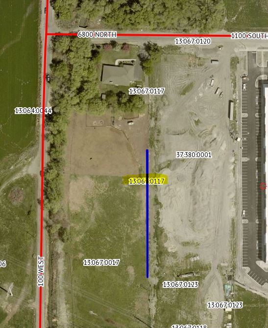
Property Information
mobile view
| Serial Number: 13:067:0117 |
Serial Life: 2024... |
|
|
 Total Photos: 1
|
| |
|
|
| Property Address: |
|
| Mailing Address: 42 E 1100 S STE 1A AMERICAN FORK, UT 84003 |
|
| Acreage: 0.041539 |
|
| Last Document:
72757-2023
|
|
| Subdivision Map Filing |
|
| Taxing Description:
COM E 4.2 CH & S 5.4 CH FR NW COR. OF SE 1/4 OF SEC. 26, T5S, R1E, SLB&M.; S 386.47 FT; N 0 DEG 22' 32" E 386.48 FT; W 2.54 FT TO BEG. AREA 0.011 AC. ALSO COM E 4.2 CH FR NW COR. OF SE 1/4 OF SEC. 26, T5S, R1E, SLB&M.; S 5.4 CH; E 2.54 FT; N 0 DEG 22' 32" E 356.41 FT; W 4.87 FT TO BEG. AREA 0.030 AC. TOTAL AREA .042 AC.
*Taxing description NOT FOR LEGAL DOCUMENTS
|
|
- Owner Names
- Value History
- Tax History
- Location
- Photos
- Documents
- Aerial Image
Main Menu Comments or Concerns on Value/Appraisal - Assessor's Office
Documents/Owner/Parcel information - Recorder's Office
Address Change for Tax Notice
This page was created on 4/9/2025 7:05:35 AM |