Property Information
mobile view
| Serial Number: 14:017:0246 |
Serial Life: 2012... |
|
|
Total Photos: 1
|
| |
|
|
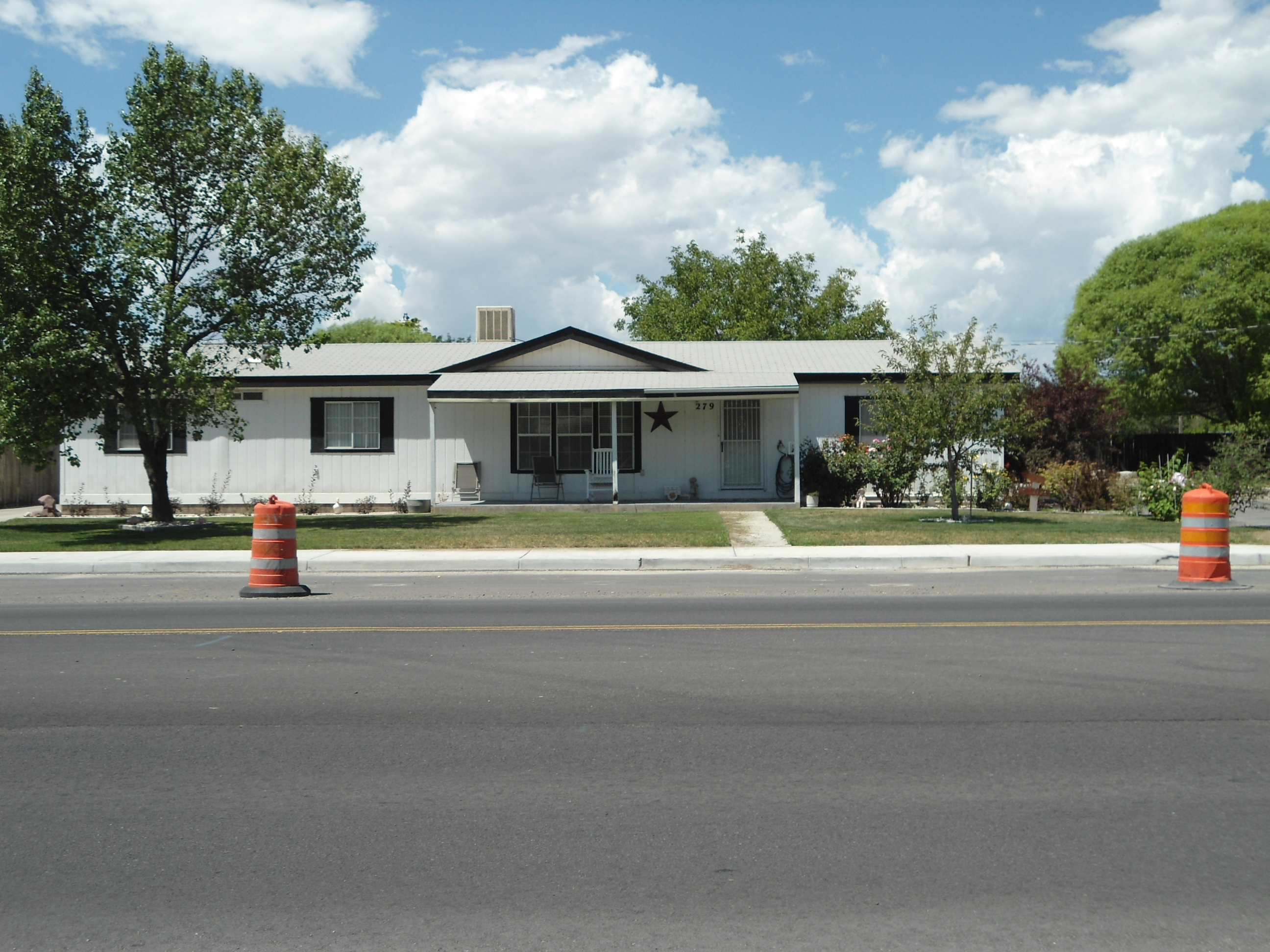
| Property Address: 279 N NORTH COUNTY BLVD - AMERICAN FORK |
|
| Mailing Address: 695 N MAIN ST LINDON, UT 84042 |
|
| Acreage: 0.488227 |
|
| Last Document:
43583-2011
|
|
| Subdivision Map Filing |
|
| Taxing Description:
COM S 676.5 FT & E 941.8 FT FR W 1/4 COR. SEC. 18, T5S, R2E, SLB&M.; E 153.52 FT; ALONG A CURVE TO R (CHORD BEARS: S 0 DEG 12' 18" W 92.28 FT, RADIUS = 74952.53 FT); S 0 DEG 14' 25" W 45.8 FT; S 89 DEG 51' 35" W 154.25 FT; N 0 DEG 31' 0" E 138.46 FT TO BEG. AREA 0.488 AC.
*Taxing description NOT FOR LEGAL DOCUMENTS
|
|
- Owner Names
- Value History
- Tax History
- Location
- Photos
- Documents
- Aerial Image
| |
----- Real Estate Values ----- |
---Improvements--- |
---Greenbelt--- |
Total |
| Year |
Com |
Res |
Agr |
Tot |
Com |
Res |
Agr |
Tot |
Land |
Homesite |
Tot |
Market Value |
| 2024 |
$0 |
$261,200 |
$0 |
$261,200 |
$0 |
$312,200 |
$0 |
$312,200 |
$0 |
$0 |
$0 |
$573,400 |
| 2023 |
$0 |
$261,100 |
$0 |
$261,100 |
$0 |
$340,900 |
$0 |
$340,900 |
$0 |
$0 |
$0 |
$602,000 |
| 2022 |
$0 |
$275,400 |
$0 |
$275,400 |
$0 |
$313,900 |
$0 |
$313,900 |
$0 |
$0 |
$0 |
$589,300 |
| 2021 |
$0 |
$172,100 |
$0 |
$172,100 |
$0 |
$237,800 |
$0 |
$237,800 |
$0 |
$0 |
$0 |
$409,900 |
| 2020 |
$0 |
$153,700 |
$0 |
$153,700 |
$0 |
$216,200 |
$0 |
$216,200 |
$0 |
$0 |
$0 |
$369,900 |
| 2019 |
$0 |
$145,200 |
$0 |
$145,200 |
$0 |
$188,000 |
$0 |
$188,000 |
$0 |
$0 |
$0 |
$333,200 |
| 2018 |
$0 |
$128,100 |
$0 |
$128,100 |
$0 |
$163,500 |
$0 |
$163,500 |
$0 |
$0 |
$0 |
$291,600 |
| 2017 |
$0 |
$111,000 |
$0 |
$111,000 |
$0 |
$142,200 |
$0 |
$142,200 |
$0 |
$0 |
$0 |
$253,200 |
| 2016 |
$0 |
$81,100 |
$0 |
$81,100 |
$0 |
$158,000 |
$0 |
$158,000 |
$0 |
$0 |
$0 |
$239,100 |
| 2015 |
$0 |
$81,100 |
$0 |
$81,100 |
$0 |
$158,000 |
$0 |
$158,000 |
$0 |
$0 |
$0 |
$239,100 |
| 2014 |
$0 |
$72,600 |
$0 |
$72,600 |
$0 |
$158,000 |
$0 |
$158,000 |
$0 |
$0 |
$0 |
$230,600 |
| 2013 |
$0 |
$64,500 |
$0 |
$64,500 |
$0 |
$158,000 |
$0 |
$158,000 |
$0 |
$0 |
$0 |
$222,500 |
| 2012 |
$0 |
$51,300 |
$0 |
$51,300 |
$0 |
$175,500 |
$0 |
$175,500 |
$0 |
$0 |
$0 |
$226,800 |
| Year |
General Taxes |
Adjustments |
Net Taxes |
Fees |
Payments |
Tax Balance* |
Balance Due |
Tax District |
| 2025 |
$0.00 |
$0.00 |
$0.00 |
$0.00 |
|
$0.00
|
$0.00 |
060 - AMERICAN FORK CITY |
| 2024 |
$0.00 |
$0.00 |
$0.00 |
$0.00 |
|
($1,457.65)
|
($1,457.65) |
060 - AMERICAN FORK CITY |
| 2023 |
$2,810.71 |
$0.00 |
$2,810.71 |
$0.00 |
|
$0.00
|
$0.00 |
060 - AMERICAN FORK CITY |
| 2022 |
$2,788.04 |
$0.00 |
$2,788.04 |
$0.00 |
|
$0.00
|
$0.00 |
060 - AMERICAN FORK CITY |
| 2021 |
$2,257.38 |
$0.00 |
$2,257.38 |
$0.00 |
|
$0.00
|
$0.00 |
060 - AMERICAN FORK CITY |
| 2020 |
$2,100.37 |
$0.00 |
$2,100.37 |
$0.00 |
|
$0.00
|
$0.00 |
060 - AMERICAN FORK CITY |
| 2019 |
$1,829.30 |
$0.00 |
$1,829.30 |
$0.00 |
|
$0.00
|
$0.00 |
060 - AMERICAN FORK CITY |
| 2018 |
$1,674.37 |
$0.00 |
$1,674.37 |
$0.00 |
|
$0.00
|
$0.00 |
060 - AMERICAN FORK CITY |
| 2017 |
$1,481.59 |
$0.00 |
$1,481.59 |
$0.00 |
|
$0.00
|
$0.00 |
060 - AMERICAN FORK CITY |
| 2016 |
$1,505.86 |
$0.00 |
$1,505.86 |
$0.00 |
|
$0.00
|
$0.00 |
060 - AMERICAN FORK CITY |
| 2015 |
$1,586.74 |
$0.00 |
$1,586.74 |
$0.00 |
|
$0.00
|
$0.00 |
060 - AMERICAN FORK CITY |
| 2014 |
$1,551.38 |
$0.00 |
$1,551.38 |
$0.00 |
|
$0.00
|
$0.00 |
060 - AMERICAN FORK CITY |
| 2013 |
$1,613.15 |
$0.00 |
$1,613.15 |
$0.00 |
|
$0.00
|
$0.00 |
060 - AMERICAN FORK CITY |
| 2012 |
$1,677.50 |
$0.00 |
$1,677.50 |
$0.00 |
|
$0.00
|
$0.00 |
060 - AMERICAN FORK CITY |
* Note: Original tax amount (Does not include applicable interest and/or fees).
| Entry # |
Date |
Recorded |
Type |
Party1 (Grantor) |
Party2 (Grantee) |
| 41455-2012 |
05/14/2012 |
05/17/2012 |
SP WD |
YOUNG, JACK ALLEN (ET AL) |
YOUNG, JACK A TEE (ET AL) |
| 43904-2011 |
05/19/2011 |
06/15/2011 |
QCD |
YOUNG, JACK ALLEN & JAMES K (ET AL) |
YOUNG, JACK ALLEN (ET AL) |
| 43583-2011 |
06/13/2011 |
06/14/2011 |
WD |
YOUNG, JACK ALLEN (ET AL) |
UTAH COUNTY |
Main Menu Comments or Concerns on Value/Appraisal - Assessor's Office
Documents/Owner/Parcel information - Recorder's Office
Address Change for Tax Notice
This page was created on 7/29/2024 12:11:30 PM |