Property Information
mobile view
| Serial Number: 14:066:0154 |
Serial Life: 1999... |
|
|
 Total Photos: 5
|
| |
|
|
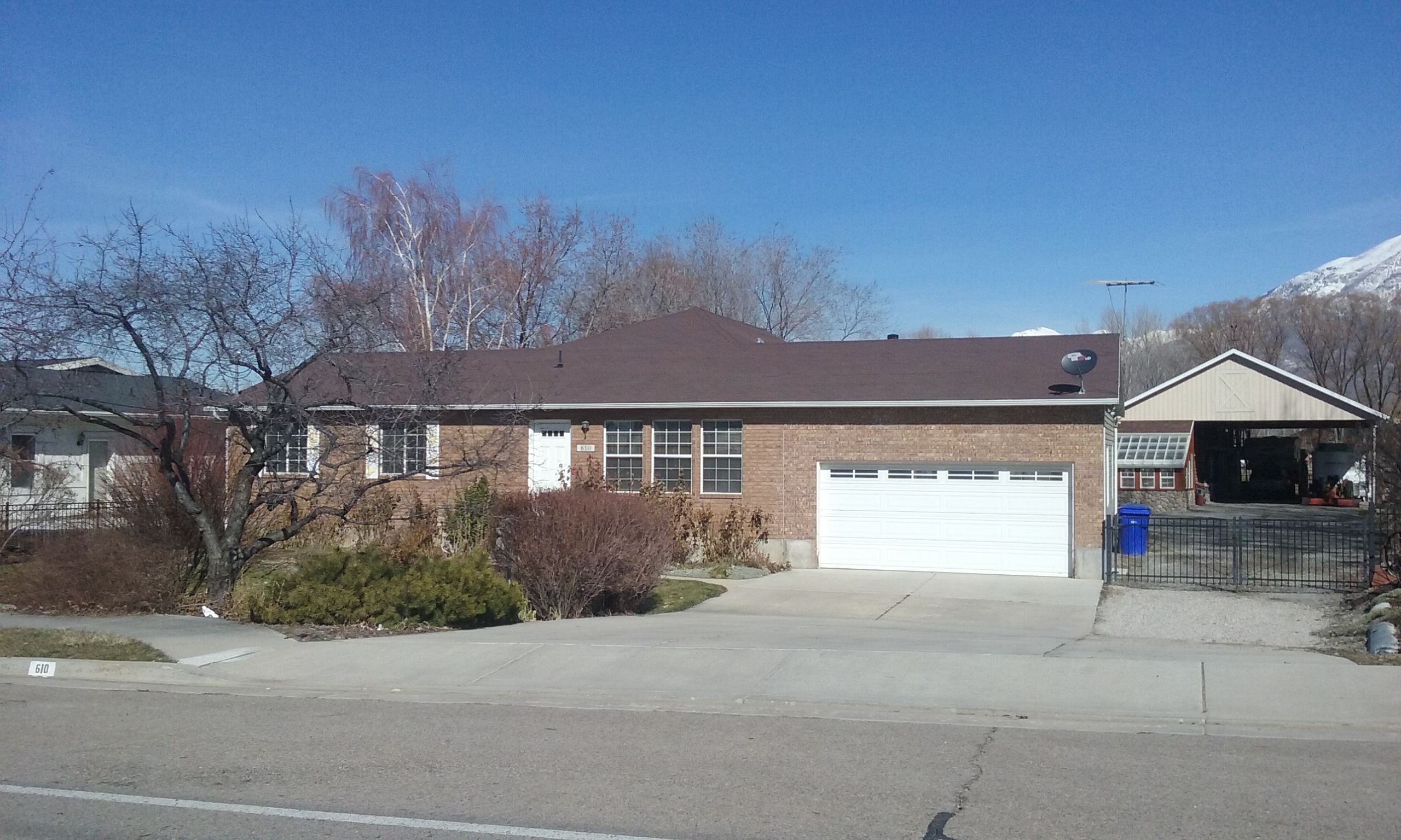
| Property Address: 610 W 200 SOUTH - LINDON |
|
| Mailing Address: 610 W 200 S LINDON, UT 84042-1716 |
|
| Acreage: 0.996243 |
|
| Last Document:
105289-2012
|
|
| Subdivision Map Filing |
|
| Taxing Description:
COM N 89 DEG 45' 36" E 1166.23 FT & N 33 FT FR SW COR. SEC. 33, T5S, R2E, SLB&M.; N 7 DEG 43' 30" E 434.4 FT; N 85 DEG 32' 55" E 101.29 FT; S 7 DEG 43' 0" W 441.9 FT; S 89 DEG 45' 36" W 100.04 FT TO BEG. AREA 0.996 AC.
*Taxing description NOT FOR LEGAL DOCUMENTS
|
|
- Owner Names
- Value History
- Tax History
- Location
- Photos
- Documents
- Aerial Image
| 2013... |
|
SPENCER, CINDY A |
|
| 2013... |
|
SPENCER, RALPH A |
|
| 2013NV |
|
SPENCER, CINDY A |
|
| 2013NV |
|
SPENCER, RALPH A |
|
| 2013NV |
|
SPENCER, CINDY A |
|
| 2013NV |
|
SPENCER, RALPH A |
|
| 2009-2012 |
|
SPENCER, CINDY |
|
| 2009-2012 |
|
SPENCER, RALPH A |
|
| 1999-2008 |
|
BURTON, CYNTHIA A |
|
| 1999-2008 |
|
BURTON, KENNETH F |
|
| 1999NV |
|
JONSSON, JODY |
|
| |
----- Real Estate Values ----- |
---Improvements--- |
---Greenbelt--- |
Total |
| Year |
Com |
Res |
Agr |
Tot |
Com |
Res |
Agr |
Tot |
Land |
Homesite |
Tot |
Market Value |
| 2024 |
$0 |
$305,600 |
$0 |
$305,600 |
$0 |
$283,600 |
$0 |
$283,600 |
$0 |
$0 |
$0 |
$589,200 |
| 2023 |
$0 |
$305,600 |
$0 |
$305,600 |
$0 |
$309,700 |
$0 |
$309,700 |
$0 |
$0 |
$0 |
$615,300 |
| 2022 |
$0 |
$322,400 |
$0 |
$322,400 |
$0 |
$376,900 |
$0 |
$376,900 |
$0 |
$0 |
$0 |
$699,300 |
| 2021 |
$0 |
$201,500 |
$0 |
$201,500 |
$0 |
$299,100 |
$0 |
$299,100 |
$0 |
$0 |
$0 |
$500,600 |
| 2020 |
$0 |
$179,900 |
$0 |
$179,900 |
$0 |
$282,200 |
$0 |
$282,200 |
$0 |
$0 |
$0 |
$462,100 |
| 2019 |
$0 |
$159,900 |
$0 |
$159,900 |
$0 |
$282,200 |
$0 |
$282,200 |
$0 |
$0 |
$0 |
$442,100 |
| 2018 |
$0 |
$139,900 |
$0 |
$139,900 |
$0 |
$245,400 |
$0 |
$245,400 |
$0 |
$0 |
$0 |
$385,300 |
| 2017 |
$0 |
$124,900 |
$0 |
$124,900 |
$0 |
$245,400 |
$0 |
$245,400 |
$0 |
$0 |
$0 |
$370,300 |
| 2016 |
$0 |
$99,900 |
$0 |
$99,900 |
$0 |
$213,400 |
$0 |
$213,400 |
$0 |
$0 |
$0 |
$313,300 |
| 2015 |
$0 |
$99,900 |
$0 |
$99,900 |
$0 |
$185,600 |
$0 |
$185,600 |
$0 |
$0 |
$0 |
$285,500 |
| 2014 |
$0 |
$79,900 |
$0 |
$79,900 |
$0 |
$161,400 |
$0 |
$161,400 |
$0 |
$0 |
$0 |
$241,300 |
| 2013 |
$0 |
$79,900 |
$0 |
$79,900 |
$0 |
$161,400 |
$0 |
$161,400 |
$0 |
$0 |
$0 |
$241,300 |
| 2012 |
$0 |
$59,900 |
$0 |
$59,900 |
$0 |
$179,300 |
$0 |
$179,300 |
$0 |
$0 |
$0 |
$239,200 |
| 2011 |
$0 |
$59,900 |
$0 |
$59,900 |
$0 |
$186,700 |
$0 |
$186,700 |
$0 |
$0 |
$0 |
$246,600 |
| 2010 |
$0 |
$69,000 |
$0 |
$69,000 |
$0 |
$175,494 |
$0 |
$175,494 |
$0 |
$0 |
$0 |
$244,494 |
| 2009 |
$0 |
$138,000 |
$0 |
$138,000 |
$0 |
$116,000 |
$0 |
$116,000 |
$0 |
$0 |
$0 |
$254,000 |
| 2008 |
$0 |
$175,000 |
$0 |
$175,000 |
$0 |
$81,600 |
$0 |
$81,600 |
$0 |
$0 |
$0 |
$256,600 |
| 2007 |
$0 |
$105,000 |
$0 |
$105,000 |
$0 |
$151,600 |
$0 |
$151,600 |
$0 |
$0 |
$0 |
$256,600 |
| 2006 |
$0 |
$105,000 |
$0 |
$105,000 |
$0 |
$102,300 |
$0 |
$102,300 |
$0 |
$0 |
$0 |
$207,300 |
| 2005 |
$0 |
$59,495 |
$0 |
$59,495 |
$0 |
$106,585 |
$0 |
$106,585 |
$0 |
$0 |
$0 |
$166,080 |
| 2004 |
$0 |
$59,495 |
$0 |
$59,495 |
$0 |
$106,585 |
$0 |
$106,585 |
$0 |
$0 |
$0 |
$166,080 |
| 2003 |
$0 |
$59,495 |
$0 |
$59,495 |
$0 |
$106,585 |
$0 |
$106,585 |
$0 |
$0 |
$0 |
$166,080 |
| 2002 |
$0 |
$59,495 |
$0 |
$59,495 |
$0 |
$106,585 |
$0 |
$106,585 |
$0 |
$0 |
$0 |
$166,080 |
| 2001 |
$0 |
$59,495 |
$0 |
$59,495 |
$0 |
$106,585 |
$0 |
$106,585 |
$0 |
$0 |
$0 |
$166,080 |
| 2000 |
$0 |
$55,603 |
$0 |
$55,603 |
$0 |
$97,740 |
$0 |
$97,740 |
$0 |
$0 |
$0 |
$153,343 |
| 1999 |
$0 |
$55,603 |
$0 |
$55,603 |
$0 |
$97,740 |
$0 |
$97,740 |
$0 |
$0 |
$0 |
$153,343 |
| Year |
General Taxes |
Adjustments |
Net Taxes |
Fees |
Payments |
Tax Balance* |
Balance Due |
Tax District |
| 2025 |
$0.00 |
$0.00 |
$0.00 |
$0.00 |
|
$0.00
|
$0.00 |
080 - LINDON CITY |
| 2024 |
$2,628.77 |
$0.00 |
$2,628.77 |
$0.00 |
|
$0.00
|
$0.00 |
080 - LINDON CITY |
| 2023 |
$2,555.71 |
$0.00 |
$2,555.71 |
$0.00 |
|
$0.00
|
$0.00 |
080 - LINDON CITY |
| 2022 |
$3,006.92 |
$0.00 |
$3,006.92 |
$0.00 |
|
$0.00
|
$0.00 |
080 - LINDON CITY |
| 2021 |
$2,595.54 |
$0.00 |
$2,595.54 |
$0.00 |
|
$0.00
|
$0.00 |
080 - LINDON CITY |
| 2020 |
$2,433.79 |
$0.00 |
$2,433.79 |
$0.00 |
|
$0.00
|
$0.00 |
080 - LINDON CITY |
| 2019 |
$2,231.92 |
$0.00 |
$2,231.92 |
$0.00 |
|
$0.00
|
$0.00 |
080 - LINDON CITY |
| 2018 |
$2,063.20 |
$0.00 |
$2,063.20 |
$0.00 |
|
$0.00
|
$0.00 |
080 - LINDON CITY |
| 2017 |
$2,034.00 |
$0.00 |
$2,034.00 |
$0.00 |
|
$0.00
|
$0.00 |
080 - LINDON CITY |
| 2016 |
$1,860.49 |
$0.00 |
$1,860.49 |
$0.00 |
|
$0.00
|
$0.00 |
080 - LINDON CITY |
| 2015 |
$1,793.38 |
$0.00 |
$1,793.38 |
$0.00 |
|
$0.00
|
$0.00 |
080 - LINDON CITY |
| 2014 |
$1,530.07 |
$0.00 |
$1,530.07 |
$0.00 |
|
$0.00
|
$0.00 |
080 - LINDON CITY |
| 2013 |
$1,651.90 |
$0.00 |
$1,651.90 |
$0.00 |
|
$0.00
|
$0.00 |
080 - LINDON CITY |
| 2012 |
$1,672.65 |
$0.00 |
$1,672.65 |
$0.00 |
|
$0.00
|
$0.00 |
080 - LINDON CITY |
| 2011 |
$1,718.43 |
$0.00 |
$1,718.43 |
$0.00 |
|
$0.00
|
$0.00 |
080 - LINDON CITY |
| 2010 |
$1,587.85 |
$0.00 |
$1,587.85 |
$0.00 |
|
$0.00
|
$0.00 |
080 - LINDON CITY |
| 2009 |
$1,512.95 |
$0.00 |
$1,512.95 |
$0.00 |
|
$0.00
|
$0.00 |
080 - LINDON CITY |
| 2008 |
$1,375.17 |
$0.00 |
$1,375.17 |
$0.00 |
|
$0.00
|
$0.00 |
080 - LINDON CITY |
| 2007 |
$1,358.94 |
$0.00 |
$1,358.94 |
$0.00 |
|
$0.00
|
$0.00 |
080 - LINDON CITY |
| 2006 |
$1,163.41 |
$0.00 |
$1,163.41 |
$0.00 |
|
$0.00
|
$0.00 |
080 - LINDON CITY |
| 2005 |
$1,071.92 |
$0.00 |
$1,071.92 |
$0.00 |
|
$0.00
|
$0.00 |
080 - LINDON CITY |
| 2004 |
$1,071.83 |
$0.00 |
$1,071.83 |
$0.00 |
|
$0.00
|
$0.00 |
080 - LINDON CITY |
| 2003 |
$1,052.92 |
$0.00 |
$1,052.92 |
$0.00 |
|
$0.00
|
$0.00 |
080 - LINDON CITY |
| 2002 |
$965.78 |
$0.00 |
$965.78 |
$0.00 |
|
$0.00
|
$0.00 |
080 - LINDON CITY |
| 2001 |
$964.59 |
$0.00 |
$964.59 |
$0.00 |
|
$0.00
|
$0.00 |
080 - LINDON CITY |
| 2000 |
$920.22 |
$0.00 |
$920.22 |
$0.00 |
|
$0.00
|
$0.00 |
080 - LINDON CITY |
| 1999 |
$940.80 |
$0.00 |
$940.80 |
$0.00 |
|
$0.00
|
$0.00 |
080 - LINDON CITY |
* Note: Original tax amount (Does not include applicable interest and/or fees).
| Entry # |
Date |
Recorded |
Type |
Party1 (Grantor) |
Party2 (Grantee) |
| 142595-2021 |
08/06/2021 |
08/16/2021 |
REC |
ALTABANK TEE |
SPENCER, RALPH A & CINDY A |
| 7535-2013 |
01/10/2013 |
01/24/2013 |
RSUBTEE |
JPMORGAN CHASE BANK (ET AL) |
SPENCER, RALPH A & CINDY |
| 105291-2012 |
11/26/2012 |
11/30/2012 |
SP WD |
SPENCER, RALPH A & CINDY A |
SPENCER, RALPH A & CINDY A TEE |
| 105290-2012 |
11/26/2012 |
11/30/2012 |
D TR |
SPENCER, RALPH A & CINDY A |
BANK OF AMERICAN FORK |
| 105289-2012 |
11/26/2012 |
11/30/2012 |
SP WD |
SPENCER, RALPH A & CINDY A TEE (ET AL) |
SPENCER, RALPH A & CINDY A |
| 22077-2012 |
02/10/2012 |
03/20/2012 |
WD |
SPENCER, RALPH A & CINDY |
SPENCER, RALPH A & CINDY A TEE |
| 941-2010 |
12/17/2009 |
01/06/2010 |
RSUBTEE |
MORTGAGE ELECTRONIC REGISTRATION SYSTEMS INC (ET AL) |
SPENCER, RALPH A & CINDY |
| 127956-2009 |
12/09/2009 |
12/14/2009 |
D TR |
SPENCER, RALPH A & CINDY |
JPMORGAN CHASE BANK |
| 89483-2008 |
08/08/2008 |
08/11/2008 |
D TR |
SPENCER, RALPH A & CINDY |
DIRECT MORTGAGE CORP |
| 89451-2008 |
07/29/2008 |
08/11/2008 |
WD |
NATIONAL TRANSFER SERVICES LLC |
SPENCER, RALPH A & CINDY |
| 89450-2008 |
07/29/2008 |
08/11/2008 |
WD |
BURTON, KENNETH F & CYNTHIA A |
NATIONAL TRANSFER SERVICES LLC |
| 70773-2008 |
06/17/2008 |
06/18/2008 |
REC |
SECURITY TITLE AND ABSTRACT COMPANY TEE |
STUBBS, BRENDA JOY |
| 187998-2003 |
10/30/2003 |
11/26/2003 |
REC |
RIVERS, ROD TEE |
BURTON, KENNETH F & CYNTHIA A |
| 187997-2003 |
10/13/2003 |
11/26/2003 |
SUB TEE |
GMAC MORTGAGE CORPORATION |
RIVERS, ROD SUCTEE |
| 61763-2000 |
08/01/2000 |
08/07/2000 |
N |
LINDON CITY |
WHOM OF INTEREST |
| 16277-2000 |
12/01/1999 |
03/01/2000 |
AS |
CHASE MORTGAGE COMPANY |
GMAC MORTGAGE CORPORATION |
| 66275-1998 |
07/01/1998 |
07/01/1998 |
REC |
OLD REPUBLIC TITLE OF UTAH SUCTEE |
JONSSON, JODY |
| 66274-1998 |
06/17/1998 |
07/01/1998 |
SUB TEE |
ACCUBANC MORTGAGE CORPORATION |
OLD REPUBLIC TITLE OF UTAH SUCTEE |
| 32476-1998 |
03/26/1998 |
04/03/1998 |
D TR |
BURTON, KENNETH F & CYNTHIA A |
NEW AMERICA FINANCIAL INC |
| 32475-1998 |
03/31/1998 |
04/03/1998 |
WD |
JONSSON, JODY |
BURTON, KENNETH F & CYNTHIA A |
| 30102-1998 |
03/24/1998 |
03/30/1998 |
BLA |
JONSSON, JODY (ET AL) |
JASPER, BETHENE & JAMES R (ET AL) |
| 30101-1998 |
03/30/1998 |
03/30/1998 |
BLA |
JOHNSON, JODY (ET AL) |
MARCHBANKS, HAL L & TERRY A (ET AL) |
Main Menu Comments or Concerns on Value/Appraisal - Assessor's Office
Documents/Owner/Parcel information - Recorder's Office
Address Change for Tax Notice
This page was created on 3/6/2025 9:14:15 AM |


