Property Information
mobile view
| Serial Number: 17:039:0020 |
Serial Life: 1997-2006 |
|
|
Total Photos: 1
|
| |
|
|
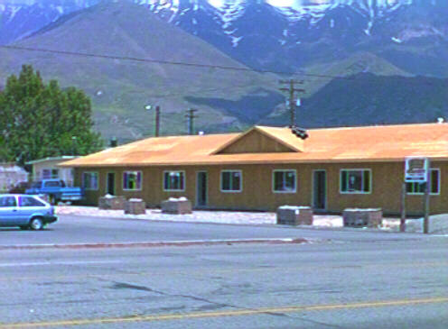
| Property Address: |
|
| Mailing Address: 797 BOWL DR OREM, UT 84097-2324 |
|
| Acreage: 0.763055 |
|
| Last Document:
32077-1991
|
|
| Subdivision Map Filing |
|
| Taxing Description:
COM N 71.22 FT & W 1870.71 FT FR E 1/4 COR. SEC. 10, T6S, R2E, SLB&M.; N 85 DEG 30' 0" W 68.32 FT; N 5 DEG 21' 0" W 242.49 FT; N 88 DEG 31' 0" E 216.61 FT; S 18 DEG 30' 0" E 108.32 FT; S 88 DEG 44' 2" W 89.29 FT; S 89 DEG 34' 15" W 83.9 FT; S 5 DEG 2' 27" E 147.65 FT TO BEG. AREA 0.763 AC.
*Taxing description NOT FOR LEGAL DOCUMENTS
|
|
- Owner Names
- Value History
- Tax History
- Location
- Photos
- Documents
- Aerial Image
| |
----- Real Estate Values ----- |
---Improvements--- |
---Greenbelt--- |
Total |
| Year |
Com |
Res |
Agr |
Tot |
Com |
Res |
Agr |
Tot |
Land |
Homesite |
Tot |
Market Value |
| 2006 |
$257,688 |
$0 |
$0 |
$257,688 |
$228,098 |
$0 |
$0 |
$228,098 |
$0 |
$0 |
$0 |
$485,786 |
| 2005 |
$257,688 |
$0 |
$0 |
$257,688 |
$228,098 |
$0 |
$0 |
$228,098 |
$0 |
$0 |
$0 |
$485,786 |
| 2004 |
$257,688 |
$0 |
$0 |
$257,688 |
$228,098 |
$0 |
$0 |
$228,098 |
$0 |
$0 |
$0 |
$485,786 |
| 2003 |
$257,688 |
$0 |
$0 |
$257,688 |
$228,098 |
$0 |
$0 |
$228,098 |
$0 |
$0 |
$0 |
$485,786 |
| 2002 |
$257,688 |
$0 |
$0 |
$257,688 |
$228,098 |
$0 |
$0 |
$228,098 |
$0 |
$0 |
$0 |
$485,786 |
| 2001 |
$221,002 |
$0 |
$0 |
$221,002 |
$195,624 |
$0 |
$0 |
$195,624 |
$0 |
$0 |
$0 |
$416,626 |
| 2000 |
$206,544 |
$0 |
$0 |
$206,544 |
$195,624 |
$0 |
$0 |
$195,624 |
$0 |
$0 |
$0 |
$402,168 |
| 1999 |
$206,544 |
$0 |
$0 |
$206,544 |
$195,624 |
$0 |
$0 |
$195,624 |
$0 |
$0 |
$0 |
$402,168 |
| 1998 |
$198,600 |
$0 |
$0 |
$198,600 |
$188,100 |
$0 |
$0 |
$188,100 |
$0 |
$0 |
$0 |
$386,700 |
| 1997 |
$198,600 |
$0 |
$0 |
$198,600 |
$188,100 |
$0 |
$0 |
$188,100 |
$0 |
$0 |
$0 |
$386,700 |
| Year |
General Taxes |
Adjustments |
Net Taxes |
Fees |
Payments |
Tax Balance* |
Balance Due |
Tax District |
| 2006 |
$5,143.99 |
$0.00 |
$5,143.99 |
$0.00 |
|
$0.00
|
$0.00 |
090 - OREM CITY |
| 2005 |
$5,806.11 |
$0.00 |
$5,806.11 |
$0.00 |
|
$0.00
|
$0.00 |
090 - OREM CITY |
| 2004 |
$5,703.13 |
$0.00 |
$5,703.13 |
$0.00 |
|
$0.00
|
$0.00 |
090 - OREM CITY |
| 2003 |
$5,534.07 |
$0.00 |
$5,534.07 |
$0.00 |
|
$0.00
|
$0.00 |
090 - OREM CITY |
| 2002 |
$5,057.52 |
$0.00 |
$5,057.52 |
$0.00 |
|
$0.00
|
$0.00 |
090 - OREM CITY |
| 2001 |
$4,295.83 |
$0.00 |
$4,295.83 |
$0.00 |
|
$0.00
|
$0.00 |
090 - OREM CITY |
| 2000 |
$4,287.51 |
$0.00 |
$4,287.51 |
$0.00 |
|
$0.00
|
$0.00 |
090 - OREM CITY |
| 1999 |
$4,414.20 |
$0.00 |
$4,414.20 |
$0.00 |
|
$0.00
|
$0.00 |
090 - OREM CITY |
| 1998 |
$4,007.76 |
$0.00 |
$4,007.76 |
$0.00 |
|
$0.00
|
$0.00 |
090 - OREM CITY |
| 1997 |
$3,991.13 |
$0.00 |
$3,991.13 |
$0.00 |
|
$0.00
|
$0.00 |
090 - OREM CITY |
* Note: Original tax amount (Does not include applicable interest and/or fees).
| Entry # |
Date |
Recorded |
Type |
Party1 (Grantor) |
Party2 (Grantee) |
| 165244-2006 |
07/21/2006 |
12/07/2006 |
WD |
NITA B PARK FAMILY LC |
UTAH DEPARTMENT OF TRANSPORTATION |
| 151281-2006 |
10/20/2006 |
11/13/2006 |
R EAS |
QWEST CORPORATION |
WHOM OF INTEREST |
| 45219-2002 |
03/13/2001 |
04/23/2002 |
WD |
PARK, NITA B TEE (ET AL) |
NITA B PARK FAMILY LC |
| 45217-2002 |
03/13/2002 |
04/23/2002 |
AF DC |
PARK, RICHARD D & RICHARD DEAN AKA |
PARK, NITA B TEE |
| 132099-1999 |
11/27/1999 |
12/27/1999 |
QCD |
D F PROPERTIES LC AKA (ET AL) |
D F ADAMS PROPERTIES LC |
| 272-1996 |
12/27/1995 |
01/02/1996 |
BLA |
RACKMAN, GARY MC COY & SHARON D (ET AL) |
PARK FAMILY TRUST (ET AL) |
Main Menu Comments or Concerns on Value/Appraisal - Assessor's Office
Documents/Owner/Parcel information - Recorder's Office
Address Change for Tax Notice
This page was created on 7/22/2024 8:27:20 PM |