Property Information
mobile view
| Serial Number: 17:054:0105 |
Serial Life: 2008-2014 |
|
|
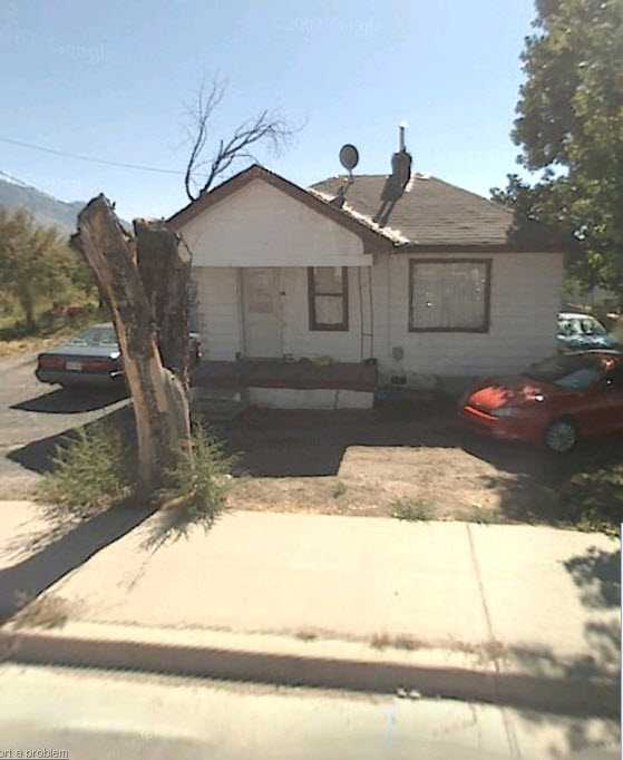
Total Photos: 1
|
| |
|
|
| Property Address: 902 E 800 NORTH - OREM |
|
| Mailing Address: %STRATTON, D CHAD 663 N 960 E OREM, UT 84097-4297 |
|
| Acreage: 5.231391 |
|
| Last Document:
177165-2007
|
|
| Subdivision Map Filing |
|
| Taxing Description:
COM S 36.33 FT & E 661.53 FT FR W 1/4 COR. SEC. 12, T6S, R2E, SLB&M.; N 89 DEG 59' 45" E 78.59 FT; N 89 DEG 59' 45" E 238.26 FT; S 86 DEG 54' 55" E 33.43 FT; S 0 DEG 31' 36" E 647.82 FT; S 89 DEG 36' 37" W 350.2 FT; N 0 DEG 31' 36" W 6.57 FT; N 0 DEG 31' 36" W 645.41 FT TO BEG. AREA 5.231 AC.
*Taxing description NOT FOR LEGAL DOCUMENTS
|
|
- Owner Names
- Value History
- Tax History
- Location
- Photos
- Documents
- Aerial Image
| 2015NV |
|
ABBOTT, KAREN |
|
| 2015NV |
|
ALLEN & ANN PERRY PROPERTIES LLC |
|
| 2015NV |
|
CHAD & DIANE STRATTON PROPERTIES LLC |
|
| 2015NV |
|
CYNTHIA STRATTON PROPERTIES LLC |
|
| 2015NV |
|
J&N MCNEIL PROPERTIES LLC |
|
| 2015NV |
|
STRATTON, CONNIE |
|
| 2015NV |
|
ABBOTT, KAREN |
|
| 2015NV |
|
ALLEN & ANN PERRY PROPERTIES LLC |
|
| 2015NV |
|
CHAD & DIANE STRATTON PROPERTIES LLC |
|
| 2015NV |
|
CYNTHIA STRATTON PROPERTIES LLC |
|
| 2015NV |
|
MC NIEL NANCY |
|
| 2015NV |
|
STRATTON, CONNIE |
|
| 2015NV |
|
ABBOTT, KAREN |
|
| 2015NV |
|
ALLEN & ANN PERRY PROPERTIES LLC |
|
| 2015NV |
|
CHAD & DIANE STRATTON PROPERTIES LLC |
|
| 2015NV |
|
MC NIEL NANCY |
|
| 2015NV |
|
STRATTON, CINDY |
|
| 2015NV |
|
STRATTON, CONNIE |
|
| 2015NV |
|
ABBOTT, KAREN |
|
| 2015NV |
|
CHAD & DIANE STRATTON PROPERTIES LLC |
|
| 2015NV |
|
MC NIEL NANCY |
|
| 2015NV |
|
PERRY, ANN |
|
| 2015NV |
|
STRATTON, CINDY |
|
| 2015NV |
|
STRATTON, CONNIE |
|
| 2015NV |
|
ABBOTT, KAREN |
|
| 2015NV |
|
MC NIEL NANCY |
|
| 2015NV |
|
PERRY, ANN |
|
| 2015NV |
|
STRATTON, CINDY |
|
| 2015NV |
|
STRATTON, CONNIE |
|
| 2015NV |
|
STRATTON, D CHAD |
|
| 2008-2014 |
|
JDS FAMILY PROPERTIES LLC |
|
| |
----- Real Estate Values ----- |
---Improvements--- |
---Greenbelt--- |
Total |
| Year |
Com |
Res |
Agr |
Tot |
Com |
Res |
Agr |
Tot |
Land |
Homesite |
Tot |
Market Value |
| 2014 |
$0 |
$100,000 |
$169,300 |
$269,300 |
$0 |
$0 |
$0 |
$0 |
$3,300 |
$0 |
$3,300 |
$269,300 |
| 2013 |
$0 |
$100,000 |
$169,300 |
$269,300 |
$0 |
$35,700 |
$0 |
$35,700 |
$2,644 |
$50,000 |
$52,644 |
$305,000 |
| 2012 |
$0 |
$130,000 |
$126,900 |
$256,900 |
$0 |
$24,500 |
$0 |
$24,500 |
$2,585 |
$50,000 |
$52,585 |
$281,400 |
| 2011 |
$0 |
$167,000 |
$203,000 |
$370,000 |
$0 |
$24,500 |
$0 |
$24,500 |
$2,545 |
$50,000 |
$52,545 |
$394,500 |
| 2010 |
$0 |
$167,000 |
$203,000 |
$370,000 |
$0 |
$24,500 |
$0 |
$24,500 |
$2,540 |
$50,000 |
$52,540 |
$394,500 |
| 2009 |
$0 |
$167,000 |
$203,000 |
$370,000 |
$0 |
$24,500 |
$0 |
$24,500 |
$2,490 |
$50,000 |
$52,490 |
$394,500 |
| 2008 |
$0 |
$167,000 |
$203,000 |
$370,000 |
$0 |
$24,500 |
$0 |
$24,500 |
$2,465 |
$50,000 |
$52,465 |
$394,500 |
| Year |
General Taxes |
Adjustments |
Net Taxes |
Fees |
Payments |
Tax Balance* |
Balance Due |
Tax District |
| 2014 |
$37.68 |
$0.00 |
$37.68 |
$0.00 |
|
$0.00
|
$0.00 |
090 - OREM CITY |
| 2013 |
$612.98 |
$0.00 |
$612.98 |
$0.00 |
|
$0.00
|
$0.00 |
090 - OREM CITY |
| 2012 |
$547.46 |
$0.00 |
$547.46 |
$0.00 |
|
$0.00
|
$0.00 |
090 - OREM CITY |
| 2011 |
$544.35 |
$0.00 |
$544.35 |
$0.00 |
|
$0.00
|
$0.00 |
090 - OREM CITY |
| 2010 |
$509.56 |
$0.00 |
$509.56 |
$0.00 |
|
$0.00
|
$0.00 |
090 - OREM CITY |
| 2009 |
$471.81 |
$0.00 |
$471.81 |
$0.00 |
|
$0.00
|
$0.00 |
090 - OREM CITY |
| 2008 |
$436.96 |
$0.00 |
$436.96 |
$0.00 |
|
$0.00
|
$0.00 |
090 - OREM CITY |
* Note: Original tax amount (Does not include applicable interest and/or fees).
| Entry # |
Date |
Recorded |
Type |
Party1 (Grantor) |
Party2 (Grantee) |
| 81793-2014 |
11/10/2014 |
11/13/2014 |
WD |
ABBOTT, KAREN (ET AL) |
CASCADE ESTATES LLC |
| 81792-2014 |
11/03/2014 |
11/13/2014 |
R NI |
STRATTON, D CHAD & RUBY D PERREP (ET AL) |
WHOM OF INTEREST |
| 71254-2014 |
09/26/2014 |
10/06/2014 |
WD |
MCNIEL, NANCY |
J&N MCNEIL PROPERTIES LLC |
| 71253-2014 |
09/16/2014 |
10/06/2014 |
WD |
STRATTON, CINDY |
CYNTHIA STRATTON PROPERTIES LLC |
| 64428-2014 |
09/10/2014 |
09/10/2014 |
WD |
PERRY, ANN |
ALLEN & ANN PERRY PROPERTIES LLC |
| 63115-2014 |
09/04/2014 |
09/05/2014 |
WD |
STRATTON, D CHAD |
CHAD & DIANE STRATTON PROPERTIES LLC |
| 19019-2014 |
03/13/2014 |
03/21/2014 |
WD |
JDS FAMILY PROPERTIES LLC |
ABBOTT, KAREN (ET AL) |
| 43599-2012 |
05/18/2012 |
05/25/2012 |
FARM |
JDS FAMILY PROPERTIES LLC |
WHOM OF INTEREST |
| 177165-2007 |
12/10/2007 |
12/27/2007 |
WD |
JOHN D STRATTON PROPERTIES LC |
JDS FAMILY PROPERTIES LLC |
Main Menu Comments or Concerns on Value/Appraisal - Assessor's Office
Documents/Owner/Parcel information - Recorder's Office
Address Change for Tax Notice
This page was created on 7/22/2024 10:39:08 AM |