Property Information
mobile view
| Serial Number: 17:054:0120 |
Serial Life: 2025... |
|
|
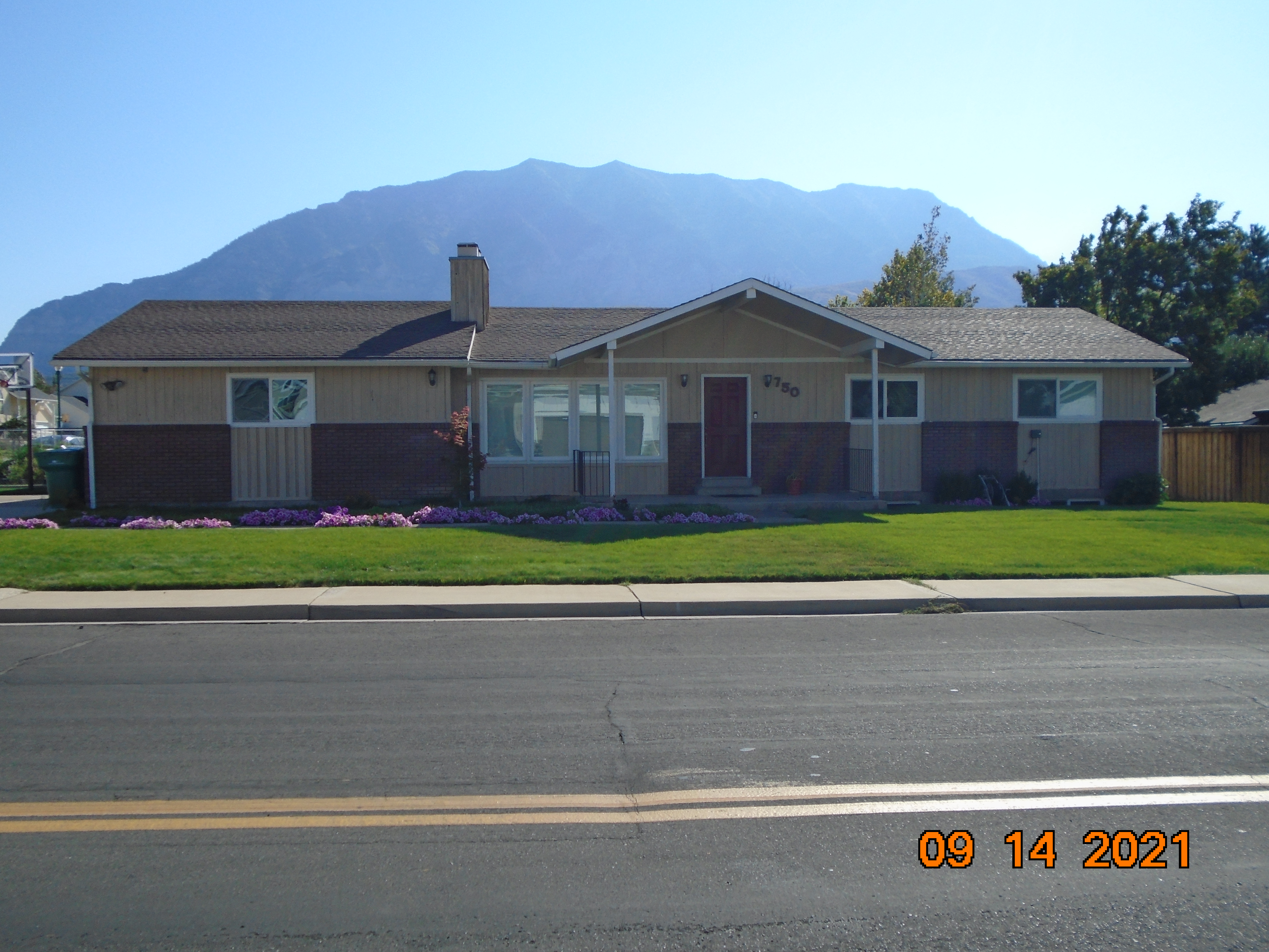 Total Photos: 1
|
| |
|
|
| Property Address: 750 N 1000 EAST - OREM |
|
| Mailing Address: 750 N 1000 E OREM, UT 84097-4378 |
|
| Acreage: 0.25575 |
|
| Last Document:
70352-2024
|
|
| Subdivision Map Filing |
|
| Taxing Description:
COM E 1355.33 FT & S 422.38 FT FR W 1/4 COR. SEC. 12, T6S, R2E, SLB&M.; N 1 DEG 5' 59" W 94.8 FT; ALONG A CURVE TO R (CHORD BEARS: N 44 DEG 17' 51" E 21.36 FT, RADIUS = 15 FT); N 89 DEG 41' 42" E 86.87 FT; S 0 DEG 47' 20" E 110.01 FT; S 89 DEG 41' 42" W 101.49 FT TO BEG. AREA 0.256 AC.
*Taxing description NOT FOR LEGAL DOCUMENTS
|
|
- Owner Names
- Value History
- Tax History
- Location
- Photos
- Documents
- Aerial Image
Main Menu Comments or Concerns on Value/Appraisal - Assessor's Office
Documents/Owner/Parcel information - Recorder's Office
Address Change for Tax Notice
This page was created on 2/6/2025 6:45:50 AM |