Property Information
mobile view
| Serial Number: 18:032:0011 |
Serial Life: 1977... |
|
|
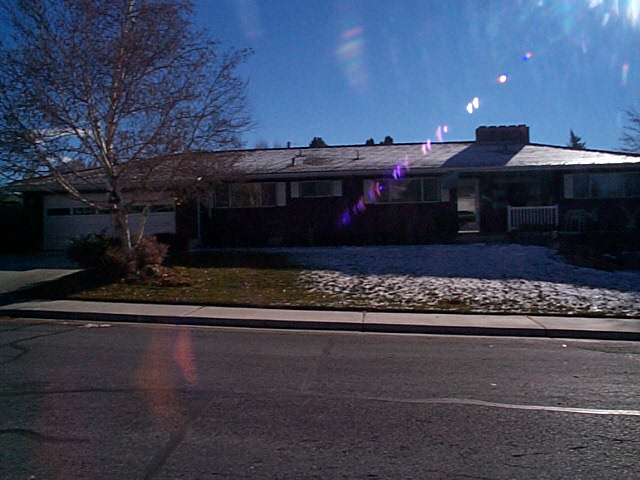 Total Photos: 1
|
| |
|
|
| Property Address: 671 W 650 SOUTH - OREM |
|
| Mailing Address: 671 W 650 S OREM, UT 84058-6065 |
|
| Acreage: 0.26 |
|
| Last Document:
48988-2014
|
|
| Subdivision Map Filing |
|
| Taxing Description:
COM. N 63 37' W 84.77 FT FROM NE COR OF LOT 2, BLK 8, PLAT A, SUNSET VISRA OREM; N 1 04.5' W 84.77 FT; S 88 55.5' W 98.73 FT; S 1 04.5' E 120 FT TO N LINE OF LOT 3, BLK 8; N 88 55.5' E 72 FT TO NECOR OF SD LOT 3; NE-LY 41.15 FT TO BEG. AREA .26 OF AN ACRE.
*Taxing description NOT FOR LEGAL DOCUMENTS
|
|
- Owner Names
- Value History
- Tax History
- Location
- Photos
- Documents
- Aerial Image
| 2020... |
|
JOHNSON, AARON |
|
| 2020... |
|
JOHNSON, LINDY |
|
| 2015-2019 |
|
REIBER, KAY |
|
| 2015NV |
|
CHRISTIANSEN, JUDY J |
|
| 2015NV |
|
CHRISTIANSEN, LARRY C |
|
| 2015NV |
|
CHRISTIANSEN, JUDY J |
|
| 2015NV |
|
CHRISTIANSEN, LARRY C |
|
| 1993-2014 |
|
CHRISTIANSEN, JUDITH J TEE |
|
| 1993-2014 |
|
CHRISTIANSEN, LAWRENCE C TEE |
|
| 1993NV |
|
ALBRECHT, LEANN |
|
| 1993NV |
|
CHRISTIANSEN, JUDITH J |
|
| 1993NV |
|
CHRISTIANSEN, LAWRENCE C |
|
| 1986-1992 |
|
CHRISTIANSEN, JUDITH J |
|
| 1986-1992 |
|
CHRISTIANSEN, LAWRENCE C |
|
| 1984-1985 |
|
SLOCOMB, CHARLES AUBERT |
|
| 1984-1985 |
|
SLOCOMB, GLADYS MARIE |
|
| 1982-1983 |
|
SLOCOMB, CHARLES AUBERT |
|
| 1982-1983 |
|
SLOCOMB, GLADYS MARIE |
|
| 1977-1981 |
|
STRATE, WALLACE H |
|
| |
----- Real Estate Values ----- |
---Improvements--- |
---Greenbelt--- |
Total |
| Year |
Com |
Res |
Agr |
Tot |
Com |
Res |
Agr |
Tot |
Land |
Homesite |
Tot |
Market Value |
| 2024 |
$0 |
$221,100 |
$0 |
$221,100 |
$0 |
$274,200 |
$0 |
$274,200 |
$0 |
$0 |
$0 |
$495,300 |
| 2023 |
$0 |
$221,100 |
$0 |
$221,100 |
$0 |
$263,600 |
$0 |
$263,600 |
$0 |
$0 |
$0 |
$484,700 |
| 2022 |
$0 |
$235,700 |
$0 |
$235,700 |
$0 |
$224,600 |
$0 |
$224,600 |
$0 |
$0 |
$0 |
$460,300 |
| 2021 |
$0 |
$181,300 |
$0 |
$181,300 |
$0 |
$175,500 |
$0 |
$175,500 |
$0 |
$0 |
$0 |
$356,800 |
| 2020 |
$0 |
$145,000 |
$0 |
$145,000 |
$0 |
$172,100 |
$0 |
$172,100 |
$0 |
$0 |
$0 |
$317,100 |
| 2019 |
$0 |
$133,800 |
$0 |
$133,800 |
$0 |
$172,100 |
$0 |
$172,100 |
$0 |
$0 |
$0 |
$305,900 |
| 2018 |
$0 |
$115,200 |
$0 |
$115,200 |
$0 |
$162,000 |
$0 |
$162,000 |
$0 |
$0 |
$0 |
$277,200 |
| 2017 |
$0 |
$96,700 |
$0 |
$96,700 |
$0 |
$162,000 |
$0 |
$162,000 |
$0 |
$0 |
$0 |
$258,700 |
| 2016 |
$0 |
$72,100 |
$0 |
$72,100 |
$0 |
$157,900 |
$0 |
$157,900 |
$0 |
$0 |
$0 |
$230,000 |
| 2015 |
$0 |
$72,100 |
$0 |
$72,100 |
$0 |
$141,200 |
$0 |
$141,200 |
$0 |
$0 |
$0 |
$213,300 |
| 2014 |
$0 |
$69,100 |
$0 |
$69,100 |
$0 |
$141,200 |
$0 |
$141,200 |
$0 |
$0 |
$0 |
$210,300 |
| 2013 |
$0 |
$48,100 |
$0 |
$48,100 |
$0 |
$138,100 |
$0 |
$138,100 |
$0 |
$0 |
$0 |
$186,200 |
| 2012 |
$0 |
$48,300 |
$0 |
$48,300 |
$0 |
$134,700 |
$0 |
$134,700 |
$0 |
$0 |
$0 |
$183,000 |
| 2011 |
$0 |
$51,400 |
$0 |
$51,400 |
$0 |
$137,400 |
$0 |
$137,400 |
$0 |
$0 |
$0 |
$188,800 |
| 2010 |
$0 |
$53,400 |
$0 |
$53,400 |
$0 |
$147,257 |
$0 |
$147,257 |
$0 |
$0 |
$0 |
$200,657 |
| 2009 |
$0 |
$53,400 |
$0 |
$53,400 |
$0 |
$153,800 |
$0 |
$153,800 |
$0 |
$0 |
$0 |
$207,200 |
| 2008 |
$0 |
$77,400 |
$0 |
$77,400 |
$0 |
$138,400 |
$0 |
$138,400 |
$0 |
$0 |
$0 |
$215,800 |
| 2007 |
$0 |
$80,600 |
$0 |
$80,600 |
$0 |
$144,200 |
$0 |
$144,200 |
$0 |
$0 |
$0 |
$224,800 |
| 2006 |
$0 |
$39,500 |
$0 |
$39,500 |
$0 |
$129,400 |
$0 |
$129,400 |
$0 |
$0 |
$0 |
$168,900 |
| 2005 |
$0 |
$37,622 |
$0 |
$37,622 |
$0 |
$123,201 |
$0 |
$123,201 |
$0 |
$0 |
$0 |
$160,823 |
| 2004 |
$0 |
$37,622 |
$0 |
$37,622 |
$0 |
$123,201 |
$0 |
$123,201 |
$0 |
$0 |
$0 |
$160,823 |
| 2003 |
$0 |
$37,622 |
$0 |
$37,622 |
$0 |
$123,201 |
$0 |
$123,201 |
$0 |
$0 |
$0 |
$160,823 |
| 2002 |
$0 |
$37,622 |
$0 |
$37,622 |
$0 |
$123,201 |
$0 |
$123,201 |
$0 |
$0 |
$0 |
$160,823 |
| 2001 |
$0 |
$37,622 |
$0 |
$37,622 |
$0 |
$123,201 |
$0 |
$123,201 |
$0 |
$0 |
$0 |
$160,823 |
| 2000 |
$0 |
$35,161 |
$0 |
$35,161 |
$0 |
$110,385 |
$0 |
$110,385 |
$0 |
$0 |
$0 |
$145,546 |
| 1999 |
$0 |
$32,861 |
$0 |
$32,861 |
$0 |
$103,164 |
$0 |
$103,164 |
$0 |
$0 |
$0 |
$136,025 |
| 1998 |
$0 |
$32,861 |
$0 |
$32,861 |
$0 |
$103,164 |
$0 |
$103,164 |
$0 |
$0 |
$0 |
$136,025 |
| 1997 |
$0 |
$32,861 |
$0 |
$32,861 |
$0 |
$103,164 |
$0 |
$103,164 |
$0 |
$0 |
$0 |
$136,025 |
| 1996 |
$0 |
$28,048 |
$0 |
$28,048 |
$0 |
$88,054 |
$0 |
$88,054 |
$0 |
$0 |
$0 |
$116,102 |
| 1995 |
$0 |
$25,498 |
$0 |
$25,498 |
$0 |
$88,054 |
$0 |
$88,054 |
$0 |
$0 |
$0 |
$113,552 |
| 1994 |
$0 |
$14,911 |
$0 |
$14,911 |
$0 |
$71,011 |
$0 |
$71,011 |
$0 |
$0 |
$0 |
$85,922 |
| 1993 |
$0 |
$14,911 |
$0 |
$14,911 |
$0 |
$71,011 |
$0 |
$71,011 |
$0 |
$0 |
$0 |
$85,922 |
| 1992 |
$0 |
$13,680 |
$0 |
$13,680 |
$0 |
$65,148 |
$0 |
$65,148 |
$0 |
$0 |
$0 |
$78,828 |
| 1991 |
$0 |
$12,000 |
$0 |
$12,000 |
$0 |
$63,379 |
$0 |
$63,379 |
$0 |
$0 |
$0 |
$75,379 |
| 1990 |
$0 |
$12,000 |
$0 |
$12,000 |
$0 |
$63,379 |
$0 |
$63,379 |
$0 |
$0 |
$0 |
$75,379 |
| 1989 |
$0 |
$12,000 |
$0 |
$12,000 |
$0 |
$63,325 |
$0 |
$63,325 |
$0 |
$0 |
$0 |
$75,325 |
| 1988 |
$0 |
$12,000 |
$0 |
$12,000 |
$0 |
$61,953 |
$0 |
$61,953 |
$0 |
$0 |
$0 |
$73,953 |
| 1987 |
$0 |
$12,000 |
$0 |
$12,000 |
$0 |
$65,000 |
$0 |
$65,000 |
$0 |
$0 |
$0 |
$77,000 |
| 1986 |
$0 |
$12,000 |
$0 |
$12,000 |
$0 |
$69,001 |
$0 |
$69,001 |
$0 |
$0 |
$0 |
$81,001 |
| 1985 |
$0 |
$24,450 |
$0 |
$24,450 |
$0 |
$76,916 |
$0 |
$76,916 |
$0 |
$0 |
$0 |
$101,366 |
| 1984 |
$0 |
$24,700 |
$0 |
$24,700 |
$0 |
$77,692 |
$0 |
$77,692 |
$0 |
$0 |
$0 |
$102,392 |
| Year |
General Taxes |
Adjustments |
Net Taxes |
Fees |
Payments |
Tax Balance* |
Balance Due |
Tax District |
| 2025 |
$0.00 |
$0.00 |
$0.00 |
$0.00 |
|
$0.00
|
$0.00 |
090 - OREM CITY |
| 2024 |
$2,227.81 |
$0.00 |
$2,227.81 |
$0.00 |
|
$0.00
|
$0.00 |
090 - OREM CITY |
| 2023 |
$2,028.45 |
$0.00 |
$2,028.45 |
$0.00 |
|
$0.00
|
$0.00 |
090 - OREM CITY |
| 2022 |
$1,988.36 |
$0.00 |
$1,988.36 |
$0.00 |
|
$0.00
|
$0.00 |
090 - OREM CITY |
| 2021 |
$1,850.15 |
$0.00 |
$1,850.15 |
$0.00 |
|
$0.00
|
$0.00 |
090 - OREM CITY |
| 2020 |
$1,673.07 |
$0.00 |
$1,673.07 |
$0.00 |
|
$0.00
|
$0.00 |
090 - OREM CITY |
| 2019 |
$1,552.06 |
$0.00 |
$1,552.06 |
$0.00 |
|
$0.00
|
$0.00 |
090 - OREM CITY |
| 2018 |
$1,472.00 |
$0.00 |
$1,472.00 |
$0.00 |
|
$0.00
|
$0.00 |
090 - OREM CITY |
| 2017 |
$1,410.47 |
$0.00 |
$1,410.47 |
$0.00 |
|
$0.00
|
$0.00 |
090 - OREM CITY |
| 2016 |
$1,359.88 |
$0.00 |
$1,359.88 |
$0.00 |
|
$0.00
|
$0.00 |
090 - OREM CITY |
| 2015 |
$1,333.52 |
$0.00 |
$1,333.52 |
$0.00 |
|
$0.00
|
$0.00 |
090 - OREM CITY |
| 2014 |
$1,320.78 |
$0.00 |
$1,320.78 |
$0.00 |
|
$0.00
|
$0.00 |
090 - OREM CITY |
| 2013 |
$1,261.08 |
($630.54) |
$630.54 |
$0.00 |
|
$0.00
|
$0.00 |
090 - OREM CITY |
| 2012 |
$1,264.97 |
($845.99) |
$418.98 |
$0.00 |
|
$0.00
|
$0.00 |
090 - OREM CITY |
| 2011 |
$1,298.83 |
($578.30) |
$720.53 |
$0.00 |
|
$0.00
|
$0.00 |
090 - OREM CITY |
| 2010 |
$1,292.33 |
($682.94) |
$609.39 |
$0.00 |
|
$0.00
|
$0.00 |
090 - OREM CITY |
| 2009 |
$1,237.04 |
($371.00) |
$866.04 |
$0.00 |
|
$0.00
|
$0.00 |
090 - OREM CITY |
| 2008 |
$1,193.90 |
($1,193.90) |
$0.00 |
$0.00 |
|
$0.00
|
$0.00 |
090 - OREM CITY |
| 2007 |
$1,229.48 |
($1,229.48) |
$0.00 |
$0.00 |
|
$0.00
|
$0.00 |
090 - OREM CITY |
| 2006 |
$983.67 |
($983.67) |
$0.00 |
$0.00 |
|
$0.00
|
$0.00 |
090 - OREM CITY |
| 2005 |
$1,057.19 |
($1,057.19) |
$0.00 |
$0.00 |
|
$0.00
|
$0.00 |
090 - OREM CITY |
| 2004 |
$1,038.44 |
$0.00 |
$1,038.44 |
$0.00 |
|
$0.00
|
$0.00 |
090 - OREM CITY |
| 2003 |
$1,007.66 |
$0.00 |
$1,007.66 |
$0.00 |
|
$0.00
|
$0.00 |
090 - OREM CITY |
| 2002 |
$920.88 |
$0.00 |
$920.88 |
$0.00 |
|
$0.00
|
$0.00 |
090 - OREM CITY |
| 2001 |
$912.04 |
$0.00 |
$912.04 |
$0.00 |
|
$0.00
|
$0.00 |
090 - OREM CITY |
| 2000 |
$853.42 |
$0.00 |
$853.42 |
$0.00 |
|
$0.00
|
$0.00 |
090 - OREM CITY |
| 1999 |
$821.16 |
$0.00 |
$821.16 |
$0.00 |
|
$0.00
|
$0.00 |
090 - OREM CITY |
| 1998 |
$775.37 |
$0.00 |
$775.37 |
$0.00 |
|
$0.00
|
$0.00 |
090 - OREM CITY |
| 1997 |
$772.16 |
$0.00 |
$772.16 |
$0.00 |
|
$0.00
|
$0.00 |
090 - OREM CITY |
| 1996 |
$602.10 |
$0.00 |
$602.10 |
$0.00 |
|
$0.00
|
$0.00 |
090 - OREM CITY |
| 1995 |
$666.38 |
$0.00 |
$666.38 |
$0.00 |
|
$0.00
|
$0.00 |
090 - OREM CITY |
| 1994 |
$803.36 |
$0.00 |
$803.36 |
$0.00 |
|
$0.00
|
$0.00 |
090 - OREM CITY |
| 1993 |
$710.99 |
$0.00 |
$710.99 |
$0.00 |
|
$0.00
|
$0.00 |
090 - OREM CITY |
| 1992 |
$657.65 |
$0.00 |
$657.65 |
$0.00 |
|
$0.00
|
$0.00 |
090 - OREM CITY |
| 1991 |
$657.51 |
$0.00 |
$657.51 |
$0.00 |
|
$0.00
|
$0.00 |
090 - OREM CITY |
| 1990 |
$632.05 |
$0.00 |
$632.05 |
$0.00 |
|
$0.00
|
$0.00 |
090 - OREM CITY |
| 1989 |
$643.71 |
$0.00 |
$643.71 |
$0.00 |
|
$0.00
|
$0.00 |
090 - OREM CITY |
| 1988 |
$630.48 |
$0.00 |
$630.48 |
$0.00 |
|
$0.00
|
$0.00 |
090 - OREM CITY |
| 1987 |
$645.60 |
$0.00 |
$645.60 |
$0.00 |
|
$0.00
|
$0.00 |
090 - OREM CITY |
| 1986 |
$670.00 |
($33.09) |
$636.91 |
$0.00 |
|
$0.00
|
$0.00 |
090 - OREM CITY |
| 1985 |
$843.45 |
$0.00 |
$843.45 |
$0.00 |
|
$0.00
|
$0.00 |
090 - OREM CITY |
| 1984 |
$835.64 |
$0.00 |
$835.64 |
$0.00 |
|
$0.00
|
$0.00 |
090 - OREM CITY |
* Note: Original tax amount (Does not include applicable interest and/or fees).
| Entry # |
Date |
Recorded |
Type |
Party1 (Grantor) |
Party2 (Grantee) |
| 85930-2019 |
09/03/2019 |
09/03/2019 |
D TR |
JOHNSON, AARON & LINDY |
FLYING PIGS FAMILY CORPORATION |
| 70572-2019 |
07/19/2019 |
07/29/2019 |
REC |
MORAN, KEVIN P SUBTEE |
REIBER, KAY |
| 70571-2019 |
07/08/2019 |
07/29/2019 |
SUB TEE |
MORTGAGE ELECTRONIC REGISTRATION SYSTEMS INC |
MORAN, KEVIN P SUBTEE |
| 61542-2019 |
07/03/2019 |
07/03/2019 |
D TR |
JOHNSON, AARON & LINDY |
UNITED WHOLESALE MORTGAGE LLC |
| 61541-2019 |
06/28/2019 |
07/03/2019 |
WD |
REIBER, KAY |
JOHNSON, AARON & LINDY |
| 48989-2014 |
07/11/2014 |
07/16/2014 |
D TR |
REIBER, KAY |
MOUNTAIN AMERICA FEDERAL CREDIT UNION |
| 48988-2014 |
07/08/2014 |
07/16/2014 |
WD |
ALBRECHT, LEANN SUCTEE (ET AL) |
REIBER, KAY |
| 41970-2014 |
06/19/2014 |
06/19/2014 |
AF DC |
CHRISTIANSEN, LAWRENCE CARL & LAWRENCE C AKA |
WHOM OF INTEREST |
| 41969-2014 |
06/19/2014 |
06/19/2014 |
AF DC |
CHRISTIANSEN, JUDITH JEAN GEHLING & JUDITH J AKA |
WHOM OF INTEREST |
| 142066-2005 |
10/04/2005 |
12/08/2005 |
DECLRES |
BROWN, JAMES K |
WHOM OF INTEREST |
| 59131-1992 |
10/29/1992 |
11/03/1992 |
QCD |
ALBRECHT, LEANN & LE ANN |
CHRISTIANSEN, LARRY C & JUDY J TEE |
| 51623-1992 |
09/29/1992 |
09/29/1992 |
N |
JENSEN, WOODRUFF |
WHOM OF INTEREST |
| 25488-1992 |
05/18/1992 |
05/26/1992 |
QCD |
CHRISTIANSEN, LAWRENCE C & JUDITH J |
CHRISTIANSEN, LAWRENCE C & JUDITH J (ET AL) |
| 22247-1991 |
06/07/1991 |
06/10/1991 |
REC |
FIDELITY LAND & TITLE TEE |
CHRISTIANSEN, LAWRENCE C & JUDITH J |
| 15243-1991 |
04/25/1991 |
04/26/1991 |
TR D |
CHRISTIANSEN, LAWRENCE C & JUDITH J |
FIRST SECURITY BANK OF UTAH |
| 1692-1988 |
01/08/1988 |
01/22/1988 |
REC |
DESERET FEDERAL SAVINGS & LOAN ASSOCIATION TEE |
CHRISTIANSEN, LAWRENCE C & JUDITH J |
| 2869-1986 |
01/22/1986 |
01/28/1986 |
QCD |
SLOCOMB, CHARLES AUBERT & GLADYS MARIE TEE |
SLOCOMB, CHARLES AUBERT & GLADYS MARIE |
| 37047-1985 |
12/12/1985 |
12/17/1985 |
AS |
DESERET FEDERAL SAVINGS & LOAN ASSOCIATION |
UTAH HOUSING FINANCE AGENCY |
| 36611-1985 |
12/12/1985 |
12/12/1985 |
D TR |
CHRISTIANSEN, LAWRENCE C & JUDITH J |
DESERET FEDERAL SAVINGS & LOAN ASSOCIATION |
| 36610-1985 |
08/21/1984 |
12/12/1985 |
WD |
SLOCOMB, CHARLES AUBERT & GLADYS MARIE |
CHRISTIANSEN, LAWRENCE C & JUDITH J |
| 10633-1984 |
04/10/1984 |
04/11/1984 |
REC |
SECURITY TITLE AND ABSTRACT COMPANY TEE |
SLOCOMB, CHARLES AUBERT & GLADYS MARIE |
| 21798-1983 |
|
07/22/1983 |
QCD |
SLOCOMB, CHARLES AUBERT & GLADYS MARIE |
SLOCOMB, CHARLES AUBERT & GLADYS MARIE TEE |
| 34795-1981 |
12/01/1981 |
12/10/1981 |
TR D |
SLOCOMB, CHARLES AUBERT & GLADYS MARIE |
STRATE, MADELINE A |
| 34794-1981 |
12/01/1981 |
12/10/1981 |
WD |
STRATE, MADELINE A PERREP |
SLOCOMB, CHARLES AUBERT & GLADYS MARIE |
| 34793-1981 |
10/13/1962 |
12/10/1981 |
REL |
JENSEN, WOODRUFF & MORONI A |
STRATE, WALLACE H |
Main Menu Comments or Concerns on Value/Appraisal - Assessor's Office
Documents/Owner/Parcel information - Recorder's Office
Address Change for Tax Notice
This page was created on 3/12/2025 9:08:07 PM |