Property Information
mobile view
| Serial Number: 18:057:0109 |
Serial Life: 1981-1997 |
|
|
Total Photos: 1
|
| |
|
|
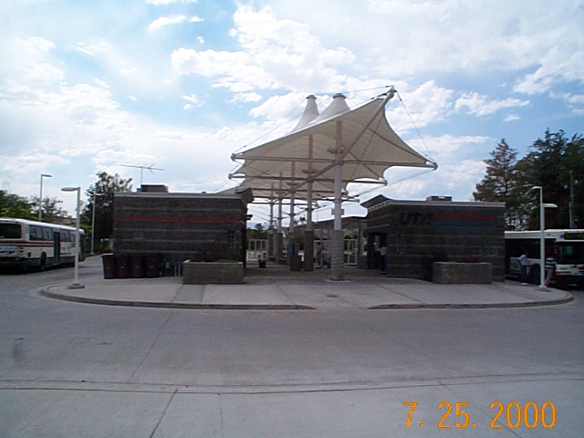
| Property Address: 1154 S 800 EAST - OREM |
|
| Mailing Address: 1962 N 920 W OREM, UT 84057-2014 |
|
| Acreage: 0.26 |
|
| Last Document:
49683-1992
|
|
| Subdivision Map Filing |
|
| Taxing Description:
COM. AT A PT IN W LINE OF 800 E ST, OREM, UTAH, 330 FT ALONG SEC LINE N 3' E & 25 FT N 89 2' W FROM SE COR OF SEC 23, T 6 S, R 2 E, SLM; N 89 2' W 140 FT; N 3' E 82.5 FT; S 89 2' E 136.9 FT; S 9' E 83 FT TO BEG. AREA .26 OF AN ACRE.
*Taxing description NOT FOR LEGAL DOCUMENTS
|
|
- Owner Names
- Value History
- Tax History
- Location
- Photos
- Documents
- Aerial Image
| |
----- Real Estate Values ----- |
---Improvements--- |
---Greenbelt--- |
Total |
| Year |
Com |
Res |
Agr |
Tot |
Com |
Res |
Agr |
Tot |
Land |
Homesite |
Tot |
Market Value |
| 1996 |
$0 |
$38,097 |
$0 |
$38,097 |
$0 |
$46,904 |
$0 |
$46,904 |
$0 |
$0 |
$0 |
$85,001 |
| 1995 |
$0 |
$34,634 |
$0 |
$34,634 |
$0 |
$46,904 |
$0 |
$46,904 |
$0 |
$0 |
$0 |
$81,538 |
| 1994 |
$0 |
$20,254 |
$0 |
$20,254 |
$0 |
$37,826 |
$0 |
$37,826 |
$0 |
$0 |
$0 |
$58,080 |
| 1993 |
$0 |
$20,254 |
$0 |
$20,254 |
$0 |
$37,826 |
$0 |
$37,826 |
$0 |
$0 |
$0 |
$58,080 |
| 1992 |
$0 |
$18,582 |
$0 |
$18,582 |
$0 |
$34,703 |
$0 |
$34,703 |
$0 |
$0 |
$0 |
$53,285 |
| 1991 |
$0 |
$16,300 |
$0 |
$16,300 |
$0 |
$27,469 |
$0 |
$27,469 |
$0 |
$0 |
$0 |
$43,769 |
| 1990 |
$0 |
$16,300 |
$0 |
$16,300 |
$0 |
$27,469 |
$0 |
$27,469 |
$0 |
$0 |
$0 |
$43,769 |
| 1989 |
$0 |
$16,300 |
$0 |
$16,300 |
$0 |
$27,452 |
$0 |
$27,452 |
$0 |
$0 |
$0 |
$43,752 |
| 1988 |
$0 |
$16,300 |
$0 |
$16,300 |
$0 |
$28,798 |
$0 |
$28,798 |
$0 |
$0 |
$0 |
$45,098 |
| 1987 |
$0 |
$16,300 |
$0 |
$16,300 |
$0 |
$35,217 |
$0 |
$35,217 |
$0 |
$0 |
$0 |
$51,517 |
| 1986 |
$0 |
$16,300 |
$0 |
$16,300 |
$0 |
$35,217 |
$0 |
$35,217 |
$0 |
$0 |
$0 |
$51,517 |
| 1985 |
$0 |
$16,300 |
$0 |
$16,300 |
$0 |
$35,217 |
$0 |
$35,217 |
$0 |
$0 |
$0 |
$51,517 |
| 1984 |
$0 |
$16,467 |
$0 |
$16,467 |
$0 |
$35,575 |
$0 |
$35,575 |
$0 |
$0 |
$0 |
$52,042 |
| Year |
General Taxes |
Adjustments |
Net Taxes |
Fees |
Payments |
Tax Balance* |
Balance Due |
Tax District |
| 1996 |
$440.81 |
($122.24) |
$318.57 |
$0.00 |
|
$0.00
|
$0.00 |
090 - OREM CITY |
| 1995 |
$478.51 |
$0.00 |
$478.51 |
$0.00 |
|
$0.00
|
$0.00 |
090 - OREM CITY |
| 1994 |
$543.06 |
$0.00 |
$543.06 |
$0.00 |
|
$0.00
|
$0.00 |
090 - OREM CITY |
| 1993 |
$480.60 |
$0.00 |
$480.60 |
$0.00 |
|
$0.00
|
$0.00 |
090 - OREM CITY |
| 1992 |
$444.55 |
$0.00 |
$444.55 |
$0.00 |
|
$0.00
|
$0.00 |
090 - OREM CITY |
| 1991 |
$381.77 |
$0.00 |
$381.77 |
$0.00 |
|
$0.00
|
$0.00 |
090 - OREM CITY |
| 1990 |
$367.00 |
$0.00 |
$367.00 |
$0.00 |
|
$0.00
|
$0.00 |
090 - OREM CITY |
| 1989 |
$373.89 |
$0.00 |
$373.89 |
$0.00 |
|
$0.00
|
$0.00 |
090 - OREM CITY |
| 1988 |
$384.48 |
$0.00 |
$384.48 |
$0.00 |
|
$0.00
|
$0.00 |
090 - OREM CITY |
| 1987 |
$431.94 |
$0.00 |
$431.94 |
$0.00 |
|
$0.00
|
$0.00 |
090 - OREM CITY |
| 1986 |
$426.13 |
$0.00 |
$426.13 |
$0.00 |
|
$0.00
|
$0.00 |
090 - OREM CITY |
| 1985 |
$428.66 |
$0.00 |
$428.66 |
$0.00 |
|
$0.00
|
$0.00 |
090 - OREM CITY |
| 1984 |
$424.72 |
$0.00 |
$424.72 |
$0.00 |
|
$0.00
|
$0.00 |
090 - OREM CITY |
* Note: Original tax amount (Does not include applicable interest and/or fees).
| Entry # |
Date |
Recorded |
Type |
Party1 (Grantor) |
Party2 (Grantee) |
| 64142-1997 |
08/19/1997 |
08/21/1997 |
S PLAT |
UTAH TRANSIT AUTHORITY |
UTA PLAT B |
| 82815-1996 |
09/12/1996 |
10/09/1996 |
REC |
FIRST SECURITY BANK OF UTAH SUBTEE |
JOHNSON, DANIEL T & ELAINE C |
| 82814-1996 |
09/12/1996 |
10/09/1996 |
SUB TEE |
FIRST SECURITY BANK OF UTAH |
FIRST SECURITY BANK OF UTAH SUBTEE |
| 71586-1996 |
08/30/1996 |
08/30/1996 |
WD |
JOHNSON, DANIEL T & ELAINE C |
UTAH TRANSIT AUTHORITY |
| 49684-1992 |
09/21/1992 |
09/22/1992 |
D TR |
JOHNSON, DANIEL T & ELAINE C |
FIRST SECURITY BANK OF UTAH |
| 49683-1992 |
09/21/1992 |
09/22/1992 |
WD |
BINGHAM, SHIRLEY L (ET AL) |
JOHNSON, DANIEL T & ELAINE C |
Main Menu Comments or Concerns on Value/Appraisal - Assessor's Office
Documents/Owner/Parcel information - Recorder's Office
Address Change for Tax Notice
This page was created on 7/22/2024 10:30:31 AM |