Property Information
mobile view
| Serial Number: 21:047:0064 |
Serial Life: 2021... |
|
|
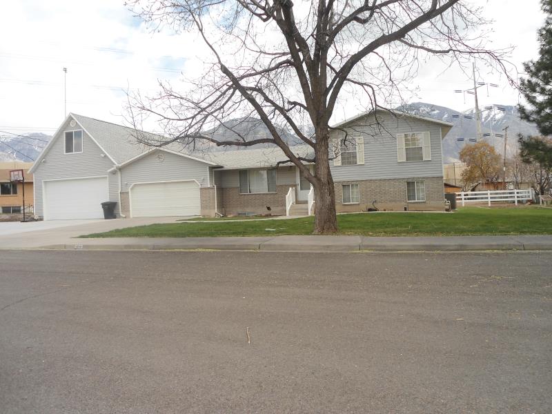 Total Photos: 1
|
| |
|
|
| Property Address: 1211 S 560 WEST - PROVO |
|
| Mailing Address: 1211 S 560 W PROVO, UT 84601-5538 |
|
| Acreage: 0.727572 |
|
| Last Document:
54129-2022
|
|
| Subdivision Map Filing |
|
| Taxing Description:
COM N 46.47 FT & W 574.57 FT FR S 1/4 COR. SEC. 12, T7S, R2E, SLB&M.; N 89 DEG 37' 2" W 304.37 FT; N 0 DEG 23' 54" W 115.77 FT; S 89 DEG 0' 0" E 194.9 FT; S 43 DEG 57' 10" E 158.91 FT TO BEG. AREA 0.656 AC. ALSO COM N 46.47 FT & W 574.57 FT & N 43 DEG 57' 10" W 158.91 FT FR S 1/4 COR. SEC. 12, T7S, R2E, SLB&M.; N 89 DEG 0' 0" W 194.9 FT; N 0 DEG 23' 54" W 15.34 FT; S 89 DEG 52' 27" E 177.28 FT; S 43 DEG 57' 10" E 25.49 FT TO BEG. AREA 0.072 AC. TOTAL AREA .728 AC.
*Taxing description NOT FOR LEGAL DOCUMENTS
|
|
- Owner Names
- Value History
- Tax History
- Location
- Photos
- Documents
- Aerial Image
| |
----- Real Estate Values ----- |
---Improvements--- |
---Greenbelt--- |
Total |
| Year |
Com |
Res |
Agr |
Tot |
Com |
Res |
Agr |
Tot |
Land |
Homesite |
Tot |
Market Value |
| 2024 |
$0 |
$213,600 |
$0 |
$213,600 |
$0 |
$278,100 |
$0 |
$278,100 |
$0 |
$0 |
$0 |
$491,700 |
| 2023 |
$0 |
$213,600 |
$0 |
$213,600 |
$0 |
$250,500 |
$0 |
$250,500 |
$0 |
$0 |
$0 |
$464,100 |
| 2022 |
$0 |
$227,700 |
$0 |
$227,700 |
$0 |
$279,300 |
$0 |
$279,300 |
$0 |
$0 |
$0 |
$507,000 |
| 2021 |
$0 |
$123,100 |
$0 |
$123,100 |
$0 |
$249,400 |
$0 |
$249,400 |
$0 |
$0 |
$0 |
$372,500 |
| Year |
General Taxes |
Adjustments |
Net Taxes |
Fees |
Payments |
Tax Balance* |
Balance Due |
Tax District |
| 2025 |
$0.00 |
$0.00 |
$0.00 |
$0.00 |
|
$0.00
|
$0.00 |
110 - PROVO CITY |
| 2024 |
$0.00 |
$0.00 |
$0.00 |
$0.00 |
|
$0.00
|
$0.00 |
110 - PROVO CITY |
| 2023 |
$2,630.40 |
$0.00 |
$2,630.40 |
$0.00 |
|
$0.00
|
$0.00 |
110 - PROVO CITY |
| 2022 |
$2,849.85 |
$0.00 |
$2,849.85 |
$0.00 |
|
$0.00
|
$0.00 |
110 - PROVO CITY |
| 2021 |
$2,182.74 |
$0.00 |
$2,182.74 |
$0.00 |
|
$0.00
|
$0.00 |
110 - PROVO CITY |
* Note: Original tax amount (Does not include applicable interest and/or fees).
| Entry # |
Date |
Recorded |
Type |
Party1 (Grantor) |
Party2 (Grantee) |
| 54129-2022 |
04/20/2022 |
05/02/2022 |
WD |
PORTER, BRYCE E & DIANN C |
PORTER, BRYCE E & DIANN C TEE (ET AL) |
| 212884-2021 |
12/22/2021 |
12/27/2021 |
RSUBTEE |
WELLS FARGO BANK (ET AL) |
PORTER, BRYCE E & DIANN C |
| 109047-2020 |
07/28/2020 |
07/28/2020 |
N SPREC |
UTAH COUNTY RECORDER |
WHOM OF INTEREST |
Main Menu Comments or Concerns on Value/Appraisal - Assessor's Office
Documents/Owner/Parcel information - Recorder's Office
Address Change for Tax Notice
This page was created on 8/18/2024 11:30:54 AM |