Property Information
mobile view
| Serial Number: 24:035:0064 |
Serial Life: 2022... |
|
|
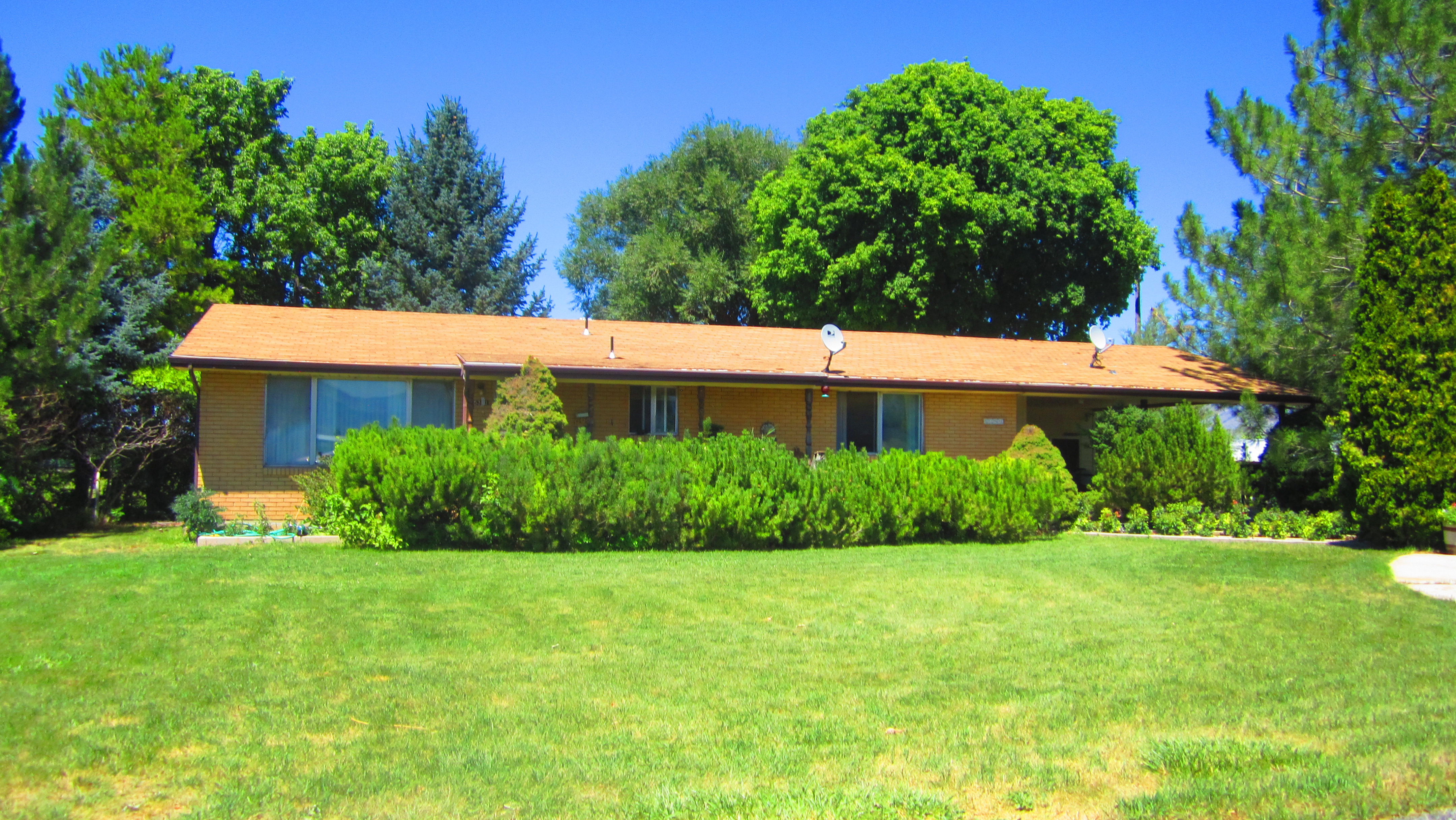 Total Photos: 1
|
| |
|
|
| Property Address: 5391 S RIVER DR - SPANISH FORK DISTR |
|
| Mailing Address: 5391 S RIVER DR SPANISH FORK, UT 84660-5214 |
|
| Acreage: 14.46998 |
|
| Last Document:
99503-2021
|
|
| Subdivision Map Filing |
|
| Taxing Description:
COM N 2177.52 FT & E 444.03 FT FR SW COR. SEC. 10, T8S, R2E, SLB&M.; E 776.83 FT; S 2 DEG 45' 14" W 317.01 FT; S 14 DEG 34' 59" E 168.13 FT; S 23 DEG 45' 0" W 372.29 FT; S 88 DEG 30' 0" W 197.97 FT; N 37 DEG 20' 0" W 57.21 FT; S 103.36 FT; N 34 DEG 29' 59" W 25.81 FT; ALONG A CURVE TO L (CHORD BEARS: N 38 DEG 6' 15" W 19.86 FT, RADIUS = 158 FT); S 88 DEG 30' 0" W 367.52 FT; N 3 DEG 59' 18" W 682.28 FT; N 89 DEG 30' 16" E 17.75 FT; N 0 DEG 50' 30" E 175.13 FT TO BEG. AREA 14.470 AC.
*Taxing description NOT FOR LEGAL DOCUMENTS
|
|
- Owner Names
- Value History
- Tax History
- Location
- Photos
- Documents
- Aerial Image
| |
----- Real Estate Values ----- |
---Improvements--- |
---Greenbelt--- |
Total |
| Year |
Com |
Res |
Agr |
Tot |
Com |
Res |
Agr |
Tot |
Land |
Homesite |
Tot |
Market Value |
| 2024 |
$0 |
$175,900 |
$548,000 |
$723,900 |
$0 |
$288,800 |
$9,600 |
$298,400 |
$8,674 |
$112,000 |
$120,674 |
$1,022,300 |
| 2023 |
$0 |
$175,900 |
$548,000 |
$723,900 |
$0 |
$296,600 |
$17,400 |
$314,000 |
$7,963 |
$112,000 |
$119,963 |
$1,037,900 |
| 2022 |
$0 |
$187,500 |
$584,300 |
$771,800 |
$0 |
$256,000 |
$10,600 |
$266,600 |
$8,049 |
$112,000 |
$120,049 |
$1,038,400 |
| Year |
General Taxes |
Adjustments |
Net Taxes |
Fees |
Payments |
Tax Balance* |
Balance Due |
Tax District |
| 2025 |
$0.00 |
$0.00 |
$0.00 |
$0.00 |
|
$0.00
|
$0.00 |
120 - NEBO SCHOOL DIST S/A 6-7-8 |
| 2024 |
$2,388.09 |
$0.00 |
$2,388.09 |
$0.00 |
|
|
Click for Payoff
|
120 - NEBO SCHOOL DIST S/A 6-7-8 |
| 2023 |
$2,499.93 |
$0.00 |
$2,499.93 |
$0.00 |
|
|
Click for Payoff
|
120 - NEBO SCHOOL DIST S/A 6-7-8 |
| 2022 |
$2,250.06 |
$0.00 |
$2,250.06 |
$0.00 |
|
|
Click for Payoff
|
120 - NEBO SCHOOL DIST S/A 6-7-8 |
* Note: Original tax amount (Does not include applicable interest and/or fees).
* Note - There is a killed Lien associated with this property.
| Entry # |
Date |
Recorded |
Type |
Party1 (Grantor) |
Party2 (Grantee) |
| 46555-2024 |
07/11/2024 |
07/12/2024 |
AS |
ALTABANK |
EBTI LLC |
| 181993-2021 |
10/19/2021 |
10/26/2021 |
FARM |
CHRISTMAS, ZEB |
WHOM OF INTEREST |
| 99503-2021 |
05/26/2021 |
05/27/2021 |
WD |
CHRISTMAS, ZEB |
CROPPER, BROCK & KATI M |
Main Menu Comments or Concerns on Value/Appraisal - Assessor's Office
Documents/Owner/Parcel information - Recorder's Office
Address Change for Tax Notice
This page was created on 10/20/2024 12:44:43 PM |