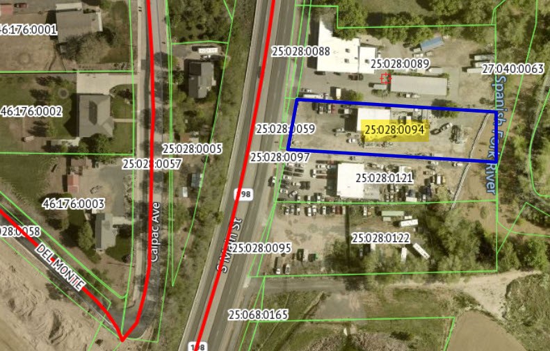
Property Information
mobile view
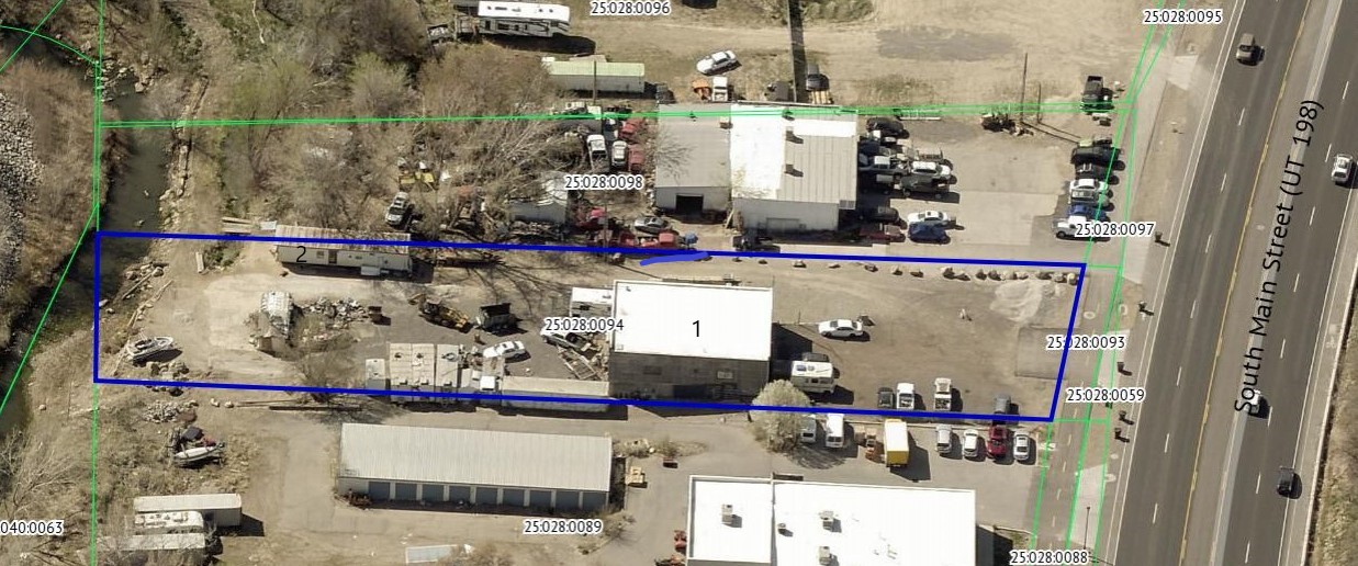
| Serial Number: 25:028:0094 |
Serial Life: 2019... |
|
|
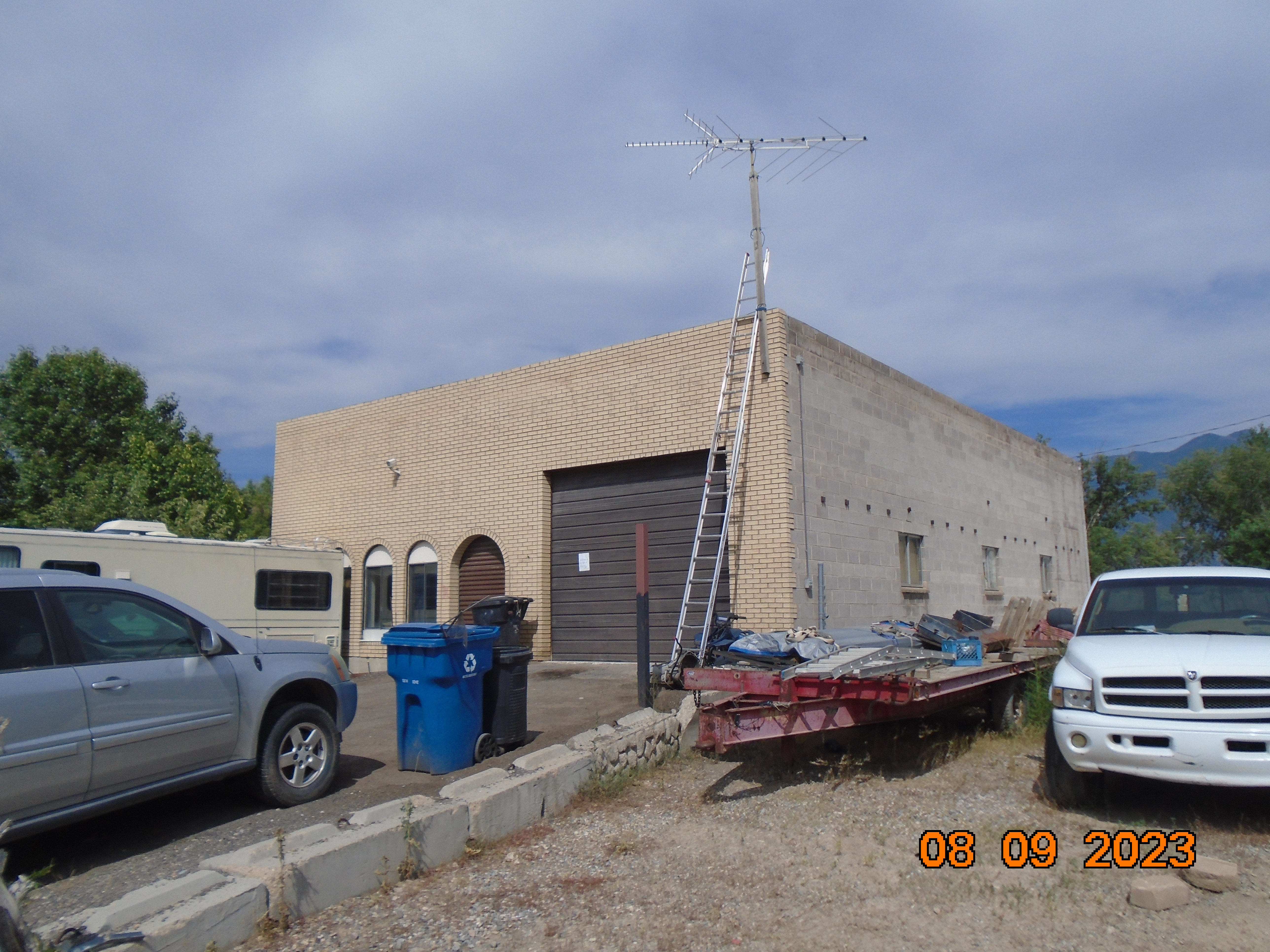
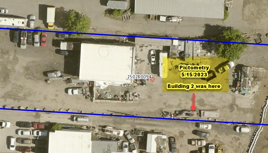
 Total Photos: 11
|
| |
|
|
| Property Address: 1819 S MAIN ST - SPANISH FORK |
|
| Mailing Address: 1819 S MAIN SPANISH FORK, UT 84660 |
|
| Acreage: 0.759192 |
|
| Last Document:
57517-2018
|
|
| Subdivision Map Filing |
|
| Taxing Description:
COM N 659.48 FT & W 360.84 FT FR SE COR. SEC. 25, T8S, R2E, SLB&M.; S 86 DEG 24' 30" E 359.24 FT; S 0 DEG 12' 24" E 90.2 FT; N 86 DEG 24' 30" W 376.5 FT; N 10 DEG 38' 57" E .08 FT; ALONG A CURVE TO L (CHORD BEARS: N 10 DEG 44' 17" E 90.63 FT, RADIUS = 3220.01 FT) TO BEG. AREA 0.759 AC.
*Taxing description NOT FOR LEGAL DOCUMENTS
|
|
- Owner Names
- Value History
- Tax History
- Location
- Photos
- Documents
- Aerial Image
| |
----- Real Estate Values ----- |
---Improvements--- |
---Greenbelt--- |
Total |
| Year |
Com |
Res |
Agr |
Tot |
Com |
Res |
Agr |
Tot |
Land |
Homesite |
Tot |
Market Value |
| 2024 |
$243,200 |
$0 |
$0 |
$243,200 |
$152,100 |
$0 |
$0 |
$152,100 |
$0 |
$0 |
$0 |
$395,300 |
| 2023 |
$177,300 |
$0 |
$0 |
$177,300 |
$144,600 |
$0 |
$0 |
$144,600 |
$0 |
$0 |
$0 |
$321,900 |
| 2022 |
$160,300 |
$0 |
$0 |
$160,300 |
$145,700 |
$0 |
$0 |
$145,700 |
$0 |
$0 |
$0 |
$306,000 |
| 2021 |
$158,400 |
$0 |
$0 |
$158,400 |
$111,100 |
$0 |
$0 |
$111,100 |
$0 |
$0 |
$0 |
$269,500 |
| 2020 |
$142,500 |
$0 |
$0 |
$142,500 |
$127,000 |
$0 |
$0 |
$127,000 |
$0 |
$0 |
$0 |
$269,500 |
| 2019 |
$109,600 |
$0 |
$0 |
$109,600 |
$127,000 |
$0 |
$0 |
$127,000 |
$0 |
$0 |
$0 |
$236,600 |
| Year |
General Taxes |
Adjustments |
Net Taxes |
Fees |
Payments |
Tax Balance* |
Balance Due |
Tax District |
| 2025 |
$0.00 |
$0.00 |
$0.00 |
$0.00 |
|
$0.00
|
$0.00 |
150 - SPANISH FORK CITY |
| 2024 |
$0.00 |
$0.00 |
$0.00 |
$0.00 |
|
$0.00
|
$0.00 |
150 - SPANISH FORK CITY |
| 2023 |
$3,119.53 |
$0.00 |
$3,119.53 |
$0.00 |
|
$0.00
|
$0.00 |
150 - SPANISH FORK CITY |
| 2022 |
$3,023.59 |
$0.00 |
$3,023.59 |
$0.00 |
|
$0.00
|
$0.00 |
150 - SPANISH FORK CITY |
| 2021 |
$3,026.49 |
$0.00 |
$3,026.49 |
$0.00 |
|
$0.00
|
$0.00 |
150 - SPANISH FORK CITY |
| 2020 |
$3,112.99 |
$0.00 |
$3,112.99 |
$0.00 |
|
|
Click for Payoff
|
150 - SPANISH FORK CITY |
| 2019 |
$2,597.63 |
$0.00 |
$2,597.63 |
$0.00 |
|
$0.00
|
$0.00 |
150 - SPANISH FORK CITY |
* Note: Original tax amount (Does not include applicable interest and/or fees).
| Entry # |
Date |
Recorded |
Type |
Party1 (Grantor) |
Party2 (Grantee) |
| 4860-2019 |
12/21/2018 |
01/18/2019 |
EAS |
BUTLER, MARVIN TEE (ET AL) |
WHOM OF INTEREST |
| 57518-2018 |
05/22/2018 |
06/20/2018 |
EAS |
BUTLER, MARVIN TEE (ET AL) |
UTAH DEPARTMENT OF TRANSPORTATION |
| 57517-2018 |
05/22/2018 |
06/20/2018 |
WD |
BUTLER, MARVIN TEE (ET AL) |
UTAH DEPARTMENT OF TRANSPORTATION |
Main Menu Comments or Concerns on Value/Appraisal - Assessor's Office
Documents/Owner/Parcel information - Recorder's Office
Address Change for Tax Notice
This page was created on 9/4/2024 2:18:39 PM |