Property Information
mobile view
| Serial Number: 25:029:0054 |
Serial Life: 2020... |
|
|
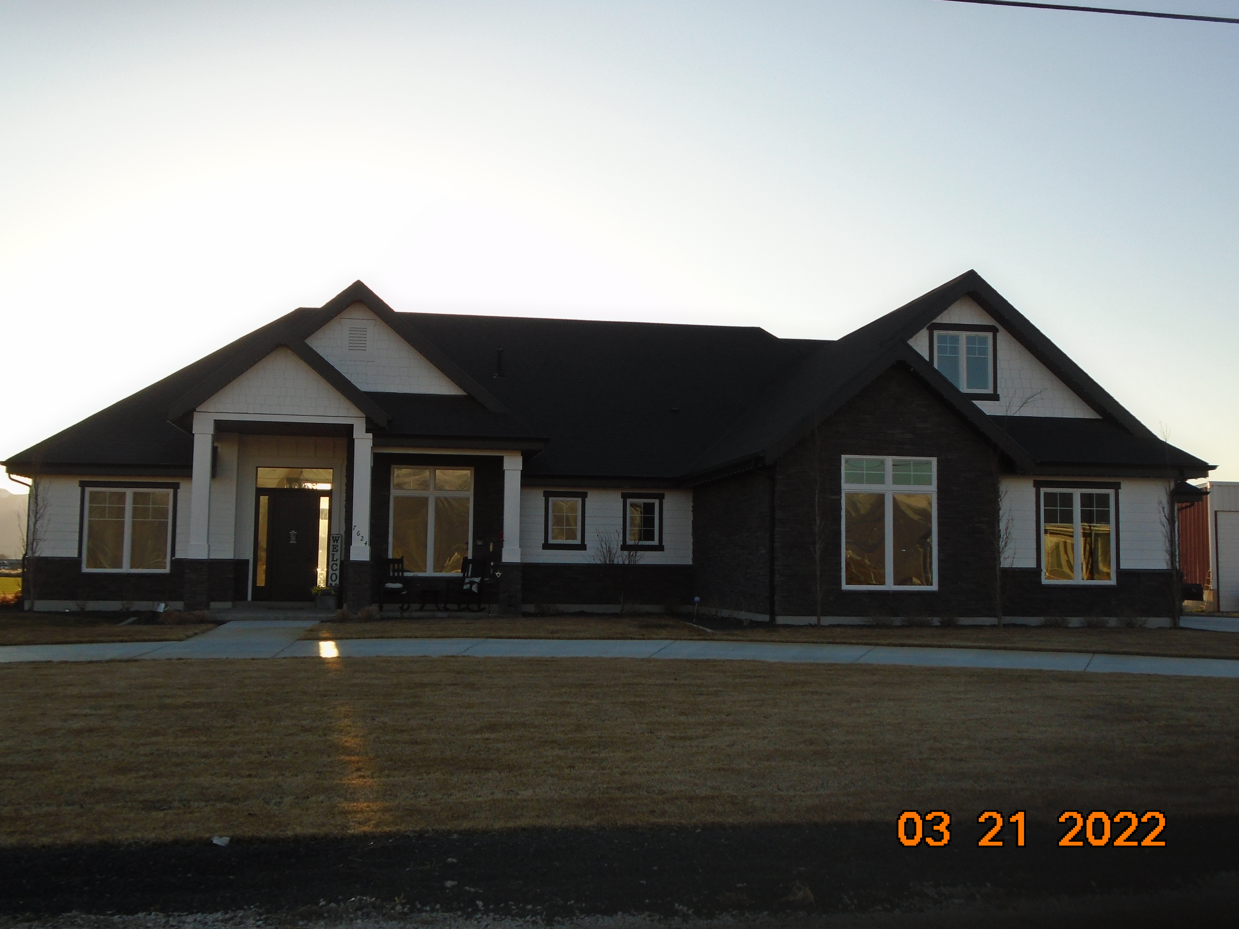 Total Photos: 1
|
| |
|
|
| Property Address: 7624 S 1400 WEST - SPANISH FORK DISTR |
|
| Mailing Address: 7592 S 1400 W SPANISH FORK, UT 84660-4905 |
|
| Acreage: 10.531378 |
|
| Last Document:
121028-2019
|
|
| Subdivision Map Filing |
|
| Taxing Description:
COM N 2 DEG 48' 35" E 16.9 FT & E 1362.31 FT FR W 1/4 COR. SEC. 26, T8S, R2E, SLB&M.; S 0 DEG 14' 41" W 667.92 FT; S 89 DEG 36' 49" W 677.33 FT; N 0 DEG 5' 0" W 683.6 FT; S 89 DEG 3' 56" E 681.25 FT TO BEG. AREA 10.531 AC.
*Taxing description NOT FOR LEGAL DOCUMENTS
|
|
- Owner Names
- Value History
- Tax History
- Location
- Photos
- Documents
- Aerial Image
| |
----- Real Estate Values ----- |
---Improvements--- |
---Greenbelt--- |
Total |
| Year |
Com |
Res |
Agr |
Tot |
Com |
Res |
Agr |
Tot |
Land |
Homesite |
Tot |
Market Value |
| 2024 |
$0 |
$246,200 |
$425,100 |
$671,300 |
$0 |
$633,600 |
$0 |
$633,600 |
$6,271 |
$112,000 |
$118,271 |
$1,304,900 |
| 2023 |
$0 |
$246,200 |
$479,200 |
$725,400 |
$0 |
$635,200 |
$0 |
$635,200 |
$5,757 |
$112,000 |
$117,757 |
$1,360,600 |
| 2022 |
$0 |
$262,500 |
$510,900 |
$773,400 |
$0 |
$441,600 |
$0 |
$441,600 |
$5,818 |
$112,000 |
$117,818 |
$1,215,000 |
| 2021 |
$0 |
$210,000 |
$300,500 |
$510,500 |
$0 |
$372,700 |
$0 |
$372,700 |
$5,705 |
$80,000 |
$85,705 |
$883,200 |
| 2020 |
$0 |
$0 |
$263,300 |
$263,300 |
$0 |
$0 |
$0 |
$0 |
$5,813 |
$0 |
$5,813 |
$263,300 |
| Year |
General Taxes |
Adjustments |
Net Taxes |
Fees |
Payments |
Tax Balance* |
Balance Due |
Tax District |
| 2025 |
$0.00 |
$0.00 |
$0.00 |
$0.00 |
|
$0.00
|
$0.00 |
120 - NEBO SCHOOL DIST S/A 6-7-8 |
| 2024 |
$0.00 |
$0.00 |
$0.00 |
$0.00 |
|
$0.00
|
$0.00 |
120 - NEBO SCHOOL DIST S/A 6-7-8 |
| 2023 |
$4,165.50 |
($2,396.56) |
$1,768.94 |
$0.00 |
|
$0.00
|
$0.00 |
120 - NEBO SCHOOL DIST S/A 6-7-8 |
| 2022 |
$3,158.52 |
($1,445.23) |
$1,713.29 |
$0.00 |
|
$0.00
|
$0.00 |
120 - NEBO SCHOOL DIST S/A 6-7-8 |
| 2021 |
$3,018.59 |
($1,633.79) |
$1,384.80 |
$0.00 |
|
$0.00
|
$0.00 |
120 - NEBO SCHOOL DIST S/A 6-7-8 |
| 2020 |
$70.96 |
($41.99) |
$28.97 |
$0.00 |
|
$0.00
|
$0.00 |
120 - NEBO SCHOOL DIST S/A 6-7-8 |
* Note: Original tax amount (Does not include applicable interest and/or fees).
| Entry # |
Date |
Recorded |
Type |
Party1 (Grantor) |
Party2 (Grantee) |
| 29570-2023 |
05/04/2023 |
05/10/2023 |
N |
UTAH COUNTY COMMISSIONERS |
WHOM OF INTEREST |
| 109891-2020 |
07/30/2020 |
07/30/2020 |
REC |
ALTABANK TEE |
EATON, BENJAMIN J & MAGAN O |
| 103666-2020 |
07/14/2020 |
07/20/2020 |
D TR |
EATON, BENJAMIN J & MAGAN O (ET AL) |
ALTABANK |
| 33754-2020 |
03/13/2020 |
03/17/2020 |
R/W EAS |
EATON, BENJAMIN J & MAGAN O |
SOUTH UTAH VALLEY ELECTRIC SERVICE DISTRICT |
| 133584-2019 |
12/17/2019 |
12/17/2019 |
D TR |
EATON, BENJAMIN J & MAGAN O |
ALTABANK |
| 121028-2019 |
07/30/2019 |
11/18/2019 |
SP WD |
EATON, JAMES A & SHERRY L TEE (ET AL) |
EATON, BENJAMIN J & MAGAN O |
Main Menu Comments or Concerns on Value/Appraisal - Assessor's Office
Documents/Owner/Parcel information - Recorder's Office
Address Change for Tax Notice
This page was created on 8/30/2024 10:04:19 PM |