Property Information
mobile view
| Serial Number: 26:064:0004 |
Serial Life: 1980-1998 |
|
|
Total Photos: 1
|
| |
|
|
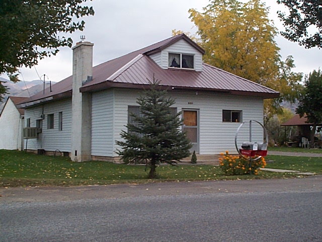
| Property Address: 685 E MAPLE ST - MAPLETON |
|
| Mailing Address: 685 E MAPLE ST MAPLETON, UT 84664-4610 |
|
| Acreage: 0.96 |
|
| Last Document:
6882-1974
|
|
| Subdivision Map Filing |
|
| Taxing Description:
COM E 33.5 CH FR SW COR. SEC. 11, T8S, R3E, SLB&M.; N 17 RD; E 9 RD; S 17 RD; W 9 RD TO BEG. AREA 0.956 AC.
*Taxing description NOT FOR LEGAL DOCUMENTS
|
|
- Owner Names
- Value History
- Tax History
- Location
- Photos
- Documents
- Aerial Image
| |
----- Real Estate Values ----- |
---Improvements--- |
---Greenbelt--- |
Total |
| Year |
Com |
Res |
Agr |
Tot |
Com |
Res |
Agr |
Tot |
Land |
Homesite |
Tot |
Market Value |
| 1998 |
$0 |
$75,310 |
$0 |
$75,310 |
$0 |
$44,544 |
$0 |
$44,544 |
$0 |
$0 |
$0 |
$119,854 |
| 1997 |
$0 |
$75,310 |
$0 |
$75,310 |
$0 |
$44,544 |
$0 |
$44,544 |
$0 |
$0 |
$0 |
$119,854 |
| 1996 |
$0 |
$56,231 |
$0 |
$56,231 |
$0 |
$33,259 |
$0 |
$33,259 |
$0 |
$0 |
$0 |
$89,490 |
| 1995 |
$0 |
$51,119 |
$0 |
$51,119 |
$0 |
$33,259 |
$0 |
$33,259 |
$0 |
$0 |
$0 |
$84,378 |
| 1994 |
$0 |
$29,894 |
$0 |
$29,894 |
$0 |
$24,042 |
$0 |
$24,042 |
$0 |
$0 |
$0 |
$53,936 |
| 1993 |
$0 |
$29,894 |
$0 |
$29,894 |
$0 |
$24,042 |
$0 |
$24,042 |
$0 |
$0 |
$0 |
$53,936 |
| 1992 |
$0 |
$27,426 |
$0 |
$27,426 |
$0 |
$22,057 |
$0 |
$22,057 |
$0 |
$0 |
$0 |
$49,483 |
| 1991 |
$0 |
$24,058 |
$0 |
$24,058 |
$0 |
$19,348 |
$0 |
$19,348 |
$0 |
$0 |
$0 |
$43,406 |
| 1990 |
$0 |
$24,058 |
$0 |
$24,058 |
$0 |
$19,348 |
$0 |
$19,348 |
$0 |
$0 |
$0 |
$43,406 |
| 1989 |
$0 |
$24,058 |
$0 |
$24,058 |
$0 |
$19,348 |
$0 |
$19,348 |
$0 |
$0 |
$0 |
$43,406 |
| 1988 |
$0 |
$24,058 |
$0 |
$24,058 |
$0 |
$19,348 |
$0 |
$19,348 |
$0 |
$0 |
$0 |
$43,406 |
| 1987 |
$0 |
$24,058 |
$0 |
$24,058 |
$0 |
$19,183 |
$0 |
$19,183 |
$0 |
$0 |
$0 |
$43,241 |
| 1986 |
$0 |
$24,059 |
$0 |
$24,059 |
$0 |
$19,184 |
$0 |
$19,184 |
$0 |
$0 |
$0 |
$43,243 |
| 1985 |
$0 |
$24,058 |
$0 |
$24,058 |
$0 |
$19,183 |
$0 |
$19,183 |
$0 |
$0 |
$0 |
$43,241 |
| 1984 |
$0 |
$24,300 |
$0 |
$24,300 |
$0 |
$19,375 |
$0 |
$19,375 |
$0 |
$0 |
$0 |
$43,675 |
| Year |
General Taxes |
Adjustments |
Net Taxes |
Fees |
Payments |
Tax Balance* |
Balance Due |
Tax District |
| 1998 |
$743.51 |
$0.00 |
$743.51 |
$0.00 |
|
$0.00
|
$0.00 |
140 - MAPLETON CITY |
| 1997 |
$738.50 |
$0.00 |
$738.50 |
$0.00 |
|
$0.00
|
$0.00 |
140 - MAPLETON CITY |
| 1996 |
$537.72 |
$0.00 |
$537.72 |
$0.00 |
|
$0.00
|
$0.00 |
140 - MAPLETON CITY |
| 1995 |
$507.04 |
$0.00 |
$507.04 |
$0.00 |
|
$0.00
|
$0.00 |
140 - MAPLETON CITY |
| 1994 |
$502.11 |
$0.00 |
$502.11 |
$0.00 |
|
$0.00
|
$0.00 |
140 - MAPLETON CITY |
| 1993 |
$455.60 |
$0.00 |
$455.60 |
$0.00 |
|
$0.00
|
$0.00 |
140 - MAPLETON CITY |
| 1992 |
$409.62 |
$0.00 |
$409.62 |
$0.00 |
|
$0.00
|
$0.00 |
140 - MAPLETON CITY |
| 1991 |
$387.36 |
$0.00 |
$387.36 |
$0.00 |
|
$0.00
|
$0.00 |
140 - MAPLETON CITY |
| 1990 |
$382.59 |
$0.00 |
$382.59 |
$0.00 |
|
$0.00
|
$0.00 |
140 - MAPLETON CITY |
| 1989 |
$393.94 |
$0.00 |
$393.94 |
$0.00 |
|
$0.00
|
$0.00 |
140 - MAPLETON CITY |
| 1988 |
$397.38 |
$0.00 |
$397.38 |
$0.00 |
|
$0.00
|
$0.00 |
140 - MAPLETON CITY |
| 1987 |
$395.40 |
$0.00 |
$395.40 |
$0.00 |
|
$0.00
|
$0.00 |
140 - MAPLETON CITY |
| 1986 |
$374.44 |
$0.00 |
$374.44 |
$0.00 |
|
$0.00
|
$0.00 |
140 - MAPLETON CITY |
| 1985 |
$365.46 |
$0.00 |
$365.46 |
$0.00 |
|
$0.00
|
$0.00 |
140 - MAPLETON CITY |
| 1984 |
$350.99 |
$0.00 |
$350.99 |
$0.00 |
|
$0.00
|
$0.00 |
140 - MAPLETON CITY |
* Note: Original tax amount (Does not include applicable interest and/or fees).
| Entry # |
Date |
Recorded |
Type |
Party1 (Grantor) |
Party2 (Grantee) |
| 137804-1998 |
|
12/31/1998 |
QCD |
JACKSON, JOHN N & JULIA B |
JACKSON, JOHN N & JULIA B |
| 50005-1997 |
06/20/1997 |
07/01/1997 |
QCD |
HOWES, H REID |
JACKSON, JOHN N & JULIA B |
| 50004-1997 |
06/20/1997 |
07/01/1997 |
QCD |
HOWES, H REID |
JACKSON, JOHN N & JULIA B |
| 5765-1997 |
01/23/1997 |
01/24/1997 |
REC |
PROVO LAND TITLE COMPANY TEE |
JACKSON, JOHN N & JULIA B |
| 17039-1995 |
03/17/1995 |
03/21/1995 |
D TR |
JACKSON, JOHN M & JULIA B |
CENTRAL BANK |
| 16087-1989 |
06/01/1989 |
06/08/1989 |
TR D |
JACKSON, JOHN N & JULIA B |
OPERATING ENGINEERS LOCAL UNION #3 FEDERAL CREDIT UNION |
Main Menu Comments or Concerns on Value/Appraisal - Assessor's Office
Documents/Owner/Parcel information - Recorder's Office
Address Change for Tax Notice
This page was created on 7/22/2024 11:28:57 PM |