Property Information
mobile view
| Serial Number: 26:064:0310 |
Serial Life: 2009-2013 |
|
|
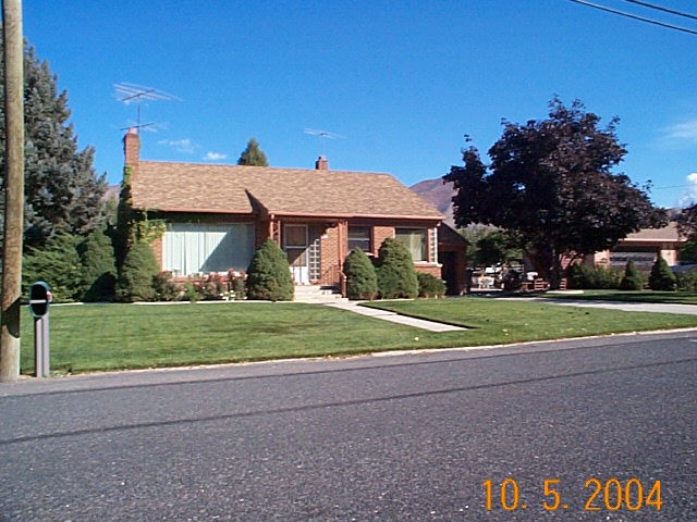 Total Photos: 3
|
| |
|
|
| Property Address: 615 E MAPLE - MAPLETON |
|
| Mailing Address: 615 E MAPLE ST MAPLETON, UT 84664-4610 |
|
| Acreage: 1.359868 |
|
| Last Document:
120898-2008
|
|
| Subdivision Map Filing |
|
| Taxing Description:
COM N 18.45 FT & W 716.9 FT FR S 1/4 COR. SEC. 11, T8S, R3E, SLB&M.; N 0 DEG 21' 28" W 117.59 FT; N 89 DEG 40' 48" E 142.2 FT; N 0 DEG 21' 48" W 120.43 FT; S 89 DEG 40' 48" W 142.2 FT; N 0 DEG 21' 48" W 100 FT; N 89 DEG 40' 48" E 226.98 FT; S 338.02 FT; S 89 DEG 40' 48" W 224.85 FT TO BEG. AREA 1.360 AC.
*Taxing description NOT FOR LEGAL DOCUMENTS
|
|
- Owner Names
- Value History
- Tax History
- Location
- Photos
- Documents
- Aerial Image
| |
----- Real Estate Values ----- |
---Improvements--- |
---Greenbelt--- |
Total |
| Year |
Com |
Res |
Agr |
Tot |
Com |
Res |
Agr |
Tot |
Land |
Homesite |
Tot |
Market Value |
| 2013 |
$0 |
$105,000 |
$12,600 |
$117,600 |
$0 |
$69,600 |
$0 |
$69,600 |
$0 |
$0 |
$0 |
$187,200 |
| 2012 |
$0 |
$113,000 |
$12,600 |
$125,600 |
$0 |
$60,200 |
$0 |
$60,200 |
$0 |
$0 |
$0 |
$185,800 |
| 2011 |
$0 |
$98,000 |
$12,600 |
$110,600 |
$0 |
$77,000 |
$0 |
$77,000 |
$0 |
$0 |
$0 |
$187,600 |
| 2010 |
$0 |
$105,935 |
$5,964 |
$111,899 |
$0 |
$94,629 |
$0 |
$94,629 |
$0 |
$0 |
$0 |
$206,528 |
| 2009 |
$0 |
$102,900 |
$9,000 |
$111,900 |
$0 |
$118,000 |
$0 |
$118,000 |
$0 |
$0 |
$0 |
$229,900 |
| Year |
General Taxes |
Adjustments |
Net Taxes |
Fees |
Payments |
Tax Balance* |
Balance Due |
Tax District |
| 2013 |
$1,596.54 |
$0.00 |
$1,596.54 |
$0.00 |
|
$0.00
|
$0.00 |
140 - MAPLETON CITY |
| 2012 |
$1,621.46 |
$0.00 |
$1,621.46 |
$0.00 |
|
$0.00
|
$0.00 |
140 - MAPLETON CITY |
| 2011 |
$1,602.05 |
$0.00 |
$1,602.05 |
$0.00 |
|
$0.00
|
$0.00 |
140 - MAPLETON CITY |
| 2010 |
$1,663.18 |
$0.00 |
$1,663.18 |
$0.00 |
|
$0.00
|
$0.00 |
140 - MAPLETON CITY |
| 2009 |
$1,747.20 |
$0.00 |
$1,747.20 |
$0.00 |
|
$0.00
|
$0.00 |
140 - MAPLETON CITY |
* Note: Original tax amount (Does not include applicable interest and/or fees).
| Entry # |
Date |
Recorded |
Type |
Party1 (Grantor) |
Party2 (Grantee) |
| 86838-2013 |
09/10/2013 |
09/11/2013 |
BLA |
JACKSON, JOHN N & JULIA B TEE (ET AL) |
CANTO, RON (ET AL) |
| 90726-2009 |
08/17/2009 |
08/18/2009 |
WD |
CANTO, RON (ET AL) |
CANTO, RON (ET AL) |
| 120898-2008 |
11/12/2008 |
11/12/2008 |
N SPREC |
UTAH COUNTY RECORDER |
WHOM OF INTEREST |
Main Menu Comments or Concerns on Value/Appraisal - Assessor's Office
Documents/Owner/Parcel information - Recorder's Office
Address Change for Tax Notice
This page was created on 2/14/2025 10:06:10 PM |

