Property Information
mobile view
| Serial Number: 27:039:0070 |
Serial Life: 1979-2012 |
|
|
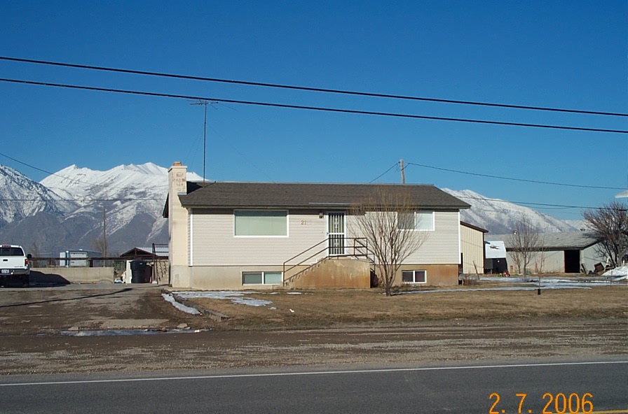 Total Photos: 1
|
| |
|
|
| Property Address: 2216 E CANYON RD - SPANISH FORK |
|
| Mailing Address: 2115 E CANYON RD SPANISH FORK, UT 84660-9305 |
|
| Acreage: 2.15 |
|
| Last Document:
33376-1989
|
|
| Subdivision Map Filing |
|
| Taxing Description:
COM. AT PT IN FENCE ON N-LY SIDE OF US HI-WAY 50 & 6 N ALONG SEC LINE 1059.08 FT & N 69 46' W 700 FT FR E1/4 COR OF SEC 29, T 8 S, R 3 E, SLM; N 69 46' W 150 FT ALONG HI-WAY; N 617.72 FT; E 140.74 FT; S 669.59 FT TO BEG. AREA 2.15 ACRES.
*Taxing description NOT FOR LEGAL DOCUMENTS
|
|
- Owner Names
- Value History
- Tax History
- Location
- Photos
- Documents
- Aerial Image
| 2006-2012 |
|
TILTON, CHARLES |
|
| 2006-2012 |
|
TILTON, PAMELA |
|
| 2001-2005 |
|
TILTON, CHARLES |
|
| 2001-2005 |
|
TILTON, PAMELA |
|
| 1998-2000 |
|
MORRIS, CHRISTINE J |
|
| 1998-2000 |
|
MORRIS, KELLY L |
|
| 1997 |
|
MORRIS, KELLY L |
|
| 1991-1996 |
|
MORRIS, CHRISTINE J |
|
| 1991-1996 |
|
MORRIS, KELLY L |
|
| 1990 |
|
MORRIS, CHRISTINE J |
|
| 1990 |
|
MORRIS, KELLY L |
|
| 1983-1989 |
|
CARTER, DENNIS FRANCIS |
|
| 1979-1982 |
|
CARTER, CARLA A |
|
| 1979-1982 |
|
CARTER, DENNIS FRANCIS |
|
| |
----- Real Estate Values ----- |
---Improvements--- |
---Greenbelt--- |
Total |
| Year |
Com |
Res |
Agr |
Tot |
Com |
Res |
Agr |
Tot |
Land |
Homesite |
Tot |
Market Value |
| 2012 |
$0 |
$75,000 |
$27,600 |
$102,600 |
$0 |
$88,800 |
$0 |
$88,800 |
$0 |
$0 |
$0 |
$191,400 |
| 2011 |
$0 |
$75,000 |
$27,600 |
$102,600 |
$0 |
$96,600 |
$0 |
$96,600 |
$0 |
$0 |
$0 |
$199,200 |
| 2010 |
$0 |
$89,000 |
$11,518 |
$100,518 |
$0 |
$115,572 |
$0 |
$115,572 |
$0 |
$0 |
$0 |
$216,090 |
| 2009 |
$0 |
$80,000 |
$32,200 |
$112,200 |
$0 |
$108,300 |
$0 |
$108,300 |
$0 |
$0 |
$0 |
$220,500 |
| 2008 |
$0 |
$80,000 |
$32,200 |
$112,200 |
$0 |
$108,330 |
$0 |
$108,330 |
$0 |
$0 |
$0 |
$220,530 |
| 2007 |
$0 |
$80,000 |
$32,200 |
$112,200 |
$0 |
$102,731 |
$0 |
$102,731 |
$0 |
$0 |
$0 |
$214,931 |
| 2006 |
$0 |
$80,000 |
$32,200 |
$112,200 |
$0 |
$86,300 |
$0 |
$86,300 |
$0 |
$0 |
$0 |
$198,500 |
| 2005 |
$0 |
$29,347 |
$33,750 |
$63,097 |
$0 |
$69,975 |
$0 |
$69,975 |
$0 |
$0 |
$0 |
$133,072 |
| 2004 |
$0 |
$29,347 |
$33,750 |
$63,097 |
$0 |
$69,975 |
$0 |
$69,975 |
$0 |
$0 |
$0 |
$133,072 |
| 2003 |
$0 |
$29,347 |
$33,750 |
$63,097 |
$0 |
$69,975 |
$0 |
$69,975 |
$0 |
$0 |
$0 |
$133,072 |
| 2002 |
$0 |
$29,347 |
$33,750 |
$63,097 |
$0 |
$69,975 |
$0 |
$69,975 |
$0 |
$0 |
$0 |
$133,072 |
| 2001 |
$0 |
$29,347 |
$33,750 |
$63,097 |
$0 |
$69,975 |
$0 |
$69,975 |
$0 |
$0 |
$0 |
$133,072 |
| 2000 |
$0 |
$27,427 |
$31,542 |
$58,969 |
$0 |
$65,428 |
$0 |
$65,428 |
$0 |
$0 |
$0 |
$124,397 |
| 1999 |
$0 |
$31,542 |
$27,427 |
$58,969 |
$0 |
$65,428 |
$0 |
$65,428 |
$0 |
$0 |
$0 |
$124,397 |
| 1998 |
$0 |
$31,542 |
$27,427 |
$58,969 |
$0 |
$65,428 |
$0 |
$65,428 |
$0 |
$0 |
$0 |
$124,397 |
| 1997 |
$0 |
$30,050 |
$28,919 |
$58,969 |
$0 |
$65,428 |
$0 |
$65,428 |
$0 |
$0 |
$0 |
$124,397 |
| 1996 |
$0 |
$26,902 |
$28,919 |
$55,821 |
$0 |
$58,575 |
$0 |
$58,575 |
$0 |
$0 |
$0 |
$114,396 |
| 1995 |
$0 |
$24,456 |
$26,290 |
$50,746 |
$0 |
$58,575 |
$0 |
$58,575 |
$0 |
$0 |
$0 |
$109,321 |
| 1994 |
$0 |
$14,302 |
$15,374 |
$29,676 |
$0 |
$47,238 |
$0 |
$47,238 |
$0 |
$0 |
$0 |
$76,914 |
| 1993 |
$0 |
$14,302 |
$15,374 |
$29,676 |
$0 |
$47,238 |
$0 |
$47,238 |
$0 |
$0 |
$0 |
$76,914 |
| 1992 |
$0 |
$13,121 |
$14,105 |
$27,226 |
$0 |
$43,338 |
$0 |
$43,338 |
$0 |
$0 |
$0 |
$70,564 |
| 1991 |
$0 |
$11,510 |
$12,373 |
$23,883 |
$0 |
$38,016 |
$0 |
$38,016 |
$0 |
$0 |
$0 |
$61,899 |
| 1990 |
$0 |
$11,510 |
$12,373 |
$23,883 |
$0 |
$38,016 |
$0 |
$38,016 |
$0 |
$0 |
$0 |
$61,899 |
| 1989 |
$0 |
$11,510 |
$12,373 |
$23,883 |
$0 |
$38,016 |
$0 |
$38,016 |
$0 |
$0 |
$0 |
$61,899 |
| 1988 |
$0 |
$11,510 |
$12,374 |
$23,884 |
$0 |
$38,017 |
$0 |
$38,017 |
$0 |
$0 |
$0 |
$61,901 |
| 1987 |
$0 |
$11,867 |
$12,756 |
$24,623 |
$0 |
$39,192 |
$0 |
$39,192 |
$0 |
$0 |
$0 |
$63,815 |
| 1986 |
$0 |
$11,867 |
$12,756 |
$24,623 |
$0 |
$39,192 |
$0 |
$39,192 |
$0 |
$0 |
$0 |
$63,815 |
| 1985 |
$0 |
$11,867 |
$12,756 |
$24,623 |
$0 |
$39,192 |
$0 |
$39,192 |
$0 |
$0 |
$0 |
$63,815 |
| 1984 |
$0 |
$11,983 |
$12,888 |
$24,871 |
$0 |
$39,592 |
$0 |
$39,592 |
$0 |
$0 |
$0 |
$64,463 |
| Year |
General Taxes |
Adjustments |
Net Taxes |
Fees |
Payments |
Tax Balance* |
Balance Due |
Tax District |
| 2012 |
$1,484.66 |
$0.00 |
$1,484.66 |
$0.00 |
|
$0.00
|
$0.00 |
150 - SPANISH FORK CITY |
| 2011 |
$1,504.50 |
$0.00 |
$1,504.50 |
$0.00 |
|
$0.00
|
$0.00 |
150 - SPANISH FORK CITY |
| 2010 |
$1,491.12 |
$0.00 |
$1,491.12 |
$0.00 |
|
$0.00
|
$0.00 |
150 - SPANISH FORK CITY |
| 2009 |
$1,545.01 |
$0.00 |
$1,545.01 |
$0.00 |
|
$0.00
|
$0.00 |
150 - SPANISH FORK CITY |
| 2008 |
$1,435.76 |
$0.00 |
$1,435.76 |
$0.00 |
|
$0.00
|
$0.00 |
150 - SPANISH FORK CITY |
| 2007 |
$1,406.11 |
$0.00 |
$1,406.11 |
$0.00 |
|
$0.00
|
$0.00 |
150 - SPANISH FORK CITY |
| 2006 |
$1,419.55 |
$0.00 |
$1,419.55 |
$0.00 |
|
$0.00
|
$0.00 |
150 - SPANISH FORK CITY |
| 2005 |
$1,089.42 |
$0.00 |
$1,089.42 |
$0.00 |
|
$0.00
|
$0.00 |
150 - SPANISH FORK CITY |
| 2004 |
$1,091.01 |
$0.00 |
$1,091.01 |
$0.00 |
|
$0.00
|
$0.00 |
150 - SPANISH FORK CITY |
| 2003 |
$986.20 |
$0.00 |
$986.20 |
$0.00 |
|
$0.00
|
$0.00 |
150 - SPANISH FORK CITY |
| 2002 |
$960.22 |
$0.00 |
$960.22 |
$0.00 |
|
$0.00
|
$0.00 |
150 - SPANISH FORK CITY |
| 2001 |
$975.15 |
$0.00 |
$975.15 |
$0.00 |
|
$0.00
|
$0.00 |
150 - SPANISH FORK CITY |
| 2000 |
$905.18 |
$0.00 |
$905.18 |
$0.00 |
|
$0.00
|
$0.00 |
150 - SPANISH FORK CITY |
| 1999 |
$840.55 |
$0.00 |
$840.55 |
$0.00 |
|
$0.00
|
$0.00 |
150 - SPANISH FORK CITY |
| 1998 |
$824.08 |
$0.00 |
$824.08 |
$0.00 |
|
$0.00
|
$0.00 |
150 - SPANISH FORK CITY |
| 1997 |
$935.17 |
$0.00 |
$935.17 |
$0.00 |
|
$0.00
|
$0.00 |
150 - SPANISH FORK CITY |
| 1996 |
$858.40 |
$0.00 |
$858.40 |
$0.00 |
|
$0.00
|
$0.00 |
150 - SPANISH FORK CITY |
| 1995 |
$803.98 |
$0.00 |
$803.98 |
$0.00 |
|
$0.00
|
$0.00 |
150 - SPANISH FORK CITY |
| 1994 |
$793.31 |
$0.00 |
$793.31 |
$0.00 |
|
$0.00
|
$0.00 |
150 - SPANISH FORK CITY |
| 1993 |
$708.21 |
$0.00 |
$708.21 |
$0.00 |
|
$0.00
|
$0.00 |
150 - SPANISH FORK CITY |
| 1992 |
$644.37 |
$0.00 |
$644.37 |
$0.00 |
|
$0.00
|
$0.00 |
150 - SPANISH FORK CITY |
| 1991 |
$591.35 |
$0.00 |
$591.35 |
$0.00 |
|
$0.00
|
$0.00 |
150 - SPANISH FORK CITY |
| 1990 |
$605.38 |
$0.00 |
$605.38 |
$0.00 |
|
$0.00
|
$0.00 |
120 - NEBO SCHOOL DIST S/A 6-7-8 |
| 1989 |
$623.96 |
$0.00 |
$623.96 |
$0.00 |
|
$0.00
|
$0.00 |
120 - NEBO SCHOOL DIST S/A 6-7-8 |
| 1988 |
$609.91 |
($346.41) |
$263.50 |
$0.00 |
|
$0.00
|
$0.00 |
120 - NEBO SCHOOL DIST S/A 6-7-8 |
| 1987 |
$690.85 |
($342.57) |
$348.28 |
$0.00 |
|
$0.00
|
$0.00 |
120 - NEBO SCHOOL DIST S/A 6-7-8 |
| 1986 |
$583.77 |
($428.82) |
$154.95 |
$0.00 |
|
$0.00
|
$0.00 |
120 - NEBO SCHOOL DIST S/A 6-7-8 |
| 1985 |
$541.78 |
($397.98) |
$143.80 |
$0.00 |
|
$0.00
|
$0.00 |
120 - NEBO SCHOOL DIST S/A 6-7-8 |
| 1984 |
$520.80 |
($378.72) |
$142.08 |
$0.00 |
|
$0.00
|
$0.00 |
120 - NEBO SCHOOL DIST S/A 6-7-8 |
* Note: Original tax amount (Does not include applicable interest and/or fees).
| Entry # |
Date |
Recorded |
Type |
Party1 (Grantor) |
Party2 (Grantee) |
| 37732-2012 |
05/07/2012 |
05/07/2012 |
BLA |
GREENFIELD PROPERTIES LP |
TILTON, CHARLES & PAMELA |
| 114949-2008 |
10/20/2008 |
10/22/2008 |
CT |
STATE OF UTAH |
WHOM OF INTEREST |
| 107508-2008 |
09/30/2008 |
09/30/2008 |
RESOL |
BOARD OF COUNTY COMMISSIONERS UTAH COUNTY |
WHOM OF INTEREST |
| 85147-2008 |
07/02/2008 |
07/30/2008 |
REC |
WELLS FARGO BANK NORTHWEST TEE |
TILTON, CHARLES D & CHARLES ATA (ET AL) |
| 72432-2008 |
06/13/2008 |
06/23/2008 |
RSUBTEE |
WELLS FARGO BANK (ET AL) |
TILTON, CHARLES & PAMELA |
| 63065-2008 |
05/23/2008 |
05/30/2008 |
D TR |
TILTON, CHARLES & PAMELA |
WELLS FARGO BANK |
| 22310-2006 |
01/20/2006 |
02/24/2006 |
D TR |
TILTON, CHARLES D & CHARLES ATA (ET AL) |
WELLS FARGO BANK |
| 127304-2001 |
10/04/2001 |
12/06/2001 |
REC |
WELLS FARGO FINANCIAL NATIONAL BANK TEE |
TILTON, CHARLES & PAMELA |
| 127303-2001 |
10/02/2001 |
12/06/2001 |
SUC TEE |
WELLS FARGO HOME MORTGAGE INC SUC TO (ET AL) |
WELLS FARGO FINANCIAL NATIONAL BANK SUCTEE |
| 92233-2001 |
08/21/2001 |
09/12/2001 |
EAS |
TILTON, CHARLES & PAMELA |
QWEST CORPORATION |
| 89674-2001 |
09/04/2001 |
09/05/2001 |
D TR |
TILTON, CHARLES & PAMELA |
WELLS FARGO HOME MORTGAGE INC |
| 79555-2000 |
09/20/2000 |
10/10/2000 |
REC |
CHICAGO TITLE INSURANCE COMPANY SUCTEE |
MORRIS, KELLY L & CHRISTINE J |
| 79554-2000 |
09/08/2000 |
10/10/2000 |
SUB TEE |
COUNTRYWIDE HOMES LOANS INC FKA (ET AL) |
CHICAGO TITLE INSURANCE COMPANY SUCTEE |
| 64501-2000 |
08/16/2000 |
08/17/2000 |
D TR |
TILTON, CHARLES & PAMELA |
CROSSLAND MORTGAGE CORP |
| 64500-2000 |
08/16/2000 |
08/17/2000 |
WD |
MORRIS, KELLY L & CHRISTINE J |
TILTON, CHARLES & PAMELA |
| 33479-1998 |
02/18/1998 |
04/07/1998 |
REC |
BANC ONE FINANCIAL SERVICES INC TEE |
MORRIS, KELLY L & CHRISTINE J |
| 33478-1998 |
02/18/1998 |
04/07/1998 |
SUB TEE |
BANC ONE FINANCIAL SERVICES INC |
BANC ONE FINANCIAL SERVICES INC SUBTEE |
| 20976-1997 |
02/26/1997 |
03/21/1997 |
REC |
BANK ONE TEE (ET AL) |
MORRIS, KELLY L |
| 3423-1997 |
12/06/1996 |
01/14/1997 |
QCD |
MORRIS, KELLY L |
MORRIS, KELLY L & CHRISTINE J |
| 3418-1997 |
12/06/1996 |
01/14/1997 |
AS |
VANDERFORD COMPANY INC THE |
COUNTRYWIDE HOME LOANS INC |
| 98767-1996 |
12/02/1996 |
12/06/1996 |
D TR |
MORRIS, KELLY L & CHRISTINE J |
VANDERFORD COMPANY INC THE |
| 98766-1996 |
12/02/1996 |
12/06/1996 |
QCD |
MORRIS, KELLY L & CHRISTINE J |
MORRIS, KELLY L |
| 78628-1996 |
09/11/1996 |
09/25/1996 |
AS |
BANC ONE MORTGAGE CORPORATION |
CDC SERVICING INC |
| 47839-1996 |
06/06/1996 |
06/07/1996 |
REC |
FIDELITY LAND & TITLE TEE |
MORRIS, KELLY L & CHRISTINE J |
| 45818-1996 |
05/28/1996 |
06/03/1996 |
REC |
FIDELITY LAND & TITLE TEE |
MORRIS, KELLY L & CHRISTINE J |
| 37416-1996 |
05/01/1996 |
05/03/1996 |
RC |
BANC ONE FINANCIAL SERVICES INC |
WHOM OF INTEREST |
| 37415-1996 |
04/24/1996 |
05/03/1996 |
D TR |
MORRIS, KELLY L & CHRISTINE J |
BANC ONE FINANCIAL SERVICES INC |
| 62512-1995 |
05/03/1994 |
09/19/1995 |
TR D |
MORRIS, KELLY L & CHRISTINE J |
HOUSING AUTHORITY OF UTAH COUNTY (ET AL) |
| 45471-1995 |
07/12/1995 |
07/17/1995 |
RC |
UTAH VALLEY CONSORTIUM OF CITIES AND COUNTY |
WHOM OF INTEREST |
| 40107-1995 |
06/23/1995 |
06/26/1995 |
TR D |
MORRIS, KELLY L & CHRISTINE J |
UTAH VALLEY CONSORTIUM OF CITIES AND COUNTY |
| 68013-1994 |
08/18/1994 |
08/25/1994 |
REC |
GUARDIAN TITLE COMPANY OF UTAH COUNTY TEE (ET AL) |
MORRIS, KELLY L & CHRISTINE J |
| 68012-1994 |
11/23/1993 |
08/25/1994 |
SUB TEE |
FLEET MORTGAGE CORP |
GUARDIAN TITLE COMPANY OF UTAH COUNTY SUCTEE |
| 47906-1993 |
07/12/1993 |
07/19/1993 |
REC |
BANK ONE FKA (ET AL) |
MORRIS, KELLY L & CHRISTINE J |
| 40095-1993 |
06/14/1993 |
06/18/1993 |
TR D |
MORRIS, KELLY L & CHRISTINE J |
BANC ONE MORTGAGE CORP |
| 40094-1993 |
06/14/1993 |
06/18/1993 |
D TR |
MORRIS, KELLY L & CHRISTINE J |
BANC ONE MORTGAGE CORPORATION |
| 6970-1992 |
01/29/1992 |
02/18/1992 |
RC |
VALLEY BANK AND TRUST COMPANY |
WHOM OF INTEREST |
| 6969-1992 |
01/28/1992 |
02/18/1992 |
D TR |
MORRIS, KELLY L & CHRISTINE J |
VALLEY BANK AND TRUST |
| 34314-1990 |
06/20/1990 |
10/16/1990 |
A ANX |
SPANISH FORK CITY |
WHOM OF INTEREST |
| 32270-1990 |
07/20/1990 |
09/28/1990 |
ANXRESL |
SPANISH FORK CITY |
WHOM OF INTEREST |
| 32269-1990 |
06/20/1990 |
09/28/1990 |
A PLAT |
CANYON ROAD ANNEXATION |
SPANISH FORK CITY |
| 10842-1990 |
04/06/1990 |
04/09/1990 |
REC |
PROVO ABSTRACT COMPANY INC TEE |
CARTER, DENNIS FRANCIS & CARLA A |
| 435-1990 |
12/20/1989 |
01/04/1990 |
AS |
FIRST SECURITY BANK OF UTAH |
FLEET MORTGAGE CORP |
| 37611-1989 |
11/16/1989 |
12/11/1989 |
REC |
ZIONS FIRST NATIONAL BANK TEE |
CARTER, DENNIS FRANCIS |
| 34435-1989 |
11/13/1989 |
11/14/1989 |
REC |
PROVO LAND TITLE COMPANY TEE |
CARTER, DENNIS FRANCIS |
| 33377-1989 |
11/02/1989 |
11/02/1989 |
TR D |
MORRIS, KELLY L & CHRISTINE J |
FIRST SECURITY BANK OF UTAH |
| 33376-1989 |
11/01/1989 |
11/02/1989 |
WD |
CARTER, DENNIS FRANCIS |
MORRIS, KELLY L & CHRISTINE J |
| 3588-1989 |
09/16/1988 |
02/10/1989 |
REC |
PROVO LAND TITLE COMPANY TEE |
CARTER, DENNIS FRANCIS |
| 24814-1988 |
08/17/1988 |
08/22/1988 |
TR D |
CARTER, DENNIS FRANCIS |
NORWEST FINANCIAL UTAH |
| 1201-1987 |
01/06/1987 |
01/12/1987 |
TR D |
CARTER, DENNIS FRANCIS |
NORWEST FINANCIAL UTAH INC |
| 25604-1985 |
09/05/1985 |
09/06/1985 |
REC |
PROVO LAND TITLE COMPANY TEE |
CARTER, DENNIS FRANCIS |
| 22351-1985 |
08/02/1985 |
08/07/1985 |
RC |
ZIONS FIRST NATIONAL BANK |
WHOM OF INTEREST |
| 22350-1985 |
08/02/1985 |
08/07/1985 |
TR D |
CARTER, DENNIS FRANCIS |
ZIONS FIRST NATIONAL BANK |
| 5096-1984 |
02/10/1984 |
02/16/1984 |
RC |
NORWEST FINANCIAL UTAH INC |
WHOM OF INTEREST |
| 5095-1984 |
02/16/1984 |
02/16/1984 |
REC |
PROVO LAND TITLE COMPANY TEE |
CARTER, DENNIS F |
| 3721-1984 |
02/06/1984 |
02/07/1984 |
TR D |
CARTER, DENNIS FRANCIS |
NORWEST FINANCIAL UTAH INC |
| 22747-1982 |
09/09/1982 |
09/14/1982 |
RC |
DIAL FINANCE COMPANY OF UTAH |
WHOM OF INTEREST |
| 22746-1982 |
09/09/1982 |
09/14/1982 |
TR D |
CARTER, DENNIS F |
DIAL FINANCE COMPANY OF UTAH |
| 22745-1982 |
09/14/1982 |
09/14/1982 |
QCD |
CARTER, CARLA A |
CARTER, DENNIS FRANCIS |
Main Menu Comments or Concerns on Value/Appraisal - Assessor's Office
Documents/Owner/Parcel information - Recorder's Office
Address Change for Tax Notice
This page was created on 4/11/2025 5:50:34 AM |