Property Information
mobile view
| Serial Number: 32:018:0350 |
Serial Life: 2018-2022 |
|
|
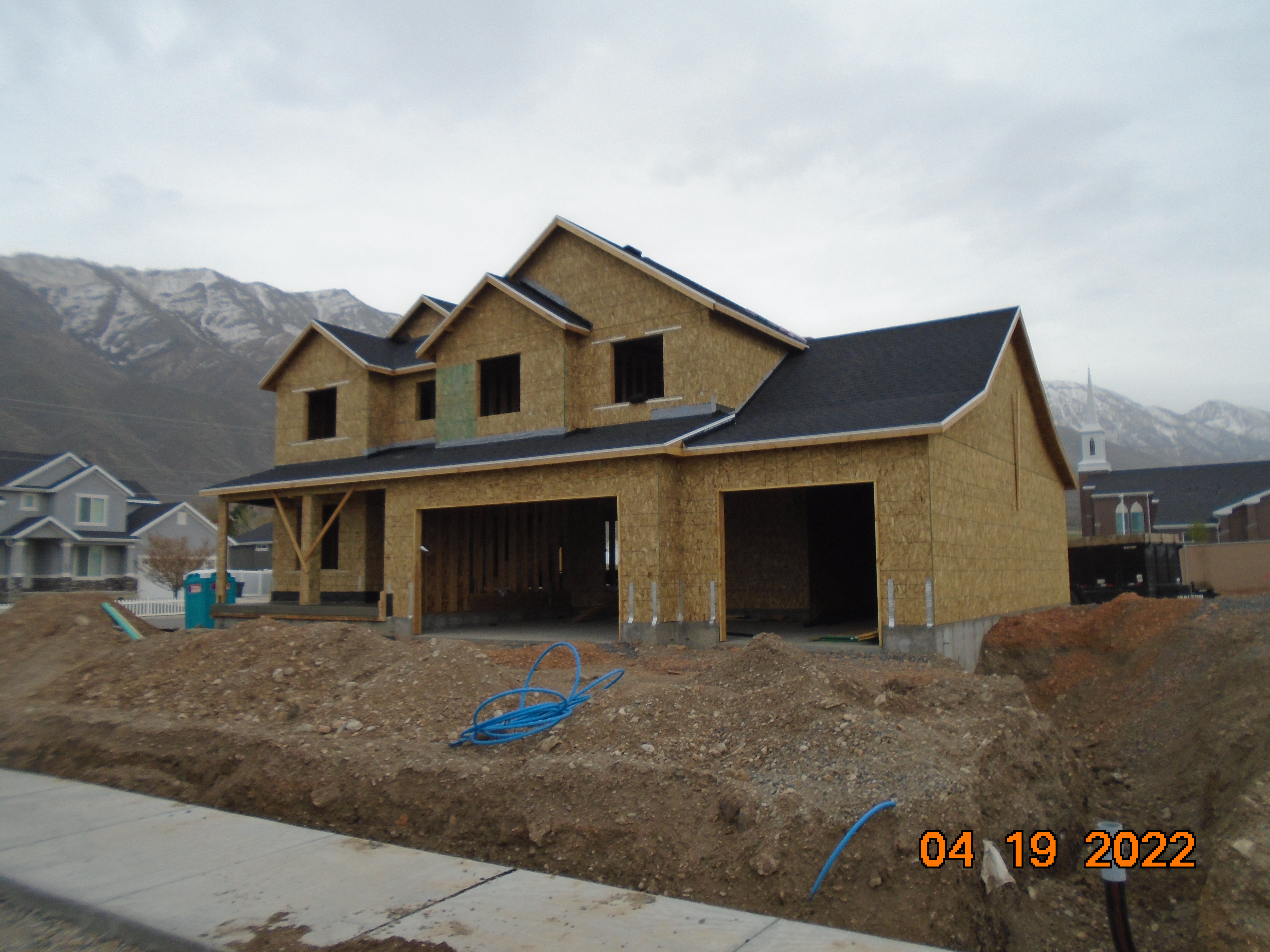 Total Photos: 1
|
| |
|
|
| Property Address: 495 S 300 EAST - SANTAQUIN |
|
| Mailing Address: 391 N MAIN SPANISH FORK, UT 84660 |
|
| Acreage: 5.15158 |
|
| Last Document:
90358-2020
|
|
| Subdivision Map Filing |
|
| Taxing Description:
COM AT NE COR. NW 1/4, SEC. 12, T10S, R1E, SLB&M.; S 346.21 FT; S 89 DEG 5' 2" W 569.96 FT; S 0 DEG 54' 58" E 298.18 FT; N 31 DEG 58' 14" W 157.99 FT; S 73 DEG 16' 6" W 16.35 FT; N 0 DEG 9' 1" W 490.52 FT; N 87 DEG 8' 20" E 5.72 FT; N 33.35 FT; E 94.1 FT; S 61.6 FT; N 89 DEG 36' 11" E 508 FT; N 2 DEG 4' 0" W 58.1 FT; E 60 FT TO BEG. AREA 5.152 AC.
*Taxing description NOT FOR LEGAL DOCUMENTS
|
|
- Owner Names
- Value History
- Tax History
- Location
- Photos
- Documents
- Aerial Image
| |
----- Real Estate Values ----- |
---Improvements--- |
---Greenbelt--- |
Total |
| Year |
Com |
Res |
Agr |
Tot |
Com |
Res |
Agr |
Tot |
Land |
Homesite |
Tot |
Market Value |
| 2022 |
$0 |
$0 |
$369,700 |
$369,700 |
$0 |
$0 |
$0 |
$0 |
$0 |
$0 |
$0 |
$369,700 |
| 2021 |
$0 |
$103,500 |
$124,100 |
$227,600 |
$0 |
$221,700 |
$0 |
$221,700 |
$0 |
$0 |
$0 |
$449,300 |
| 2020 |
$0 |
$90,000 |
$107,900 |
$197,900 |
$0 |
$210,100 |
$0 |
$210,100 |
$0 |
$0 |
$0 |
$408,000 |
| 2019 |
$0 |
$85,000 |
$99,600 |
$184,600 |
$0 |
$182,700 |
$0 |
$182,700 |
$0 |
$0 |
$0 |
$367,300 |
| 2018 |
$0 |
$80,000 |
$99,600 |
$179,600 |
$0 |
$158,900 |
$0 |
$158,900 |
$0 |
$0 |
$0 |
$338,500 |
| Year |
General Taxes |
Adjustments |
Net Taxes |
Fees |
Payments |
Tax Balance* |
Balance Due |
Tax District |
| 2022 |
$3,587.94 |
$0.00 |
$3,587.94 |
$0.00 |
|
$0.00
|
$0.00 |
190 - SANTAQUIN CITY |
| 2021 |
$3,448.59 |
$0.00 |
$3,448.59 |
$0.00 |
|
$0.00
|
$0.00 |
190 - SANTAQUIN CITY |
| 2020 |
$3,206.40 |
$0.00 |
$3,206.40 |
$0.00 |
|
$0.00
|
$0.00 |
190 - SANTAQUIN CITY |
| 2019 |
$2,835.39 |
$0.00 |
$2,835.39 |
$0.00 |
|
$0.00
|
$0.00 |
190 - SANTAQUIN CITY |
| 2018 |
$2,782.80 |
$0.00 |
$2,782.80 |
$0.00 |
|
$0.00
|
$0.00 |
190 - SANTAQUIN CITY |
* Note: Original tax amount (Does not include applicable interest and/or fees).
| Entry # |
Date |
Recorded |
Type |
Party1 (Grantor) |
Party2 (Grantee) |
| 65014-2022 |
09/07/2021 |
05/31/2022 |
S PLAT |
PILOT PEAK INVESTMENTS LLC |
FALCON RIDGE |
| 19438-2021 |
02/01/2021 |
02/01/2021 |
PERREPD |
JONES, WANDA P & GENE LANE PERREP (ET AL) |
PILOT PEAK INVESTMENTS LLC |
| 19437-2021 |
02/01/2021 |
02/01/2021 |
WD |
JONES, WANDA P TEE (ET AL) |
PILOT PEAK INVESTMENTS LLC |
| 90358-2020 |
06/24/2020 |
06/29/2020 |
WD |
JONES, WANDA & WANDA P AKA |
JONES, WANDA P TEE (ET AL) |
| 14383-2017 |
02/09/2017 |
02/10/2017 |
WD |
JONES, GENE L & GENE AKA (ET AL) |
CORP OF PRES BISHOP CHURCH OF JESUS CHRIST OF LDS |
Main Menu Comments or Concerns on Value/Appraisal - Assessor's Office
Documents/Owner/Parcel information - Recorder's Office
Address Change for Tax Notice
This page was created on 1/25/2025 7:57:44 AM |