Property Information
mobile view
| Serial Number: 35:255:0007 |
Serial Life: 1996... |
|
|
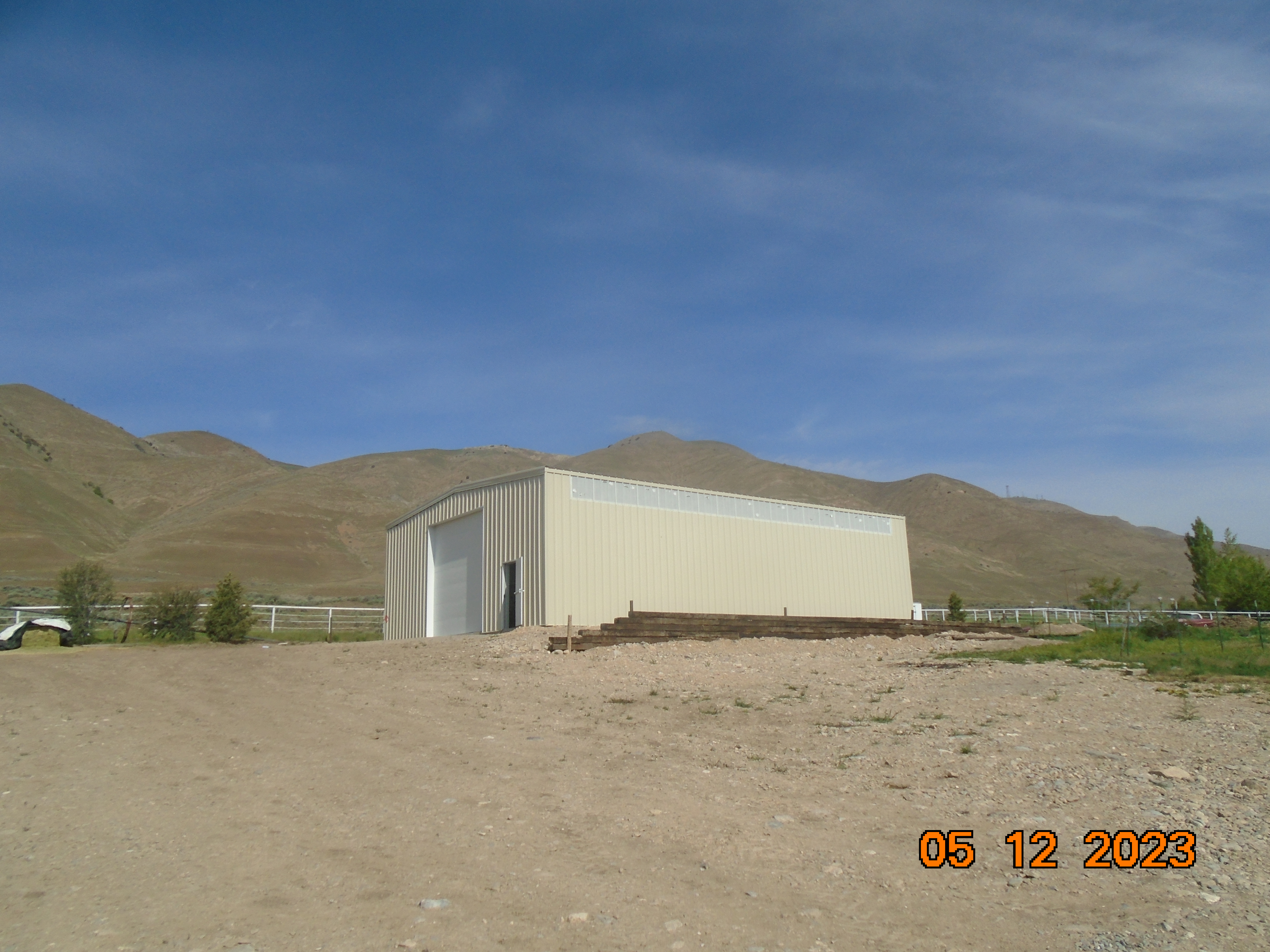
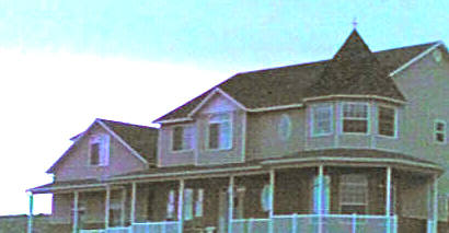
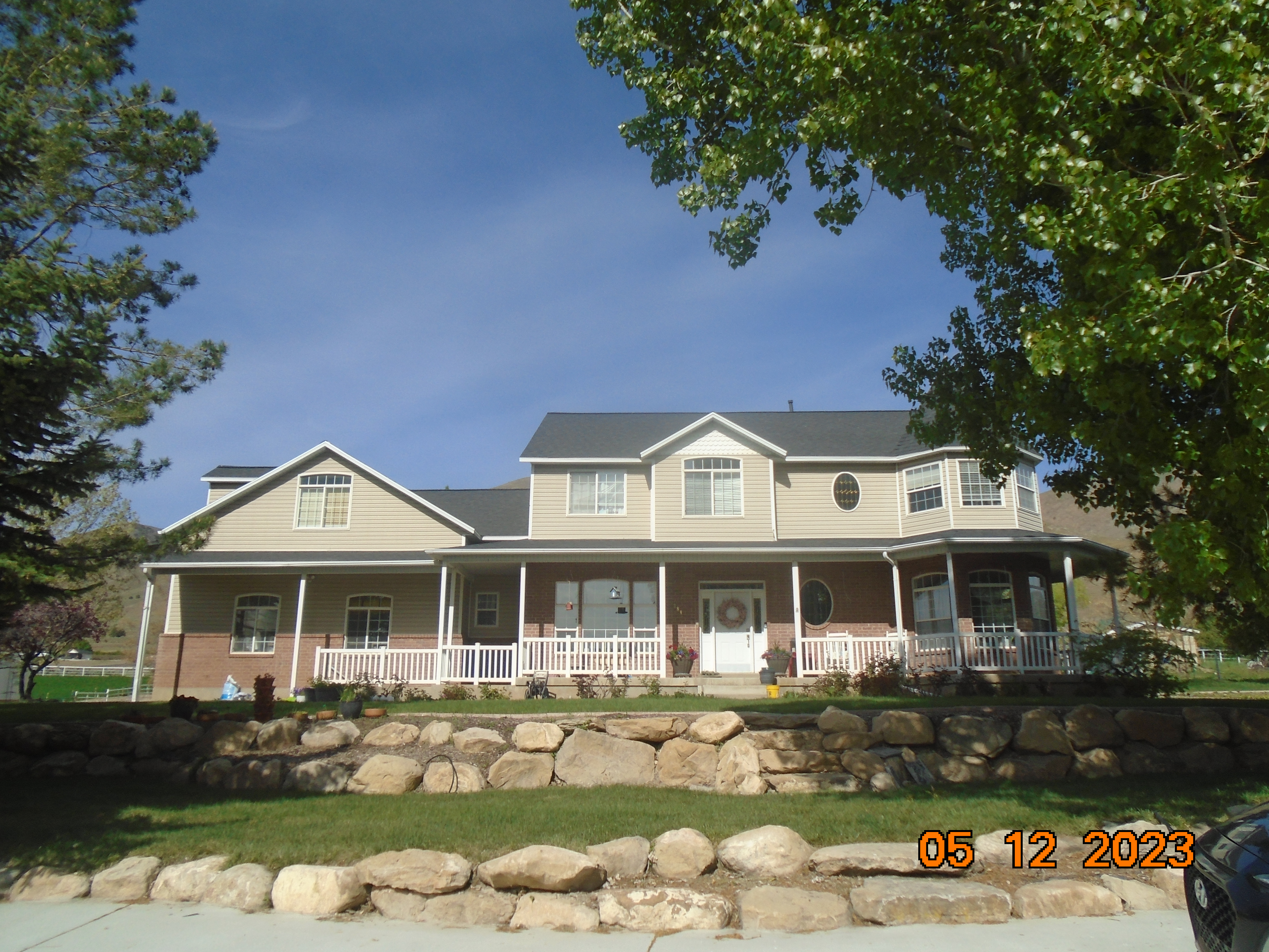 Total Photos: 3
|
| |
|
|
| Property Address: 9384 S 6200 WEST - PAYSON DISTR |
|
| Mailing Address: 9384 S 6200 W PAYSON, UT 84651-9758 |
|
| Acreage: 5.003 |
|
| Last Document:
5519-2005
|
|
| Subdivision Map Filing |
|
| Taxing Description:
LOT 7, PLAT A, BROAD LAND PROPERTIES WEST MOUNTAIN RANCHES SUB AREA 5.003 AC.
*Taxing description NOT FOR LEGAL DOCUMENTS
|
|
- Owner Names
- Value History
- Tax History
- Location
- Photos
- Documents
- Aerial Image
| 2021... |
|
ANDERTON, JUSTINE |
|
| 2021... |
|
ANDERTON, MARK |
|
| 2016-2020 |
|
ANDERTON, JUSTINE A |
|
| 2016-2020 |
|
ANDERTON, MARK E |
|
| 2007-2015 |
|
ANDERTON, JUSTINE A |
|
| 2007-2015 |
|
ANDERTON, MARK E |
|
| 2006 |
|
ECHOLS, GRANT GORDON |
|
| 2006 |
|
ECHOLS, THERESA JANE |
|
| 2005 |
|
ECHOLS, GRANT GORDON |
|
| 2005 |
|
ECHOLS, THERESA JANE |
|
| 2004 |
|
ECHOLS, GRANT GORDON |
|
| 2004 |
|
ECHOLS, THERESA JANE |
|
| 2004NV |
|
ECHOLS, GRANT GORDON |
|
| 2004NV |
|
ECHOLS, THERESA JANE |
|
| 2003 |
|
ECHOLS, GRANT GORDON |
|
| 2003 |
|
ECHOLS, THERESA JANE |
|
| 2002 |
|
ECHOLS, GRANT GORDON |
|
| 2002 |
|
ECHOLS, THERESA JANE |
|
| 2002NV |
|
ECHOLS, GRANT GORDON |
|
| 2002NV |
|
ECHOLS, THERESAJANE |
|
| 2002NV |
|
ECHOLS, GRANT G |
|
| 2002NV |
|
ECHOLS, THERESA |
|
| 2000-2001 |
|
ECHOLS, GRANT GORDON |
|
| 2000-2001 |
|
ECHOLS, THERESA JANE |
|
| 1998-1999 |
|
ECHOLS, GRANT G |
|
| 1998-1999 |
|
ECHOLS, THERESA |
|
| 1997 |
|
ECHOLS, GRANT |
|
| 1997 |
|
ECHOLS, THERESA |
|
| 1997NV |
|
ECHOLS, GRANT |
|
| 1997NV |
|
ECHOLS, THERESA |
|
| 1997NV |
|
BRODERICK CHAD CONSTRUCTION INC |
|
| 1996 |
|
ECHOLS, GRANT |
|
| 1996 |
|
ECHOLS, THERESA |
|
| 1996NV |
|
BROAD LAND PROPERTIES |
|
| |
----- Real Estate Values ----- |
---Improvements--- |
---Greenbelt--- |
Total |
| Year |
Com |
Res |
Agr |
Tot |
Com |
Res |
Agr |
Tot |
Land |
Homesite |
Tot |
Market Value |
| 2024 |
$0 |
$246,200 |
$178,800 |
$425,000 |
$0 |
$652,100 |
$0 |
$652,100 |
$0 |
$0 |
$0 |
$1,077,100 |
| 2023 |
$0 |
$246,200 |
$178,800 |
$425,000 |
$0 |
$652,100 |
$0 |
$652,100 |
$0 |
$0 |
$0 |
$1,077,100 |
| 2022 |
$0 |
$262,500 |
$190,600 |
$453,100 |
$0 |
$522,800 |
$0 |
$522,800 |
$0 |
$0 |
$0 |
$975,900 |
| 2021 |
$0 |
$210,000 |
$112,100 |
$322,100 |
$0 |
$393,100 |
$0 |
$393,100 |
$0 |
$0 |
$0 |
$715,200 |
| 2020 |
$0 |
$175,000 |
$100,100 |
$275,100 |
$0 |
$393,100 |
$0 |
$393,100 |
$0 |
$0 |
$0 |
$668,200 |
| 2019 |
$0 |
$160,000 |
$68,100 |
$228,100 |
$0 |
$384,500 |
$0 |
$384,500 |
$0 |
$0 |
$0 |
$612,600 |
| 2018 |
$0 |
$140,000 |
$68,100 |
$208,100 |
$0 |
$343,800 |
$0 |
$343,800 |
$0 |
$0 |
$0 |
$551,900 |
| 2017 |
$0 |
$120,000 |
$68,100 |
$188,100 |
$0 |
$301,600 |
$0 |
$301,600 |
$0 |
$0 |
$0 |
$489,700 |
| 2016 |
$0 |
$90,000 |
$68,100 |
$158,100 |
$0 |
$290,000 |
$0 |
$290,000 |
$0 |
$0 |
$0 |
$448,100 |
| 2015 |
$0 |
$85,000 |
$68,100 |
$153,100 |
$0 |
$273,600 |
$0 |
$273,600 |
$0 |
$0 |
$0 |
$426,700 |
| 2014 |
$0 |
$85,000 |
$68,100 |
$153,100 |
$0 |
$273,600 |
$0 |
$273,600 |
$0 |
$0 |
$0 |
$426,700 |
| 2013 |
$0 |
$25,500 |
$102,200 |
$127,700 |
$0 |
$304,000 |
$0 |
$304,000 |
$0 |
$0 |
$0 |
$431,700 |
| 2012 |
$0 |
$25,500 |
$102,200 |
$127,700 |
$0 |
$304,000 |
$0 |
$304,000 |
$0 |
$0 |
$0 |
$431,700 |
| 2011 |
$0 |
$25,500 |
$102,200 |
$127,700 |
$0 |
$304,000 |
$0 |
$304,000 |
$0 |
$0 |
$0 |
$431,700 |
| 2010 |
$0 |
$25,500 |
$102,200 |
$127,700 |
$0 |
$304,000 |
$0 |
$304,000 |
$0 |
$0 |
$0 |
$431,700 |
| 2009 |
$0 |
$25,500 |
$102,200 |
$127,700 |
$0 |
$304,000 |
$0 |
$304,000 |
$0 |
$0 |
$0 |
$431,700 |
| 2008 |
$0 |
$25,500 |
$102,200 |
$127,700 |
$0 |
$304,000 |
$0 |
$304,000 |
$0 |
$0 |
$0 |
$431,700 |
| 2007 |
$0 |
$25,500 |
$102,200 |
$127,700 |
$0 |
$304,000 |
$0 |
$304,000 |
$0 |
$0 |
$0 |
$431,700 |
| 2006 |
$0 |
$22,211 |
$88,843 |
$111,054 |
$0 |
$276,371 |
$0 |
$276,371 |
$0 |
$0 |
$0 |
$387,425 |
| 2005 |
$0 |
$22,211 |
$88,843 |
$111,054 |
$0 |
$276,371 |
$0 |
$276,371 |
$0 |
$0 |
$0 |
$387,425 |
| 2004 |
$0 |
$22,211 |
$88,843 |
$111,054 |
$0 |
$276,371 |
$0 |
$276,371 |
$0 |
$0 |
$0 |
$387,425 |
| 2003 |
$0 |
$22,211 |
$88,843 |
$111,054 |
$0 |
$276,371 |
$0 |
$276,371 |
$0 |
$0 |
$0 |
$387,425 |
| 2002 |
$0 |
$22,211 |
$88,843 |
$111,054 |
$0 |
$276,371 |
$0 |
$276,371 |
$0 |
$0 |
$0 |
$387,425 |
| 2001 |
$0 |
$19,314 |
$77,255 |
$96,569 |
$0 |
$299,622 |
$0 |
$299,622 |
$0 |
$0 |
$0 |
$396,191 |
| 2000 |
$0 |
$18,050 |
$72,201 |
$90,251 |
$0 |
$264,007 |
$0 |
$264,007 |
$0 |
$0 |
$0 |
$354,258 |
| 1999 |
$0 |
$20,758 |
$69,493 |
$90,251 |
$0 |
$264,007 |
$0 |
$264,007 |
$0 |
$0 |
$0 |
$354,258 |
| 1998 |
$0 |
$20,758 |
$69,493 |
$90,251 |
$0 |
$264,007 |
$0 |
$264,007 |
$0 |
$0 |
$0 |
$354,258 |
| 1997 |
$0 |
$18,331 |
$71,920 |
$90,251 |
$0 |
$264,007 |
$0 |
$264,007 |
$0 |
$0 |
$0 |
$354,258 |
| 1996 |
$0 |
$89,900 |
$0 |
$89,900 |
$0 |
$0 |
$0 |
$0 |
$0 |
$0 |
$0 |
$89,900 |
| Year |
General Taxes |
Adjustments |
Net Taxes |
Fees |
Payments |
Tax Balance* |
Balance Due |
Tax District |
| 2025 |
$0.00 |
$0.00 |
$0.00 |
$0.00 |
|
$0.00
|
$0.00 |
120 - NEBO SCHOOL DIST S/A 6-7-8 |
| 2024 |
$6,731.34 |
$0.00 |
$6,731.34 |
$0.00 |
|
|
Click for Payoff
|
120 - NEBO SCHOOL DIST S/A 6-7-8 |
| 2023 |
$6,725.96 |
$0.00 |
$6,725.96 |
$0.00 |
|
|
Click for Payoff
|
120 - NEBO SCHOOL DIST S/A 6-7-8 |
| 2022 |
$6,336.58 |
($2,890.47) |
$3,446.11 |
$0.00 |
|
$0.00
|
$0.00 |
120 - NEBO SCHOOL DIST S/A 6-7-8 |
| 2021 |
$5,259.98 |
($3,267.58) |
$1,992.40 |
$0.00 |
|
$0.00
|
$0.00 |
120 - NEBO SCHOOL DIST S/A 6-7-8 |
| 2020 |
$5,036.06 |
($3,317.08) |
$1,718.98 |
$0.00 |
|
$0.00
|
$0.00 |
120 - NEBO SCHOOL DIST S/A 6-7-8 |
| 2019 |
$4,397.30 |
($1,914.10) |
$2,483.20 |
$0.00 |
|
$0.00
|
$0.00 |
120 - NEBO SCHOOL DIST S/A 6-7-8 |
| 2018 |
$4,178.71 |
($1,953.40) |
$2,225.31 |
$0.00 |
|
$0.00
|
$0.00 |
120 - NEBO SCHOOL DIST S/A 6-7-8 |
| 2017 |
$3,858.34 |
($1,970.21) |
$1,888.13 |
$0.00 |
|
$0.00
|
$0.00 |
120 - NEBO SCHOOL DIST S/A 6-7-8 |
| 2016 |
$3,676.01 |
($2,015.88) |
$1,660.13 |
$0.00 |
|
$0.00
|
$0.00 |
120 - NEBO SCHOOL DIST S/A 6-7-8 |
| 2015 |
$3,549.58 |
($2,023.76) |
$1,525.82 |
$0.00 |
|
$0.00
|
$0.00 |
120 - NEBO SCHOOL DIST S/A 6-7-8 |
| 2014 |
$3,547.73 |
($1,991.23) |
$1,556.50 |
$0.00 |
|
$0.00
|
$0.00 |
120 - NEBO SCHOOL DIST S/A 6-7-8 |
| 2013 |
$3,942.16 |
($2,036.81) |
$1,905.35 |
$0.00 |
|
$0.00
|
$0.00 |
120 - NEBO SCHOOL DIST S/A 6-7-8 |
| 2012 |
$3,992.04 |
($2,010.91) |
$1,981.13 |
$0.00 |
|
$0.00
|
$0.00 |
120 - NEBO SCHOOL DIST S/A 6-7-8 |
| 2011 |
$3,919.48 |
($1,927.59) |
$1,991.89 |
$0.00 |
|
$0.00
|
$0.00 |
120 - NEBO SCHOOL DIST S/A 6-7-8 |
| 2010 |
$3,828.79 |
($1,855.58) |
$1,973.21 |
$0.00 |
|
$0.00
|
$0.00 |
120 - NEBO SCHOOL DIST S/A 6-7-8 |
| 2009 |
$3,662.98 |
$0.00 |
$3,662.98 |
$0.00 |
|
$0.00
|
$0.00 |
120 - NEBO SCHOOL DIST S/A 6-7-8 |
| 2008 |
$3,276.39 |
$0.00 |
$3,276.39 |
$0.00 |
|
$0.00
|
$0.00 |
120 - NEBO SCHOOL DIST S/A 6-7-8 |
| 2007 |
$3,242.95 |
$0.00 |
$3,242.95 |
$0.00 |
|
$0.00
|
$0.00 |
120 - NEBO SCHOOL DIST S/A 6-7-8 |
| 2006 |
$3,179.48 |
$0.00 |
$3,179.48 |
$0.00 |
|
$0.00
|
$0.00 |
120 - NEBO SCHOOL DIST S/A 6-7-8 |
| 2005 |
$3,363.21 |
$0.00 |
$3,363.21 |
$0.00 |
|
$0.00
|
$0.00 |
120 - NEBO SCHOOL DIST S/A 6-7-8 |
| 2004 |
$3,362.70 |
$0.00 |
$3,362.70 |
$0.00 |
|
$0.00
|
$0.00 |
120 - NEBO SCHOOL DIST S/A 6-7-8 |
| 2003 |
$3,088.89 |
$0.00 |
$3,088.89 |
$0.00 |
|
$0.00
|
$0.00 |
120 - NEBO SCHOOL DIST S/A 6-7-8 |
| 2002 |
$3,012.21 |
$0.00 |
$3,012.21 |
$0.00 |
|
$0.00
|
$0.00 |
120 - NEBO SCHOOL DIST S/A 6-7-8 |
| 2001 |
$3,055.29 |
$0.00 |
$3,055.29 |
$0.00 |
|
$0.00
|
$0.00 |
120 - NEBO SCHOOL DIST S/A 6-7-8 |
| 2000 |
$2,710.95 |
$0.00 |
$2,710.95 |
$0.00 |
|
$0.00
|
$0.00 |
120 - NEBO SCHOOL DIST S/A 6-7-8 |
| 1999 |
$2,564.36 |
$0.00 |
$2,564.36 |
$0.00 |
|
$0.00
|
$0.00 |
120 - NEBO SCHOOL DIST S/A 6-7-8 |
| 1998 |
$2,529.09 |
$0.00 |
$2,529.09 |
$0.00 |
|
$0.00
|
$0.00 |
120 - NEBO SCHOOL DIST S/A 6-7-8 |
| 1997 |
$2,770.32 |
$0.00 |
$2,770.32 |
$0.00 |
|
$0.00
|
$0.00 |
120 - NEBO SCHOOL DIST S/A 6-7-8 |
| 1996 |
$955.19 |
$0.00 |
$955.19 |
$0.00 |
|
$0.00
|
$0.00 |
125 - NEBO SCHOOL DIST S/A 6-9 |
* Note: Original tax amount (Does not include applicable interest and/or fees).
| Entry # |
Date |
Recorded |
Type |
Party1 (Grantor) |
Party2 (Grantee) |
| 2252-2021 |
12/26/2020 |
01/06/2021 |
RSUBTEE |
MORTGAGE ELECTRONIC REGISTRATION SYSTEMS INC (ET AL) |
ANDERTON, MARK & JUSTINE |
| 195266-2020 |
12/03/2020 |
12/08/2020 |
D TR |
ANDERTON, MARK & JUSTINE |
UNITED WHOLESALE MORTGAGE LLC |
| 91504-2020 |
06/25/2020 |
06/30/2020 |
R LN |
STRAWBERRY WATER USER'S ASSOCIATION |
WHOM OF INTEREST |
| 33216-2020 |
03/12/2020 |
03/16/2020 |
REC |
FIRST AMERICAN TITLE INSURANCE COMPANY TEE |
ANDERTON, MARK E & JUSTINE A |
| 33215-2020 |
03/12/2020 |
03/16/2020 |
SUB TEE |
MORTGAGE ELECTRONIC REGISTRATION SYSTEMS INC |
FIRST AMERICAN TITLE INSURANCE COMPANY SUBTEE |
| 23807-2020 |
02/20/2020 |
02/25/2020 |
N LN |
ANDERTON, MARK E & JUSTINE A |
STRAWBERRY WATER USER'S ASSOCIATION |
| 20897-2020 |
02/14/2020 |
02/20/2020 |
D TR |
ANDERTON, MARK & JUSTINE |
UNITED WHOLESALE MORTGAGE LLC |
| 20896-2020 |
02/14/2020 |
02/20/2020 |
WD |
ANDERTON, MARK E & JUSTINE A |
ANDERTON, MARK & JUSTINE |
| 22009-2018 |
03/01/2018 |
03/07/2018 |
REC |
HALLIDAY, PAUL M JR SUCTEE |
ANDERTON, MARK E & JUSTINE A |
| 22008-2018 |
02/06/2018 |
03/07/2018 |
SUB TEE |
MORTGAGE ELECTRONIC REGISTRATION SYSTEMS INC |
HALLIDAY, PAUL M JR SUBTEE |
| 9868-2018 |
01/18/2018 |
01/31/2018 |
REC |
ZB NA TEE |
ANDERTON, MARK E & JUSTINE A |
| 13-2018 |
12/27/2017 |
01/02/2018 |
D TR |
ANDERTON, MARK E & JUSTINE A |
CALIBER HOME LOANS INC |
| 3187-2015 |
12/04/2014 |
01/14/2015 |
QCD |
UNITED STATES OF AMERICA |
SOUTH UTAH VALLEY ELECTRIC SERVICE DISTRICT |
| 26764-2012 |
04/03/2012 |
04/03/2012 |
REC |
FIRST AMERICAN TITLE INSURANCE AGENCY LLC TEE |
ANDERTON, MARK E & JUSTINE A |
| 25626-2012 |
03/20/2012 |
03/30/2012 |
RC |
ZIONS FIRST NATIONAL BANK |
WHOM OF INTEREST |
| 25625-2012 |
03/26/2012 |
03/30/2012 |
SUB AGR |
ZIONS FIRST NATIONAL BANK |
FIRST COLONY MORTGAGE CORP |
| 25584-2012 |
03/26/2012 |
03/30/2012 |
D TR |
ANDERTON, MARK E & JUSTINE A |
FIRST COLONY MORTGAGE CORPORATION |
| 50963-2009 |
05/04/2009 |
05/08/2009 |
CT |
STATE OF UTAH |
WHOM OF INTEREST |
| 42373-2009 |
04/21/2009 |
04/21/2009 |
RESOL |
BOARD OF COUNTY COMMISSIONERS UTAH COUNTY |
WHOM OF INTEREST |
| 40860-2009 |
04/07/2009 |
04/16/2009 |
RSUBTEE |
MORTGAGE ELECTRONIC REGISTRATION SYSTEMS INC (ET AL) |
ANDERTON, MARK E & JUSTINE A |
| 31804-2009 |
03/23/2009 |
03/26/2009 |
RC |
ZIONS FIRST NATIONAL BANK |
WHOM OF INTEREST |
| 31803-2009 |
03/23/2009 |
03/26/2009 |
SUB AGR |
ZIONS FIRST NATIONAL BANK |
PROVIDENT FUNDING ASSOCIATES LP |
| 31802-2009 |
03/19/2009 |
03/26/2009 |
D TR |
ANDERTON, MARK E & JUSTINE A |
PROVIDENT FUNDING ASSOCIATES LP |
| 122665-2008 |
10/22/2008 |
11/17/2008 |
RSUBTEE |
JPMORGAN CHASE BANK (ET AL) |
ANDERTON, MARK E & JUSTINE A |
| 114949-2008 |
10/20/2008 |
10/22/2008 |
CT |
STATE OF UTAH |
WHOM OF INTEREST |
| 107508-2008 |
09/30/2008 |
09/30/2008 |
RESOL |
BOARD OF COUNTY COMMISSIONERS UTAH COUNTY |
WHOM OF INTEREST |
| 165524-2007 |
10/31/2007 |
11/27/2007 |
D TR |
ANDERTON, MARK E & JUSTINE A |
ZIONS FIRST NATIONAL BANK |
| 152625-2006 |
09/01/2005 |
11/14/2006 |
D TR |
ANDERTON, MARK E & JUSTINE A |
REPUBLIC MORTGAGE HOME LOANS LLC |
| 117180-2006 |
09/01/2006 |
09/07/2006 |
D TR |
ANDERTON, MARK E & JUSTINE A |
REPUBLIC MORTGAGE HOME LOANS LLC |
| 87504-2006 |
08/31/2005 |
07/12/2006 |
WD |
ECHOLS, GRANT GORDON & THERESA JANE TEE (ET AL) |
ANDERTON, MARK E & JUSTINE A |
| 137146-2005 |
11/08/2005 |
11/29/2005 |
REC |
MITCHELL, ALLISON TEE |
ECHOLS, GRANT GORDON & THERESA JANE |
| 137145-2005 |
11/08/2005 |
11/29/2005 |
SUB TEE |
FIRST HORIZON HOME LOAN CORPORATION |
FIRST TENNESSEE BANK SUCTEE |
| 115051-2005 |
09/22/2005 |
10/11/2005 |
REC |
LUNDBERG, J SCOTT TEE |
ECHOLS, GRANT GORDON & THERESA JANE |
| 115050-2005 |
09/13/2005 |
10/11/2005 |
SUB TEE |
MORTGAGE ELECTRONIC REGISTRATION SYSTEMS INC |
LUNDBERG, J SCOTT SUCTEE |
| 100699-2005 |
09/01/2005 |
09/08/2005 |
D TR |
ANDERTON, MARK E & JUSTINE A |
JPMORGAN CHASE BANK |
| 100698-2005 |
08/31/2005 |
09/08/2005 |
D TR |
ANDERTON, MARK E & JUSTINE A |
REPUBLIC MORTGAGE HOME LOANS LLC |
| 100697-2005 |
08/31/2005 |
09/08/2005 |
WD |
ECHOLS, GRANT GORDON & THERESA JANE TEE (ET AL) |
WHOM OF INTEREST |
| 41459-2005 |
04/08/2005 |
04/19/2005 |
REC |
LUNDBERG, J SCOTT TEE |
ECHOLS, GRANG GORDON & THERESA JANE |
| 41458-2005 |
03/11/2005 |
04/19/2005 |
SUB TEE |
FIRST HORIZON HOME LOAN CORPORATION |
LUNDBERG, J SCOTT SUCTEE |
| 5519-2005 |
12/17/2004 |
01/18/2005 |
WD |
ECHOLS, GRANT GORON & THERESA JANE |
ECHOLS, GRANT GORDON & THERESA JANE TEE |
| 143475-2004 |
12/10/2004 |
12/22/2004 |
SUB AGR |
FIRST TENNESSEE BANK NATIONAL ASSOCIATION |
FIRST HORIZON HOME LOAN CORPORATION |
| 143474-2004 |
12/17/2004 |
12/22/2004 |
D TR |
ECHOLS, GRANT GORDON & THERESA JANE |
FIRST HORIZON HOME LOAN CORPORATION |
| 138337-2004 |
12/08/2004 |
12/09/2004 |
WD |
ECHOLS, GRANT GORDON & THERESA JANE TEE (ET AL) |
ECHOLS, GRANT GORDON & THERESA JANE |
| 168478-2003 |
10/13/2003 |
10/20/2003 |
REC |
FIDELITY NATIONAL TITLE INSURANCE COMPANY TEE |
ECHOLS, GRANT GORDON & THERESA JANE |
| 168477-2003 |
10/06/2003 |
10/20/2003 |
SUB TEE |
WASHINGTON MUTUAL BANK |
FIDELITY NATIONAL TITLE INSURANCE COMPANY SUCTEE |
| 149377-2003 |
08/29/2003 |
09/11/2003 |
RSUBTEE |
BANK OF AMERICA (ET AL) |
ECHOLS, GRANT GORDON & THERESA JANE |
| 118914-2003 |
07/07/2003 |
07/31/2003 |
WD |
ECHOLS, GRAND GORDON & THERESA JANE |
ECHOLS, GRANT GORDON & THERESA JANE TEE |
| 104786-2003 |
07/07/2003 |
07/11/2003 |
D TR |
ECHOLS, GRANT GORDON & THERESA JANE |
FIRST HORIZON HOME LOAN CORPORATION |
| 104785-2003 |
07/07/2003 |
07/11/2003 |
D TR |
ECHOLS, GRANT GORDON & THERESA JANE |
FIRST HORIZON HOME LOAN CORPORATION |
| 104784-2003 |
07/07/2003 |
07/11/2003 |
WD |
ECHOLS, GRANT GORDON & THERESA JANE TEE (ET AL) |
ECHOLS, GRANT GORDON & THERESA JANE |
| 57981-2003 |
02/15/2003 |
04/16/2003 |
RSUBTEE |
NORTH AMERICAN MORTGAGE COMPANY (ET AL) |
ECHOLS, GRANT G & THERESA |
| 7264-2003 |
12/03/2002 |
01/15/2003 |
SUB AGR |
WASHINGTON MUTUAL BANK |
BANK OF AMERICA |
| 151098-2002 |
12/04/2002 |
12/12/2002 |
WD |
WHOM OF INTEREST |
ECHOLS, GRANT GORDON & THERESA JANE TEE |
| 151097-2002 |
12/04/2002 |
12/12/2002 |
D TR |
ECHOLS, GRANT GORDON & THERESA JANE |
BANK OF AMERICA |
| 151096-2002 |
12/04/2002 |
12/12/2002 |
WD |
ECHOLS, GRANT GORDON & THERESA JANE TEE (ET AL) |
ECHOLS, GRANT GORDON & THERESA JANE |
| 14276-2002 |
01/31/2002 |
02/05/2002 |
REC |
EQUITY TITLE AGENCY INC TEE |
ECHOLS, GRANT G & THERESA |
| 136451-2001 |
12/20/2001 |
12/26/2001 |
WD |
ECHOLS, GRANT GORDON & THERESA JANE |
ECHOLS, GRANT GORDON & THERESA JANE TEE |
| 136450-2001 |
12/20/2001 |
12/26/2001 |
D TR |
ECHOLS, GRANT GORDON & THERESA JANE |
NORTH AMERICAN MORTGAGE COMPANY |
| 136449-2001 |
12/20/2001 |
12/26/2001 |
WD |
ECHOLS, GRANT GORDAN & THERESA JANE TEE (ET AL) |
ECHOLS, GRANT GORDON & THERESA JANE |
| 107993-2001 |
09/29/2001 |
10/23/2001 |
REC |
WELLS FARGO FINANCIAL NATIONAL BANK TEE |
ECHOLS, GRANT G & THERESA |
| 107992-2001 |
09/29/2001 |
10/23/2001 |
SUB TEE |
WELLS FARGO HOME MORTGAGE INC FKA (ET AL) |
WELLS FARGO FINANCIAL NATIONAL BANK SUCTEE |
| 75944-2001 |
07/12/2001 |
07/31/2001 |
QCD |
ECHOLS, GRANT G & THERESA |
ECHOLS, GRANT GORDON & THERESAJANE TEE |
| 70232-2001 |
07/12/2001 |
07/17/2001 |
D TR |
ECHOLS, GRANT G & THERESA |
NORTH AMERICAN MORTGAGE COMPANY |
| 70231-2001 |
07/12/2001 |
07/17/2001 |
D TR |
ECHOLS, GRANT G & THERESA |
NORTH AMERICAN MORTGAGE COMPANY |
| 70230-2001 |
07/12/2001 |
07/17/2001 |
QCD |
ECHOLS, GRANT GORDON & THERESA JANE TEE (ET AL) |
ECHOLS, GRANT G & THERESA |
| 13098-2000 |
02/17/2000 |
02/17/2000 |
CORR AF |
ACCESS TITLE COMPANY (ET AL) |
WHOM OF INTEREST |
| 13097-2000 |
02/17/2000 |
02/17/2000 |
CORR AF |
ACCESS TITLE COMPANY (ET AL) |
WHOM OF INTEREST |
| 124424-1999 |
11/18/1999 |
11/29/1999 |
AS |
NORWEST MORTGAGE INC |
FIRST UNION NATIONAL BANK |
| 92059-1999 |
07/19/1999 |
08/17/1999 |
WD |
ECHOLS, GRANT & GRANT GORDON (ET AL) |
ECHOLS, GRANT GORDON & THERESA JANE TEE |
| 65602-1998 |
10/27/1997 |
06/30/1998 |
AS |
ZIONS MORTGAGE COMPANY |
NORWEST MORTGAGE INC |
| 16055-1998 |
02/13/1998 |
02/20/1998 |
REC |
MERRILL TITLE COMPANY TEE |
ECHOLS, GRANT & THERESA |
| 16054-1998 |
01/17/1998 |
02/20/1998 |
SUB TEE |
WASHINGTON MUTUAL BANK SUC TO (ET AL) |
MERRILL TITLE COMPANY SUBTEE |
| 94750-1997 |
11/24/1997 |
12/01/1997 |
REC |
BONNEVILLE TITLE TEE |
ECHOLS, GRANT & THERESA |
| 94749-1997 |
11/11/1997 |
12/01/1997 |
SUB TEE |
PRUDENTIAL HOME MORTGAGE COMPANY INC |
BONNEVILLE TITLE SUCTEE |
| 84725-1997 |
10/25/1996 |
10/28/1997 |
AS |
NORWEST MORTGAGE INC DBA (ET AL) |
FIRST UNION NATIONAL BANK OF NORTH CAROLINA |
| 83292-1997 |
10/17/1997 |
10/22/1997 |
D TR |
ECHOLS, GRANT G & THERESA |
ZIONS MORTGAGE COMPANY |
| 83291-1997 |
10/17/1997 |
10/22/1997 |
QCD |
ECHOLS, GRANT & THERESA |
ECHOLS, GRANT G & THERESA |
| 42951-1997 |
06/04/1997 |
06/04/1997 |
W FARM |
UTAH COUNTY ASSESSOR |
WHOM OF INTEREST |
| 6039-1997 |
10/22/1996 |
01/27/1997 |
AS |
COUNTRYWIDE HOME LOANS INC FKA (ET AL) |
NORWEST MORTGAGE INC |
| 4153-1997 |
01/07/1997 |
01/16/1997 |
REC |
BANK OF AMERICAN FORK TEE |
BROAD LAND PROPERTIES (UTAH) |
| 89790-1996 |
10/22/1996 |
11/04/1996 |
AS |
COUNTRYWIDE HOME LOANS INC FKA (ET AL) |
NORWEST MORTGAGE INC |
| 55453-1996 |
07/01/1996 |
07/05/1996 |
REC |
BANK OF AMERICAN FORK TEE |
ECHOLS, GRANT & THERESA |
| 54870-1996 |
06/27/1996 |
07/02/1996 |
RC |
UNITED SAVINGS BANK |
WHOM OF INTEREST |
| 54869-1996 |
06/27/1996 |
07/02/1996 |
TR D |
ECHOLS, GRANT & THERESA |
UNITED SAVINGS BANK |
| 49188-1996 |
06/11/1996 |
06/13/1996 |
D TR |
ECHOLS, GRANT & THERESA |
AMERICAS WHOLESALE LENDER |
| 49187-1996 |
06/11/1996 |
06/13/1996 |
WD |
BRODERICK CHAD CONSTRUCTION INC |
ECHOLS, GRANT & THERESA |
| 46931-1996 |
06/04/1996 |
06/05/1996 |
QCD |
ECHOLS, GRANT & THERESA |
BRODERICK CHAD CONSTRUCTION INC |
| 85549-1995 |
12/05/1995 |
12/11/1995 |
P REC |
BANK OF AMERICAN FORK TEE |
BROAD LAND PROPERTIES (UTAH) |
| 85548-1995 |
12/08/1995 |
12/11/1995 |
REC |
ACCESS TITLE COMPANY SUCTEE |
ECHOLS, GRANT & THERESA |
| 75583-1995 |
10/30/1995 |
11/02/1995 |
TR D |
ECHOLS, GRANT & THERESA |
BROAD LAND PROPERTIES |
| 75582-1995 |
10/30/1995 |
11/02/1995 |
WD |
BROAD LAND PROPERTIES |
ECHOLS, GRANT & THERESA |
| 74424-1995 |
10/31/1995 |
10/31/1995 |
D TR |
ECHOLS, GRANT & THERESA |
BANK OF AMERICAN FORK |
| 72618-1995 |
10/25/1995 |
10/25/1995 |
DECLCOV |
BROADLAND PROPERTIES (UTAH) LLC |
WHOM OF INTEREST |
| 72617-1995 |
10/18/1995 |
10/25/1995 |
S PLAT |
BROAD LAND PROPERTIES (UTAH) |
BROAD LAND PROPERTIES WEST MOUNTAIN RANCHES PLAT A |
Main Menu Comments or Concerns on Value/Appraisal - Assessor's Office
Documents/Owner/Parcel information - Recorder's Office
Address Change for Tax Notice
This page was created on 2/24/2025 7:32:12 AM |