Property Information
mobile view
| Serial Number: 36:208:0018 |
Serial Life: 1982... |
|
|
 Total Photos: 2
|
| |
|
|
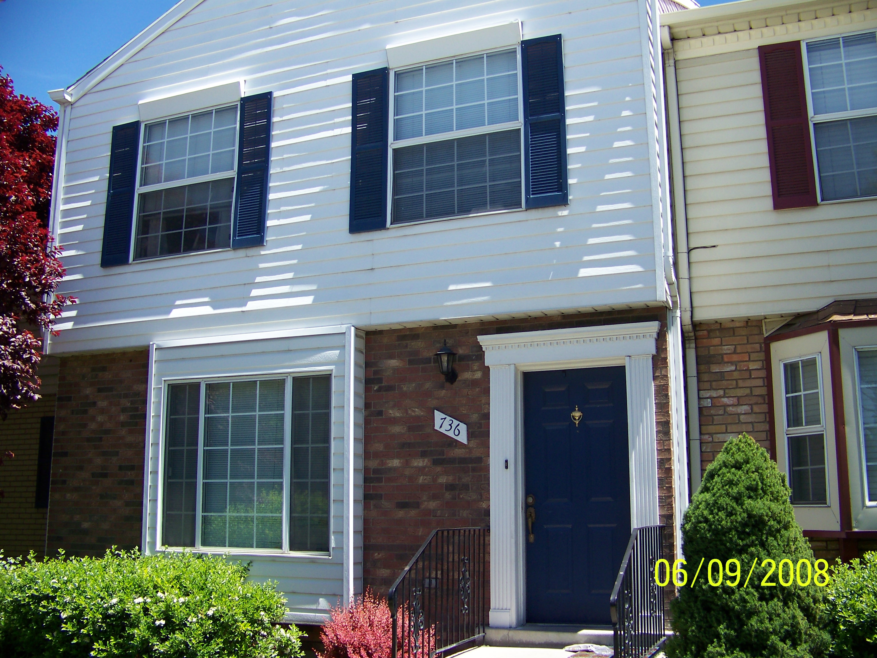
| Property Address: 736 N 450 WEST - OREM |
|
| Mailing Address: 736 N 450 W OREM, UT 84057-3786 |
|
| Acreage: 0.01 |
|
| Last Document:
9726-1988
|
|
| Subdivision Map Filing |
|
| Taxing Description:
UNIT 18B, THE COLONIES PUD SUBDV. AREA 0.028 AC.
*Taxing description NOT FOR LEGAL DOCUMENTS
|
|
- Owner Names
- Value History
- Tax History
- Location
- Photos
- Documents
- Aerial Image
| 2008... |
|
MC CONNELL, NATHAN D |
|
| 2008... |
|
MC CONNELL, NATHAN D |
|
| 2008... |
|
MC CONNELL, REBECCA J |
|
| 2008... |
|
MC CONNELL, REBECCA J |
|
| 2007 |
|
TAYLOR, J BRENT |
|
| 2007 |
|
TAYLOR, LINDSAY N |
|
| 2006 |
|
TAYLOR, JAMES B |
|
| 2006NV |
|
TAYLOR, JAMES B |
|
| 2004-2005 |
|
FLOYD, KODY C |
|
| 2004-2005 |
|
FLOYD, SAMANTHA |
|
| 2004NV |
|
BELLISTON, CAROLYN |
|
| 2004NV |
|
BELLISTON, MARCUS J |
|
| 1998-2003 |
|
BELLISTON, CAROLYN |
|
| 1998-2003 |
|
BELLISTON, MARCUS J |
|
| 1989-1997 |
|
BEKEARIAN, ARA |
|
| 1989-1997 |
|
BEKEARIAN, HAROUT |
|
| 1983-1988 |
|
BUSCHE, MATTHIAS |
|
| 1983-1988 |
|
BUSCHE, THEA PATRICIA |
|
| 1982 |
|
COLONY DEVELOPMENT JT VENTURE |
|
| |
----- Real Estate Values ----- |
---Improvements--- |
---Greenbelt--- |
Total |
| Year |
Com |
Res |
Agr |
Tot |
Com |
Res |
Agr |
Tot |
Land |
Homesite |
Tot |
Market Value |
| 2024 |
$0 |
$53,400 |
$0 |
$53,400 |
$0 |
$310,100 |
$0 |
$310,100 |
$0 |
$0 |
$0 |
$363,500 |
| 2023 |
$0 |
$53,500 |
$0 |
$53,500 |
$0 |
$310,300 |
$0 |
$310,300 |
$0 |
$0 |
$0 |
$363,800 |
| 2022 |
$0 |
$52,000 |
$0 |
$52,000 |
$0 |
$294,500 |
$0 |
$294,500 |
$0 |
$0 |
$0 |
$346,500 |
| 2021 |
$0 |
$39,100 |
$0 |
$39,100 |
$0 |
$221,400 |
$0 |
$221,400 |
$0 |
$0 |
$0 |
$260,500 |
| 2020 |
$0 |
$36,800 |
$0 |
$36,800 |
$0 |
$208,300 |
$0 |
$208,300 |
$0 |
$0 |
$0 |
$245,100 |
| 2019 |
$0 |
$36,800 |
$0 |
$36,800 |
$0 |
$208,300 |
$0 |
$208,300 |
$0 |
$0 |
$0 |
$245,100 |
| 2018 |
$0 |
$30,300 |
$0 |
$30,300 |
$0 |
$171,700 |
$0 |
$171,700 |
$0 |
$0 |
$0 |
$202,000 |
| 2017 |
$0 |
$27,900 |
$0 |
$27,900 |
$0 |
$158,100 |
$0 |
$158,100 |
$0 |
$0 |
$0 |
$186,000 |
| 2016 |
$0 |
$25,000 |
$0 |
$25,000 |
$0 |
$139,000 |
$0 |
$139,000 |
$0 |
$0 |
$0 |
$164,000 |
| 2015 |
$0 |
$20,000 |
$0 |
$20,000 |
$0 |
$138,000 |
$0 |
$138,000 |
$0 |
$0 |
$0 |
$158,000 |
| 2014 |
$0 |
$20,000 |
$0 |
$20,000 |
$0 |
$123,000 |
$0 |
$123,000 |
$0 |
$0 |
$0 |
$143,000 |
| 2013 |
$0 |
$20,000 |
$0 |
$20,000 |
$0 |
$105,000 |
$0 |
$105,000 |
$0 |
$0 |
$0 |
$125,000 |
| 2012 |
$0 |
$20,000 |
$0 |
$20,000 |
$0 |
$105,000 |
$0 |
$105,000 |
$0 |
$0 |
$0 |
$125,000 |
| 2011 |
$0 |
$26,600 |
$0 |
$26,600 |
$0 |
$106,400 |
$0 |
$106,400 |
$0 |
$0 |
$0 |
$133,000 |
| 2010 |
$0 |
$20,000 |
$0 |
$20,000 |
$0 |
$120,000 |
$0 |
$120,000 |
$0 |
$0 |
$0 |
$140,000 |
| 2009 |
$0 |
$20,000 |
$0 |
$20,000 |
$0 |
$120,000 |
$0 |
$120,000 |
$0 |
$0 |
$0 |
$140,000 |
| 2008 |
$0 |
$20,000 |
$0 |
$20,000 |
$0 |
$120,000 |
$0 |
$120,000 |
$0 |
$0 |
$0 |
$140,000 |
| 2007 |
$0 |
$20,000 |
$0 |
$20,000 |
$0 |
$120,000 |
$0 |
$120,000 |
$0 |
$0 |
$0 |
$140,000 |
| 2006 |
$0 |
$19,024 |
$0 |
$19,024 |
$0 |
$96,294 |
$0 |
$96,294 |
$0 |
$0 |
$0 |
$115,318 |
| 2005 |
$0 |
$19,024 |
$0 |
$19,024 |
$0 |
$96,294 |
$0 |
$96,294 |
$0 |
$0 |
$0 |
$115,318 |
| 2004 |
$0 |
$19,024 |
$0 |
$19,024 |
$0 |
$96,294 |
$0 |
$96,294 |
$0 |
$0 |
$0 |
$115,318 |
| 2003 |
$0 |
$19,024 |
$0 |
$19,024 |
$0 |
$96,294 |
$0 |
$96,294 |
$0 |
$0 |
$0 |
$115,318 |
| 2002 |
$0 |
$19,024 |
$0 |
$19,024 |
$0 |
$96,294 |
$0 |
$96,294 |
$0 |
$0 |
$0 |
$115,318 |
| 2001 |
$0 |
$19,024 |
$0 |
$19,024 |
$0 |
$96,294 |
$0 |
$96,294 |
$0 |
$0 |
$0 |
$115,318 |
| 2000 |
$0 |
$17,779 |
$0 |
$17,779 |
$0 |
$90,417 |
$0 |
$90,417 |
$0 |
$0 |
$0 |
$108,196 |
| 1999 |
$0 |
$16,616 |
$0 |
$16,616 |
$0 |
$84,502 |
$0 |
$84,502 |
$0 |
$0 |
$0 |
$101,118 |
| 1998 |
$0 |
$16,616 |
$0 |
$16,616 |
$0 |
$84,502 |
$0 |
$84,502 |
$0 |
$0 |
$0 |
$101,118 |
| 1997 |
$0 |
$16,616 |
$0 |
$16,616 |
$0 |
$84,502 |
$0 |
$84,502 |
$0 |
$0 |
$0 |
$101,118 |
| 1996 |
$0 |
$16,361 |
$0 |
$16,361 |
$0 |
$83,204 |
$0 |
$83,204 |
$0 |
$0 |
$0 |
$99,565 |
| 1995 |
$0 |
$14,874 |
$0 |
$14,874 |
$0 |
$83,204 |
$0 |
$83,204 |
$0 |
$0 |
$0 |
$98,078 |
| 1994 |
$0 |
$0 |
$0 |
$0 |
$0 |
$75,798 |
$0 |
$75,798 |
$0 |
$0 |
$0 |
$75,798 |
| 1993 |
$0 |
$8,698 |
$0 |
$8,698 |
$0 |
$67,100 |
$0 |
$67,100 |
$0 |
$0 |
$0 |
$75,798 |
| 1992 |
$0 |
$7,980 |
$0 |
$7,980 |
$0 |
$61,560 |
$0 |
$61,560 |
$0 |
$0 |
$0 |
$69,540 |
| 1991 |
$0 |
$7,000 |
$0 |
$7,000 |
$0 |
$54,000 |
$0 |
$54,000 |
$0 |
$0 |
$0 |
$61,000 |
| 1990 |
$0 |
$7,000 |
$0 |
$7,000 |
$0 |
$54,000 |
$0 |
$54,000 |
$0 |
$0 |
$0 |
$61,000 |
| 1989 |
$0 |
$7,000 |
$0 |
$7,000 |
$0 |
$54,000 |
$0 |
$54,000 |
$0 |
$0 |
$0 |
$61,000 |
| 1988 |
$0 |
$7,000 |
$0 |
$7,000 |
$0 |
$54,000 |
$0 |
$54,000 |
$0 |
$0 |
$0 |
$61,000 |
| 1987 |
$0 |
$3,200 |
$0 |
$3,200 |
$0 |
$61,425 |
$0 |
$61,425 |
$0 |
$0 |
$0 |
$64,625 |
| 1986 |
$0 |
$3,200 |
$0 |
$3,200 |
$0 |
$61,426 |
$0 |
$61,426 |
$0 |
$0 |
$0 |
$64,626 |
| 1985 |
$0 |
$6,867 |
$0 |
$6,867 |
$0 |
$61,425 |
$0 |
$61,425 |
$0 |
$0 |
$0 |
$68,292 |
| 1984 |
$0 |
$5,492 |
$0 |
$5,492 |
$0 |
$56,875 |
$0 |
$56,875 |
$0 |
$0 |
$0 |
$62,367 |
| Year |
General Taxes |
Adjustments |
Net Taxes |
Fees |
Payments |
Tax Balance* |
Balance Due |
Tax District |
| 2025 |
$0.00 |
$0.00 |
$0.00 |
$0.00 |
|
$0.00
|
$0.00 |
090 - OREM CITY |
| 2024 |
$1,634.99 |
$0.00 |
$1,634.99 |
$0.00 |
|
$0.00
|
$0.00 |
090 - OREM CITY |
| 2023 |
$1,522.48 |
$0.00 |
$1,522.48 |
$0.00 |
|
$0.00
|
$0.00 |
090 - OREM CITY |
| 2022 |
$1,496.78 |
$0.00 |
$1,496.78 |
$0.00 |
|
$0.00
|
$0.00 |
090 - OREM CITY |
| 2021 |
$1,350.80 |
$0.00 |
$1,350.80 |
$0.00 |
|
$0.00
|
$0.00 |
090 - OREM CITY |
| 2020 |
$1,293.18 |
$0.00 |
$1,293.18 |
$0.00 |
|
$0.00
|
$0.00 |
090 - OREM CITY |
| 2019 |
$1,243.58 |
$0.00 |
$1,243.58 |
$0.00 |
|
$0.00
|
$0.00 |
090 - OREM CITY |
| 2018 |
$1,072.67 |
$0.00 |
$1,072.67 |
$0.00 |
|
$0.00
|
$0.00 |
090 - OREM CITY |
| 2017 |
$1,014.10 |
$0.00 |
$1,014.10 |
$0.00 |
|
$0.00
|
$0.00 |
090 - OREM CITY |
| 2016 |
$969.65 |
$0.00 |
$969.65 |
$0.00 |
|
$0.00
|
$0.00 |
090 - OREM CITY |
| 2015 |
$987.79 |
$0.00 |
$987.79 |
$0.00 |
|
$0.00
|
$0.00 |
090 - OREM CITY |
| 2014 |
$898.10 |
$0.00 |
$898.10 |
$0.00 |
|
$0.00
|
$0.00 |
090 - OREM CITY |
| 2013 |
$846.59 |
$0.00 |
$846.59 |
$0.00 |
|
$0.00
|
$0.00 |
090 - OREM CITY |
| 2012 |
$864.05 |
$0.00 |
$864.05 |
$0.00 |
|
$0.00
|
$0.00 |
090 - OREM CITY |
| 2011 |
$914.96 |
$0.00 |
$914.96 |
$0.00 |
|
$0.00
|
$0.00 |
090 - OREM CITY |
| 2010 |
$901.67 |
$0.00 |
$901.67 |
$0.00 |
|
$0.00
|
$0.00 |
090 - OREM CITY |
| 2009 |
$835.84 |
$0.00 |
$835.84 |
$0.00 |
|
$0.00
|
$0.00 |
090 - OREM CITY |
| 2008 |
$774.54 |
$0.00 |
$774.54 |
$0.00 |
|
$0.00
|
$0.00 |
090 - OREM CITY |
| 2007 |
$765.69 |
$0.00 |
$765.69 |
$0.00 |
|
$0.00
|
$0.00 |
090 - OREM CITY |
| 2006 |
$671.61 |
$0.00 |
$671.61 |
$0.00 |
|
$0.00
|
$0.00 |
090 - OREM CITY |
| 2005 |
$758.06 |
$0.00 |
$758.06 |
$0.00 |
|
$0.00
|
$0.00 |
090 - OREM CITY |
| 2004 |
$744.61 |
$0.00 |
$744.61 |
$0.00 |
|
$0.00
|
$0.00 |
090 - OREM CITY |
| 2003 |
$722.54 |
$0.00 |
$722.54 |
$0.00 |
|
$0.00
|
$0.00 |
090 - OREM CITY |
| 2002 |
$660.32 |
$0.00 |
$660.32 |
$0.00 |
|
$0.00
|
$0.00 |
090 - OREM CITY |
| 2001 |
$653.98 |
$0.00 |
$653.98 |
$0.00 |
|
$0.00
|
$0.00 |
090 - OREM CITY |
| 2000 |
$634.40 |
$0.00 |
$634.40 |
$0.00 |
|
$0.00
|
$0.00 |
090 - OREM CITY |
| 1999 |
$610.43 |
$0.00 |
$610.43 |
$0.00 |
|
$0.00
|
$0.00 |
090 - OREM CITY |
| 1998 |
$576.39 |
$0.00 |
$576.39 |
$0.00 |
|
$0.00
|
$0.00 |
090 - OREM CITY |
| 1997 |
$574.00 |
$0.00 |
$574.00 |
$0.00 |
|
$0.00
|
$0.00 |
090 - OREM CITY |
| 1996 |
$516.34 |
$0.00 |
$516.34 |
$0.00 |
|
$0.00
|
$0.00 |
090 - OREM CITY |
| 1995 |
$575.57 |
$0.00 |
$575.57 |
$0.00 |
|
$0.00
|
$0.00 |
090 - OREM CITY |
| 1994 |
$708.72 |
$0.00 |
$708.72 |
$0.00 |
|
$0.00
|
$0.00 |
090 - OREM CITY |
| 1993 |
$627.20 |
$0.00 |
$627.20 |
$0.00 |
|
$0.00
|
$0.00 |
090 - OREM CITY |
| 1992 |
$580.17 |
$0.00 |
$580.17 |
$0.00 |
|
$0.00
|
$0.00 |
090 - OREM CITY |
| 1991 |
$532.08 |
$0.00 |
$532.08 |
$0.00 |
|
$0.00
|
$0.00 |
090 - OREM CITY |
| 1990 |
$511.49 |
$0.00 |
$511.49 |
$0.00 |
|
$0.00
|
$0.00 |
090 - OREM CITY |
| 1989 |
$521.29 |
$0.00 |
$521.29 |
$0.00 |
|
$0.00
|
$0.00 |
090 - OREM CITY |
| 1988 |
$520.05 |
$0.00 |
$520.05 |
$0.00 |
|
$0.00
|
$0.00 |
090 - OREM CITY |
| 1987 |
$541.84 |
$0.00 |
$541.84 |
$0.00 |
|
$0.00
|
$0.00 |
090 - OREM CITY |
| 1986 |
$534.55 |
$0.00 |
$534.55 |
$0.00 |
|
$0.00
|
$0.00 |
090 - OREM CITY |
| 1985 |
$568.24 |
$0.00 |
$568.24 |
$0.00 |
|
$0.00
|
$0.00 |
090 - OREM CITY |
| 1984 |
$508.99 |
$0.00 |
$508.99 |
$0.00 |
|
$0.00
|
$0.00 |
090 - OREM CITY |
* Note: Original tax amount (Does not include applicable interest and/or fees).
| Entry # |
Date |
Recorded |
Type |
Party1 (Grantor) |
Party2 (Grantee) |
| 18823-2017 |
02/16/2017 |
02/24/2017 |
REC |
RIVERS, ROD TEE |
MCCONNELL, NATHAN D & REBECCA J |
| 18822-2017 |
02/10/2017 |
02/24/2017 |
SUB TEE |
DITECH FINANCIAL LLC FKA (ET AL) |
RIVERS, ROD |
| 7629-2017 |
01/16/2017 |
01/25/2017 |
D TR |
MCCONNELL, NATHAN D & REBECCA J |
DITECH FINANCIAL LLC |
| 123496-2016 |
12/07/2016 |
12/07/2016 |
R LN |
COLONIES HOMEOWNERS ASSOCIATION INC THE |
MCBEE, SONDRA |
| 33530-2010 |
04/12/2010 |
04/26/2010 |
AS |
PNC BANK |
GREEN TREE SERVICING LLC |
| 39218-2008 |
04/03/2008 |
04/03/2008 |
N LN |
MC CONNELL, NATHAN D & NATHAN D |
COLONIES HOMEOWNERS ASSOCIATION THE |
| 121250-2007 |
08/06/2007 |
08/20/2007 |
RSUBTEE |
MORTGAGE ELECTRONIC REGISTRATION SYSTEMS INC (ET AL) |
TAYLOR, JAMES B |
| 108559-2007 |
07/26/2007 |
07/27/2007 |
D TR |
MC CONNELL, NATHAN D & REBECCA J |
NATIONAL CITY MORTGAGE |
| 108558-2007 |
07/26/2007 |
07/27/2007 |
WD |
TAYLOR, J BRENT & LINDSAY N |
MC CONNELL, NATHAN D & REBECCA J |
| 159942-2006 |
11/27/2006 |
11/29/2006 |
N |
CITY OF OREM |
WHOM OF INTEREST |
| 8313-2006 |
01/20/2005 |
01/23/2006 |
SP WD |
TAYLOR, JAMES B |
TAYLOR, J BRENT & LINDSAY N |
| 139805-2005 |
12/01/2005 |
12/05/2005 |
REC |
FIRST AMERICAN TITLE INSURANCE AGENCY LLC |
FLOYD, KODY C & SAMANTHA |
| 138614-2005 |
11/11/2005 |
12/01/2005 |
RSUBTEE |
UNIVERSAL MORTGAGE CORPORATION |
FLOYD, KODY C & SAMANTHA |
| 118170-2005 |
10/14/2005 |
10/17/2005 |
D TR |
TAYLOR, JAMES B |
FIRST SOURCE FUNDING |
| 118169-2005 |
10/14/2005 |
10/17/2005 |
WD |
FLOYD, KODY C & SAMANTHA |
TAYLOR, JAMES B |
| 109834-2004 |
07/29/2004 |
09/27/2004 |
RSUBTEE |
MORTGAGE ELECTRONIC REGISTRATION SYSTEMS INC (ET AL) |
FLOYD, KODY C & SAMANTHA |
| 47669-2004 |
04/21/2004 |
04/26/2004 |
D TR |
FLOYD, KODY C & SAMANTHA |
UNIVERSAL MORTGAGE CORPORATION |
| 47668-2004 |
04/16/2004 |
04/26/2004 |
PA |
FLOYD, KODY C |
FLOYD, SAMANTHA |
| 2266-2004 |
12/16/2003 |
01/07/2004 |
RSUBTEE |
OHIO SAVINGS BANK (ET AL) |
BELLISTON, MARCUS J & CAROLYN |
| 189868-2003 |
11/26/2003 |
12/02/2003 |
D TR |
FLOYD, KODY C & SAMANTHA |
NEW LINE MORTGAGE DIV OF (ET AL) |
| 189867-2003 |
11/26/2003 |
12/02/2003 |
WD |
BELLISTON, MARCUS J & CAROLYN |
FLOYD, KODY C & SAMANTHA |
| 153933-2002 |
12/17/2002 |
12/19/2002 |
RDECCOV |
COLONIES PLANNED DEVELOPMENT HOMEOWNERS ASSOCIATION INC |
WHOM OF INTEREST |
| 62788-1998 |
06/09/1997 |
06/24/1998 |
AS |
TEMPLE-INLAND MORTGAGE CORPORATION |
OHIO SAVINGS BANK |
| 16241-1997 |
02/28/1997 |
03/04/1997 |
D TR |
BELLISTON, MARCUS J & CAROLYN |
TEMPLE-INLAND MORTGAGE CORPORATION |
| 16240-1997 |
02/28/1997 |
03/04/1997 |
WD |
BEKEARIAN, ARA & HAROUT |
BELLISTON, MARCUS J & CAROLYN |
| 11174-1995 |
02/06/1995 |
02/23/1995 |
N |
COLONIES HOMEOWNERS ASSOCIATION THE |
WHOM OF INTEREST |
| 79862-1994 |
05/27/1994 |
10/13/1994 |
QCD |
COLONIES PLANNED DEVELOPMENT HOMEOWNERS ASSOCIATION INC |
FRERICH, WILLIAM R & BETTY S |
| 9726-1988 |
04/07/1988 |
04/08/1988 |
WD |
BUSCHE, MATTHIAS & THEA PATRICIA |
BEKEARIAN, ARA & HAROUT |
| 16482-1983 |
06/03/1983 |
06/06/1983 |
ADECCON |
COLONIES DEVELOPMENT THE (ET AL) |
WHOM OF INTEREST |
| 13197-1983 |
09/11/1981 |
05/05/1983 |
ADECCON |
COLONIES DEVELOPMENT THE (ET AL) |
WHOM OF INTEREST |
| 7257-1983 |
03/02/1983 |
03/16/1983 |
ADECCON |
COLONIES DEVELOPMENT THE (ET AL) |
WHOM OF INTEREST |
| 2832-1983 |
12/20/1982 |
01/31/1983 |
R LN |
FOREST HILLS NURSERY INC (ET AL) |
WHOM OF INTEREST |
| 1107-1983 |
01/11/1983 |
01/13/1983 |
REC |
ZIONS FIRST NATIONAL BANK TEE |
COLONY DEVELOPMENT JOINT VENTURE (ET AL) |
| 512-1983 |
01/07/1983 |
01/07/1983 |
W FARM |
UTAH COUNTY ASSESSOR |
WHOM OF INTEREST |
| 465-1983 |
09/11/1981 |
01/07/1983 |
PRO COV |
DESTER & LUCK INC (ET AL) |
WHOM OF INTEREST |
| 28293-1982 |
11/10/1982 |
11/12/1982 |
R LN |
TRANSWEST BUILDING SUPPLY |
WHOM OF INTEREST |
| 26664-1982 |
10/27/1982 |
10/27/1982 |
N LN |
COLONY DEVELOPMENT CORP |
TRANS WEST BUILDING SUPPLY |
| 22190-1982 |
09/07/1982 |
09/08/1982 |
N LN |
COLONY DEVELOPMENT CORPORATION |
FOREST HILL NURSERY INC NOTFND (ET AL) |
| 15013-1982 |
06/09/1982 |
06/16/1982 |
P REC |
ASSOCIATED TITLE COMPANY TEE |
LUCK WAYNE CONSTRUCTION (ET AL) |
| 15012-1982 |
06/09/1982 |
06/16/1982 |
P REC |
ASSOCIATED TITLE COMPANY TEE |
LUCK WAYNE CONSTRUCTION INC (ET AL) |
| 15006-1982 |
06/14/1982 |
06/16/1982 |
P REC |
ZIONS FIRST NATIONAL BANK TEE |
COLONY DEVELOPMENT JOINT VENTURE (ET AL) |
| 14123-1982 |
06/07/1982 |
06/07/1982 |
WD |
COLONY DEVELOPMENT JOINT VENTURE (ET AL) |
BUSCHE, MATTHIAS & THEA PATRICIA |
| 14122-1982 |
06/01/1982 |
06/07/1982 |
PA |
LUCK, WAYNE R |
DESTER, JOHN L |
| 2842-1982 |
02/01/1982 |
02/04/1982 |
AS |
ZIONS MORTGAGE COMPANY |
ZIONS FIRST NATIONAL BANK OF OREM |
| 1727-1982 |
01/20/1982 |
01/21/1982 |
QCD |
NEW CENTURY REALTY INC |
COLONY DEVELOPMENT JOINT VENTURE (ET AL) |
| 30322-1981 |
09/11/1981 |
10/20/1981 |
DECLCOV |
NEW CENTURY REALTY INC (ET AL) |
WHOM OF INTEREST |
| 30321-1981 |
05/26/1981 |
10/20/1981 |
S PLAT |
DESTER, JOHN L (ET AL) |
COLONIES THE |
Main Menu Comments or Concerns on Value/Appraisal - Assessor's Office
Documents/Owner/Parcel information - Recorder's Office
Address Change for Tax Notice
This page was created on 4/6/2025 6:55:37 PM |
