Property Information
mobile view
| Serial Number: 36:372:0005 |
Serial Life: 1992... |
|
|
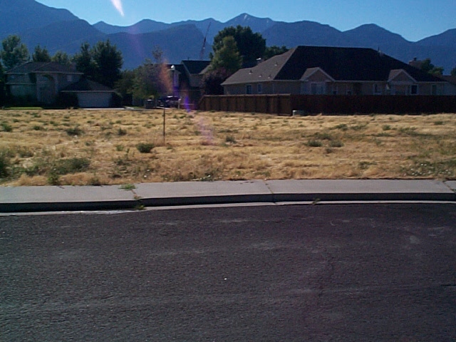
Total Photos: 1
|
| |
|
|
| Property Address: 181 S 200 WEST - OREM |
|
| Mailing Address: 9252 W 7750 N LEHI, UT 84043-3451 |
|
| Acreage: 0.470396 |
|
| Last Document:
71817-2019
|
|
| Subdivision Map Filing |
|
| Taxing Description:
LOT 5, PLAT F, COUNTRY SIDE SUB AREA 0.470 AC.
*Taxing description NOT FOR LEGAL DOCUMENTS
|
|
- Owner Names
- Value History
- Tax History
- Location
- Photos
- Documents
- Aerial Image
| 2020... |
|
GOMM, ANNETTE J T |
|
| 2020... |
|
GOMM, ANNETTE J T |
|
| 2020... |
|
JAMA TRUST 03-29-2012 AS AMENDED THE |
|
| 2020... |
|
LYLE BAARON GOMM TRUST 03-19-2012 AMD THE |
|
| 2020... |
|
THOMASON, ANNETTE J |
|
| 2020NV |
|
ANNETTE J T GOMM TRUST 03-19-2012 THE |
|
| 2020NV |
|
GOMM, ANNETTE J T |
|
| 2020NV |
|
GOMM, ANNETTE J T |
|
| 2020NV |
|
LYLE BAARON GOMM TRUST 03-19-2012 AMD THE |
|
| 2020NV |
|
GOMM, ANNETTE J T |
|
| 2020NV |
|
GOMM, ANNETTE J T |
|
| 2020NV |
|
LYLE BAARON GOMM TRUST 03-19-2012 AS AMD THE |
|
| 2015-2019 |
|
GOMM, ANNETTE J T |
|
| 2015-2019 |
|
GOMM, LYLE BAARON |
|
| 2011-2014 |
|
GOMM, ANNETTE J |
|
| 2011-2014 |
|
GOMM, LYLE B |
|
| 1993-2010 |
|
GOMM, ANNETTE J |
|
| 1993-2010 |
|
GOMM, LYLE B |
|
| 1992 |
|
BRONSON, CLARK |
|
| 1992NV |
|
COLES DEVELOPMENT COMPANY |
|
| |
----- Real Estate Values ----- |
---Improvements--- |
---Greenbelt--- |
Total |
| Year |
Com |
Res |
Agr |
Tot |
Com |
Res |
Agr |
Tot |
Land |
Homesite |
Tot |
Market Value |
| 2024 |
$0 |
$279,200 |
$0 |
$279,200 |
$0 |
$0 |
$0 |
$0 |
$0 |
$0 |
$0 |
$279,200 |
| 2023 |
$0 |
$279,200 |
$0 |
$279,200 |
$0 |
$0 |
$0 |
$0 |
$0 |
$0 |
$0 |
$279,200 |
| 2022 |
$0 |
$297,700 |
$0 |
$297,700 |
$0 |
$0 |
$0 |
$0 |
$0 |
$0 |
$0 |
$297,700 |
| 2021 |
$0 |
$229,000 |
$0 |
$229,000 |
$0 |
$0 |
$0 |
$0 |
$0 |
$0 |
$0 |
$229,000 |
| 2020 |
$0 |
$199,100 |
$0 |
$199,100 |
$0 |
$0 |
$0 |
$0 |
$0 |
$0 |
$0 |
$199,100 |
| 2019 |
$0 |
$199,100 |
$0 |
$199,100 |
$0 |
$0 |
$0 |
$0 |
$0 |
$0 |
$0 |
$199,100 |
| 2018 |
$0 |
$156,700 |
$0 |
$156,700 |
$0 |
$0 |
$0 |
$0 |
$0 |
$0 |
$0 |
$156,700 |
| 2017 |
$0 |
$135,500 |
$0 |
$135,500 |
$0 |
$0 |
$0 |
$0 |
$0 |
$0 |
$0 |
$135,500 |
| 2016 |
$0 |
$127,100 |
$0 |
$127,100 |
$0 |
$0 |
$0 |
$0 |
$0 |
$0 |
$0 |
$127,100 |
| 2015 |
$0 |
$127,100 |
$0 |
$127,100 |
$0 |
$0 |
$0 |
$0 |
$0 |
$0 |
$0 |
$127,100 |
| 2014 |
$0 |
$114,400 |
$0 |
$114,400 |
$0 |
$0 |
$0 |
$0 |
$0 |
$0 |
$0 |
$114,400 |
| 2013 |
$0 |
$107,700 |
$0 |
$107,700 |
$0 |
$0 |
$0 |
$0 |
$0 |
$0 |
$0 |
$107,700 |
| 2012 |
$0 |
$101,800 |
$0 |
$101,800 |
$0 |
$0 |
$0 |
$0 |
$0 |
$0 |
$0 |
$101,800 |
| 2011 |
$0 |
$116,900 |
$0 |
$116,900 |
$0 |
$0 |
$0 |
$0 |
$0 |
$0 |
$0 |
$116,900 |
| 2010 |
$0 |
$110,023 |
$0 |
$110,023 |
$0 |
$0 |
$0 |
$0 |
$0 |
$0 |
$0 |
$110,023 |
| 2009 |
$0 |
$110,023 |
$0 |
$110,023 |
$0 |
$0 |
$0 |
$0 |
$0 |
$0 |
$0 |
$110,023 |
| 2008 |
$0 |
$209,000 |
$0 |
$209,000 |
$0 |
$0 |
$0 |
$0 |
$0 |
$0 |
$0 |
$209,000 |
| 2007 |
$0 |
$209,000 |
$0 |
$209,000 |
$0 |
$0 |
$0 |
$0 |
$0 |
$0 |
$0 |
$209,000 |
| 2006 |
$0 |
$71,521 |
$0 |
$71,521 |
$0 |
$0 |
$0 |
$0 |
$0 |
$0 |
$0 |
$71,521 |
| 2005 |
$0 |
$71,521 |
$0 |
$71,521 |
$0 |
$0 |
$0 |
$0 |
$0 |
$0 |
$0 |
$71,521 |
| 2004 |
$0 |
$71,521 |
$0 |
$71,521 |
$0 |
$0 |
$0 |
$0 |
$0 |
$0 |
$0 |
$71,521 |
| 2003 |
$0 |
$71,521 |
$0 |
$71,521 |
$0 |
$0 |
$0 |
$0 |
$0 |
$0 |
$0 |
$71,521 |
| 2002 |
$0 |
$71,521 |
$0 |
$71,521 |
$0 |
$0 |
$0 |
$0 |
$0 |
$0 |
$0 |
$71,521 |
| 2001 |
$0 |
$71,521 |
$0 |
$71,521 |
$0 |
$0 |
$0 |
$0 |
$0 |
$0 |
$0 |
$71,521 |
| 2000 |
$0 |
$66,842 |
$0 |
$66,842 |
$0 |
$0 |
$0 |
$0 |
$0 |
$0 |
$0 |
$66,842 |
| 1999 |
$0 |
$62,469 |
$0 |
$62,469 |
$0 |
$0 |
$0 |
$0 |
$0 |
$0 |
$0 |
$62,469 |
| 1998 |
$0 |
$62,469 |
$0 |
$62,469 |
$0 |
$0 |
$0 |
$0 |
$0 |
$0 |
$0 |
$62,469 |
| 1997 |
$0 |
$62,469 |
$0 |
$62,469 |
$0 |
$0 |
$0 |
$0 |
$0 |
$0 |
$0 |
$62,469 |
| 1996 |
$0 |
$61,509 |
$0 |
$61,509 |
$0 |
$0 |
$0 |
$0 |
$0 |
$0 |
$0 |
$61,509 |
| 1995 |
$0 |
$55,917 |
$0 |
$55,917 |
$0 |
$0 |
$0 |
$0 |
$0 |
$0 |
$0 |
$55,917 |
| 1994 |
$0 |
$32,700 |
$0 |
$32,700 |
$0 |
$0 |
$0 |
$0 |
$0 |
$0 |
$0 |
$32,700 |
| 1993 |
$0 |
$32,700 |
$0 |
$32,700 |
$0 |
$0 |
$0 |
$0 |
$0 |
$0 |
$0 |
$32,700 |
| 1992 |
$0 |
$30,000 |
$0 |
$30,000 |
$0 |
$0 |
$0 |
$0 |
$0 |
$0 |
$0 |
$30,000 |
| Year |
General Taxes |
Adjustments |
Net Taxes |
Fees |
Payments |
Tax Balance* |
Balance Due |
Tax District |
| 2025 |
$0.00 |
$0.00 |
$0.00 |
$0.00 |
|
$0.00
|
$0.00 |
090 - OREM CITY |
| 2024 |
$0.00 |
$0.00 |
$0.00 |
$0.00 |
|
$0.00
|
$0.00 |
090 - OREM CITY |
| 2023 |
$2,124.43 |
$0.00 |
$2,124.43 |
$0.00 |
|
$0.00
|
$0.00 |
090 - OREM CITY |
| 2022 |
$2,338.14 |
$0.00 |
$2,338.14 |
$0.00 |
|
$0.00
|
$0.00 |
090 - OREM CITY |
| 2021 |
$2,159.01 |
$0.00 |
$2,159.01 |
$0.00 |
|
$0.00
|
$0.00 |
090 - OREM CITY |
| 2020 |
$1,909.97 |
$0.00 |
$1,909.97 |
$0.00 |
|
$0.00
|
$0.00 |
090 - OREM CITY |
| 2019 |
$1,836.70 |
$0.00 |
$1,836.70 |
$0.00 |
|
$0.00
|
$0.00 |
090 - OREM CITY |
| 2018 |
$1,512.94 |
$0.00 |
$1,512.94 |
$0.00 |
|
$0.00
|
$0.00 |
090 - OREM CITY |
| 2017 |
$1,343.21 |
$0.00 |
$1,343.21 |
$0.00 |
|
$0.00
|
$0.00 |
090 - OREM CITY |
| 2016 |
$1,366.33 |
$0.00 |
$1,366.33 |
$0.00 |
|
$0.00
|
$0.00 |
090 - OREM CITY |
| 2015 |
$1,444.75 |
$0.00 |
$1,444.75 |
$0.00 |
|
$0.00
|
$0.00 |
090 - OREM CITY |
| 2014 |
$1,306.33 |
$0.00 |
$1,306.33 |
$0.00 |
|
$0.00
|
$0.00 |
090 - OREM CITY |
| 2013 |
$1,326.22 |
$0.00 |
$1,326.22 |
$0.00 |
|
$0.00
|
$0.00 |
090 - OREM CITY |
| 2012 |
$1,279.42 |
$0.00 |
$1,279.42 |
$0.00 |
|
$0.00
|
$0.00 |
090 - OREM CITY |
| 2011 |
$1,462.19 |
$0.00 |
$1,462.19 |
$0.00 |
|
$0.00
|
$0.00 |
090 - OREM CITY |
| 2010 |
$1,288.37 |
$0.00 |
$1,288.37 |
$0.00 |
|
$0.00
|
$0.00 |
090 - OREM CITY |
| 2009 |
$2,177.51 |
($983.21) |
$1,194.30 |
$0.00 |
|
$0.00
|
$0.00 |
090 - OREM CITY |
| 2008 |
$2,102.33 |
$0.00 |
$2,102.33 |
$0.00 |
|
$0.00
|
$0.00 |
090 - OREM CITY |
| 2007 |
$2,078.30 |
$0.00 |
$2,078.30 |
$0.00 |
|
$0.00
|
$0.00 |
090 - OREM CITY |
| 2006 |
$757.34 |
$0.00 |
$757.34 |
$0.00 |
|
$0.00
|
$0.00 |
090 - OREM CITY |
| 2005 |
$854.82 |
$0.00 |
$854.82 |
$0.00 |
|
$0.00
|
$0.00 |
090 - OREM CITY |
| 2004 |
$839.66 |
$0.00 |
$839.66 |
$0.00 |
|
$0.00
|
$0.00 |
090 - OREM CITY |
| 2003 |
$814.77 |
$0.00 |
$814.77 |
$0.00 |
|
$0.00
|
$0.00 |
090 - OREM CITY |
| 2002 |
$744.61 |
$0.00 |
$744.61 |
$0.00 |
|
$0.00
|
$0.00 |
090 - OREM CITY |
| 2001 |
$737.45 |
$0.00 |
$737.45 |
$0.00 |
|
$0.00
|
$0.00 |
090 - OREM CITY |
| 2000 |
$712.60 |
$0.00 |
$712.60 |
$0.00 |
|
$0.00
|
$0.00 |
090 - OREM CITY |
| 1999 |
$685.66 |
$0.00 |
$685.66 |
$0.00 |
|
$0.00
|
$0.00 |
090 - OREM CITY |
| 1998 |
$647.43 |
$0.00 |
$647.43 |
$0.00 |
|
$0.00
|
$0.00 |
090 - OREM CITY |
| 1997 |
$644.74 |
$0.00 |
$644.74 |
$0.00 |
|
$0.00
|
$0.00 |
090 - OREM CITY |
| 1996 |
$579.97 |
$0.00 |
$579.97 |
$0.00 |
|
$0.00
|
$0.00 |
090 - OREM CITY |
| 1995 |
$596.63 |
$0.00 |
$596.63 |
$0.00 |
|
$0.00
|
$0.00 |
090 - OREM CITY |
| 1994 |
$449.63 |
$0.00 |
$449.63 |
$0.00 |
|
$0.00
|
$0.00 |
090 - OREM CITY |
| 1993 |
$383.81 |
$0.00 |
$383.81 |
$0.00 |
|
$0.00
|
$0.00 |
090 - OREM CITY |
| 1992 |
$356.28 |
$0.00 |
$356.28 |
$0.00 |
|
$0.00
|
$0.00 |
090 - OREM CITY |
* Note: Original tax amount (Does not include applicable interest and/or fees).
| Entry # |
Date |
Recorded |
Type |
Party1 (Grantor) |
Party2 (Grantee) |
| 71821-2019 |
04/12/2019 |
07/31/2019 |
QCD |
GOMM, ANNETTE J T TEE (ET AL) |
THOMASON, ANNETTE J AKA (ET AL) |
| 71817-2019 |
04/12/2019 |
07/31/2019 |
QCD |
GOMM, ANNETTE J T SUCTEE (ET AL) |
GOMM, ANNETTE J T SUCTEE (ET AL) |
| 71813-2019 |
04/12/2019 |
07/31/2019 |
AF DC |
GOMM, LYLE BAARON DEC (ET AL) |
GOMM, ANNETTE J T SUCTEE (ET AL) |
| 27385-2014 |
04/24/2014 |
04/25/2014 |
WD |
GOMM, LYLE B & ANNETTE J |
GOMM, LYLE BAARON & ANNETTE J T TEE |
| 36422-1997 |
04/30/1997 |
05/12/1997 |
REC |
MOUNTAIN WEST REALTY TEE |
COLES DEVELOPMENT COMPANY |
| 34512-1997 |
04/30/1997 |
05/05/1997 |
REC |
MOUNTAIN WEST TITLE CO TEE |
COLES DEVELOPMENT COMPANY |
| 21147-1993 |
04/08/1993 |
04/09/1993 |
REC |
MOUNTAIN WEST TITLE CO TEE |
COLES, DEVELOPMENT CO |
| 20757-1992 |
04/29/1992 |
04/29/1992 |
WD |
BRONSON, CLARK |
GOMM, LYLE B & ANNETTE J |
| 2125-1992 |
01/15/1992 |
01/16/1992 |
N LN |
HOMEOWNERS ASSOCIATION THE |
WHOM OF INTEREST |
| 49409-1991 |
12/09/1991 |
12/13/1991 |
WD |
COLES, O KENT (ET AL) |
BRONSON, CLARK |
| 23126-1991 |
05/15/1991 |
06/14/1991 |
S PLAT |
COLES, O KENT (ET AL) |
COUNTRY SIDE PLAT F |
Main Menu Comments or Concerns on Value/Appraisal - Assessor's Office
Documents/Owner/Parcel information - Recorder's Office
Address Change for Tax Notice
This page was created on 7/20/2024 2:15:00 AM |