Property Information
mobile view
| Serial Number: 37:332:0048 |
Serial Life: 2019... |
|
|
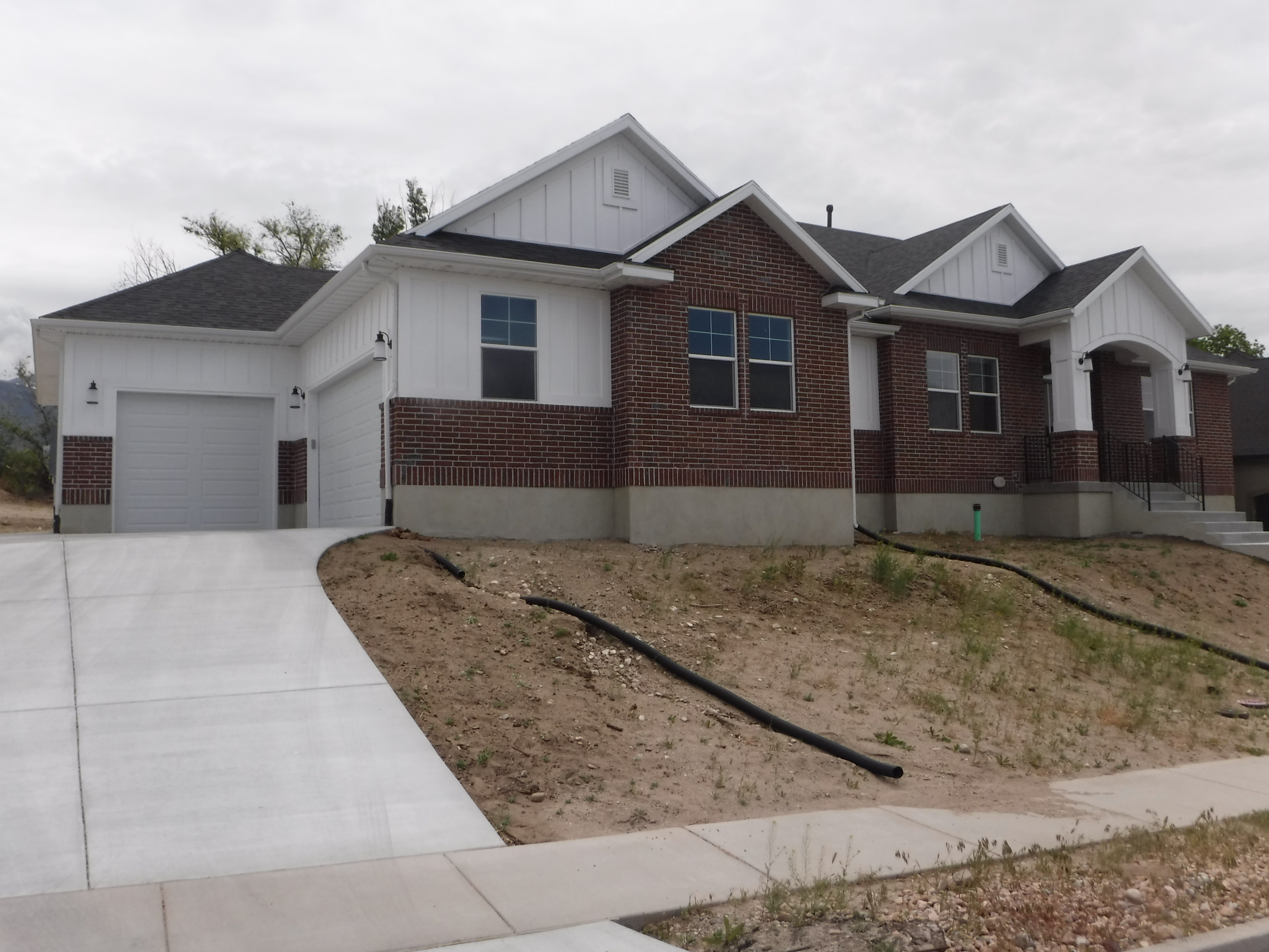
 Total Photos: 5
|
| |
|
|
| Property Address: 972 N 1710 EAST - LEHI |
|
| Mailing Address: 972 N 1710 E LEHI, UT 84043 |
|
| Acreage: 0.346495 |
|
| Last Document:
92562-2018
|
|
| Subdivision Map Filing |
|
| Taxing Description:
LOT 48, PLAT H, DAIRY VIEW ESTATES SUB AREA 0.346 AC.
*Taxing description NOT FOR LEGAL DOCUMENTS
|
|
- Owner Names
- Value History
- Tax History
- Location
- Photos
- Documents
- Aerial Image
| |
----- Real Estate Values ----- |
---Improvements--- |
---Greenbelt--- |
Total |
| Year |
Com |
Res |
Agr |
Tot |
Com |
Res |
Agr |
Tot |
Land |
Homesite |
Tot |
Market Value |
| 2024 |
$0 |
$368,000 |
$0 |
$368,000 |
$0 |
$612,800 |
$0 |
$612,800 |
$0 |
$0 |
$0 |
$980,800 |
| 2023 |
$0 |
$357,300 |
$0 |
$357,300 |
$0 |
$542,800 |
$0 |
$542,800 |
$0 |
$0 |
$0 |
$900,100 |
| 2022 |
$0 |
$364,600 |
$0 |
$364,600 |
$0 |
$517,200 |
$0 |
$517,200 |
$0 |
$0 |
$0 |
$881,800 |
| 2021 |
$0 |
$227,900 |
$0 |
$227,900 |
$0 |
$421,500 |
$0 |
$421,500 |
$0 |
$0 |
$0 |
$649,400 |
| 2020 |
$0 |
$211,000 |
$0 |
$211,000 |
$0 |
$343,900 |
$0 |
$343,900 |
$0 |
$0 |
$0 |
$554,900 |
| 2019 |
$0 |
$211,000 |
$0 |
$211,000 |
$0 |
$0 |
$0 |
$0 |
$0 |
$0 |
$0 |
$211,000 |
| Year |
General Taxes |
Adjustments |
Net Taxes |
Fees |
Payments |
Tax Balance* |
Balance Due |
Tax District |
| 2025 |
$0.00 |
$0.00 |
$0.00 |
$0.00 |
|
$0.00
|
$0.00 |
010 - LEHI CITY |
| 2024 |
$4,609.51 |
$0.00 |
$4,609.51 |
$0.00 |
|
$0.00
|
$0.00 |
010 - LEHI CITY |
| 2023 |
$3,896.08 |
$0.00 |
$3,896.08 |
$0.00 |
|
$0.00
|
$0.00 |
010 - LEHI CITY |
| 2022 |
$3,937.15 |
$0.00 |
$3,937.15 |
$0.00 |
|
$0.00
|
$0.00 |
010 - LEHI CITY |
| 2021 |
$3,487.05 |
$0.00 |
$3,487.05 |
$0.00 |
|
$0.00
|
$0.00 |
010 - LEHI CITY |
| 2020 |
$3,014.41 |
$0.00 |
$3,014.41 |
$0.00 |
|
$0.00
|
$0.00 |
010 - LEHI CITY |
| 2019 |
$2,004.71 |
$0.00 |
$2,004.71 |
$0.00 |
|
$0.00
|
$0.00 |
010 - LEHI CITY |
* Note: Original tax amount (Does not include applicable interest and/or fees).
| Entry # |
Date |
Recorded |
Type |
Party1 (Grantor) |
Party2 (Grantee) |
| 106392-2022 |
09/20/2022 |
09/30/2022 |
N |
ALAILIMA, TAVANA & KAISHA |
WHOM OF INTEREST |
| 76865-2022 |
07/01/2022 |
07/01/2022 |
D TR |
ALAILIMA, TAVANA & KAISHA |
ALLY BANK |
| 76770-2022 |
07/01/2022 |
07/01/2022 |
WD |
JORGENSEN, JOHN T & KARYN A |
ALAILIMA, TAVANA & KAISHA |
| 207441-2021 |
12/14/2021 |
12/15/2021 |
TR D |
JORGENSEN, JOHN T & KARYN A |
VANGUARD TITLE INSURANCE AGENCY LLC |
| 38733-2020 |
07/23/2019 |
03/26/2020 |
N |
JORGENSEN, JOHN & KARYN |
WHOM OF INTEREST |
| 49471-2019 |
05/31/2019 |
06/03/2019 |
WD |
MINER, GORDON L & NANCY J |
JORGENSEN, JOHN T & KARYN A |
| 22167-2019 |
03/13/2019 |
03/19/2019 |
RSUBTEE |
UTAH FIRST FEDERAL CREDIT UNION (ET AL) |
MINER, GORDON L & NANCY J |
| 11201-2019 |
02/11/2019 |
02/11/2019 |
WD |
HENDRICKS, DENNIS |
HENDRICKS, DENNIS K TEE (ET AL) |
| 92562-2018 |
09/17/2018 |
09/26/2018 |
S PLAT |
MINER, GORDON L & NANCY J |
DAIRY VIEW ESTATES PLAT H |
Main Menu Comments or Concerns on Value/Appraisal - Assessor's Office
Documents/Owner/Parcel information - Recorder's Office
Address Change for Tax Notice
This page was created on 4/24/2025 7:12:43 AM |