Property Information
mobile view
| Serial Number: 39:069:0003 |
Serial Life: 1994-1995 |
|
|
Total Photos: 1
|
| |
|
|
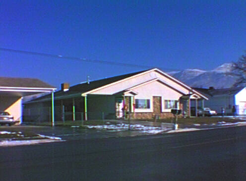
| Property Address: 177 E 200 SOUTH - AMERICAN FORK |
|
| Mailing Address: 1426 GRAND AV PROVO, UT 84604-2278 |
|
| Acreage: 0.386 |
|
| Last Document:
29807-1993
|
|
| Subdivision Map Filing |
|
| Taxing Description:
LOT 3, PLAT A, BEN FORD SUBDV. AREA 0.386 AC.
*Taxing description NOT FOR LEGAL DOCUMENTS
|
|
- Owner Names
- Value History
- Tax History
- Location
- Photos
- Documents
- Aerial Image
| |
----- Real Estate Values ----- |
---Improvements--- |
---Greenbelt--- |
Total |
| Year |
Com |
Res |
Agr |
Tot |
Com |
Res |
Agr |
Tot |
Land |
Homesite |
Tot |
Market Value |
| 1995 |
$0 |
$27,873 |
$0 |
$27,873 |
$0 |
$130,200 |
$0 |
$130,200 |
$0 |
$0 |
$0 |
$158,073 |
| 1994 |
$0 |
$16,300 |
$0 |
$16,300 |
$0 |
$105,000 |
$0 |
$105,000 |
$0 |
$0 |
$0 |
$121,300 |
| Year |
General Taxes |
Adjustments |
Net Taxes |
Fees |
Payments |
Tax Balance* |
Balance Due |
Tax District |
| 1995 |
$1,018.50 |
$0.00 |
$1,018.50 |
$0.00 |
|
$0.00
|
$0.00 |
060 - AMERICAN FORK CITY |
| 1994 |
$1,232.06 |
$0.00 |
$1,232.06 |
$0.00 |
|
$0.00
|
$0.00 |
060 - AMERICAN FORK CITY |
* Note: Original tax amount (Does not include applicable interest and/or fees).
| Entry # |
Date |
Recorded |
Type |
Party1 (Grantor) |
Party2 (Grantee) |
| 28428-1995 |
02/16/1995 |
05/08/1995 |
DECLCOV |
HINTZE, SCOTT L & CHERYL W |
WHOM OF INTEREST |
| 28427-1995 |
03/14/1995 |
05/08/1995 |
S PLAT |
HINTZE, SCOTT & CHERYL |
SCOTT HINTZ PLAT A |
| 2149-1994 |
01/07/1994 |
01/07/1994 |
R LN |
PHELON, MARTHA FOR (ET AL) |
WHOM OF INTEREST |
| 75243-1993 |
10/25/1993 |
10/25/1993 |
N LN |
HINTZE, SCOTT & CHERYL W |
ESP EXCAVATION |
| 40957-1993 |
05/20/1993 |
06/23/1993 |
P REC |
WASATCH BANK TEE |
FORD, BEN LEE & JO LYNN |
| 29807-1993 |
05/04/1993 |
05/13/1993 |
WD |
FORD, BEN LEE & JO LYNN (ET AL) |
HINTZE, SCOTT & CHERYL W |
| 29303-1993 |
04/27/1993 |
05/11/1993 |
S PLAT |
FORD, BEN LEE & JO LYNN |
FORD BEN PLAT A |
Main Menu Comments or Concerns on Value/Appraisal - Assessor's Office
Documents/Owner/Parcel information - Recorder's Office
Address Change for Tax Notice
This page was created on 7/21/2024 4:14:06 AM |