Property Information
mobile view
| Serial Number: 39:260:0001 |
Serial Life: 2018... |
|
|
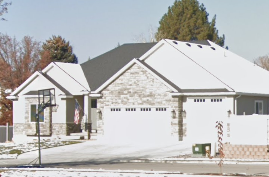 Total Photos: 2
|
| |
|
|
| Property Address: 356 W 470 NORTH - AMERICAN FORK |
|
| Mailing Address: 676 W 1950 S LEHI, UT 84043-9807 |
|
| Acreage: 0.299904 |
|
| Last Document:
104133-2019
|
|
| Subdivision Map Filing |
|
| Taxing Description:
LOT 1, F-PULLEY SUB AREA 0.300 AC.
*Taxing description NOT FOR LEGAL DOCUMENTS
|
|
- Owner Names
- Value History
- Tax History
- Location
- Photos
- Documents
- Aerial Image
| |
----- Real Estate Values ----- |
---Improvements--- |
---Greenbelt--- |
Total |
| Year |
Com |
Res |
Agr |
Tot |
Com |
Res |
Agr |
Tot |
Land |
Homesite |
Tot |
Market Value |
| 2024 |
$0 |
$228,100 |
$0 |
$228,100 |
$0 |
$635,000 |
$0 |
$635,000 |
$0 |
$0 |
$0 |
$863,100 |
| 2023 |
$0 |
$228,000 |
$0 |
$228,000 |
$0 |
$635,700 |
$0 |
$635,700 |
$0 |
$0 |
$0 |
$863,700 |
| 2022 |
$0 |
$240,500 |
$0 |
$240,500 |
$0 |
$562,600 |
$0 |
$562,600 |
$0 |
$0 |
$0 |
$803,100 |
| 2021 |
$0 |
$171,800 |
$0 |
$171,800 |
$0 |
$488,600 |
$0 |
$488,600 |
$0 |
$0 |
$0 |
$660,400 |
| 2020 |
$0 |
$153,400 |
$0 |
$153,400 |
$0 |
$0 |
$0 |
$0 |
$0 |
$0 |
$0 |
$153,400 |
| 2019 |
$0 |
$141,900 |
$0 |
$141,900 |
$0 |
$0 |
$0 |
$0 |
$0 |
$0 |
$0 |
$141,900 |
| 2018 |
$0 |
$134,300 |
$0 |
$134,300 |
$0 |
$0 |
$0 |
$0 |
$0 |
$0 |
$0 |
$134,300 |
| Year |
General Taxes |
Adjustments |
Net Taxes |
Fees |
Payments |
Tax Balance* |
Balance Due |
Tax District |
| 2025 |
$0.00 |
$0.00 |
$0.00 |
$0.00 |
|
$0.00
|
$0.00 |
060 - AMERICAN FORK CITY |
| 2024 |
$4,272.35 |
$0.00 |
$4,272.35 |
$0.00 |
|
|
Click for Payoff
|
060 - AMERICAN FORK CITY |
| 2023 |
$4,032.57 |
$0.00 |
$4,032.57 |
$0.00 |
|
$0.00
|
$0.00 |
060 - AMERICAN FORK CITY |
| 2022 |
$3,799.55 |
$0.00 |
$3,799.55 |
$0.00 |
|
$0.00
|
$0.00 |
060 - AMERICAN FORK CITY |
| 2021 |
$3,636.92 |
$0.00 |
$3,636.92 |
$0.00 |
|
$0.00
|
$0.00 |
060 - AMERICAN FORK CITY |
| 2020 |
$1,583.70 |
$0.00 |
$1,583.70 |
$0.00 |
|
$0.00
|
$0.00 |
060 - AMERICAN FORK CITY |
| 2019 |
$1,416.45 |
$0.00 |
$1,416.45 |
$0.00 |
|
$0.00
|
$0.00 |
060 - AMERICAN FORK CITY |
| 2018 |
$1,402.09 |
$0.00 |
$1,402.09 |
$0.00 |
|
$0.00
|
$0.00 |
060 - AMERICAN FORK CITY |
* Note: Original tax amount (Does not include applicable interest and/or fees).
| Entry # |
Date |
Recorded |
Type |
Party1 (Grantor) |
Party2 (Grantee) |
| 57449-2022 |
05/04/2022 |
05/10/2022 |
D TR |
PIERCE, BRET C & ASHLEE |
ALPINE CREDIT UNION |
| 104362-2020 |
07/21/2020 |
07/21/2020 |
REC |
VANGUARD TITLE INSURANCE AGENCY LLC TEE |
PIERCE, BRET C & ASHLEE |
| 90442-2020 |
06/23/2020 |
06/29/2020 |
D TR |
PIERCE, BRET C & ASHLEE |
ALPINE CREDIT UNION |
| 112976-2019 |
10/25/2019 |
10/31/2019 |
D TR |
PIERCE, BRET C & ASHLEE |
ALPINE CREDIT UNION |
| 104133-2019 |
07/31/2019 |
10/11/2019 |
WD |
PULLEY, FRANK D & TAMMY P |
PIERCE, BRET C & ASHLEE |
| 39485-2017 |
04/17/2017 |
04/25/2017 |
REC |
CITIBANK TEE |
PULLEY, FRANK D & TAMMY P |
| 39484-2017 |
04/17/2017 |
04/25/2017 |
SUB TEE |
CITIMORTGAGE INC |
CITIBANK SUCTEE |
| 18074-2017 |
01/10/2017 |
02/22/2017 |
S PLAT |
PULLEY, FRANK D & TAMMY P |
F-PULLEY |
Main Menu Comments or Concerns on Value/Appraisal - Assessor's Office
Documents/Owner/Parcel information - Recorder's Office
Address Change for Tax Notice
This page was created on 10/6/2024 12:59:50 PM |
