Property Information
mobile view
| Serial Number: 41:276:0007 |
Serial Life: 2001-2015 |
|
|
 Total Photos: 2
|
| |
|
|
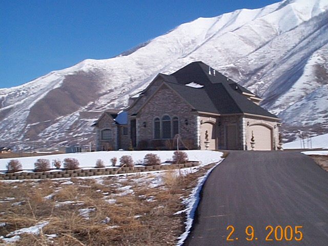
| Property Address: 3091 S 450 WEST - MAPLETON |
|
| Mailing Address: 3091 S 450 W MAPLETON, UT 84664-4740 |
|
| Acreage: 2.007 |
|
| Last Document:
22905-2001
|
|
| Subdivision Map Filing |
|
| Taxing Description:
PT LOT 4, HORIZON HEIGHTS SUB DESCRIBED AS:; COM N 555.79 FT & E 1069.31 FT FR S 1/4 COR. SEC. 22, T8S, R3E, SLB&M.; N 89 DEG 18' 3" E 437.02 FT; S 0 DEG 41' 57" E 199.99 FT; S 89 DEG 18' 3" W 437.02 FT; N 0 DEG 41' 57" W 200 FT TO BEG. AREA 2.007 AC.
*Taxing description NOT FOR LEGAL DOCUMENTS
|
|
- Owner Names
- Value History
- Tax History
- Location
- Photos
- Documents
- Aerial Image
| |
----- Real Estate Values ----- |
---Improvements--- |
---Greenbelt--- |
Total |
| Year |
Com |
Res |
Agr |
Tot |
Com |
Res |
Agr |
Tot |
Land |
Homesite |
Tot |
Market Value |
| 2015 |
$0 |
$170,000 |
$55,400 |
$225,400 |
$0 |
$247,400 |
$0 |
$247,400 |
$0 |
$0 |
$0 |
$472,800 |
| 2014 |
$0 |
$135,000 |
$40,300 |
$175,300 |
$0 |
$215,100 |
$0 |
$215,100 |
$0 |
$0 |
$0 |
$390,400 |
| 2013 |
$0 |
$130,000 |
$35,200 |
$165,200 |
$0 |
$187,000 |
$0 |
$187,000 |
$0 |
$0 |
$0 |
$352,200 |
| 2012 |
$0 |
$115,000 |
$48,300 |
$163,300 |
$0 |
$284,900 |
$0 |
$284,900 |
$0 |
$0 |
$0 |
$448,200 |
| 2011 |
$0 |
$117,000 |
$35,200 |
$152,200 |
$0 |
$300,600 |
$0 |
$300,600 |
$0 |
$0 |
$0 |
$452,800 |
| 2010 |
$0 |
$106,000 |
$15,895 |
$121,895 |
$0 |
$394,349 |
$0 |
$394,349 |
$0 |
$0 |
$0 |
$516,244 |
| 2009 |
$0 |
$142,000 |
$57,600 |
$199,600 |
$0 |
$345,600 |
$0 |
$345,600 |
$0 |
$0 |
$0 |
$545,200 |
| 2008 |
$0 |
$120,000 |
$80,000 |
$200,000 |
$0 |
$345,600 |
$0 |
$345,600 |
$0 |
$0 |
$0 |
$545,600 |
| 2007 |
$0 |
$120,000 |
$80,000 |
$200,000 |
$0 |
$345,600 |
$0 |
$345,600 |
$0 |
$0 |
$0 |
$545,600 |
| 2006 |
$0 |
$120,000 |
$80,000 |
$200,000 |
$0 |
$345,600 |
$0 |
$345,600 |
$0 |
$0 |
$0 |
$545,600 |
| 2005 |
$0 |
$62,955 |
$20,000 |
$82,955 |
$0 |
$217,442 |
$0 |
$217,442 |
$0 |
$0 |
$0 |
$300,397 |
| 2004 |
$0 |
$62,955 |
$20,000 |
$82,955 |
$0 |
$217,442 |
$0 |
$217,442 |
$0 |
$0 |
$0 |
$300,397 |
| 2003 |
$0 |
$62,955 |
$20,000 |
$82,955 |
$0 |
$217,442 |
$0 |
$217,442 |
$0 |
$0 |
$0 |
$300,397 |
| 2002 |
$0 |
$62,955 |
$20,000 |
$82,955 |
$0 |
$212,045 |
$0 |
$212,045 |
$0 |
$0 |
$0 |
$295,000 |
| 2001 |
$0 |
$62,955 |
$20,000 |
$82,955 |
$0 |
$212,045 |
$0 |
$212,045 |
$0 |
$0 |
$0 |
$295,000 |
| Year |
General Taxes |
Adjustments |
Net Taxes |
Fees |
Payments |
Tax Balance* |
Balance Due |
Tax District |
| 2015 |
$3,863.62 |
$0.00 |
$3,863.62 |
$0.00 |
|
$0.00
|
$0.00 |
140 - MAPLETON CITY |
| 2014 |
$3,214.80 |
$0.00 |
$3,214.80 |
$0.00 |
|
$0.00
|
$0.00 |
140 - MAPLETON CITY |
| 2013 |
$3,079.76 |
$0.00 |
$3,079.76 |
$0.00 |
|
$0.00
|
$0.00 |
140 - MAPLETON CITY |
| 2012 |
$4,032.53 |
$0.00 |
$4,032.53 |
$0.00 |
|
$0.00
|
$0.00 |
140 - MAPLETON CITY |
| 2011 |
$3,898.50 |
$0.00 |
$3,898.50 |
$0.00 |
|
$0.00
|
$0.00 |
140 - MAPLETON CITY |
| 2010 |
$4,163.71 |
$0.00 |
$4,163.71 |
$0.00 |
|
$0.00
|
$0.00 |
140 - MAPLETON CITY |
| 2009 |
$4,361.87 |
$0.00 |
$4,361.87 |
$0.00 |
|
$0.00
|
$0.00 |
140 - MAPLETON CITY |
| 2008 |
$4,098.83 |
$0.00 |
$4,098.83 |
$0.00 |
|
$0.00
|
$0.00 |
140 - MAPLETON CITY |
| 2007 |
$3,835.34 |
$0.00 |
$3,835.34 |
$0.00 |
|
$0.00
|
$0.00 |
140 - MAPLETON CITY |
| 2006 |
$4,149.24 |
$0.00 |
$4,149.24 |
$0.00 |
|
$0.00
|
$0.00 |
140 - MAPLETON CITY |
| 2005 |
$2,366.05 |
$0.00 |
$2,366.05 |
$0.00 |
|
$0.00
|
$0.00 |
140 - MAPLETON CITY |
| 2004 |
$2,369.19 |
$0.00 |
$2,369.19 |
$0.00 |
|
$0.00
|
$0.00 |
140 - MAPLETON CITY |
| 2003 |
$2,172.32 |
$0.00 |
$2,172.32 |
$0.00 |
|
$0.00
|
$0.00 |
140 - MAPLETON CITY |
| 2002 |
$2,075.21 |
$0.00 |
$2,075.21 |
$0.00 |
|
$0.00
|
$0.00 |
140 - MAPLETON CITY |
| 2001 |
$2,092.16 |
$0.00 |
$2,092.16 |
$0.00 |
|
$0.00
|
$0.00 |
140 - MAPLETON CITY |
* Note: Original tax amount (Does not include applicable interest and/or fees).
| Entry # |
Date |
Recorded |
Type |
Party1 (Grantor) |
Party2 (Grantee) |
| 29970-2015 |
04/01/2015 |
04/13/2015 |
S PLAT |
ALLAN, JOHN LESLIE & ANNE (ET AL) |
HORIZON HEIGHTS PLAT D |
| 3187-2015 |
12/04/2014 |
01/14/2015 |
QCD |
UNITED STATES OF AMERICA |
SOUTH UTAH VALLEY ELECTRIC SERVICE DISTRICT |
| 62532-2011 |
08/30/2011 |
09/06/2011 |
RSUBTEE |
PNC BANK (ET AL) |
ALLAN, JOHN LESLIE & ANNE |
| 47735-2008 |
04/22/2008 |
04/22/2008 |
QCD |
ALLAN, DEAN S & JEAN A TEE (ET AL) |
ALLAN, JOHN L & ANNE |
| 123484-2003 |
04/05/2003 |
08/05/2003 |
RSUBTEE |
NATIONAL CITY MORTGAGE CO (ET AL) |
ALLAN, JOHN & ANNE |
| 35196-2003 |
03/03/2003 |
03/10/2003 |
AS |
1ST HOME MORTGAGE CORP |
NATIONAL CITY MORTGAGE CO |
| 35195-2003 |
03/05/2003 |
03/10/2003 |
D TR |
ALLAN, JOHN LESLIE & ANNE |
1ST HOME MORTGAGE CORP |
| 39134-2001 |
04/07/2001 |
04/25/2001 |
REC |
BUEHLER, J SCOTT TEE |
ALLAN, JOHN LESLIE & ANNE |
| 39133-2001 |
03/14/2001 |
04/25/2001 |
SUB TEE |
GMAC MORTGAGE CORPORATION |
BUEHLER, J SCOTT SUCTEE |
| 34191-2001 |
03/05/2001 |
04/12/2001 |
AS |
1ST HOME MORTGAGE CORPORATION BY (ET AL) |
NATIONAL CITY MORTGAGE CO DBA (ET AL) |
| 22905-2001 |
03/07/2001 |
03/12/2001 |
QCD |
ALLAN, JOHN & ANNE |
ALLAN, JOHN LESLIE & ANNE |
| 22904-2001 |
03/07/2001 |
03/12/2001 |
D TR |
ALLAN, JOHN & ANNE |
1ST HOME MORTGAGE CORPORATION |
| 22903-2001 |
03/07/2001 |
03/12/2001 |
QCD |
ALLAN, JOHN LESLIE & ANNE |
ALLAN, JOHN & ANNE |
| 40620-2000 |
05/22/2000 |
05/23/2000 |
WD |
ALLAN, JOHN LESLIE & ANNE |
ALLAN, DEAN S & DAVID W |
Main Menu Comments or Concerns on Value/Appraisal - Assessor's Office
Documents/Owner/Parcel information - Recorder's Office
Address Change for Tax Notice
This page was created on 4/22/2025 5:02:11 PM |
