Property Information
mobile view
| Serial Number: 41:375:0004 |
Serial Life: 2019... |
|
|
 Total Photos: 4
|
| |
|
|
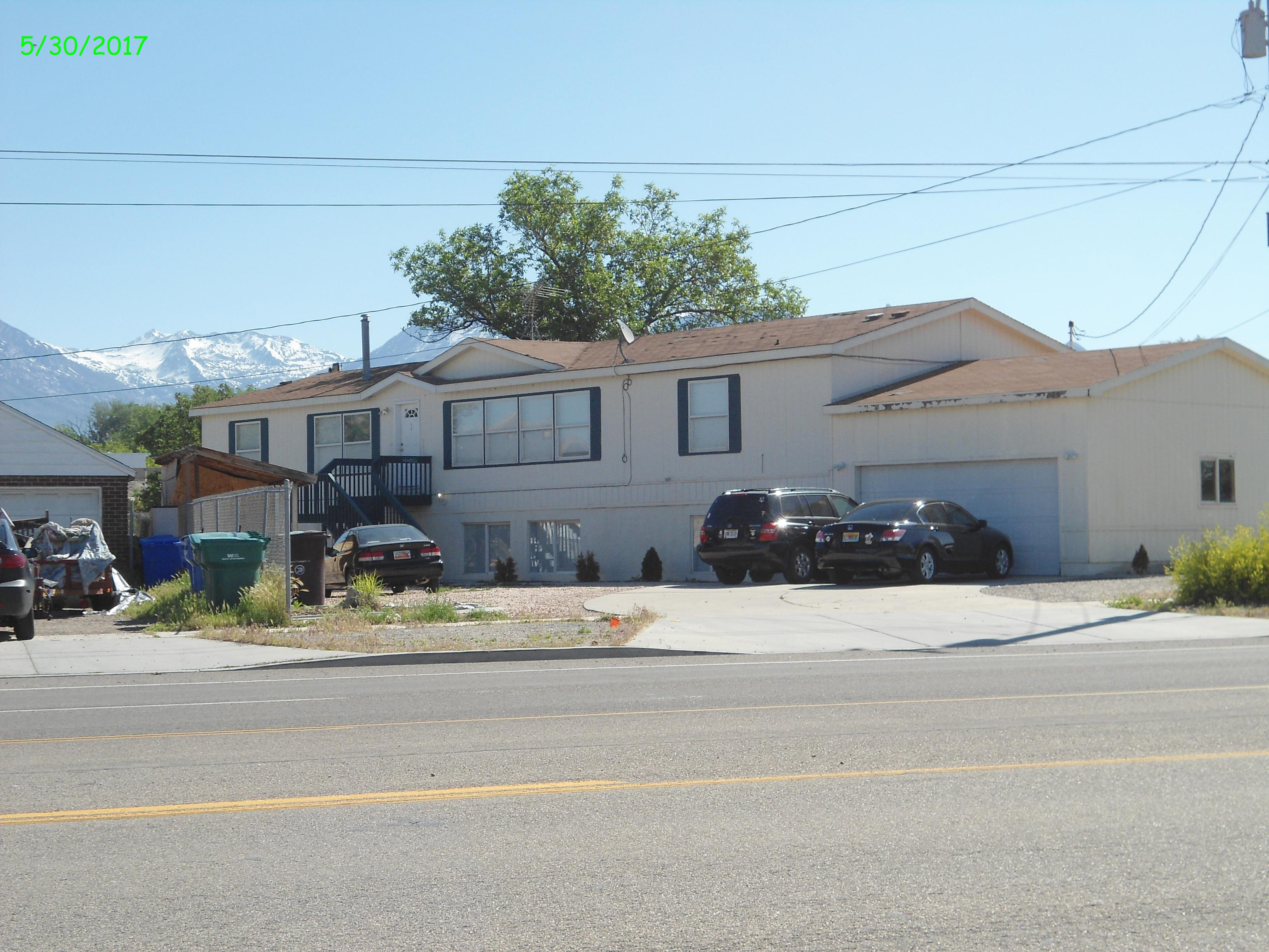
| Property Address: 1040 W STATE ST - LEHI |
|
| Mailing Address: 212 W MAIN ST LEHI, UT 84043-2050 |
|
| Acreage: 0.234058 |
|
| Last Document:
89685-2018
|
|
| Subdivision Map Filing |
|
| Taxing Description:
PART LOT 2, PLAT A, HUERTA SUB DESCRIBED AS FOLLOWS:; COM S 503.87 FT & E 537.07 FT & S 23 DEG 38' 58" W 10.95 FT FR W 1/4 COR. SEC. 5, T5S, R1E, SLB&M.; S 61 DEG 0' 7" E 25.27 FT; S 55 DEG 47' 21" E 28.54 FT; S 19 DEG 3' 57" W 166.15 FT; N 44 DEG 52' 37" W 98.58 FT; N 45 DEG 26' 6" E 68 FT; N 23 DEG 38' 58" E 73.98 FT TO BEG. AREA 0.234 AC.
*Taxing description NOT FOR LEGAL DOCUMENTS
|
|
- Owner Names
- Value History
- Tax History
- Location
- Photos
- Documents
- Aerial Image
| |
----- Real Estate Values ----- |
---Improvements--- |
---Greenbelt--- |
Total |
| Year |
Com |
Res |
Agr |
Tot |
Com |
Res |
Agr |
Tot |
Land |
Homesite |
Tot |
Market Value |
| 2024 |
$0 |
$228,500 |
$0 |
$228,500 |
$0 |
$533,100 |
$0 |
$533,100 |
$0 |
$0 |
$0 |
$761,600 |
| 2023 |
$0 |
$263,900 |
$0 |
$263,900 |
$0 |
$490,100 |
$0 |
$490,100 |
$0 |
$0 |
$0 |
$754,000 |
| 2022 |
$0 |
$251,300 |
$0 |
$251,300 |
$0 |
$466,800 |
$0 |
$466,800 |
$0 |
$0 |
$0 |
$718,100 |
| 2021 |
$0 |
$201,000 |
$0 |
$201,000 |
$0 |
$373,400 |
$0 |
$373,400 |
$0 |
$0 |
$0 |
$574,400 |
| 2020 |
$0 |
$179,500 |
$0 |
$179,500 |
$0 |
$333,400 |
$0 |
$333,400 |
$0 |
$0 |
$0 |
$512,900 |
| 2019 |
$0 |
$167,000 |
$0 |
$167,000 |
$0 |
$310,200 |
$0 |
$310,200 |
$0 |
$0 |
$0 |
$477,200 |
| Year |
General Taxes |
Adjustments |
Net Taxes |
Fees |
Payments |
Tax Balance* |
Balance Due |
Tax District |
| 2025 |
$0.00 |
$0.00 |
$0.00 |
$0.00 |
|
$0.00
|
$0.00 |
010 - LEHI CITY |
| 2024 |
$0.00 |
$0.00 |
$0.00 |
$0.00 |
|
$0.00
|
$0.00 |
010 - LEHI CITY |
| 2023 |
$3,263.69 |
$0.00 |
$3,263.69 |
$0.00 |
|
$0.00
|
$0.00 |
010 - LEHI CITY |
| 2022 |
$3,206.24 |
$0.00 |
$3,206.24 |
$0.00 |
|
$0.00
|
$0.00 |
010 - LEHI CITY |
| 2021 |
$3,084.33 |
$0.00 |
$3,084.33 |
$0.00 |
|
$0.00
|
$0.00 |
010 - LEHI CITY |
| 2020 |
$2,786.25 |
$0.00 |
$2,786.25 |
$0.00 |
|
$0.00
|
$0.00 |
010 - LEHI CITY |
| 2019 |
$2,493.63 |
$0.00 |
$2,493.63 |
$0.00 |
|
$0.00
|
$0.00 |
010 - LEHI CITY |
* Note: Original tax amount (Does not include applicable interest and/or fees).
| Entry # |
Date |
Recorded |
Type |
Party1 (Grantor) |
Party2 (Grantee) |
| 93432-2018 |
09/20/2018 |
09/28/2018 |
R LP |
UTAH DEPARTMENT OF TRANSPORTATION |
CT STATE LLC (ET AL) |
| 89685-2018 |
08/14/2018 |
09/18/2018 |
WD |
CT STATE LLC |
UTAH DEPARTMENT OF TRANSPORTATION |
Main Menu Comments or Concerns on Value/Appraisal - Assessor's Office
Documents/Owner/Parcel information - Recorder's Office
Address Change for Tax Notice
This page was created on 8/22/2024 9:22:53 PM |


