Property Information
mobile view
| Serial Number: 41:673:0005 |
Serial Life: 2009... |
|
|
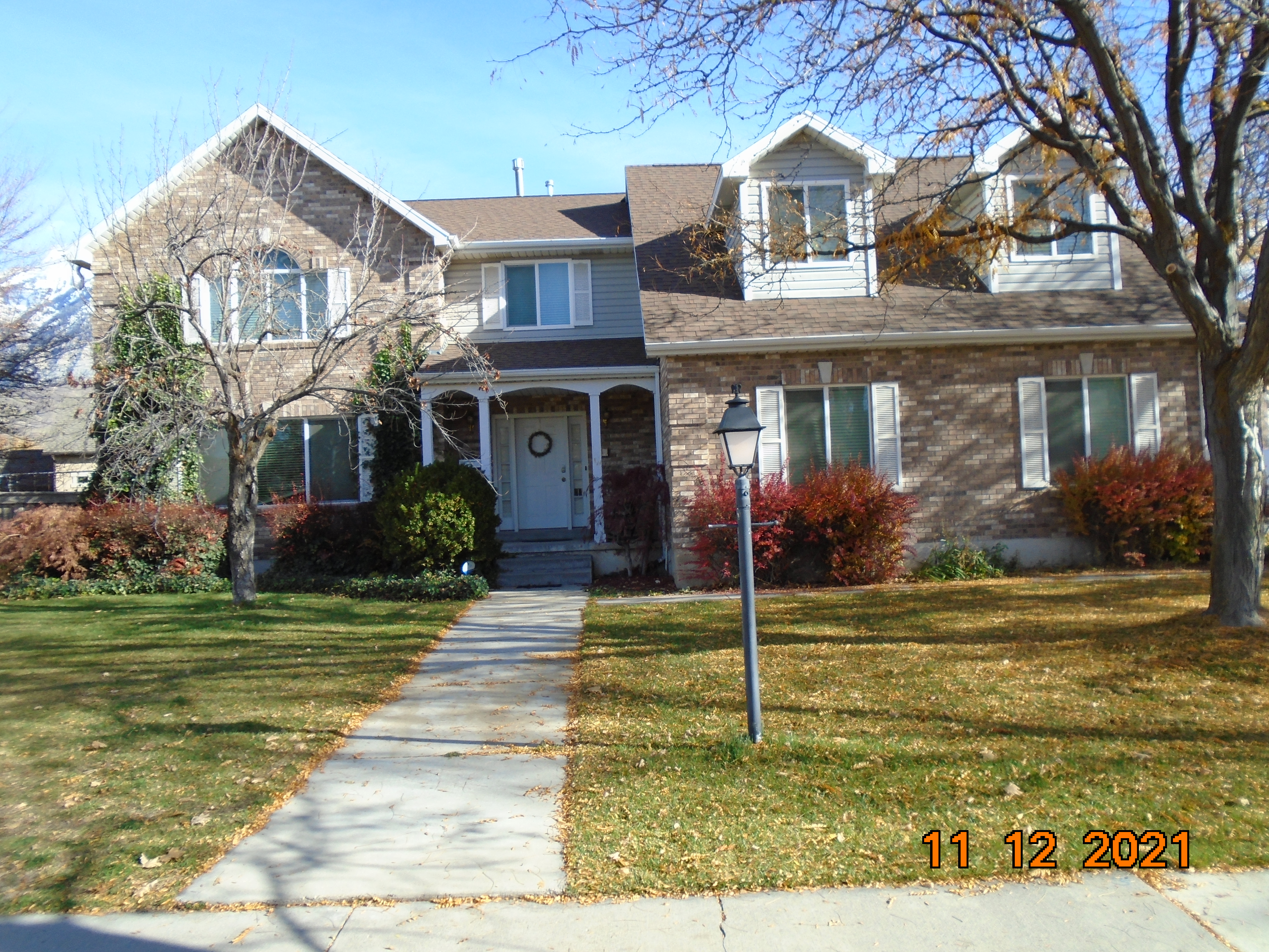 Total Photos: 3
|
| |
|
|
| Property Address: 33 S PALISADE DR - OREM |
|
| Mailing Address: 33 S PALISADES DR OREM, UT 84097-5733 |
|
| Acreage: 0.478643 |
|
| Last Document:
135088-2008
|
|
| Subdivision Map Filing |
|
| Taxing Description:
LOT 1, PLAT C, HILLSIDE ESTATES SUBDV. AREA 0.241 AC. ALSO LOT 2, PLAT C, HILLSIDE ESTATES SUBDV. AREA 0.238 AC. TOTAL AREA .479 AC.
*Taxing description NOT FOR LEGAL DOCUMENTS
|
|
- Owner Names
- Value History
- Tax History
- Location
- Photos
- Documents
- Aerial Image
| |
----- Real Estate Values ----- |
---Improvements--- |
---Greenbelt--- |
Total |
| Year |
Com |
Res |
Agr |
Tot |
Com |
Res |
Agr |
Tot |
Land |
Homesite |
Tot |
Market Value |
| 2024 |
$0 |
$317,500 |
$0 |
$317,500 |
$0 |
$449,800 |
$0 |
$449,800 |
$0 |
$0 |
$0 |
$767,300 |
| 2023 |
$0 |
$317,500 |
$0 |
$317,500 |
$0 |
$495,300 |
$0 |
$495,300 |
$0 |
$0 |
$0 |
$812,800 |
| 2022 |
$0 |
$338,500 |
$0 |
$338,500 |
$0 |
$458,900 |
$0 |
$458,900 |
$0 |
$0 |
$0 |
$797,400 |
| 2021 |
$0 |
$260,400 |
$0 |
$260,400 |
$0 |
$364,200 |
$0 |
$364,200 |
$0 |
$0 |
$0 |
$624,600 |
| 2020 |
$0 |
$208,300 |
$0 |
$208,300 |
$0 |
$353,600 |
$0 |
$353,600 |
$0 |
$0 |
$0 |
$561,900 |
| 2019 |
$0 |
$208,300 |
$0 |
$208,300 |
$0 |
$307,500 |
$0 |
$307,500 |
$0 |
$0 |
$0 |
$515,800 |
| 2018 |
$0 |
$208,300 |
$0 |
$208,300 |
$0 |
$268,900 |
$0 |
$268,900 |
$0 |
$0 |
$0 |
$477,200 |
| 2017 |
$0 |
$187,100 |
$0 |
$187,100 |
$0 |
$233,800 |
$0 |
$233,800 |
$0 |
$0 |
$0 |
$420,900 |
| 2016 |
$0 |
$178,600 |
$0 |
$178,600 |
$0 |
$203,300 |
$0 |
$203,300 |
$0 |
$0 |
$0 |
$381,900 |
| 2015 |
$0 |
$161,600 |
$0 |
$161,600 |
$0 |
$176,800 |
$0 |
$176,800 |
$0 |
$0 |
$0 |
$338,400 |
| 2014 |
$0 |
$144,600 |
$0 |
$144,600 |
$0 |
$153,700 |
$0 |
$153,700 |
$0 |
$0 |
$0 |
$298,300 |
| 2013 |
$0 |
$128,300 |
$0 |
$128,300 |
$0 |
$153,700 |
$0 |
$153,700 |
$0 |
$0 |
$0 |
$282,000 |
| 2012 |
$0 |
$121,500 |
$0 |
$121,500 |
$0 |
$170,800 |
$0 |
$170,800 |
$0 |
$0 |
$0 |
$292,300 |
| 2011 |
$0 |
$144,200 |
$0 |
$144,200 |
$0 |
$150,900 |
$0 |
$150,900 |
$0 |
$0 |
$0 |
$295,100 |
| 2010 |
$0 |
$118,152 |
$0 |
$118,152 |
$0 |
$195,594 |
$0 |
$195,594 |
$0 |
$0 |
$0 |
$313,746 |
| 2009 |
$0 |
$131,600 |
$0 |
$131,600 |
$0 |
$205,500 |
$0 |
$205,500 |
$0 |
$0 |
$0 |
$337,100 |
| Year |
General Taxes |
Adjustments |
Net Taxes |
Fees |
Payments |
Tax Balance* |
Balance Due |
Tax District |
| 2025 |
$0.00 |
$0.00 |
$0.00 |
$0.00 |
|
$0.00
|
$0.00 |
090 - OREM CITY |
| 2024 |
$3,451.24 |
$0.00 |
$3,451.24 |
$0.00 |
|
$0.00
|
$0.00 |
090 - OREM CITY |
| 2023 |
$3,401.53 |
$0.00 |
$3,401.53 |
$0.00 |
|
$0.00
|
$0.00 |
090 - OREM CITY |
| 2022 |
$3,444.53 |
$0.00 |
$3,444.53 |
$0.00 |
|
$0.00
|
$0.00 |
090 - OREM CITY |
| 2021 |
$3,238.80 |
$0.00 |
$3,238.80 |
$0.00 |
|
$0.00
|
$0.00 |
090 - OREM CITY |
| 2020 |
$2,964.67 |
$0.00 |
$2,964.67 |
$0.00 |
|
$0.00
|
$0.00 |
090 - OREM CITY |
| 2019 |
$2,617.04 |
$0.00 |
$2,617.04 |
$0.00 |
|
$0.00
|
$0.00 |
090 - OREM CITY |
| 2018 |
$2,534.05 |
$0.00 |
$2,534.05 |
$0.00 |
|
$0.00
|
$0.00 |
090 - OREM CITY |
| 2017 |
$2,294.81 |
$0.00 |
$2,294.81 |
$0.00 |
|
$0.00
|
$0.00 |
090 - OREM CITY |
| 2016 |
$2,257.98 |
$0.00 |
$2,257.98 |
$0.00 |
|
$0.00
|
$0.00 |
090 - OREM CITY |
| 2015 |
$2,115.63 |
$0.00 |
$2,115.63 |
$0.00 |
|
$0.00
|
$0.00 |
090 - OREM CITY |
| 2014 |
$1,873.46 |
$0.00 |
$1,873.46 |
$0.00 |
|
$0.00
|
$0.00 |
090 - OREM CITY |
| 2013 |
$1,909.90 |
$0.00 |
$1,909.90 |
$0.00 |
|
$0.00
|
$0.00 |
090 - OREM CITY |
| 2012 |
$2,020.49 |
$0.00 |
$2,020.49 |
$0.00 |
|
$0.00
|
$0.00 |
090 - OREM CITY |
| 2011 |
$2,030.11 |
$0.00 |
$2,030.11 |
$0.00 |
|
$0.00
|
$0.00 |
090 - OREM CITY |
| 2010 |
$2,020.69 |
$0.00 |
$2,020.69 |
$0.00 |
|
$0.00
|
$0.00 |
090 - OREM CITY |
| 2009 |
$2,012.57 |
$0.00 |
$2,012.57 |
$0.00 |
|
$0.00
|
$0.00 |
090 - OREM CITY |
* Note: Original tax amount (Does not include applicable interest and/or fees).
| Entry # |
Date |
Recorded |
Type |
Party1 (Grantor) |
Party2 (Grantee) |
| 135088-2008 |
12/29/2008 |
12/30/2008 |
QCD |
EARL, DOUGLAS F & CHERYL M |
EARL, DOUGLAS F & CHERYL M |
Main Menu Comments or Concerns on Value/Appraisal - Assessor's Office
Documents/Owner/Parcel information - Recorder's Office
Address Change for Tax Notice
This page was created on 3/3/2025 10:43:11 PM |

