Property Information
mobile view
| Serial Number: 43:148:0002 |
Serial Life: 2006... |
|
|
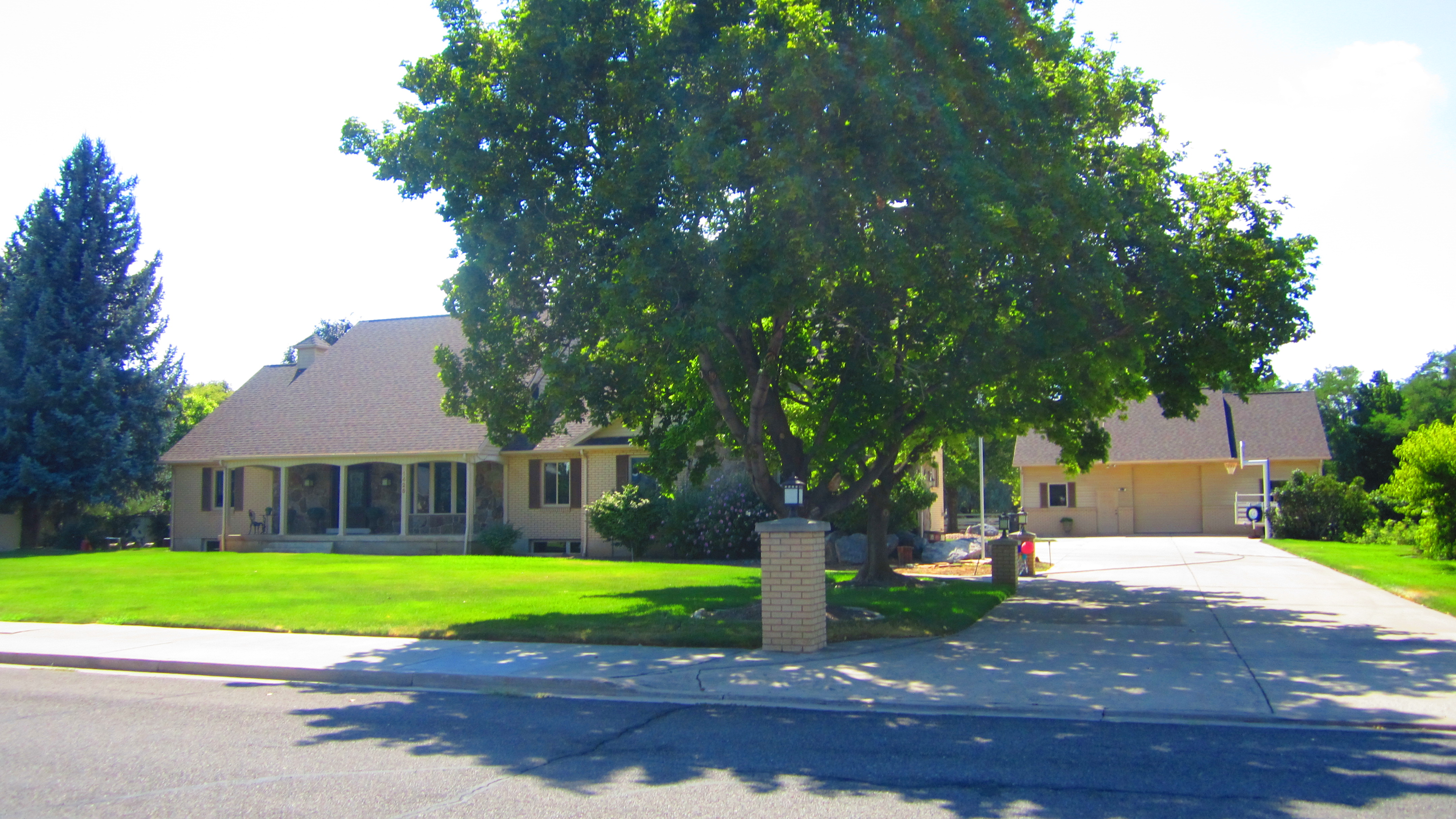 Total Photos: 2
|
| |
|
|
| Property Address: 1425 N 1000 WEST - MAPLETON |
|
| Mailing Address: 1425 N 1000 W MAPLETON, UT 84664-3309 |
|
| Acreage: 1.347881 |
|
| Last Document:
135068-2021
|
|
| Subdivision Map Filing |
|
| Taxing Description:
LOT 2, PLAT A, JONES ACRES SUB AREA 1.348 AC.
*Taxing description NOT FOR LEGAL DOCUMENTS
|
|
- Owner Names
- Value History
- Tax History
- Location
- Photos
- Documents
- Aerial Image
| 2024... |
|
07-29-2021 |
|
| 2024... |
|
DAVID K JONES FAMILY LIVING TRUST 11-04-2003 AMD & RESTATED 07-29-2021 |
|
| 2024... |
|
JERILYN F JONES FAMILY LIVING TRUST 11-04-2003 AMD & RESTATED |
|
| 2024... |
|
JONES, DAVID K |
|
| 2024... |
|
JONES, JERILYN F |
|
| 2022-2023 |
|
07-29-2021 |
|
| 2022-2023 |
|
DAVID K JONES FAMILY LIVING TRUST 11-04-2003 AMD & RESTATED 07-29-2021 |
|
| 2022-2023 |
|
JERILYN F JONES FAMILY LIVING TRUST 11-04-2003 AMD & RESTATED |
|
| 2022-2023 |
|
JONES, DAVID K |
|
| 2022-2023 |
|
JONES, JERILYN F |
|
| 2014-2021 |
|
JONES, DAVID K |
|
| 2014-2021 |
|
JONES, JERILYN F |
|
| 2014NV |
|
JONES, JUDITH R |
|
| 2014NV |
|
JONES, KENNETH H |
|
| 2007-2013 |
|
GINES, BRENT A |
|
| 2007-2013 |
|
GINES, CAREN D |
|
| 2006 |
|
JONES, JUDITH R |
|
| 2006 |
|
JONES, KENNETH H |
|
| |
----- Real Estate Values ----- |
---Improvements--- |
---Greenbelt--- |
Total |
| Year |
Com |
Res |
Agr |
Tot |
Com |
Res |
Agr |
Tot |
Land |
Homesite |
Tot |
Market Value |
| 2024 |
$0 |
$335,700 |
$37,600 |
$373,300 |
$0 |
$590,700 |
$0 |
$590,700 |
$0 |
$0 |
$0 |
$964,000 |
| 2023 |
$0 |
$335,700 |
$37,600 |
$373,300 |
$0 |
$587,900 |
$0 |
$587,900 |
$0 |
$0 |
$0 |
$961,200 |
| 2022 |
$0 |
$357,900 |
$40,100 |
$398,000 |
$0 |
$520,900 |
$0 |
$520,900 |
$0 |
$0 |
$0 |
$918,900 |
| 2021 |
$0 |
$223,700 |
$32,100 |
$255,800 |
$0 |
$400,700 |
$0 |
$400,700 |
$0 |
$0 |
$0 |
$656,500 |
| 2020 |
$0 |
$198,000 |
$27,900 |
$225,900 |
$0 |
$400,700 |
$0 |
$400,700 |
$0 |
$0 |
$0 |
$626,600 |
| 2019 |
$0 |
$190,000 |
$27,900 |
$217,900 |
$0 |
$400,700 |
$0 |
$400,700 |
$0 |
$0 |
$0 |
$618,600 |
| 2018 |
$0 |
$160,000 |
$22,700 |
$182,700 |
$0 |
$400,700 |
$0 |
$400,700 |
$0 |
$0 |
$0 |
$583,400 |
| 2017 |
$0 |
$150,000 |
$20,900 |
$170,900 |
$0 |
$400,700 |
$0 |
$400,700 |
$0 |
$0 |
$0 |
$571,600 |
| 2016 |
$0 |
$140,000 |
$19,200 |
$159,200 |
$0 |
$369,900 |
$0 |
$369,900 |
$0 |
$0 |
$0 |
$529,100 |
| 2015 |
$0 |
$125,000 |
$19,200 |
$144,200 |
$0 |
$357,800 |
$0 |
$357,800 |
$0 |
$0 |
$0 |
$502,000 |
| 2014 |
$0 |
$120,000 |
$14,000 |
$134,000 |
$0 |
$324,800 |
$0 |
$324,800 |
$0 |
$0 |
$0 |
$458,800 |
| 2013 |
$0 |
$105,000 |
$12,200 |
$117,200 |
$0 |
$292,300 |
$0 |
$292,300 |
$0 |
$0 |
$0 |
$409,500 |
| 2012 |
$0 |
$113,000 |
$12,200 |
$125,200 |
$0 |
$261,000 |
$0 |
$261,000 |
$0 |
$0 |
$0 |
$386,200 |
| 2011 |
$0 |
$98,000 |
$12,200 |
$110,200 |
$0 |
$280,000 |
$0 |
$280,000 |
$0 |
$0 |
$0 |
$390,200 |
| 2010 |
$0 |
$113,197 |
$6,202 |
$119,399 |
$0 |
$489,841 |
$0 |
$489,841 |
$0 |
$0 |
$0 |
$609,240 |
| 2009 |
$0 |
$104,600 |
$14,800 |
$119,400 |
$0 |
$534,300 |
$0 |
$534,300 |
$0 |
$0 |
$0 |
$653,700 |
| 2008 |
$0 |
$111,100 |
$9,200 |
$120,300 |
$0 |
$534,300 |
$0 |
$534,300 |
$0 |
$0 |
$0 |
$654,600 |
| 2007 |
$0 |
$111,100 |
$9,200 |
$120,300 |
$0 |
$534,300 |
$0 |
$534,300 |
$0 |
$0 |
$0 |
$654,600 |
| 2006 |
$0 |
$101,000 |
$8,400 |
$109,400 |
$0 |
$534,300 |
$0 |
$534,300 |
$0 |
$0 |
$0 |
$643,700 |
| Year |
General Taxes |
Adjustments |
Net Taxes |
Fees |
Payments |
Tax Balance* |
Balance Due |
Tax District |
| 2025 |
$0.00 |
$0.00 |
$0.00 |
$0.00 |
|
$0.00
|
$0.00 |
140 - MAPLETON CITY |
| 2024 |
$0.00 |
$0.00 |
$0.00 |
$0.00 |
|
$0.00
|
$0.00 |
140 - MAPLETON CITY |
| 2023 |
$5,534.36 |
$0.00 |
$5,534.36 |
$0.00 |
|
$0.00
|
$0.00 |
140 - MAPLETON CITY |
| 2022 |
$5,369.97 |
$0.00 |
$5,369.97 |
$0.00 |
|
$0.00
|
$0.00 |
140 - MAPLETON CITY |
| 2021 |
$4,562.19 |
$0.00 |
$4,562.19 |
$0.00 |
|
$0.00
|
$0.00 |
140 - MAPLETON CITY |
| 2020 |
$4,486.24 |
$0.00 |
$4,486.24 |
$0.00 |
|
$0.00
|
$0.00 |
140 - MAPLETON CITY |
| 2019 |
$4,341.02 |
$0.00 |
$4,341.02 |
$0.00 |
|
$0.00
|
$0.00 |
140 - MAPLETON CITY |
| 2018 |
$4,279.60 |
$0.00 |
$4,279.60 |
$0.00 |
|
$0.00
|
$0.00 |
140 - MAPLETON CITY |
| 2017 |
$4,337.42 |
$0.00 |
$4,337.42 |
$0.00 |
|
$0.00
|
$0.00 |
140 - MAPLETON CITY |
| 2016 |
$4,038.02 |
$0.00 |
$4,038.02 |
$0.00 |
|
$0.00
|
$0.00 |
140 - MAPLETON CITY |
| 2015 |
$3,860.50 |
$0.00 |
$3,860.50 |
$0.00 |
|
$0.00
|
$0.00 |
140 - MAPLETON CITY |
| 2014 |
$3,570.78 |
$0.00 |
$3,570.78 |
$0.00 |
|
$0.00
|
$0.00 |
140 - MAPLETON CITY |
| 2013 |
$3,390.82 |
$0.00 |
$3,390.82 |
$0.00 |
|
$0.00
|
$0.00 |
140 - MAPLETON CITY |
| 2012 |
$3,275.69 |
$0.00 |
$3,275.69 |
$0.00 |
|
$0.00
|
$0.00 |
140 - MAPLETON CITY |
| 2011 |
$3,239.43 |
$0.00 |
$3,239.43 |
$0.00 |
|
$0.00
|
$0.00 |
140 - MAPLETON CITY |
| 2010 |
$4,832.94 |
$0.00 |
$4,832.94 |
$0.00 |
|
$0.00
|
$0.00 |
140 - MAPLETON CITY |
| 2009 |
$4,902.98 |
$0.00 |
$4,902.98 |
$0.00 |
|
$0.00
|
$0.00 |
140 - MAPLETON CITY |
| 2008 |
$4,441.42 |
$0.00 |
$4,441.42 |
$0.00 |
|
$0.00
|
$0.00 |
140 - MAPLETON CITY |
| 2007 |
$4,155.91 |
$0.00 |
$4,155.91 |
$0.00 |
|
$0.00
|
$0.00 |
140 - MAPLETON CITY |
| 2006 |
$4,417.58 |
$0.00 |
$4,417.58 |
$0.00 |
|
$0.00
|
$0.00 |
140 - MAPLETON CITY |
* Note: Original tax amount (Does not include applicable interest and/or fees).
| Entry # |
Date |
Recorded |
Type |
Party1 (Grantor) |
Party2 (Grantee) |
| 135068-2021 |
07/29/2021 |
08/03/2021 |
QCD |
JONES, DAVID K & JERILYN F |
JONES, DAVID K TEE (ET AL) |
| 85024-2013 |
09/05/2013 |
09/05/2013 |
WD |
JONES, KENNETH H & JUDITH R TEE (ET AL) |
JONES, DAVID K & JERILYN F |
| 84765-2013 |
07/19/2013 |
09/04/2013 |
WD |
GINES, BRENT A & CAREN D |
JONES, JUDITH R & KENNETH H TEE |
| 12794-2006 |
01/18/2006 |
02/01/2006 |
TR D |
GINES, BRENT A & CAREN D |
JONES, KENNETH A & CAREN D |
| 12793-2006 |
01/18/2006 |
02/01/2006 |
WD |
JONES, KENNETH H & JUDITH R TEE (ET AL) |
GINES, BRENT A & CAREN D |
| 32552-2005 |
03/16/2005 |
03/29/2005 |
S PLAT |
JONES, KENNETH H & JUDITH R |
JONES ACRES PLAT A |
Main Menu Comments or Concerns on Value/Appraisal - Assessor's Office
Documents/Owner/Parcel information - Recorder's Office
Address Change for Tax Notice
This page was created on 9/3/2024 10:11:22 AM |
