Property Information
mobile view
| Serial Number: 44:020:0052 |
Serial Life: 2002... |
|
|
 Total Photos: 2
|
| |
|
|
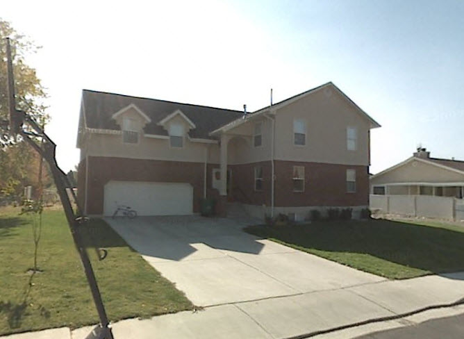
| Property Address: 722 E 500 NORTH - OREM |
|
| Mailing Address: 722 E 500 N OREM, UT 84097-4410 |
|
| Acreage: 0.34327781 |
|
| Last Document:
90025-2020
|
|
| Subdivision Map Filing |
|
| Taxing Description:
COM N 555.48 FT & W 484.64 FT FR SE COR. SEC. 11, T6S, R2E, SLB&M.; S 89 DEG 58' 35" W 81.1 FT; N 1 DEG 5' 14" W 133.23 FT; S 89 DEG 57' 49" W 10.09 FT; N 1 DEG 47' 0" W 16.53 FT; N 88 DEG 48' 0" E 196.5 FT; S 2 DEG 19' 0" E 25 FT; S 88 DEG 48' 0" W 106.9 FT; S 1 DEG 39' 0" E 126.64 FT TO BEG. AREA 0.343 AC.
*Taxing description NOT FOR LEGAL DOCUMENTS
|
|
- Owner Names
- Value History
- Tax History
- Location
- Photos
- Documents
- Aerial Image
| 2021... |
|
POPE, JOSHUA L |
|
| 2021... |
|
POPE, LETICIA |
|
| 2021NV |
|
POPE, JOSHUA L |
|
| 2018-2020 |
|
POPE, JOSHUA L |
|
| 2018-2020 |
|
POPE, LETICIA |
|
| 2018NV |
|
POPE, JOSHUA L |
|
| 2007-2017 |
|
CANO, JENNIFER |
|
| 2007-2017 |
|
CANO, RAMON B |
|
| 2004-2006 |
|
JOBLIN, ANITA |
|
| 2004-2006 |
|
JOBLIN, W TRENT |
|
| 2002-2003 |
|
JESSEE, PHILIP T |
|
| |
----- Real Estate Values ----- |
---Improvements--- |
---Greenbelt--- |
Total |
| Year |
Com |
Res |
Agr |
Tot |
Com |
Res |
Agr |
Tot |
Land |
Homesite |
Tot |
Market Value |
| 2024 |
$0 |
$207,600 |
$0 |
$207,600 |
$0 |
$424,900 |
$0 |
$424,900 |
$0 |
$0 |
$0 |
$632,500 |
| 2023 |
$0 |
$207,600 |
$0 |
$207,600 |
$0 |
$429,300 |
$0 |
$429,300 |
$0 |
$0 |
$0 |
$636,900 |
| 2022 |
$0 |
$221,300 |
$0 |
$221,300 |
$0 |
$365,800 |
$0 |
$365,800 |
$0 |
$0 |
$0 |
$587,100 |
| 2021 |
$0 |
$158,100 |
$0 |
$158,100 |
$0 |
$302,300 |
$0 |
$302,300 |
$0 |
$0 |
$0 |
$460,400 |
| 2020 |
$0 |
$126,500 |
$0 |
$126,500 |
$0 |
$296,400 |
$0 |
$296,400 |
$0 |
$0 |
$0 |
$422,900 |
| 2019 |
$0 |
$118,600 |
$0 |
$118,600 |
$0 |
$257,700 |
$0 |
$257,700 |
$0 |
$0 |
$0 |
$376,300 |
| 2018 |
$0 |
$114,600 |
$0 |
$114,600 |
$0 |
$255,600 |
$0 |
$255,600 |
$0 |
$0 |
$0 |
$370,200 |
| 2017 |
$0 |
$102,800 |
$0 |
$102,800 |
$0 |
$247,700 |
$0 |
$247,700 |
$0 |
$0 |
$0 |
$350,500 |
| 2016 |
$0 |
$73,500 |
$0 |
$73,500 |
$0 |
$242,500 |
$0 |
$242,500 |
$0 |
$0 |
$0 |
$316,000 |
| 2015 |
$0 |
$68,000 |
$0 |
$68,000 |
$0 |
$220,900 |
$0 |
$220,900 |
$0 |
$0 |
$0 |
$288,900 |
| 2014 |
$0 |
$67,200 |
$0 |
$67,200 |
$0 |
$218,300 |
$0 |
$218,300 |
$0 |
$0 |
$0 |
$285,500 |
| 2013 |
$0 |
$54,400 |
$0 |
$54,400 |
$0 |
$218,300 |
$0 |
$218,300 |
$0 |
$0 |
$0 |
$272,700 |
| 2012 |
$0 |
$53,600 |
$0 |
$53,600 |
$0 |
$202,400 |
$0 |
$202,400 |
$0 |
$0 |
$0 |
$256,000 |
| 2011 |
$0 |
$67,000 |
$0 |
$67,000 |
$0 |
$196,900 |
$0 |
$196,900 |
$0 |
$0 |
$0 |
$263,900 |
| 2010 |
$0 |
$100,600 |
$0 |
$100,600 |
$0 |
$179,984 |
$0 |
$179,984 |
$0 |
$0 |
$0 |
$280,584 |
| 2009 |
$0 |
$100,600 |
$0 |
$100,600 |
$0 |
$185,200 |
$0 |
$185,200 |
$0 |
$0 |
$0 |
$285,800 |
| 2008 |
$0 |
$103,700 |
$0 |
$103,700 |
$0 |
$197,000 |
$0 |
$197,000 |
$0 |
$0 |
$0 |
$300,700 |
| 2007 |
$0 |
$108,000 |
$0 |
$108,000 |
$0 |
$205,200 |
$0 |
$205,200 |
$0 |
$0 |
$0 |
$313,200 |
| 2006 |
$0 |
$45,700 |
$0 |
$45,700 |
$0 |
$201,100 |
$0 |
$201,100 |
$0 |
$0 |
$0 |
$246,800 |
| 2005 |
$0 |
$43,506 |
$0 |
$43,506 |
$0 |
$191,535 |
$0 |
$191,535 |
$0 |
$0 |
$0 |
$235,041 |
| 2004 |
$0 |
$43,506 |
$0 |
$43,506 |
$0 |
$191,535 |
$0 |
$191,535 |
$0 |
$0 |
$0 |
$235,041 |
| 2003 |
$0 |
$43,506 |
$0 |
$43,506 |
$0 |
$191,535 |
$0 |
$191,535 |
$0 |
$0 |
$0 |
$235,041 |
| 2002 |
$0 |
$43,506 |
$0 |
$43,506 |
$0 |
$191,535 |
$0 |
$191,535 |
$0 |
$0 |
$0 |
$235,041 |
| Year |
General Taxes |
Adjustments |
Net Taxes |
Fees |
Payments |
Tax Balance* |
Balance Due |
Tax District |
| 2025 |
$0.00 |
$0.00 |
$0.00 |
$0.00 |
|
$0.00
|
$0.00 |
090 - OREM CITY |
| 2024 |
$2,844.92 |
$0.00 |
$2,844.92 |
$0.00 |
|
$0.00
|
$0.00 |
090 - OREM CITY |
| 2023 |
$2,665.39 |
$0.00 |
$2,665.39 |
$0.00 |
|
$0.00
|
$0.00 |
090 - OREM CITY |
| 2022 |
$2,536.10 |
$0.00 |
$2,536.10 |
$0.00 |
|
$0.00
|
$0.00 |
090 - OREM CITY |
| 2021 |
$2,387.36 |
$0.00 |
$2,387.36 |
$0.00 |
|
$0.00
|
$0.00 |
090 - OREM CITY |
| 2020 |
$2,231.28 |
$0.00 |
$2,231.28 |
$0.00 |
|
$0.00
|
$0.00 |
090 - OREM CITY |
| 2019 |
$1,909.25 |
$0.00 |
$1,909.25 |
$0.00 |
|
$0.00
|
$0.00 |
090 - OREM CITY |
| 2018 |
$1,965.85 |
$0.00 |
$1,965.85 |
$0.00 |
|
$0.00
|
$0.00 |
090 - OREM CITY |
| 2017 |
$1,910.98 |
$0.00 |
$1,910.98 |
$0.00 |
|
$0.00
|
$0.00 |
090 - OREM CITY |
| 2016 |
$1,868.35 |
$0.00 |
$1,868.35 |
$0.00 |
|
$0.00
|
$0.00 |
090 - OREM CITY |
| 2015 |
$1,806.16 |
$0.00 |
$1,806.16 |
$0.00 |
|
$0.00
|
$0.00 |
090 - OREM CITY |
| 2014 |
$1,793.07 |
$0.00 |
$1,793.07 |
$0.00 |
|
$0.00
|
$0.00 |
090 - OREM CITY |
| 2013 |
$1,846.92 |
$0.00 |
$1,846.92 |
$0.00 |
|
$0.00
|
$0.00 |
090 - OREM CITY |
| 2012 |
$1,769.57 |
$0.00 |
$1,769.57 |
$0.00 |
|
$0.00
|
$0.00 |
090 - OREM CITY |
| 2011 |
$1,815.47 |
$0.00 |
$1,815.47 |
$0.00 |
|
$0.00
|
$0.00 |
090 - OREM CITY |
| 2010 |
$1,807.10 |
$0.00 |
$1,807.10 |
$0.00 |
|
$0.00
|
$0.00 |
090 - OREM CITY |
| 2009 |
$1,706.30 |
$0.00 |
$1,706.30 |
$0.00 |
|
$0.00
|
$0.00 |
090 - OREM CITY |
| 2008 |
$1,663.61 |
$0.00 |
$1,663.61 |
$0.00 |
|
$0.00
|
$0.00 |
090 - OREM CITY |
| 2007 |
$1,712.95 |
$0.00 |
$1,712.95 |
$0.00 |
|
$0.00
|
$0.00 |
090 - OREM CITY |
| 2006 |
$1,437.35 |
$0.00 |
$1,437.35 |
$0.00 |
|
$0.00
|
$0.00 |
090 - OREM CITY |
| 2005 |
$1,545.06 |
$0.00 |
$1,545.06 |
$0.00 |
|
$0.00
|
$0.00 |
090 - OREM CITY |
| 2004 |
$1,517.65 |
$0.00 |
$1,517.65 |
$0.00 |
|
$0.00
|
$0.00 |
090 - OREM CITY |
| 2003 |
$1,472.67 |
$0.00 |
$1,472.67 |
$0.00 |
|
$0.00
|
$0.00 |
090 - OREM CITY |
| 2002 |
$1,345.85 |
$0.00 |
$1,345.85 |
$0.00 |
|
$0.00
|
$0.00 |
090 - OREM CITY |
* Note: Original tax amount (Does not include applicable interest and/or fees).
| Entry # |
Date |
Recorded |
Type |
Party1 (Grantor) |
Party2 (Grantee) |
| 54530-2023 |
08/15/2023 |
08/21/2023 |
D TR |
POPE, JOSHUA L & LETICIA |
UTAH COMMUNITY FEDERAL CREDIT UNION |
| 51856-2023 |
|
08/09/2023 |
T FN ST |
VIVINT SOLAR DEVELOPER LLC |
POPE, JOSHUA |
| 51855-2023 |
|
08/09/2023 |
T FN ST |
VIVINT SOLAR DEVELOPER LLC |
POPE, JOSHUA |
| 78776-2021 |
|
04/27/2021 |
FN ST |
POPE, JOSHUA |
VIVINT SOLAR DEVELOPER LLC |
| 144426-2020 |
|
09/22/2020 |
FN ST |
POPE, JOSHUA |
VIVINT SOLAR DEVELOPER LLC |
| 117500-2020 |
|
08/10/2020 |
FN ST |
POPE, JOSHUA |
VIVINT SOLAR DEVELOPER LLC |
| 117499-2020 |
|
08/10/2020 |
FN ST |
POPE, JOSHUA |
VIVINT SOLAR DEVELOPER LLC |
| 106862-2020 |
07/23/2020 |
07/27/2020 |
RSUBTEE |
MORTGAGE ELECTRONIC REGISTRATION SYSTEMS INC (ET AL) |
POPE, JOSHUA L |
| 98620-2020 |
06/23/2020 |
07/13/2020 |
WD |
POPE, JOSHUA L |
POPE, JOSHUA L & LETICIA |
| 90026-2020 |
06/23/2020 |
06/29/2020 |
D TR |
POPE, JOSHUA L |
MY MOVE MORTGAGE LLC DBA (ET AL) |
| 90025-2020 |
06/23/2020 |
06/29/2020 |
WD |
POPE, JOSHUA L & LETICIA |
POPE, JOSHUA L |
| 90024-2020 |
|
06/29/2020 |
T FN ST |
VIVINT SOLAR DEVELOPER LLC |
POPE, JOSHUA |
| 90023-2020 |
|
06/29/2020 |
T FN ST |
VIVINT SOLAR DEVELOPER LLC |
POPE, JOSHUA |
| 90022-2020 |
|
06/29/2020 |
T FN ST |
VIVINT SOLAR DEVELOPER LLC |
CANO, RAMON |
| 90021-2020 |
|
06/29/2020 |
T FN ST |
VIVINT SOLAR DEVELOPER LLC |
CANO, RAMON |
| 114860-2017 |
|
11/20/2017 |
FN ST |
POPE, JOSHUA |
VIVINT SOLAR DEVELOPER LLC |
| 114859-2017 |
|
11/20/2017 |
FN ST |
POPE, JOSHUA |
VIVINT SOLAR DEVELOPER LLC |
| 75310-2017 |
07/27/2017 |
08/03/2017 |
REC |
WELLS FARGO FINANCIAL NATIONAL BANK TEE |
CANO, RAMON B & JENNIFER |
| 75309-2017 |
07/27/2017 |
08/03/2017 |
SUB TEE |
MORTGAGE ELECTRONIC REGISTRATION SYSTEMS INC |
WELLS FARGO FINANCIAL NATIONAL BANK SUCTEE |
| 67456-2017 |
07/11/2017 |
07/12/2017 |
WD |
POPE, JOSHUA L |
POPE, JOSHUA L & LETICIA |
| 67455-2017 |
07/11/2017 |
07/12/2017 |
D TR |
POPE, JOSHUA L |
ACADEMY MORTGAGE CORPORATION |
| 67391-2017 |
07/08/2017 |
07/12/2017 |
WD |
CANO, RAMON B & JENNIFER |
POPE, JOSHUA L |
| 76244-2016 |
|
08/12/2016 |
FN ST |
VIVINT SOLAR DEVELOPER LLC |
CANO, RAMON |
| 69046-2016 |
|
07/27/2016 |
FN ST |
CANO, RAMON |
VIVINT SOLAR DEVELOPER LLC |
| 63635-2009 |
05/25/2009 |
06/09/2009 |
REC |
FIRST AMERICAN TITLE COMPANY TEE |
CANO, RAMON B & JENNIFER |
| 63634-2009 |
05/25/2009 |
06/09/2009 |
SUB TEE |
MORTGAGE ELECTRONIC REGISTRATION SYSTEMS INC |
FIRST AMERICAN TITLE COMPANY SUCTEE |
| 63623-2009 |
05/25/2009 |
06/09/2009 |
REC |
FIRST AMERICAN TITLE COMPANY TEE |
CANO, RAMON B & JENNIFER |
| 63622-2009 |
05/25/2009 |
06/09/2009 |
SUB TEE |
MORTGAGE ELECTRONIC REGISTRATION SYSTEMS INC |
FIRST AMERICAN TITLE COMPANY SUCTEE |
| 52787-2009 |
05/08/2009 |
05/13/2009 |
D TR |
CANO, RAMON B & JENNIFER |
PROVIDENT FUNDING ASSOCIATES LP |
| 110099-2006 |
08/22/2006 |
08/23/2006 |
REC |
FIRST AMERICAN TITLE INSURANCE AGENCY LLC TEE |
JESSEE, PHILLIP T |
| 110098-2006 |
08/22/2006 |
08/23/2006 |
REC |
FIRST AMERICAN TITLE INSURANCE AGENCY LLC TEE |
JESSEE, PHILIP T |
| 110077-2006 |
08/22/2006 |
08/23/2006 |
REC |
FIRST AMERICAN TITLE INSURANCE AGENCY TEE |
JESSEE, PHILIP T |
| 99688-2006 |
06/16/2006 |
08/04/2006 |
REC |
RICHER, ARNOLD SUBTEE |
JOBLIN, W TRENT & ANITA |
| 99687-2006 |
07/18/2006 |
08/04/2006 |
SUB TEE |
MORTGAGE ELECTRONIC REGISTRATION SYSTEMS INC |
RICHER, ARNOLD TEE |
| 62008-2006 |
04/20/2006 |
05/19/2006 |
RSUBTEE |
MORTGAGE ELECTRONIC REGISTRATION SYSTEMS INC (ET AL) |
JOBLIN, W TRENT & ANITA |
| 38727-2006 |
03/31/2006 |
03/31/2006 |
D TR |
CANO, RAMON B & JENNIFER |
AMERICAN LENDING NETWORK INC |
| 38726-2006 |
03/30/2006 |
03/31/2006 |
D TR |
CANO, RAMON B & JENNIFER |
AMERICAN LENDING NETWORK INC |
| 38675-2006 |
03/28/2006 |
03/31/2006 |
WD |
JOBLIN, W TRENT & ANITA |
CANO, RAMON B & JENNIFER |
| 103752-2005 |
09/12/2005 |
09/15/2005 |
N |
CITY OF OREM |
WHOM OF INTEREST |
| 871-2005 |
12/22/2004 |
01/04/2005 |
D TR |
JOBLIN, W TRENT & ANITA |
123LOAN LLC |
| 31421-2004 |
03/02/2004 |
03/22/2004 |
EAS AGR |
JOBLIN, W TRENT & ANITA |
CITY OF OREM |
| 89717-2003 |
06/10/2003 |
06/13/2003 |
REC |
FIRST AMERICAN TITLE CO TEE |
JESSEE, PHILIP T |
| 69886-2003 |
05/07/2003 |
05/08/2003 |
D TR |
JOBLIN, W TRENT & ANITA |
WACHOVIA MORTGAGE CORPORATION |
| 69885-2003 |
05/07/2003 |
05/08/2003 |
WD |
JESSEE, PHILIP T |
JOBLIN, W TRENT & ANITA |
| 44142-2003 |
03/20/2003 |
03/25/2003 |
AF |
CITY OF OREM |
WHOM OF INTEREST |
| 39396-2003 |
03/13/2002 |
03/17/2003 |
REC |
SUNDANCE TITLE INSURANCE AGENCY TEE |
JESSE, PHILIP T |
| 39395-2003 |
03/07/2003 |
03/17/2003 |
SUB TEE |
SURELOAN LLC |
SUNDANCE TITLE INSURANCE AGENCY SUCTEE |
| 34738-2003 |
03/06/2003 |
03/07/2003 |
D TR |
JESSEE, PHILIP T |
ROBERT AND HELEN PAUL LTD (ET AL) |
| 72907-2002 |
06/27/2002 |
06/27/2002 |
REC |
SUNDANCE TITLE INSURANCE AGENCY TEE |
JESSEE, PHILIP T |
| 22431-2002 |
02/25/2002 |
02/26/2002 |
TR D |
JESSEE, PHILIP T |
SURELOAN LLC |
| 126630-2001 |
12/03/2001 |
12/05/2001 |
TR D |
JESSEE, PHILIP T |
SURELOAN LLC |
| 126596-2001 |
12/03/2001 |
12/05/2001 |
TR D |
JESSEE, PHIL |
BCI SECURED EQUITY FUND I LTD |
| 113475-2001 |
11/02/2001 |
11/02/2001 |
TR D |
JESSEE, PHILIP T |
SURELOAN LLC |
| 102351-2001 |
10/09/2001 |
10/09/2001 |
D TR |
JESSE, PHILIP T |
AMERICAN PENSION SERVICES |
| 75430-2001 |
07/30/2001 |
07/31/2001 |
D TR |
JESSEE, PHILIP T |
PAUL, R KIP |
| 69975-2001 |
06/29/2001 |
07/17/2001 |
WD |
GREEN, JOHN F & LA RUE |
JESSEE, PHILIP T |
Main Menu Comments or Concerns on Value/Appraisal - Assessor's Office
Documents/Owner/Parcel information - Recorder's Office
Address Change for Tax Notice
This page was created on 4/1/2025 12:35:54 PM |
