Property Information
mobile view
| Serial Number: 45:472:0002 |
Serial Life: 2009... |
|
|
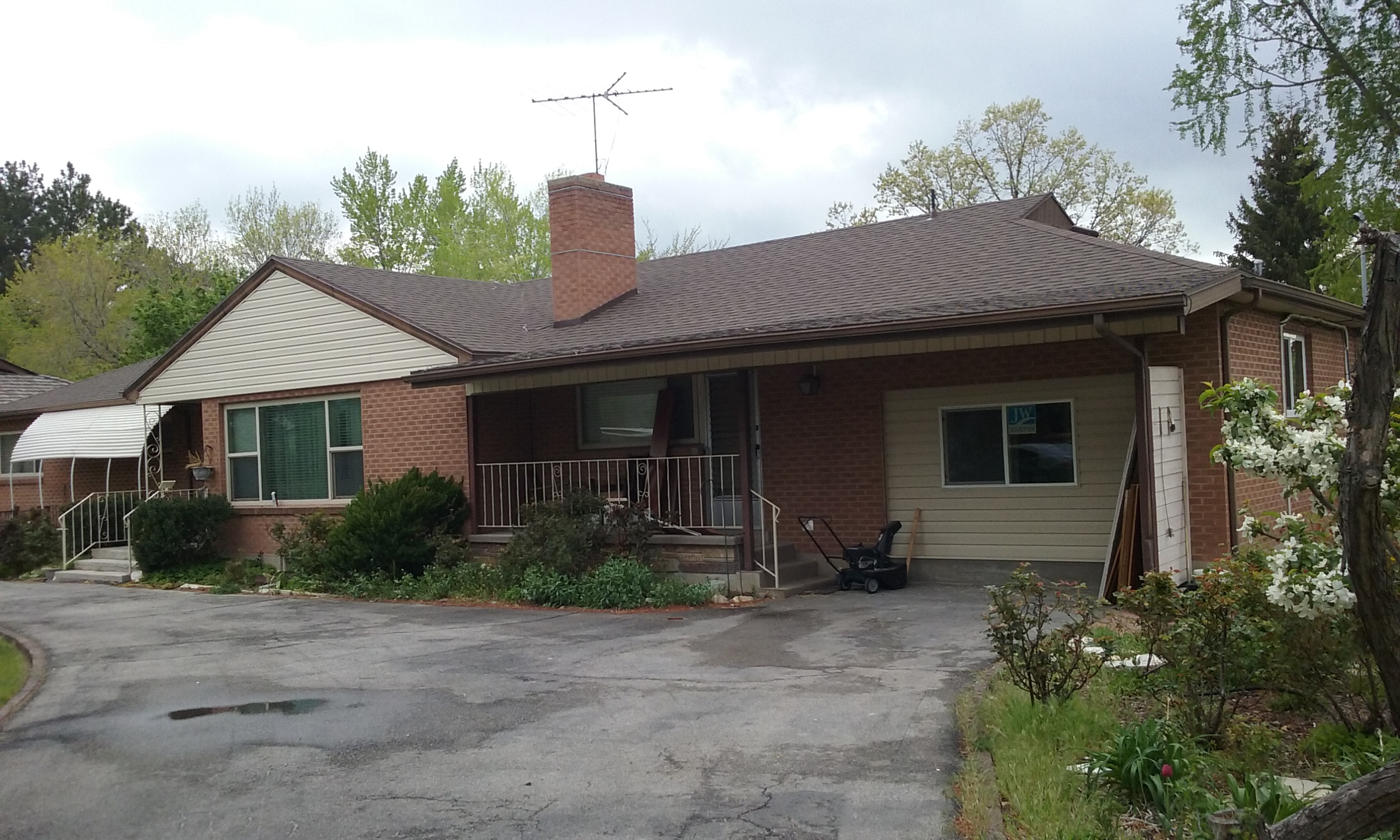 Total Photos: 3
|
| |
|
|
| Property Address: 730 S 500 EAST - OREM |
|
| Mailing Address: 730 S 500 E OREM, UT 84097-6360 |
|
| Acreage: 0.76 |
|
| Last Document:
91875-2008
|
|
| Subdivision Map Filing |
|
| Taxing Description:
LOT 2, PLAT J, LINCOLN GARDENS SUBDV. AREA 0.760 AC.
*Taxing description NOT FOR LEGAL DOCUMENTS
|
|
- Owner Names
- Value History
- Tax History
- Location
- Photos
- Documents
- Aerial Image
| 2015... |
|
PETERSON, ALICE LAREE |
|
| 2015... |
|
PETERSON, BRADLEY BURBIDGE |
|
| 2012-2014 |
|
730 ASSOCIATES LLC |
|
| 2010-2011 |
|
PETERSON, ALICE LAREE |
|
| 2010-2011 |
|
PETERSON, BRADLEY BURBIDGE |
|
| 2010-2011 |
|
SKOUSEN, GALE JOSEPH |
|
| 2010-2011 |
|
SKOUSEN, ORVAL N |
|
| 2010-2011 |
|
SKOUSEN, THERESA P |
|
| 2010-2011 |
|
SKOUSEN, VONDA A |
|
| 2009 |
|
SKOUSEN, GALE JOSEPH |
|
| 2009 |
|
SKOUSEN, ORVAL N |
|
| 2009 |
|
SKOUSEN, THERESA P |
|
| 2009 |
|
SKOUSEN, VONDA A |
|
| |
----- Real Estate Values ----- |
---Improvements--- |
---Greenbelt--- |
Total |
| Year |
Com |
Res |
Agr |
Tot |
Com |
Res |
Agr |
Tot |
Land |
Homesite |
Tot |
Market Value |
| 2025 |
$0 |
$243,400 |
$0 |
$243,400 |
$0 |
$394,400 |
$0 |
$394,400 |
$0 |
$0 |
$0 |
$637,800 |
| 2024 |
$0 |
$231,800 |
$0 |
$231,800 |
$0 |
$368,000 |
$0 |
$368,000 |
$0 |
$0 |
$0 |
$599,800 |
| 2023 |
$0 |
$231,800 |
$0 |
$231,800 |
$0 |
$344,300 |
$0 |
$344,300 |
$0 |
$0 |
$0 |
$576,100 |
| 2022 |
$0 |
$247,100 |
$0 |
$247,100 |
$0 |
$293,400 |
$0 |
$293,400 |
$0 |
$0 |
$0 |
$540,500 |
| 2021 |
$0 |
$176,500 |
$0 |
$176,500 |
$0 |
$242,500 |
$0 |
$242,500 |
$0 |
$0 |
$0 |
$419,000 |
| 2020 |
$0 |
$141,200 |
$0 |
$141,200 |
$0 |
$237,700 |
$0 |
$237,700 |
$0 |
$0 |
$0 |
$378,900 |
| 2019 |
$0 |
$131,800 |
$0 |
$131,800 |
$0 |
$206,700 |
$0 |
$206,700 |
$0 |
$0 |
$0 |
$338,500 |
| 2018 |
$0 |
$127,100 |
$0 |
$127,100 |
$0 |
$187,800 |
$0 |
$187,800 |
$0 |
$0 |
$0 |
$314,900 |
| 2017 |
$0 |
$117,700 |
$0 |
$117,700 |
$0 |
$178,500 |
$0 |
$178,500 |
$0 |
$0 |
$0 |
$296,200 |
| 2016 |
$0 |
$87,600 |
$0 |
$87,600 |
$0 |
$160,600 |
$0 |
$160,600 |
$0 |
$0 |
$0 |
$248,200 |
| 2015 |
$0 |
$87,600 |
$0 |
$87,600 |
$0 |
$160,600 |
$0 |
$160,600 |
$0 |
$0 |
$0 |
$248,200 |
| 2014 |
$0 |
$82,800 |
$0 |
$82,800 |
$0 |
$156,500 |
$0 |
$156,500 |
$0 |
$0 |
$0 |
$239,300 |
| 2013 |
$0 |
$69,100 |
$0 |
$69,100 |
$0 |
$144,400 |
$0 |
$144,400 |
$0 |
$0 |
$0 |
$213,500 |
| 2012 |
$0 |
$85,700 |
$0 |
$85,700 |
$0 |
$150,300 |
$0 |
$150,300 |
$0 |
$0 |
$0 |
$236,000 |
| 2011 |
$0 |
$94,800 |
$0 |
$94,800 |
$0 |
$148,500 |
$0 |
$148,500 |
$0 |
$0 |
$0 |
$243,300 |
| 2010 |
$0 |
$101,400 |
$0 |
$101,400 |
$0 |
$157,183 |
$0 |
$157,183 |
$0 |
$0 |
$0 |
$258,583 |
| 2009 |
$0 |
$101,400 |
$0 |
$101,400 |
$0 |
$172,700 |
$0 |
$172,700 |
$0 |
$0 |
$0 |
$274,100 |
| Year |
General Taxes |
Adjustments |
Net Taxes |
Fees |
Payments |
Tax Balance* |
Balance Due |
Tax Area |
| 2026 |
$0.00 |
$0.00 |
$0.00 |
$0.00 |
|
$0.00
|
$0.00 |
090 - OREM CITY |
| 2025 |
$0.00 |
$0.00 |
$0.00 |
$0.00 |
|
$0.00
|
$0.00 |
090 - OREM CITY |
| 2024 |
$2,697.84 |
$0.00 |
$2,697.84 |
$0.00 |
|
$0.00
|
$0.00 |
090 - OREM CITY |
| 2023 |
$2,410.95 |
$0.00 |
$2,410.95 |
$0.00 |
|
$0.00
|
$0.00 |
090 - OREM CITY |
| 2022 |
$2,334.80 |
$0.00 |
$2,334.80 |
$0.00 |
|
$0.00
|
$0.00 |
090 - OREM CITY |
| 2021 |
$2,172.68 |
$0.00 |
$2,172.68 |
$0.00 |
|
$0.00
|
$0.00 |
090 - OREM CITY |
| 2020 |
$1,999.13 |
$0.00 |
$1,999.13 |
$0.00 |
|
$0.00
|
$0.00 |
090 - OREM CITY |
| 2019 |
$1,717.46 |
$0.00 |
$1,717.46 |
$0.00 |
|
$0.00
|
$0.00 |
090 - OREM CITY |
| 2018 |
$1,672.20 |
$0.00 |
$1,672.20 |
$0.00 |
|
$0.00
|
$0.00 |
090 - OREM CITY |
| 2017 |
$1,614.93 |
$0.00 |
$1,614.93 |
$0.00 |
|
$0.00
|
$0.00 |
090 - OREM CITY |
| 2016 |
$1,467.48 |
$0.00 |
$1,467.48 |
$0.00 |
|
$0.00
|
$0.00 |
090 - OREM CITY |
| 2015 |
$1,551.71 |
$0.00 |
$1,551.71 |
$0.00 |
|
$0.00
|
$0.00 |
090 - OREM CITY |
| 2014 |
$1,502.91 |
$0.00 |
$1,502.91 |
$0.00 |
|
$0.00
|
$0.00 |
090 - OREM CITY |
| 2013 |
$1,445.97 |
$0.00 |
$1,445.97 |
$0.00 |
|
$0.00
|
$0.00 |
090 - OREM CITY |
| 2012 |
$1,631.33 |
$0.00 |
$1,631.33 |
$0.00 |
|
$0.00
|
$0.00 |
090 - OREM CITY |
| 2011 |
$1,673.76 |
$0.00 |
$1,673.76 |
$0.00 |
|
$0.00
|
$0.00 |
090 - OREM CITY |
| 2010 |
$1,665.41 |
$0.00 |
$1,665.41 |
$0.00 |
|
$0.00
|
$0.00 |
090 - OREM CITY |
| 2009 |
$1,636.45 |
$0.00 |
$1,636.45 |
$0.00 |
|
$0.00
|
$0.00 |
090 - OREM CITY |
* Note: Original tax amount (Does not include applicable interest and/or fees).
| Entry # |
Date |
Recorded |
Type |
Party1 (Grantor) |
Party2 (Grantee) |
| 71668-2018 |
07/25/2018 |
07/31/2018 |
AF |
CITY OF OREM |
WHOM OF INTEREST |
| 71667-2018 |
07/30/2018 |
07/31/2018 |
AF |
CITY OF OREM |
WHOM OF INTEREST |
| 30476-2014 |
04/30/2014 |
05/06/2014 |
WD |
730ASSOCIATES LLC |
PETERSON, BRADLEY BURBIDGE & ALICE LAREE |
| 72905-2011 |
09/23/2011 |
10/13/2011 |
QCD |
SKOUSEN, ORVAL N & VONDA A (ET AL) |
730 ASSOCIATES LLC |
| 112002-2009 |
10/19/2009 |
10/26/2009 |
QCD |
SKOUSEN, ORVAL N & VONDA A (ET AL) |
SKOUSEN, ORVAL N & VONDA A AN INT (ET AL) |
| 91875-2008 |
08/18/2008 |
08/18/2008 |
S PLAT |
SKOUSEN, GALE J & GALE JOSEPH AKA (ET AL) |
LINCOLN GARDENS PLAT J |
Main Menu Comments or Concerns on Value/Appraisal - Assessor's Office
Documents/Owner/Parcel information - Recorder's Office
Address Change for Tax Notice
This page was created on 7/21/2025 3:21:20 AM |

