Property Information
mobile view
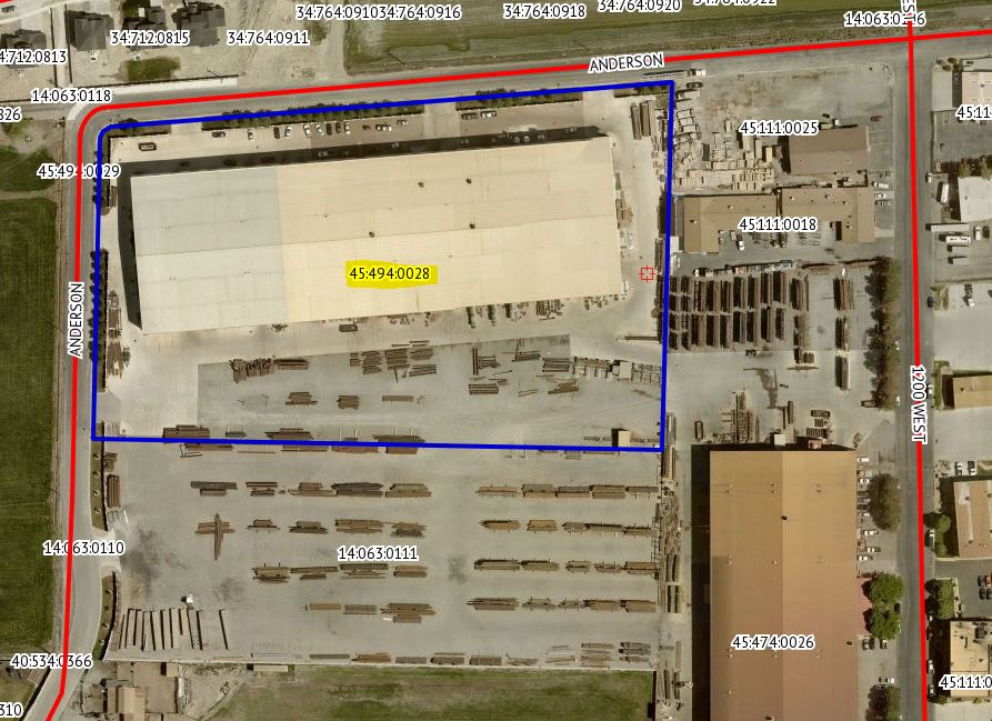
| Serial Number: 45:494:0028 |
Serial Life: 2012... |
|
|
 Total Photos: 9
|
| |
|
|
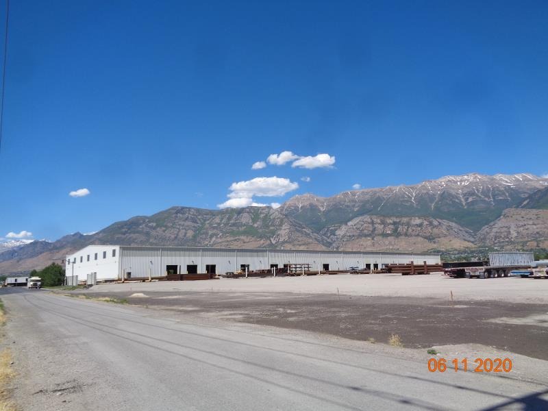
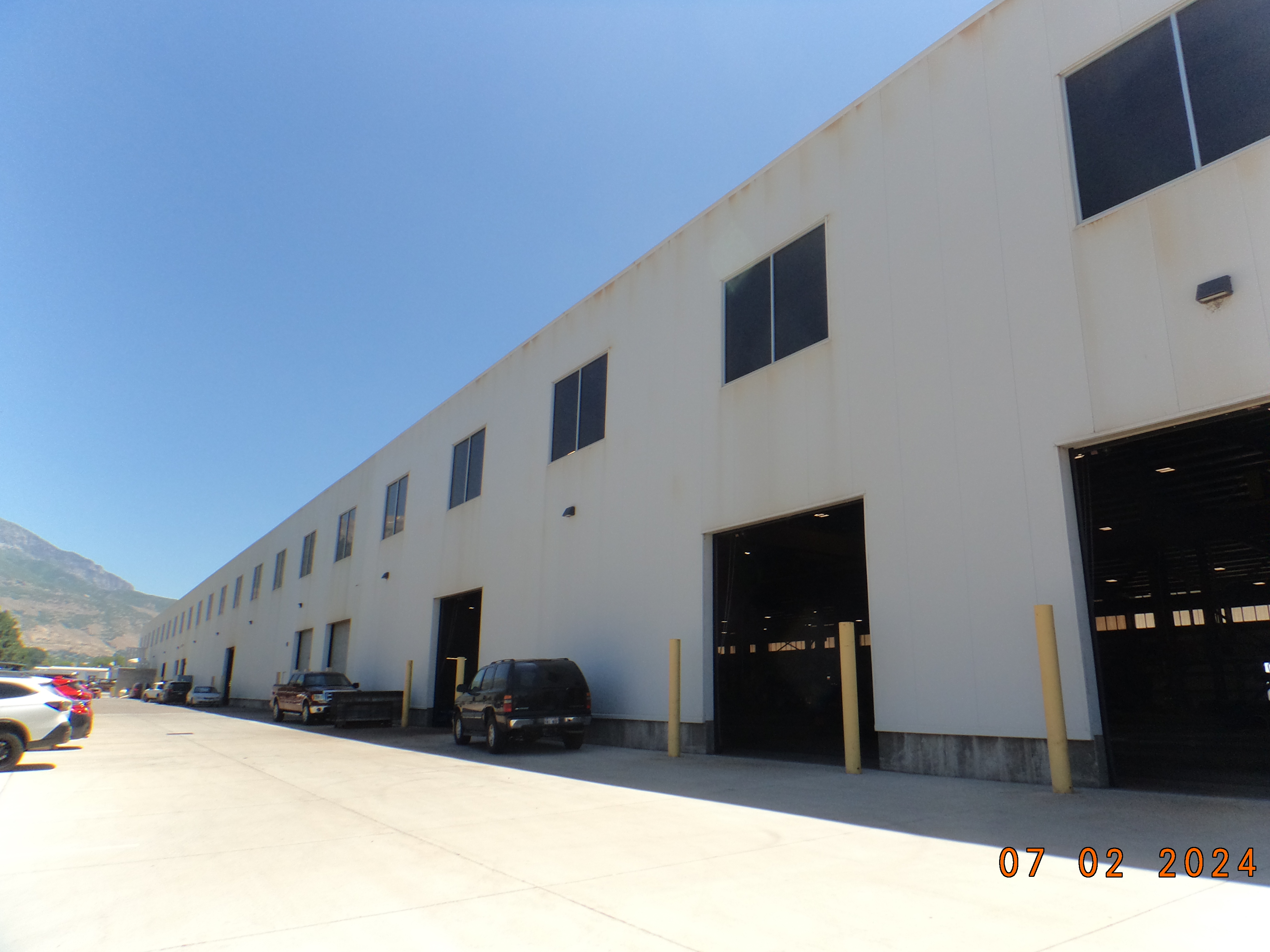
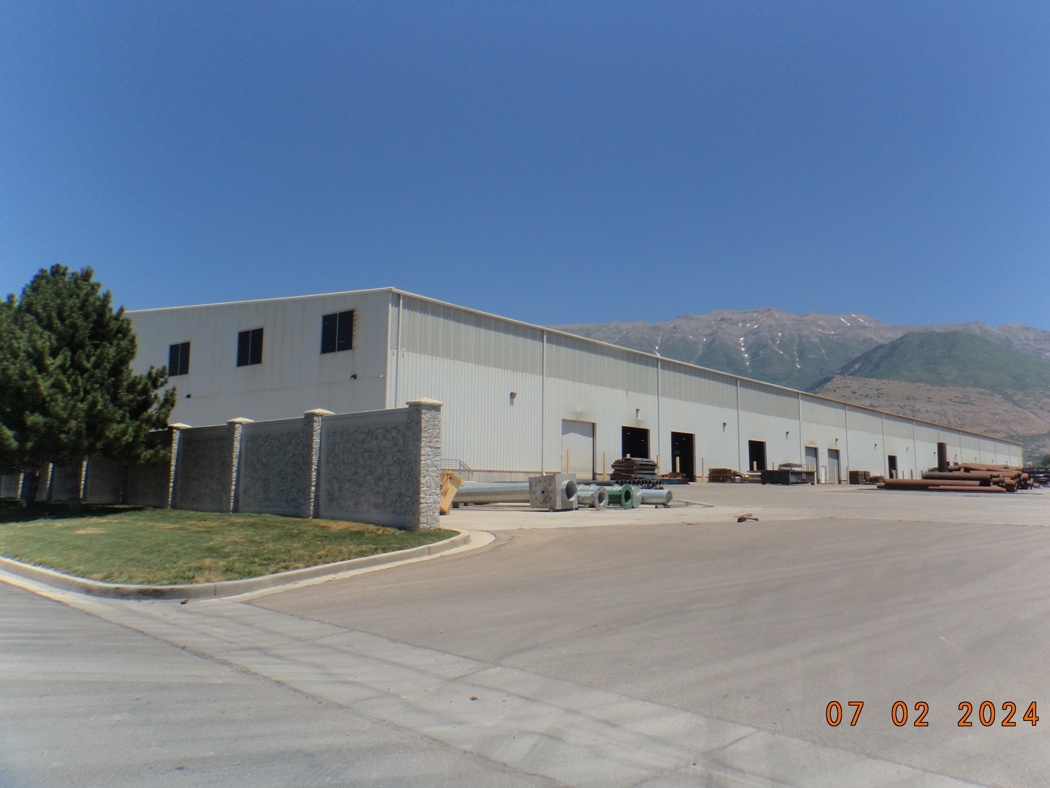
| Property Address: 1325 W 500 NORTH - LINDON |
|
| Mailing Address: PO BOX 699 PLEASANT GROVE, UT 84062-0699 |
|
| Acreage: 8.01305 |
|
| Last Document:
29461-2011
|
|
| Subdivision Map Filing |
|
| Taxing Description:
LOT 28, PLAT E, LAKEVIEW INDUSTRIAL PARK SUB AREA 8.013 AC.
*Taxing description NOT FOR LEGAL DOCUMENTS
|
|
- Owner Names
- Value History
- Tax History
- Location
- Photos
- Documents
- Aerial Image
| |
----- Real Estate Values ----- |
---Improvements--- |
---Greenbelt--- |
Total |
| Year |
Com |
Res |
Agr |
Tot |
Com |
Res |
Agr |
Tot |
Land |
Homesite |
Tot |
Market Value |
| 2024 |
$2,843,200 |
$0 |
$0 |
$2,843,200 |
$9,231,800 |
$0 |
$0 |
$9,231,800 |
$0 |
$0 |
$0 |
$12,075,000 |
| 2023 |
$2,770,900 |
$0 |
$0 |
$2,770,900 |
$8,238,700 |
$0 |
$0 |
$8,238,700 |
$0 |
$0 |
$0 |
$11,009,600 |
| 2022 |
$2,588,600 |
$0 |
$0 |
$2,588,600 |
$7,905,300 |
$0 |
$0 |
$7,905,300 |
$0 |
$0 |
$0 |
$10,493,900 |
| 2021 |
$2,491,400 |
$0 |
$0 |
$2,491,400 |
$6,061,500 |
$0 |
$0 |
$6,061,500 |
$0 |
$0 |
$0 |
$8,552,900 |
| 2020 |
$2,425,900 |
$0 |
$0 |
$2,425,900 |
$6,127,000 |
$0 |
$0 |
$6,127,000 |
$0 |
$0 |
$0 |
$8,552,900 |
| 2019 |
$2,247,900 |
$0 |
$0 |
$2,247,900 |
$6,114,500 |
$0 |
$0 |
$6,114,500 |
$0 |
$0 |
$0 |
$8,362,400 |
| 2018 |
$1,874,400 |
$0 |
$0 |
$1,874,400 |
$6,081,600 |
$0 |
$0 |
$6,081,600 |
$0 |
$0 |
$0 |
$7,956,000 |
| 2017 |
$1,787,100 |
$0 |
$0 |
$1,787,100 |
$5,056,200 |
$0 |
$0 |
$5,056,200 |
$0 |
$0 |
$0 |
$6,843,300 |
| 2016 |
$1,703,400 |
$0 |
$0 |
$1,703,400 |
$4,045,000 |
$0 |
$0 |
$4,045,000 |
$0 |
$0 |
$0 |
$5,748,400 |
| 2015 |
$1,665,000 |
$0 |
$0 |
$1,665,000 |
$4,045,000 |
$0 |
$0 |
$4,045,000 |
$0 |
$0 |
$0 |
$5,710,000 |
| 2014 |
$1,588,300 |
$0 |
$0 |
$1,588,300 |
$3,546,700 |
$0 |
$0 |
$3,546,700 |
$0 |
$0 |
$0 |
$5,135,000 |
| 2013 |
$1,443,900 |
$0 |
$0 |
$1,443,900 |
$3,546,700 |
$0 |
$0 |
$3,546,700 |
$0 |
$0 |
$0 |
$4,990,600 |
| 2012 |
$1,443,900 |
$0 |
$0 |
$1,443,900 |
$3,546,700 |
$0 |
$0 |
$3,546,700 |
$0 |
$0 |
$0 |
$4,990,600 |
| Year |
General Taxes |
Adjustments |
Net Taxes |
Fees |
Payments |
Tax Balance* |
Balance Due |
Tax District |
| 2025 |
$0.00 |
$0.00 |
$0.00 |
$0.00 |
|
$0.00
|
$0.00 |
085 - LINDON CITY W/WATER CONS |
| 2024 |
$98,097.30 |
$0.00 |
$98,097.30 |
$0.00 |
|
$0.00
|
$0.00 |
085 - LINDON CITY W/WATER CONS |
| 2023 |
$83,276.61 |
$0.00 |
$83,276.61 |
$0.00 |
|
$0.00
|
$0.00 |
085 - LINDON CITY W/WATER CONS |
| 2022 |
$82,167.24 |
$0.00 |
$82,167.24 |
$0.00 |
|
$0.00
|
$0.00 |
085 - LINDON CITY W/WATER CONS |
| 2021 |
$80,756.48 |
$0.00 |
$80,756.48 |
$0.00 |
|
$0.00
|
$0.00 |
085 - LINDON CITY W/WATER CONS |
| 2020 |
$82,039.42 |
$0.00 |
$82,039.42 |
$0.00 |
|
$0.00
|
$0.00 |
085 - LINDON CITY W/WATER CONS |
| 2019 |
$79,673.22 |
($2,772.59) |
$76,900.63 |
$0.00 |
|
$0.00
|
$0.00 |
085 - LINDON CITY W/WATER CONS |
| 2018 |
$77,610.78 |
$0.00 |
$77,610.78 |
$0.00 |
|
$0.00
|
$0.00 |
085 - LINDON CITY W/WATER CONS |
| 2017 |
$68,487.75 |
$0.00 |
$68,487.75 |
$0.00 |
|
$0.00
|
$0.00 |
085 - LINDON CITY W/WATER CONS |
| 2016 |
$62,197.69 |
$0.00 |
$62,197.69 |
$0.00 |
|
$0.00
|
$0.00 |
085 - LINDON CITY W/WATER CONS |
| 2015 |
$68,385.02 |
($3,034.07) |
$65,350.95 |
$0.00 |
|
$0.00
|
$0.00 |
085 - LINDON CITY W/WATER CONS |
| 2014 |
$59,329.79 |
$0.00 |
$59,329.79 |
$0.00 |
|
$0.00
|
$0.00 |
085 - LINDON CITY W/WATER CONS |
| 2013 |
$62,257.74 |
$0.00 |
$62,257.74 |
$0.00 |
|
$0.00
|
$0.00 |
085 - LINDON CITY W/WATER CONS |
| 2012 |
$88,486.12 |
($24,890.90) |
$63,595.22 |
$0.00 |
|
$0.00
|
$0.00 |
085 - LINDON CITY W/WATER CONS |
* Note: Original tax amount (Does not include applicable interest and/or fees).
| Entry # |
Date |
Recorded |
Type |
Party1 (Grantor) |
Party2 (Grantee) |
| 54517-2017 |
05/30/2017 |
06/06/2017 |
AGR |
MS PROPERTIES GROUP 2 LLC |
LINDON CITY CORPORATION |
| 29461-2011 |
03/15/2011 |
04/18/2011 |
S PLAT |
M S INDUSTRIAL PROPERTIES LLC |
LAKEVIEW INDUSTRIAL PARK PLAT E |
Main Menu Comments or Concerns on Value/Appraisal - Assessor's Office
Documents/Owner/Parcel information - Recorder's Office
Address Change for Tax Notice
This page was created on 4/19/2025 3:32:09 AM |