Property Information
mobile view
| Serial Number: 46:685:0003 |
Serial Life: 2007... |
|
|
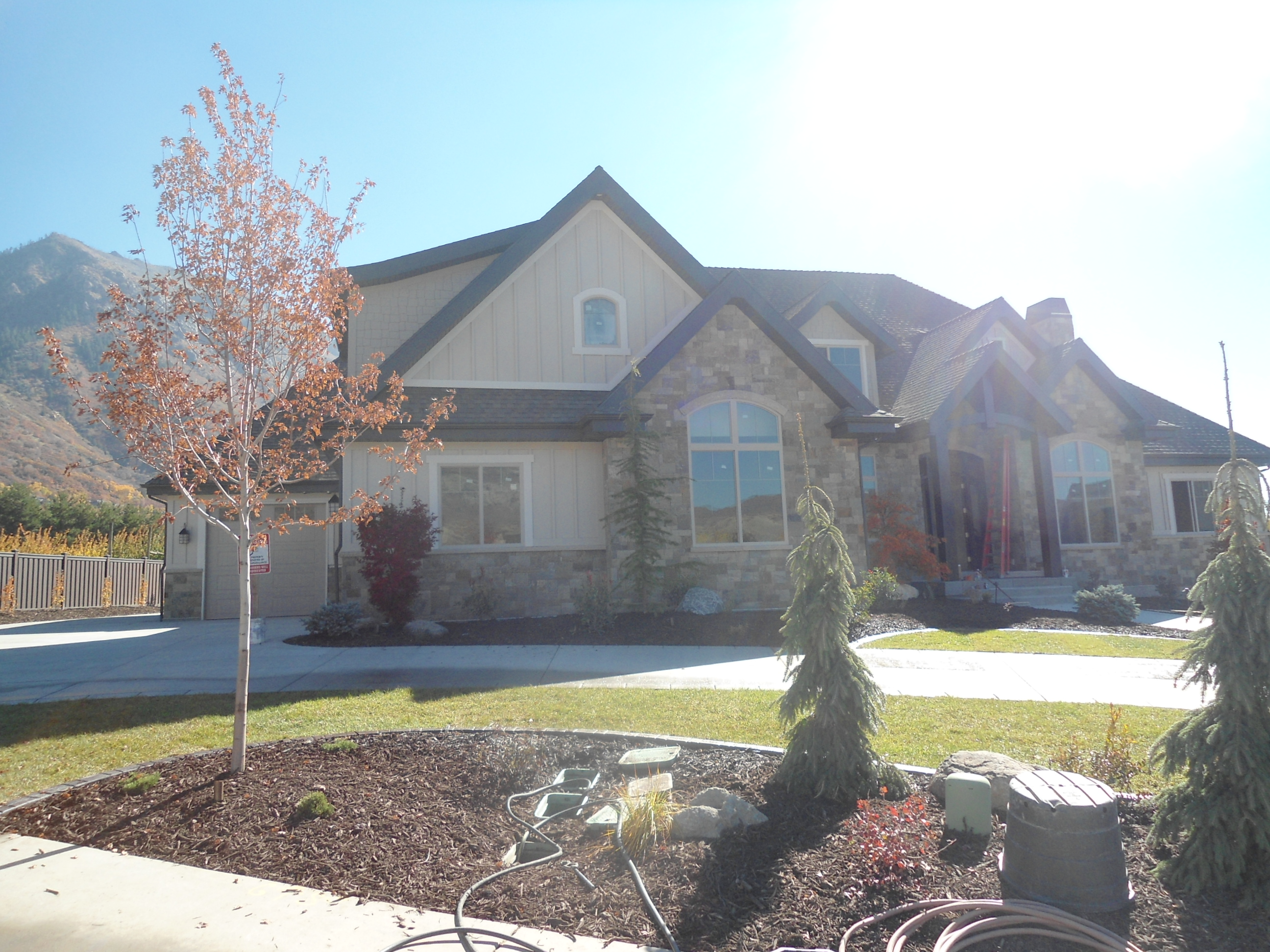 Total Photos: 1
|
| |
|
|
| Property Address: 1192 E FOX MEADOW - ALPINE |
|
| Mailing Address: 1192 E FOX MEADOW LN ALPINE, UT 84004 |
|
| Acreage: 0.946 |
|
| Last Document:
33820-2007
|
|
| Subdivision Map Filing |
|
| Taxing Description:
LOT 3, PLAT B, MC NIEL SUBDV. AREA 0.946 AC.
*Taxing description NOT FOR LEGAL DOCUMENTS
|
|
- Owner Names
- Value History
- Tax History
- Location
- Photos
- Documents
- Aerial Image
| |
----- Real Estate Values ----- |
---Improvements--- |
---Greenbelt--- |
Total |
| Year |
Com |
Res |
Agr |
Tot |
Com |
Res |
Agr |
Tot |
Land |
Homesite |
Tot |
Market Value |
| 2024 |
$0 |
$834,500 |
$0 |
$834,500 |
$0 |
$1,832,800 |
$0 |
$1,832,800 |
$0 |
$0 |
$0 |
$2,667,300 |
| 2023 |
$0 |
$758,600 |
$0 |
$758,600 |
$0 |
$1,986,700 |
$0 |
$1,986,700 |
$0 |
$0 |
$0 |
$2,745,300 |
| 2022 |
$0 |
$795,100 |
$0 |
$795,100 |
$0 |
$1,614,700 |
$0 |
$1,614,700 |
$0 |
$0 |
$0 |
$2,409,800 |
| 2021 |
$0 |
$567,900 |
$0 |
$567,900 |
$0 |
$1,170,100 |
$0 |
$1,170,100 |
$0 |
$0 |
$0 |
$1,738,000 |
| 2020 |
$0 |
$516,300 |
$0 |
$516,300 |
$0 |
$1,170,100 |
$0 |
$1,170,100 |
$0 |
$0 |
$0 |
$1,686,400 |
| 2019 |
$0 |
$516,300 |
$0 |
$516,300 |
$0 |
$1,079,300 |
$0 |
$1,079,300 |
$0 |
$0 |
$0 |
$1,595,600 |
| 2018 |
$0 |
$432,700 |
$0 |
$432,700 |
$0 |
$1,070,200 |
$0 |
$1,070,200 |
$0 |
$0 |
$0 |
$1,502,900 |
| 2017 |
$0 |
$334,400 |
$0 |
$334,400 |
$0 |
$1,042,900 |
$0 |
$1,042,900 |
$0 |
$0 |
$0 |
$1,377,300 |
| 2016 |
$0 |
$334,400 |
$0 |
$334,400 |
$0 |
$1,027,400 |
$0 |
$1,027,400 |
$0 |
$0 |
$0 |
$1,361,800 |
| 2015 |
$0 |
$334,400 |
$0 |
$334,400 |
$0 |
$506,600 |
$0 |
$506,600 |
$0 |
$0 |
$0 |
$841,000 |
| 2014 |
$0 |
$309,800 |
$0 |
$309,800 |
$0 |
$354,700 |
$0 |
$354,700 |
$0 |
$0 |
$0 |
$664,500 |
| 2013 |
$0 |
$290,800 |
$0 |
$290,800 |
$0 |
$0 |
$0 |
$0 |
$0 |
$0 |
$0 |
$290,800 |
| 2012 |
$0 |
$203,700 |
$0 |
$203,700 |
$0 |
$0 |
$0 |
$0 |
$0 |
$0 |
$0 |
$203,700 |
| 2011 |
$0 |
$215,400 |
$0 |
$215,400 |
$0 |
$0 |
$0 |
$0 |
$0 |
$0 |
$0 |
$215,400 |
| 2010 |
$0 |
$195,000 |
$0 |
$195,000 |
$0 |
$0 |
$0 |
$0 |
$0 |
$0 |
$0 |
$195,000 |
| 2009 |
$0 |
$195,000 |
$0 |
$195,000 |
$0 |
$0 |
$0 |
$0 |
$0 |
$0 |
$0 |
$195,000 |
| 2008 |
$0 |
$481,600 |
$0 |
$481,600 |
$0 |
$0 |
$0 |
$0 |
$0 |
$0 |
$0 |
$481,600 |
| 2007 |
$0 |
$430,000 |
$0 |
$430,000 |
$0 |
$0 |
$0 |
$0 |
$0 |
$0 |
$0 |
$430,000 |
| Year |
General Taxes |
Adjustments |
Net Taxes |
Fees |
Payments |
Tax Balance* |
Balance Due |
Tax District |
| 2025 |
$0.00 |
$0.00 |
$0.00 |
$0.00 |
|
$0.00
|
$0.00 |
040 - ALPINE CITY |
| 2024 |
$12,586.99 |
$0.00 |
$12,586.99 |
$0.00 |
|
|
Click for Payoff
|
040 - ALPINE CITY |
| 2023 |
$12,067.24 |
$0.00 |
$12,067.24 |
$0.00 |
|
|
Click for Payoff
|
040 - ALPINE CITY |
| 2022 |
$10,906.63 |
$0.00 |
$10,906.63 |
$0.00 |
|
$0.00
|
$0.00 |
040 - ALPINE CITY |
| 2021 |
$9,207.23 |
$0.00 |
$9,207.23 |
$0.00 |
|
$0.00
|
$0.00 |
040 - ALPINE CITY |
| 2020 |
$9,128.65 |
$0.00 |
$9,128.65 |
$0.00 |
|
$0.00
|
$0.00 |
040 - ALPINE CITY |
| 2019 |
$8,273.82 |
$0.00 |
$8,273.82 |
$0.00 |
|
$0.00
|
$0.00 |
040 - ALPINE CITY |
| 2018 |
$7,887.37 |
$0.00 |
$7,887.37 |
$0.00 |
|
$0.00
|
$0.00 |
040 - ALPINE CITY |
| 2017 |
$7,470.61 |
$0.00 |
$7,470.61 |
$0.00 |
|
$0.00
|
$0.00 |
040 - ALPINE CITY |
| 2016 |
$7,922.82 |
$0.00 |
$7,922.82 |
$0.00 |
|
$0.00
|
$0.00 |
040 - ALPINE CITY |
| 2015 |
$5,172.23 |
$0.00 |
$5,172.23 |
$0.00 |
|
$0.00
|
$0.00 |
040 - ALPINE CITY |
| 2014 |
$4,130.96 |
$0.00 |
$4,130.96 |
$0.00 |
|
$0.00
|
$0.00 |
040 - ALPINE CITY |
| 2013 |
$3,549.21 |
$0.00 |
$3,549.21 |
$0.00 |
|
$0.00
|
$0.00 |
040 - ALPINE CITY |
| 2012 |
$2,556.84 |
$0.00 |
$2,556.84 |
$0.00 |
|
$0.00
|
$0.00 |
040 - ALPINE CITY |
| 2011 |
$2,689.92 |
$0.00 |
$2,689.92 |
$0.00 |
|
$0.00
|
$0.00 |
040 - ALPINE CITY |
| 2010 |
$2,181.47 |
$0.00 |
$2,181.47 |
$0.00 |
|
$0.00
|
$0.00 |
040 - ALPINE CITY |
| 2009 |
$4,955.18 |
($2,948.82) |
$2,006.36 |
$0.00 |
|
$0.00
|
$0.00 |
040 - ALPINE CITY |
| 2008 |
$4,574.72 |
$0.00 |
$4,574.72 |
$0.00 |
|
$0.00
|
$0.00 |
040 - ALPINE CITY |
| 2007 |
$4,004.16 |
$0.00 |
$4,004.16 |
$0.00 |
|
$0.00
|
$0.00 |
040 - ALPINE CITY |
* Note: Original tax amount (Does not include applicable interest and/or fees).
| Entry # |
Date |
Recorded |
Type |
Party1 (Grantor) |
Party2 (Grantee) |
| 203651-2021 |
09/24/2019 |
12/08/2021 |
WD |
HORSTMEIER, PAUL & KARRYL |
HORSTMEIER, PAUL H & KARRYL N TEE (ET AL) |
| 8747-2013 |
01/28/2013 |
01/29/2013 |
WD |
CHYNOWETH, ROBERT & KELLI |
HORSTMEIER, PAUL & KARRYL |
| 114949-2008 |
10/20/2008 |
10/22/2008 |
CT |
STATE OF UTAH |
WHOM OF INTEREST |
| 107508-2008 |
09/30/2008 |
09/30/2008 |
RESOL |
BOARD OF COUNTY COMMISSIONERS UTAH COUNTY |
WHOM OF INTEREST |
| 50088-2007 |
03/07/2007 |
04/05/2007 |
REC |
DIVERSIFIED PLANNING PROFIT SHARING TRUST JULY 1 1986 (ET AL) |
JONES, WILL S |
| 33820-2007 |
03/01/2007 |
03/07/2007 |
WD |
JONES, WILL S |
CHYNOWETH, ROBERT & KELLI |
| 153449-2006 |
10/17/2006 |
11/15/2006 |
REC |
BANK OF AMERICAN FORK TEE |
JONES, WILL S |
| 93001-2006 |
07/21/2006 |
07/25/2006 |
R FARM |
UTAH COUNTY TREASURER |
MOYLE, H LAMAR (ET AL) |
| 92998-2006 |
07/21/2006 |
07/25/2006 |
R FARM |
UTAH COUNTY TREASURER |
MCDANIEL, WAYNE P (ET AL) |
| 92081-2006 |
07/18/2006 |
07/20/2006 |
CT |
STATE OF UTAH |
WHOM OF INTEREST |
| 87300-2006 |
06/13/2006 |
07/11/2006 |
S PLAT |
JONES, WILL S |
MC NIEL PLAT B |
Main Menu Comments or Concerns on Value/Appraisal - Assessor's Office
Documents/Owner/Parcel information - Recorder's Office
Address Change for Tax Notice
This page was created on 12/11/2024 8:25:45 AM |