Property Information
mobile view
| Serial Number: 46:697:0003 |
Serial Life: 2021... |
|
|
 Total Photos: 1
|
| |
|
|
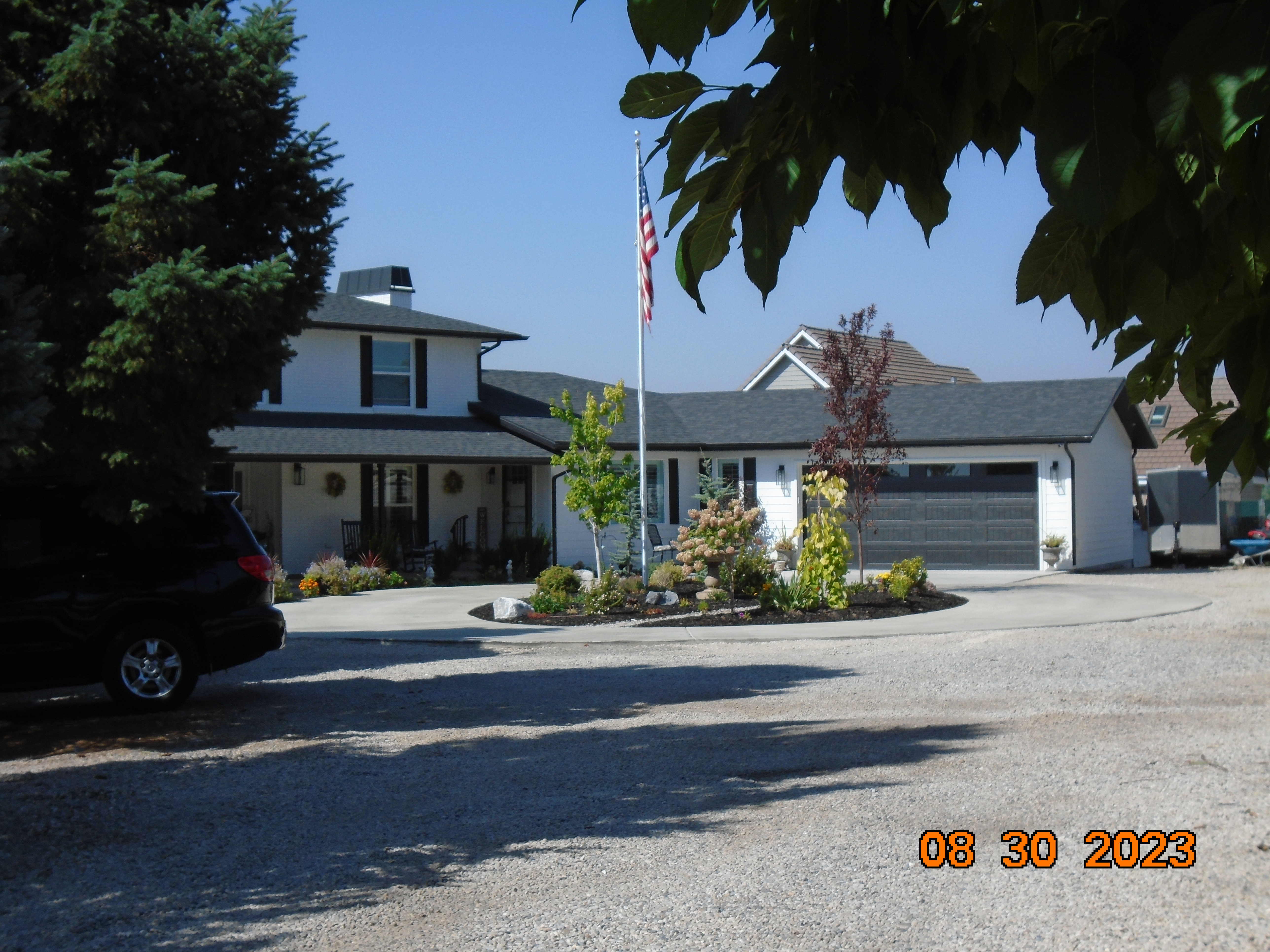
| Property Address: 1097 N 150 WEST - AMERICAN FORK |
|
| Mailing Address: 1097 N 150 W AMERICAN FORK, UT 84003-3711 |
|
| Acreage: 0.934301 |
|
| Last Document:
134884-2020
|
|
| Subdivision Map Filing |
|
| Taxing Description:
LOT 1, PLAT B, MILLER HILLTOP SUBDV. AREA 0.791 AC. ALSO PART LOT 2, PLAT A, MILLER HILLTOP SUB DESCRIBED AS FOLLOWS:; COM S 2647.35 FT & W 541.38 FT FR N 1/4 COR. SEC. 11, T5S, R1E, SLB&M.; S 89 DEG 49' 13" E 11.69 FT; S 0 DEG 56' 0" W 171.1 FT; W 33.05 FT; N 8 DEG 1' 57" E 172.81 FT TO BEG. AREA 0.088 AC. ALSO COM S 2848.73 FT & W 401.58 FT FR N 1/4 COR. SEC. 11, T5S, R1E, SLB&M.; N 79 DEG 15' 55" W 162.48 FT; N 89 DEG 59' 59" E 159.65 FT; S 0 DEG 0' 20" W 30.27 FT TO BEG. AREA 0.055 AC. TOTAL AREA .934 AC.
*Taxing description NOT FOR LEGAL DOCUMENTS
|
|
- Owner Names
- Value History
- Tax History
- Location
- Photos
- Documents
- Aerial Image
| |
----- Real Estate Values ----- |
---Improvements--- |
---Greenbelt--- |
Total |
| Year |
Com |
Res |
Agr |
Tot |
Com |
Res |
Agr |
Tot |
Land |
Homesite |
Tot |
Market Value |
| 2024 |
$0 |
$301,300 |
$0 |
$301,300 |
$0 |
$667,100 |
$0 |
$667,100 |
$0 |
$0 |
$0 |
$968,400 |
| 2023 |
$0 |
$301,200 |
$0 |
$301,200 |
$0 |
$487,100 |
$0 |
$487,100 |
$0 |
$0 |
$0 |
$788,300 |
| 2022 |
$0 |
$317,800 |
$0 |
$317,800 |
$0 |
$504,100 |
$0 |
$504,100 |
$0 |
$0 |
$0 |
$821,900 |
| 2021 |
$0 |
$198,600 |
$0 |
$198,600 |
$0 |
$381,900 |
$0 |
$381,900 |
$0 |
$0 |
$0 |
$580,500 |
| Year |
General Taxes |
Adjustments |
Net Taxes |
Fees |
Payments |
Tax Balance* |
Balance Due |
Tax District |
| 2025 |
$0.00 |
$0.00 |
$0.00 |
$0.00 |
|
$0.00
|
$0.00 |
060 - AMERICAN FORK CITY |
| 2024 |
$4,793.58 |
$0.00 |
$4,793.58 |
$0.00 |
|
$0.00
|
$0.00 |
060 - AMERICAN FORK CITY |
| 2023 |
$3,680.53 |
$0.00 |
$3,680.53 |
$0.00 |
|
$0.00
|
$0.00 |
060 - AMERICAN FORK CITY |
| 2022 |
$3,888.49 |
$0.00 |
$3,888.49 |
$0.00 |
|
$0.00
|
$0.00 |
060 - AMERICAN FORK CITY |
| 2021 |
$3,196.90 |
$0.00 |
$3,196.90 |
$0.00 |
|
$0.00
|
$0.00 |
060 - AMERICAN FORK CITY |
* Note: Original tax amount (Does not include applicable interest and/or fees).
| Entry # |
Date |
Recorded |
Type |
Party1 (Grantor) |
Party2 (Grantee) |
| 51838-2023 |
08/03/2023 |
08/09/2023 |
D TR |
HODGSON, ROSEANNE V & CLAYTON W |
ALPINE CREDIT UNION |
| 148009-2020 |
09/25/2020 |
09/28/2020 |
RSUBTEE |
WELLS FARGO BANK (ET AL) |
MILLER, RYAN J |
| 134884-2020 |
08/27/2020 |
09/04/2020 |
WD |
HODGSON, ROESANNE V & CLAYTON W |
HODGSON, ROSEANNE V & CLAYTON W |
Main Menu Comments or Concerns on Value/Appraisal - Assessor's Office
Documents/Owner/Parcel information - Recorder's Office
Address Change for Tax Notice
This page was created on 1/21/2025 8:02:21 PM |