Property Information
mobile view
| Serial Number: 46:958:0103 |
Serial Life: 2017... |
|
|
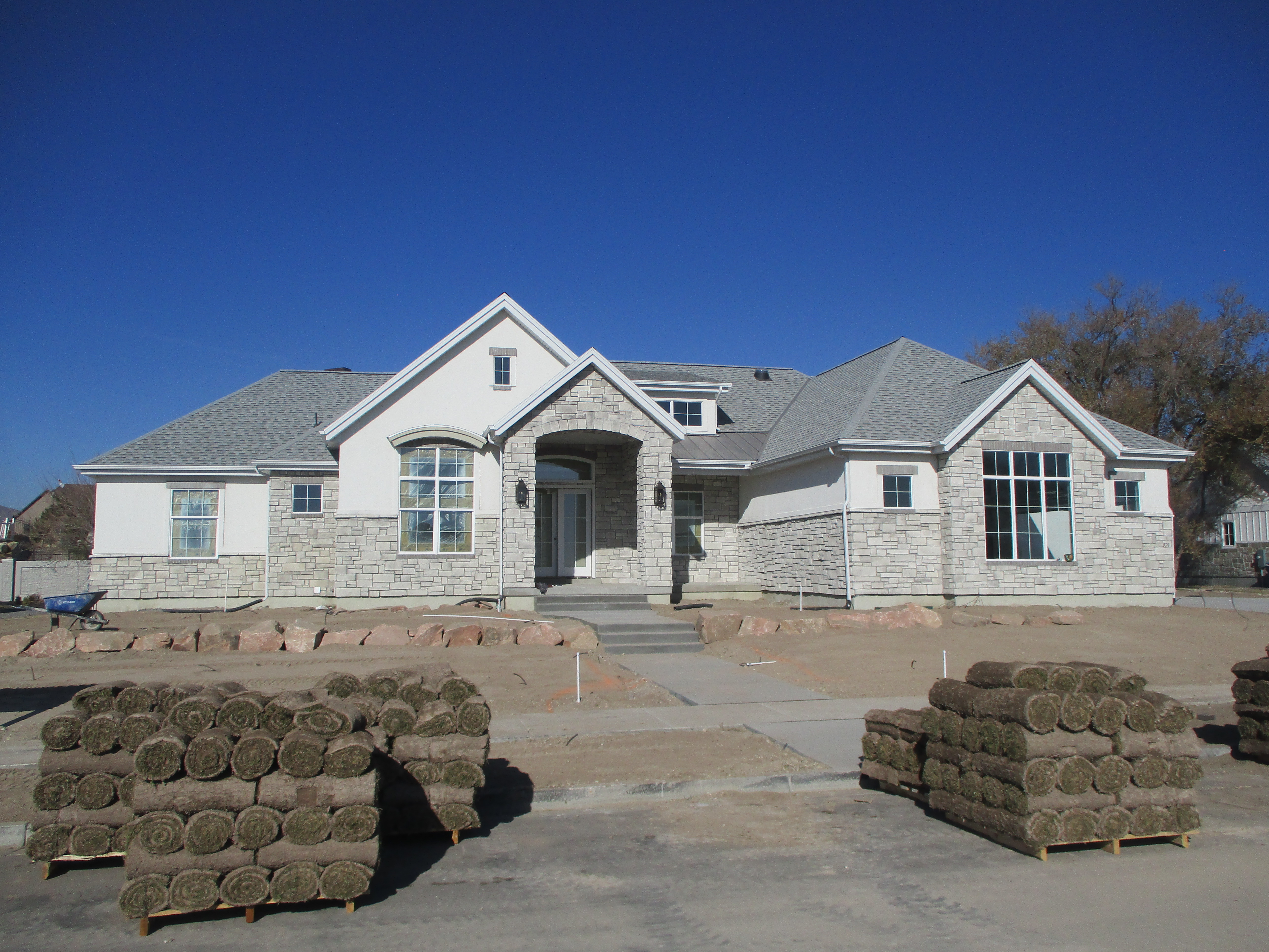 Total Photos: 2
|
| |
|
|
| Property Address: 821 W 1000 NORTH CIR - AMERICAN FORK |
|
| Mailing Address: 821 W 1000 N CIR AMERICAN FORK, UT 84003 |
|
| Acreage: 0.397146 |
|
| Last Document:
83276-2018
|
|
| Subdivision Map Filing |
|
| Taxing Description:
LOT 103, PLAT B, MITCHELL MEADOWS SUB AREA 0.397 AC.
*Taxing description NOT FOR LEGAL DOCUMENTS
|
|
- Owner Names
- Value History
- Tax History
- Location
- Photos
- Documents
- Aerial Image
| |
----- Real Estate Values ----- |
---Improvements--- |
---Greenbelt--- |
Total |
| Year |
Com |
Res |
Agr |
Tot |
Com |
Res |
Agr |
Tot |
Land |
Homesite |
Tot |
Market Value |
| 2024 |
$0 |
$311,700 |
$0 |
$311,700 |
$0 |
$1,238,500 |
$0 |
$1,238,500 |
$0 |
$0 |
$0 |
$1,550,200 |
| 2023 |
$0 |
$283,400 |
$0 |
$283,400 |
$0 |
$1,208,200 |
$0 |
$1,208,200 |
$0 |
$0 |
$0 |
$1,491,600 |
| 2022 |
$0 |
$298,000 |
$0 |
$298,000 |
$0 |
$1,044,800 |
$0 |
$1,044,800 |
$0 |
$0 |
$0 |
$1,342,800 |
| 2021 |
$0 |
$229,200 |
$0 |
$229,200 |
$0 |
$779,700 |
$0 |
$779,700 |
$0 |
$0 |
$0 |
$1,008,900 |
| 2020 |
$0 |
$212,200 |
$0 |
$212,200 |
$0 |
$742,900 |
$0 |
$742,900 |
$0 |
$0 |
$0 |
$955,100 |
| 2019 |
$0 |
$212,200 |
$0 |
$212,200 |
$0 |
$0 |
$0 |
$0 |
$0 |
$0 |
$0 |
$212,200 |
| 2018 |
$0 |
$204,000 |
$0 |
$204,000 |
$0 |
$0 |
$0 |
$0 |
$0 |
$0 |
$0 |
$204,000 |
| 2017 |
$0 |
$167,300 |
$0 |
$167,300 |
$0 |
$0 |
$0 |
$0 |
$0 |
$0 |
$0 |
$167,300 |
| Year |
General Taxes |
Adjustments |
Net Taxes |
Fees |
Payments |
Tax Balance* |
Balance Due |
Tax District |
| 2025 |
$0.00 |
$0.00 |
$0.00 |
$0.00 |
|
$0.00
|
$0.00 |
060 - AMERICAN FORK CITY |
| 2024 |
$0.00 |
$0.00 |
$0.00 |
$0.00 |
|
$0.00
|
$0.00 |
060 - AMERICAN FORK CITY |
| 2023 |
$6,964.21 |
$0.00 |
$6,964.21 |
$0.00 |
|
$0.00
|
$0.00 |
060 - AMERICAN FORK CITY |
| 2022 |
$6,352.92 |
$0.00 |
$6,352.92 |
$0.00 |
|
$0.00
|
$0.00 |
060 - AMERICAN FORK CITY |
| 2021 |
$5,556.16 |
$0.00 |
$5,556.16 |
$0.00 |
|
$0.00
|
$0.00 |
060 - AMERICAN FORK CITY |
| 2020 |
$5,423.25 |
$0.00 |
$5,423.25 |
$0.00 |
|
$0.00
|
$0.00 |
060 - AMERICAN FORK CITY |
| 2019 |
$2,118.18 |
$0.00 |
$2,118.18 |
$0.00 |
|
$0.00
|
$0.00 |
060 - AMERICAN FORK CITY |
| 2018 |
$2,129.76 |
$0.00 |
$2,129.76 |
$0.00 |
|
$0.00
|
$0.00 |
060 - AMERICAN FORK CITY |
| 2017 |
$1,779.90 |
$0.00 |
$1,779.90 |
$0.00 |
|
$0.00
|
$0.00 |
060 - AMERICAN FORK CITY |
* Note: Original tax amount (Does not include applicable interest and/or fees).
| Entry # |
Date |
Recorded |
Type |
Party1 (Grantor) |
Party2 (Grantee) |
| 112450-2020 |
07/18/2020 |
08/03/2020 |
D TR |
GOODRICH, STEPHEN & SHARON |
US BANK NATIONAL ASSOCIATION |
| 83276-2018 |
08/29/2018 |
08/31/2018 |
WD |
ERFERT, KATHRYN & RYAN |
GOODRICH, STEPHEN & SHARON |
| 63884-2017 |
06/09/2017 |
06/30/2017 |
P REC |
CENTRAL BANK TEE |
G A R MEDICAL AND MANAGEMENT INC |
| 52990-2017 |
05/31/2017 |
06/01/2017 |
WD |
G A R MEDICAL AND MANAGEMENT INC |
ERFERT, KATHRYN & RYAN |
| 116769-2016 |
11/18/2016 |
11/18/2016 |
R FARM |
UTAH COUNTY TREASURER |
RICHARDS, GUY A & GUY E |
| 105113-2016 |
10/13/2016 |
10/20/2016 |
W FARM |
G A R MEDICAL AND MANAGEMENT INC (ET AL) |
WHOM OF INTEREST |
| 84235-2016 |
06/28/2016 |
08/31/2016 |
S PLAT |
GSR PROPERTIES LLC (ET AL) |
MITCHELL MEADOWS PLAT B |
Main Menu Comments or Concerns on Value/Appraisal - Assessor's Office
Documents/Owner/Parcel information - Recorder's Office
Address Change for Tax Notice
This page was created on 9/29/2024 4:35:30 AM |
