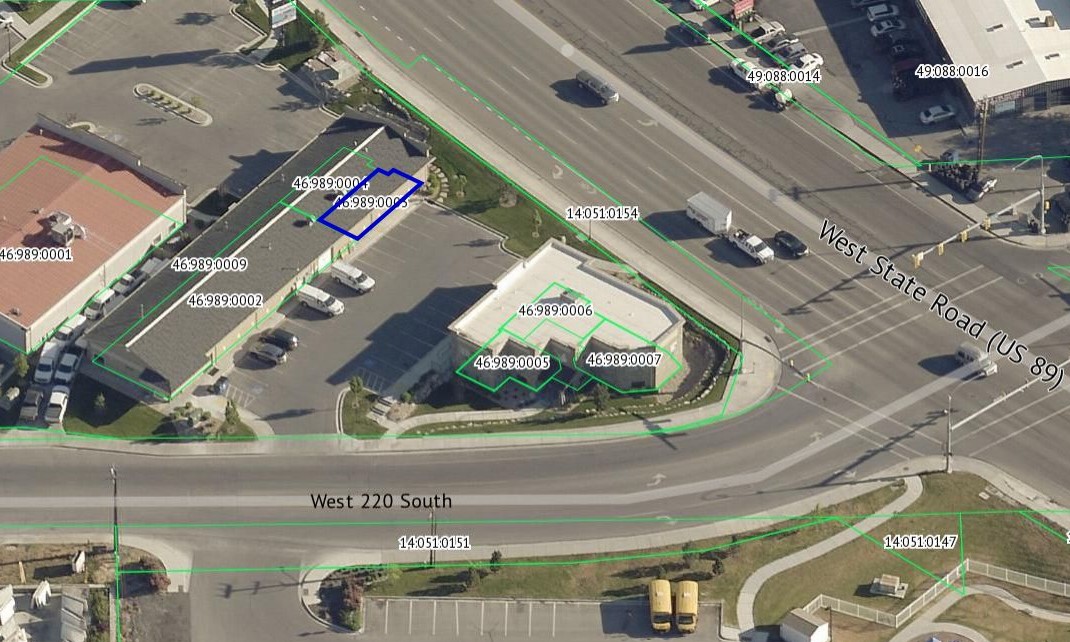
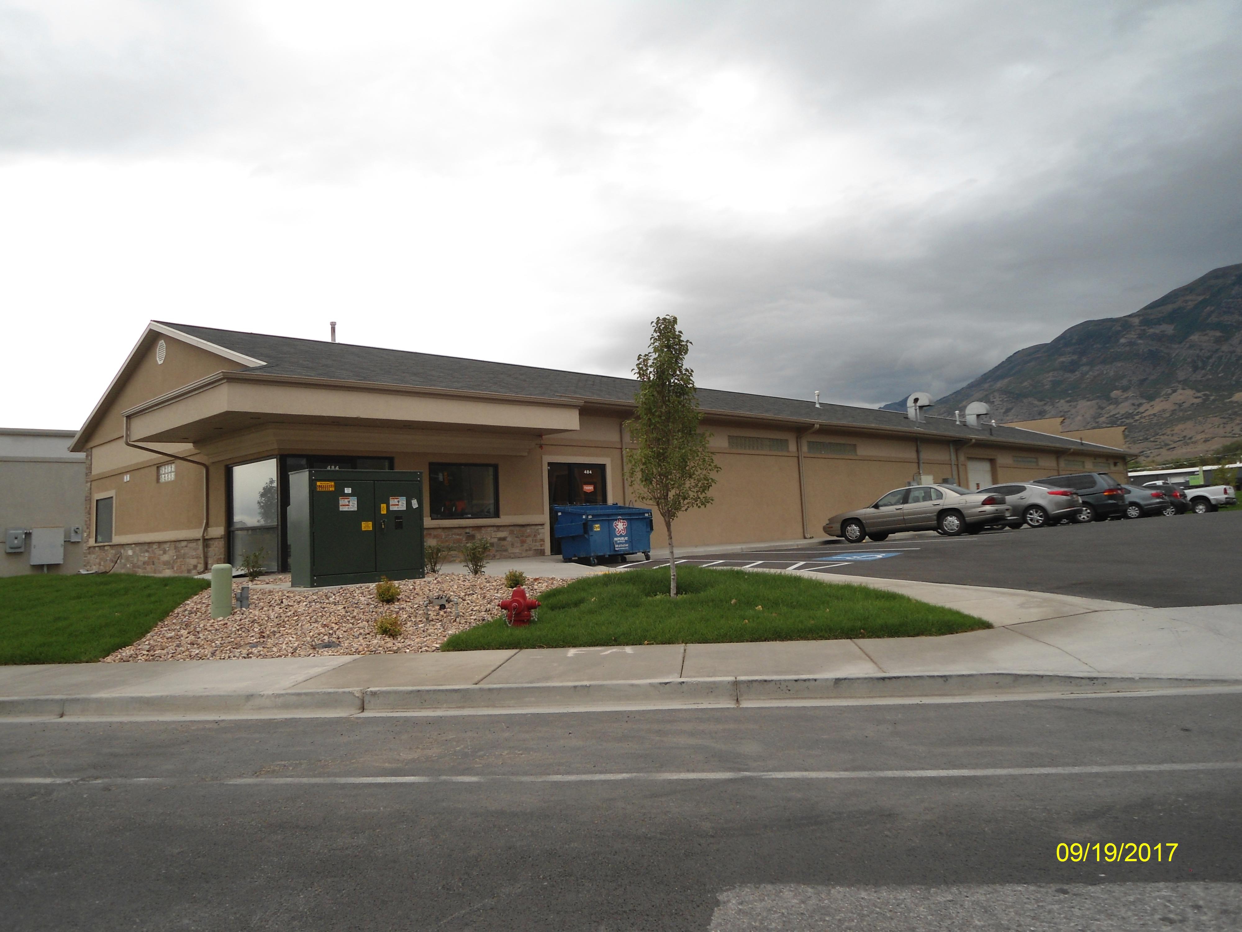
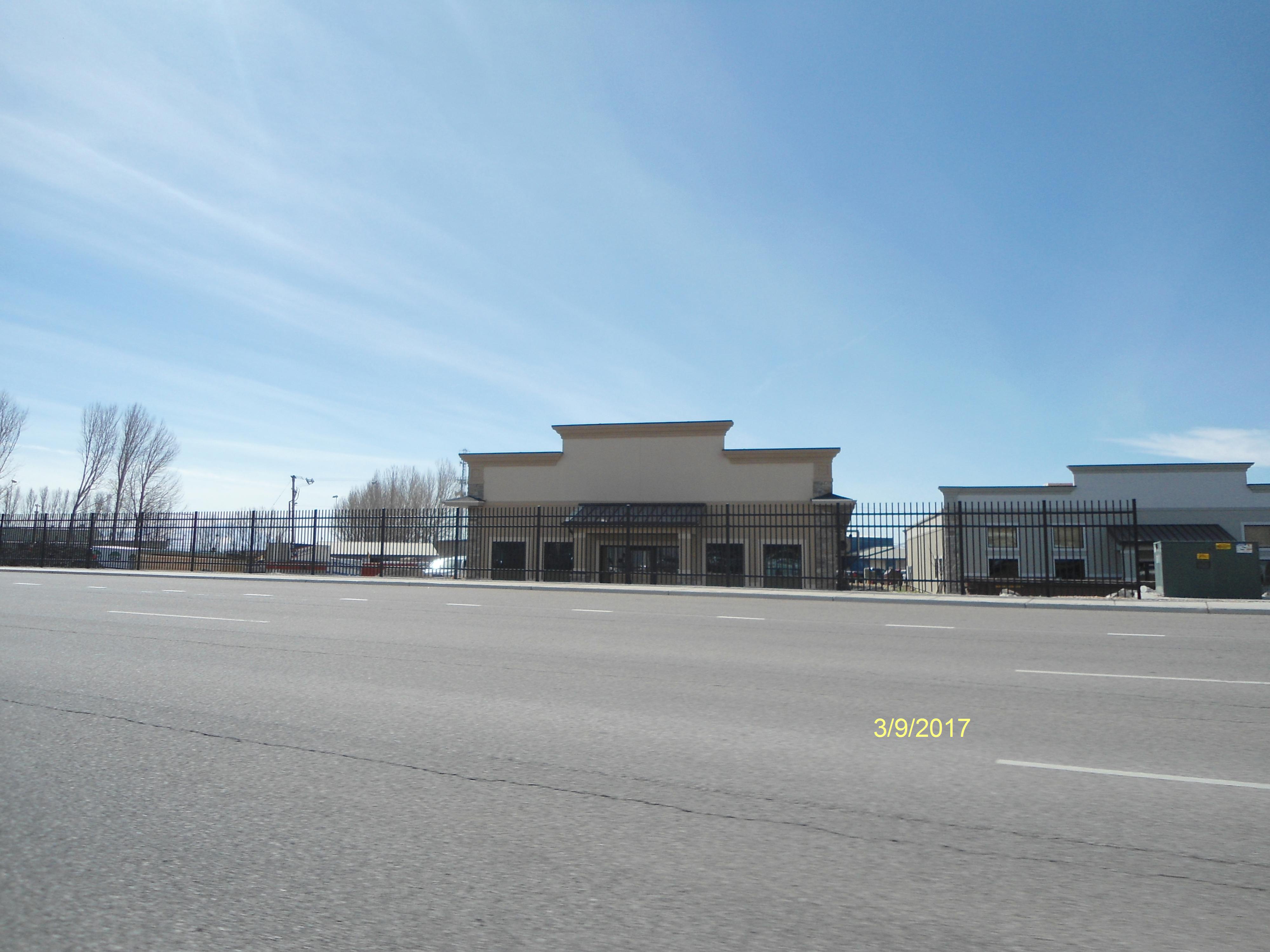
Property Information
mobile view
| Serial Number: 46:989:0003 |
Serial Life: 2018... |
|
|
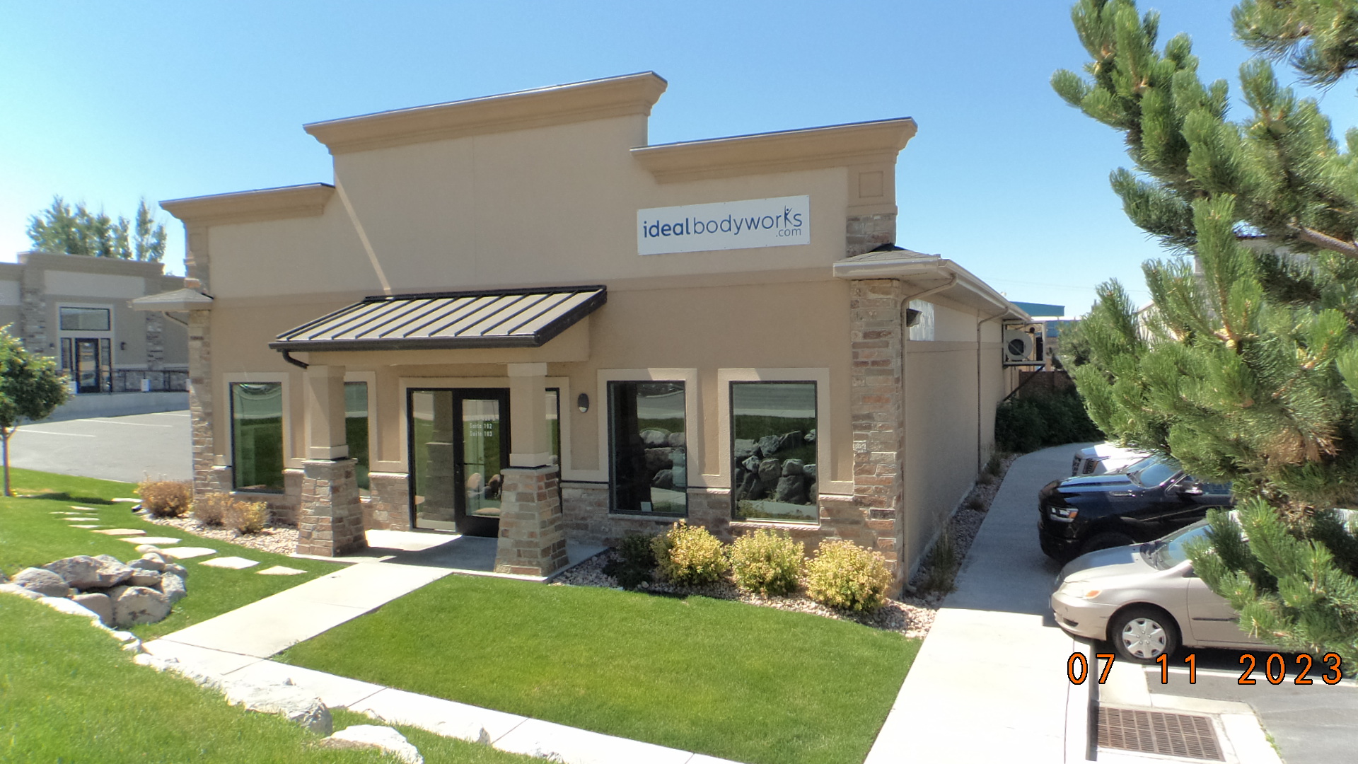 Total Photos: 9
|
| |
|
|
| Property Address: 484 W 220 SOUTH Unit# M-102 - PLEASANT GROVE |
|
| Mailing Address: 926 N FORT CANYON RD ALPINE, UT 84004 |
|
| Acreage: 0.017265 |
|
| Last Document:
125124-2017
|
|
| Subdivision Map Filing |
|
| Taxing Description:
UNIT M-102, PLAT G, MAJESTIC MEADOWS CONDOMINIUMS. AREA 0.017 AC.
*Taxing description NOT FOR LEGAL DOCUMENTS
|
|
- Owner Names
- Value History
- Tax History
- Location
- Photos
- Documents
- Aerial Image
| |
----- Real Estate Values ----- |
---Improvements--- |
---Greenbelt--- |
Total |
| Year |
Com |
Res |
Agr |
Tot |
Com |
Res |
Agr |
Tot |
Land |
Homesite |
Tot |
Market Value |
| 2024 |
$45,600 |
$0 |
$0 |
$45,600 |
$92,900 |
$0 |
$0 |
$92,900 |
$0 |
$0 |
$0 |
$138,500 |
| 2023 |
$44,700 |
$0 |
$0 |
$44,700 |
$91,100 |
$0 |
$0 |
$91,100 |
$0 |
$0 |
$0 |
$135,800 |
| 2022 |
$44,700 |
$0 |
$0 |
$44,700 |
$79,700 |
$0 |
$0 |
$79,700 |
$0 |
$0 |
$0 |
$124,400 |
| 2021 |
$44,700 |
$0 |
$0 |
$44,700 |
$79,700 |
$0 |
$0 |
$79,700 |
$0 |
$0 |
$0 |
$124,400 |
| 2020 |
$44,700 |
$0 |
$0 |
$44,700 |
$79,700 |
$0 |
$0 |
$79,700 |
$0 |
$0 |
$0 |
$124,400 |
| 2019 |
$44,700 |
$0 |
$0 |
$44,700 |
$68,400 |
$0 |
$0 |
$68,400 |
$0 |
$0 |
$0 |
$113,100 |
| 2018 |
$29,800 |
$0 |
$0 |
$29,800 |
$79,900 |
$0 |
$0 |
$79,900 |
$0 |
$0 |
$0 |
$109,700 |
| Year |
General Taxes |
Adjustments |
Net Taxes |
Fees |
Payments |
Tax Balance* |
Balance Due |
Tax District |
| 2025 |
$0.00 |
$0.00 |
$0.00 |
$0.00 |
|
$0.00
|
$0.00 |
070 - PLEASANT GROVE CITY |
| 2024 |
$1,186.81 |
$0.00 |
$1,186.81 |
$0.00 |
|
$0.00
|
$0.00 |
070 - PLEASANT GROVE CITY |
| 2023 |
$1,111.52 |
($25.80) |
$1,085.72 |
$0.00 |
|
$0.00
|
$0.00 |
070 - PLEASANT GROVE CITY |
| 2022 |
$1,023.31 |
$0.00 |
$1,023.31 |
$0.00 |
|
$0.00
|
$0.00 |
070 - PLEASANT GROVE CITY |
| 2021 |
$1,221.98 |
$0.00 |
$1,221.98 |
$0.00 |
|
$0.00
|
$0.00 |
070 - PLEASANT GROVE CITY |
| 2020 |
$1,246.49 |
$0.00 |
$1,246.49 |
$0.00 |
|
$0.00
|
$0.00 |
070 - PLEASANT GROVE CITY |
| 2019 |
$1,095.83 |
$0.00 |
$1,095.83 |
$0.00 |
|
$0.00
|
$0.00 |
070 - PLEASANT GROVE CITY |
| 2018 |
$1,124.10 |
$0.00 |
$1,124.10 |
$0.00 |
|
$0.00
|
$0.00 |
070 - PLEASANT GROVE CITY |
* Note: Original tax amount (Does not include applicable interest and/or fees).
| Entry # |
Date |
Recorded |
Type |
Party1 (Grantor) |
Party2 (Grantee) |
| 47131-2020 |
02/05/2020 |
04/10/2020 |
WD |
ALL AMERICAN INVESTMENTS XI LLC |
FORT CREEK INVESTMENTS II LLC |
| 125124-2017 |
12/18/2017 |
12/18/2017 |
WD |
TRIPLE FOCUS LLC |
ALL AMERICAN INVESTMENTS XI LLC |
| 118537-2017 |
10/26/2017 |
11/30/2017 |
N |
PLEASANT GROVE CITY CORP |
WHOM OF INTEREST |
| 94853-2017 |
09/15/2017 |
09/26/2017 |
QCD |
WARBURTON, DALE L |
TRIPLE FOCUS LC |
| 84346-2017 |
06/01/2017 |
08/29/2017 |
DECLSUP |
AA DEVELOPMENT INC (ET AL) |
WHOM OF INTEREST |
| 84345-2017 |
08/11/2017 |
08/29/2017 |
C PLAT |
AA DEVELOPMENT INC (ET AL) |
MAJESTIC MEADOWS CONDO PLAT G |
Main Menu Comments or Concerns on Value/Appraisal - Assessor's Office
Documents/Owner/Parcel information - Recorder's Office
Address Change for Tax Notice
This page was created on 2/7/2025 6:56:02 PM |