Property Information
mobile view
| Serial Number: 47:266:0102 |
Serial Life: 2008... |
|
|
Total Photos: 1
|
| |
|
|
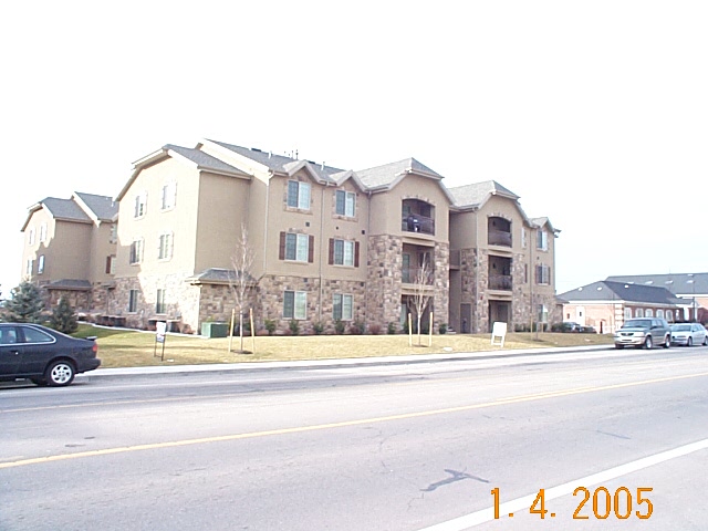
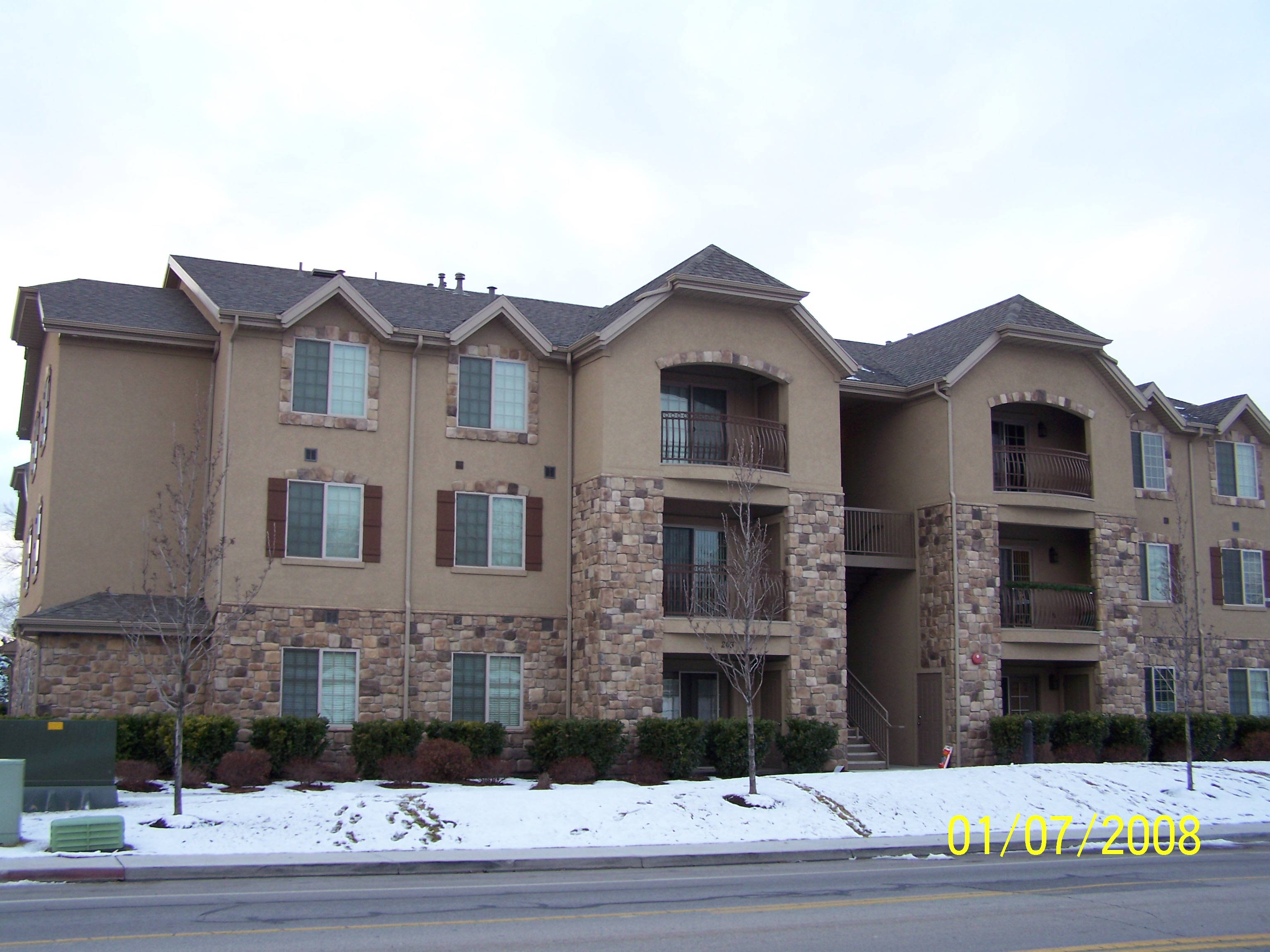
| Property Address: 231 N 1200 WEST Unit#102 - OREM |
|
| Mailing Address: 259 RIVERBEND WAY STE 102 NORTH SALT LAKE, UT 84054 |
|
| Acreage: 0.033 |
|
| Last Document:
86500-2008
|
|
| Subdivision Map Filing |
|
| Taxing Description:
UNIT 102, BUILDING C, NEWPORT VILLAGE 1 PHASE 3 CONDOS. AREA 0.033 AC.
*Taxing description NOT FOR LEGAL DOCUMENTS
|
|
- Owner Names
- Value History
- Tax History
- Location
- Photos
- Documents
- Aerial Image
| |
----- Real Estate Values ----- |
---Improvements--- |
---Greenbelt--- |
Total |
| Year |
Com |
Res |
Agr |
Tot |
Com |
Res |
Agr |
Tot |
Land |
Homesite |
Tot |
Market Value |
| 2024 |
$0 |
$33,300 |
$0 |
$33,300 |
$0 |
$266,600 |
$0 |
$266,600 |
$0 |
$0 |
$0 |
$299,900 |
| 2023 |
$0 |
$34,200 |
$0 |
$34,200 |
$0 |
$273,300 |
$0 |
$273,300 |
$0 |
$0 |
$0 |
$307,500 |
| 2022 |
$0 |
$28,200 |
$0 |
$28,200 |
$0 |
$254,100 |
$0 |
$254,100 |
$0 |
$0 |
$0 |
$282,300 |
| 2021 |
$0 |
$26,600 |
$0 |
$26,600 |
$0 |
$194,800 |
$0 |
$194,800 |
$0 |
$0 |
$0 |
$221,400 |
| 2020 |
$0 |
$23,700 |
$0 |
$23,700 |
$0 |
$173,900 |
$0 |
$173,900 |
$0 |
$0 |
$0 |
$197,600 |
| 2019 |
$0 |
$23,000 |
$0 |
$23,000 |
$0 |
$167,000 |
$0 |
$167,000 |
$0 |
$0 |
$0 |
$190,000 |
| 2018 |
$0 |
$23,000 |
$0 |
$23,000 |
$0 |
$158,100 |
$0 |
$158,100 |
$0 |
$0 |
$0 |
$181,100 |
| 2017 |
$0 |
$23,000 |
$0 |
$23,000 |
$0 |
$141,900 |
$0 |
$141,900 |
$0 |
$0 |
$0 |
$164,900 |
| 2016 |
$0 |
$23,000 |
$0 |
$23,000 |
$0 |
$135,600 |
$0 |
$135,600 |
$0 |
$0 |
$0 |
$158,600 |
| 2015 |
$0 |
$23,000 |
$0 |
$23,000 |
$0 |
$129,500 |
$0 |
$129,500 |
$0 |
$0 |
$0 |
$152,500 |
| 2014 |
$0 |
$23,000 |
$0 |
$23,000 |
$0 |
$129,500 |
$0 |
$129,500 |
$0 |
$0 |
$0 |
$152,500 |
| 2013 |
$0 |
$23,000 |
$0 |
$23,000 |
$0 |
$127,000 |
$0 |
$127,000 |
$0 |
$0 |
$0 |
$150,000 |
| 2012 |
$0 |
$23,000 |
$0 |
$23,000 |
$0 |
$127,000 |
$0 |
$127,000 |
$0 |
$0 |
$0 |
$150,000 |
| 2011 |
$0 |
$23,000 |
$0 |
$23,000 |
$0 |
$127,000 |
$0 |
$127,000 |
$0 |
$0 |
$0 |
$150,000 |
| 2010 |
$0 |
$23,800 |
$0 |
$23,800 |
$0 |
$129,400 |
$0 |
$129,400 |
$0 |
$0 |
$0 |
$153,200 |
| 2009 |
$0 |
$23,800 |
$0 |
$23,800 |
$0 |
$135,000 |
$0 |
$135,000 |
$0 |
$0 |
$0 |
$158,800 |
| 2008 |
$0 |
$32,000 |
$0 |
$32,000 |
$0 |
$148,000 |
$0 |
$148,000 |
$0 |
$0 |
$0 |
$180,000 |
| Year |
General Taxes |
Adjustments |
Net Taxes |
Fees |
Payments |
Tax Balance* |
Balance Due |
Tax District |
| 2025 |
$0.00 |
$0.00 |
$0.00 |
$0.00 |
|
$0.00
|
$0.00 |
090 - OREM CITY |
| 2024 |
$0.00 |
$0.00 |
$0.00 |
$0.00 |
|
$0.00
|
$0.00 |
090 - OREM CITY |
| 2023 |
$1,286.87 |
$0.00 |
$1,286.87 |
$0.00 |
|
$0.00
|
$0.00 |
090 - OREM CITY |
| 2022 |
$1,219.45 |
$0.00 |
$1,219.45 |
$0.00 |
|
$0.00
|
$0.00 |
090 - OREM CITY |
| 2021 |
$1,148.05 |
$0.00 |
$1,148.05 |
$0.00 |
|
$0.00
|
$0.00 |
090 - OREM CITY |
| 2020 |
$1,042.57 |
$0.00 |
$1,042.57 |
$0.00 |
|
$0.00
|
$0.00 |
090 - OREM CITY |
| 2019 |
$964.01 |
$0.00 |
$964.01 |
$0.00 |
|
$0.00
|
$0.00 |
090 - OREM CITY |
| 2018 |
$961.69 |
$0.00 |
$961.69 |
$0.00 |
|
$0.00
|
$0.00 |
090 - OREM CITY |
| 2017 |
$899.06 |
$0.00 |
$899.06 |
$0.00 |
|
$0.00
|
$0.00 |
090 - OREM CITY |
| 2016 |
$937.72 |
$0.00 |
$937.72 |
$0.00 |
|
$0.00
|
$0.00 |
090 - OREM CITY |
| 2015 |
$953.41 |
$0.00 |
$953.41 |
$0.00 |
|
$0.00
|
$0.00 |
090 - OREM CITY |
| 2014 |
$957.77 |
$0.00 |
$957.77 |
$0.00 |
|
$0.00
|
$0.00 |
090 - OREM CITY |
| 2013 |
$1,015.91 |
$0.00 |
$1,015.91 |
$0.00 |
|
$0.00
|
$0.00 |
090 - OREM CITY |
| 2012 |
$1,036.86 |
$0.00 |
$1,036.86 |
$0.00 |
|
$0.00
|
$0.00 |
090 - OREM CITY |
| 2011 |
$1,031.91 |
$0.00 |
$1,031.91 |
$0.00 |
|
$0.00
|
$0.00 |
090 - OREM CITY |
| 2010 |
$986.68 |
$0.00 |
$986.68 |
$0.00 |
|
$0.00
|
$0.00 |
090 - OREM CITY |
| 2009 |
$948.08 |
$0.00 |
$948.08 |
$0.00 |
|
$0.00
|
$0.00 |
090 - OREM CITY |
| 2008 |
$995.84 |
$0.00 |
$995.84 |
$0.00 |
|
$0.00
|
$0.00 |
090 - OREM CITY |
* Note: Original tax amount (Does not include applicable interest and/or fees).
| Entry # |
Date |
Recorded |
Type |
Party1 (Grantor) |
Party2 (Grantee) |
| 70356-2021 |
04/13/2021 |
04/14/2021 |
MOD AGR |
STS PROPERTIES LLC |
BRIGHTON BANK |
| 105342-2018 |
10/25/2018 |
11/02/2018 |
REC |
BANK OF THE WEST TEE |
STS PROPERTIES LLC |
| 105341-2018 |
10/25/2018 |
11/02/2018 |
RASSIGN |
BANK OF THE WEST |
STS PROPERTIES LLC |
| 100250-2018 |
10/18/2018 |
10/18/2018 |
D TR |
STS PROPERTIES LLC |
BRIGHTON BANK |
| 100249-2018 |
10/18/2018 |
10/18/2018 |
D TR |
STS PROPERTIES LLC |
BRIGHTON BANK |
| 106209-2008 |
09/25/2008 |
09/26/2008 |
ASSIGN |
STS PROPERTIES LLC |
BANK OF THE WEST |
| 106208-2008 |
09/25/2008 |
09/26/2008 |
D TR |
STS PROPERTIES LLC |
BANK OF THE WEST |
| 103001-2008 |
09/08/2008 |
09/18/2008 |
REC |
AMERICAN SECURITIES COMPANY OF UTAH TEE |
WILLIAMSON RENTALS LC |
| 86500-2008 |
07/30/2008 |
08/01/2008 |
SP WD |
WILLIAMSON RENTALS LC |
STS PROPERTIES LLC |
| 171776-2007 |
11/27/2007 |
12/12/2007 |
MOD AGR |
WILLIAMSON RENTALS LC |
WELLS FARGO BANK |
| 171775-2007 |
11/27/2007 |
12/12/2007 |
SP WD |
GUNSMOKE PROPERTIES LLC |
WILLIAMSON RENTALS LC |
| 46318-2007 |
03/23/2007 |
03/30/2007 |
DECLCON |
GUNSMOKE PROPERTIES LLC |
WHOM OF INTEREST |
| 46317-2007 |
03/30/2007 |
03/30/2007 |
C PLAT |
GUNSMOKE PROPERTIES LLC |
NEWPORT VILLAGE 1 PHASE 3 |
Main Menu Comments or Concerns on Value/Appraisal - Assessor's Office
Documents/Owner/Parcel information - Recorder's Office
Address Change for Tax Notice
This page was created on 7/12/2024 2:33:32 AM |