Property Information
mobile view
| Serial Number: 47:269:0304 |
Serial Life: 2008... |
|
|
Total Photos: 1
|
| |
|
|
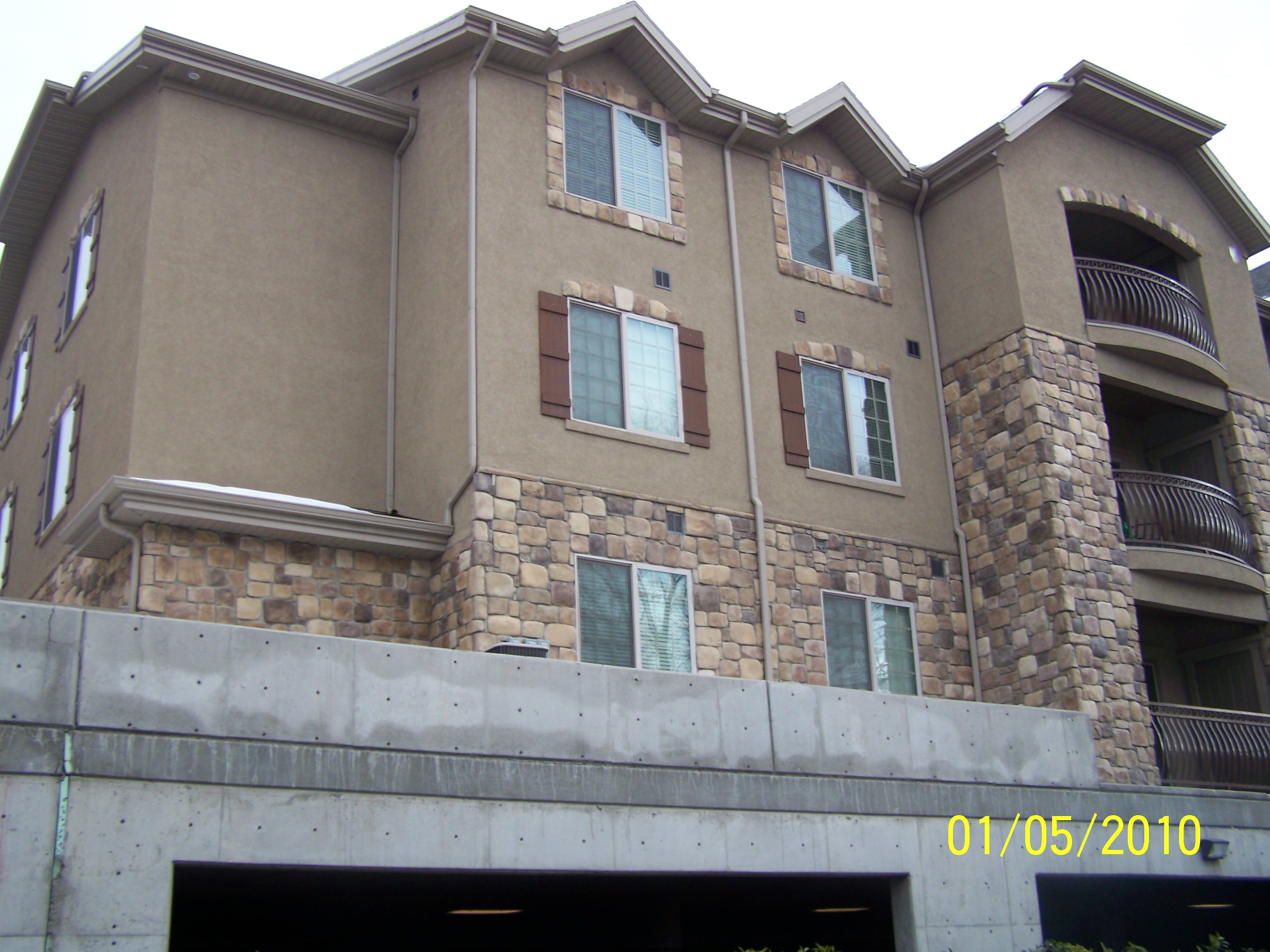
| Property Address: 209 N 1200 WEST Unit#304 - OREM |
|
| Mailing Address: 209 N 1200 W # 304 OREM, UT 84057-4586 |
|
| Acreage: 0.035 |
|
| Last Document:
170732-2020
|
|
| Subdivision Map Filing |
|
| Taxing Description:
UNIT 304, BUILDING F, NEWPORT VILLAGE 1 PHASE 6 CONDOS. AREA 0.035 AC.
*Taxing description NOT FOR LEGAL DOCUMENTS
|
|
- Owner Names
- Value History
- Tax History
- Location
- Photos
- Documents
- Aerial Image
| |
----- Real Estate Values ----- |
---Improvements--- |
---Greenbelt--- |
Total |
| Year |
Com |
Res |
Agr |
Tot |
Com |
Res |
Agr |
Tot |
Land |
Homesite |
Tot |
Market Value |
| 2024 |
$0 |
$33,300 |
$0 |
$33,300 |
$0 |
$266,600 |
$0 |
$266,600 |
$0 |
$0 |
$0 |
$299,900 |
| 2023 |
$0 |
$34,100 |
$0 |
$34,100 |
$0 |
$272,900 |
$0 |
$272,900 |
$0 |
$0 |
$0 |
$307,000 |
| 2022 |
$0 |
$28,200 |
$0 |
$28,200 |
$0 |
$254,100 |
$0 |
$254,100 |
$0 |
$0 |
$0 |
$282,300 |
| 2021 |
$0 |
$26,600 |
$0 |
$26,600 |
$0 |
$194,800 |
$0 |
$194,800 |
$0 |
$0 |
$0 |
$221,400 |
| 2020 |
$0 |
$23,700 |
$0 |
$23,700 |
$0 |
$173,900 |
$0 |
$173,900 |
$0 |
$0 |
$0 |
$197,600 |
| 2019 |
$0 |
$23,000 |
$0 |
$23,000 |
$0 |
$167,000 |
$0 |
$167,000 |
$0 |
$0 |
$0 |
$190,000 |
| 2018 |
$0 |
$23,000 |
$0 |
$23,000 |
$0 |
$158,100 |
$0 |
$158,100 |
$0 |
$0 |
$0 |
$181,100 |
| 2017 |
$0 |
$23,000 |
$0 |
$23,000 |
$0 |
$138,700 |
$0 |
$138,700 |
$0 |
$0 |
$0 |
$161,700 |
| 2016 |
$0 |
$23,000 |
$0 |
$23,000 |
$0 |
$132,500 |
$0 |
$132,500 |
$0 |
$0 |
$0 |
$155,500 |
| 2015 |
$0 |
$23,000 |
$0 |
$23,000 |
$0 |
$126,500 |
$0 |
$126,500 |
$0 |
$0 |
$0 |
$149,500 |
| 2014 |
$0 |
$23,000 |
$0 |
$23,000 |
$0 |
$126,500 |
$0 |
$126,500 |
$0 |
$0 |
$0 |
$149,500 |
| 2013 |
$0 |
$23,000 |
$0 |
$23,000 |
$0 |
$124,000 |
$0 |
$124,000 |
$0 |
$0 |
$0 |
$147,000 |
| 2012 |
$0 |
$23,000 |
$0 |
$23,000 |
$0 |
$124,000 |
$0 |
$124,000 |
$0 |
$0 |
$0 |
$147,000 |
| 2011 |
$0 |
$23,000 |
$0 |
$23,000 |
$0 |
$124,000 |
$0 |
$124,000 |
$0 |
$0 |
$0 |
$147,000 |
| 2010 |
$0 |
$23,300 |
$0 |
$23,300 |
$0 |
$126,500 |
$0 |
$126,500 |
$0 |
$0 |
$0 |
$149,800 |
| 2009 |
$0 |
$23,300 |
$0 |
$23,300 |
$0 |
$132,000 |
$0 |
$132,000 |
$0 |
$0 |
$0 |
$155,300 |
| 2008 |
$0 |
$32,000 |
$0 |
$32,000 |
$0 |
$148,000 |
$0 |
$148,000 |
$0 |
$0 |
$0 |
$180,000 |
| Year |
General Taxes |
Adjustments |
Net Taxes |
Fees |
Payments |
Tax Balance* |
Balance Due |
Tax District |
| 2025 |
$0.00 |
$0.00 |
$0.00 |
$0.00 |
|
$0.00
|
$0.00 |
090 - OREM CITY |
| 2024 |
$0.00 |
$0.00 |
$0.00 |
$0.00 |
|
$0.00
|
$0.00 |
090 - OREM CITY |
| 2023 |
$1,284.78 |
$0.00 |
$1,284.78 |
$0.00 |
|
$0.00
|
$0.00 |
090 - OREM CITY |
| 2022 |
$1,219.45 |
$0.00 |
$1,219.45 |
$0.00 |
|
$0.00
|
$0.00 |
090 - OREM CITY |
| 2021 |
$1,148.05 |
$0.00 |
$1,148.05 |
$0.00 |
|
$0.00
|
$0.00 |
090 - OREM CITY |
| 2020 |
$1,042.57 |
$0.00 |
$1,042.57 |
$0.00 |
|
$0.00
|
$0.00 |
090 - OREM CITY |
| 2019 |
$964.01 |
$0.00 |
$964.01 |
$0.00 |
|
$0.00
|
$0.00 |
090 - OREM CITY |
| 2018 |
$961.69 |
$0.00 |
$961.69 |
$0.00 |
|
$0.00
|
$0.00 |
090 - OREM CITY |
| 2017 |
$881.61 |
$0.00 |
$881.61 |
$0.00 |
|
$0.00
|
$0.00 |
090 - OREM CITY |
| 2016 |
$919.39 |
$0.00 |
$919.39 |
$0.00 |
|
$0.00
|
$0.00 |
090 - OREM CITY |
| 2015 |
$934.65 |
$0.00 |
$934.65 |
$0.00 |
|
$0.00
|
$0.00 |
090 - OREM CITY |
| 2014 |
$938.93 |
$0.00 |
$938.93 |
$0.00 |
|
$0.00
|
$0.00 |
090 - OREM CITY |
| 2013 |
$995.59 |
$0.00 |
$995.59 |
$0.00 |
|
$0.00
|
$0.00 |
090 - OREM CITY |
| 2012 |
$1,016.12 |
$0.00 |
$1,016.12 |
$0.00 |
|
$0.00
|
$0.00 |
090 - OREM CITY |
| 2011 |
$1,011.27 |
$0.00 |
$1,011.27 |
$0.00 |
|
$0.00
|
$0.00 |
090 - OREM CITY |
| 2010 |
$964.79 |
$0.00 |
$964.79 |
$0.00 |
|
$0.00
|
$0.00 |
090 - OREM CITY |
| 2009 |
$927.18 |
$0.00 |
$927.18 |
$0.00 |
|
$0.00
|
$0.00 |
090 - OREM CITY |
| 2008 |
$995.84 |
$0.00 |
$995.84 |
$0.00 |
|
$0.00
|
$0.00 |
090 - OREM CITY |
* Note: Original tax amount (Does not include applicable interest and/or fees).
| Entry # |
Date |
Recorded |
Type |
Party1 (Grantor) |
Party2 (Grantee) |
| 170824-2020 |
10/28/2020 |
10/29/2020 |
D TR |
DESTRO, ELISA |
UTAH COMMUNITY FEDERAL CREDIT UNION |
| 170732-2020 |
10/28/2020 |
10/29/2020 |
WD |
BROOKSTONE-SOA LLC |
DESTRO, ELISA |
| 116366-2013 |
12/26/2013 |
12/26/2013 |
WD |
BROOKSTONE RENTALS LLC |
BROOKSTONE-SOA LLC |
| 79872-2013 |
08/20/2013 |
08/20/2013 |
WD |
ADAMSON, LAYNE KAY |
BROOKSTONE RENTALS LLC |
| 150368-2007 |
10/16/2007 |
10/18/2007 |
QCD |
ADAMSON, KAY |
ADAMSON, LAYNE KAY |
| 150367-2007 |
10/16/2007 |
10/18/2007 |
WD |
GUNSMOKE PROPERTIES LC |
ADAMSON, KAY |
| 46324-2007 |
03/23/2007 |
03/30/2007 |
DECLCON |
GUNSMOKE PROPERTIES LLC |
WHOM OF INTEREST |
| 46323-2007 |
03/30/2007 |
03/30/2007 |
C PLAT |
GUNSMOKE PROPERTIES LLC |
NEWPORT VILLAGE 1 PHASE 6 |
Main Menu Comments or Concerns on Value/Appraisal - Assessor's Office
Documents/Owner/Parcel information - Recorder's Office
Address Change for Tax Notice
This page was created on 7/22/2024 4:40:37 PM |