Property Information
mobile view
| Serial Number: 48:494:0001 |
Serial Life: 2019... |
|
|
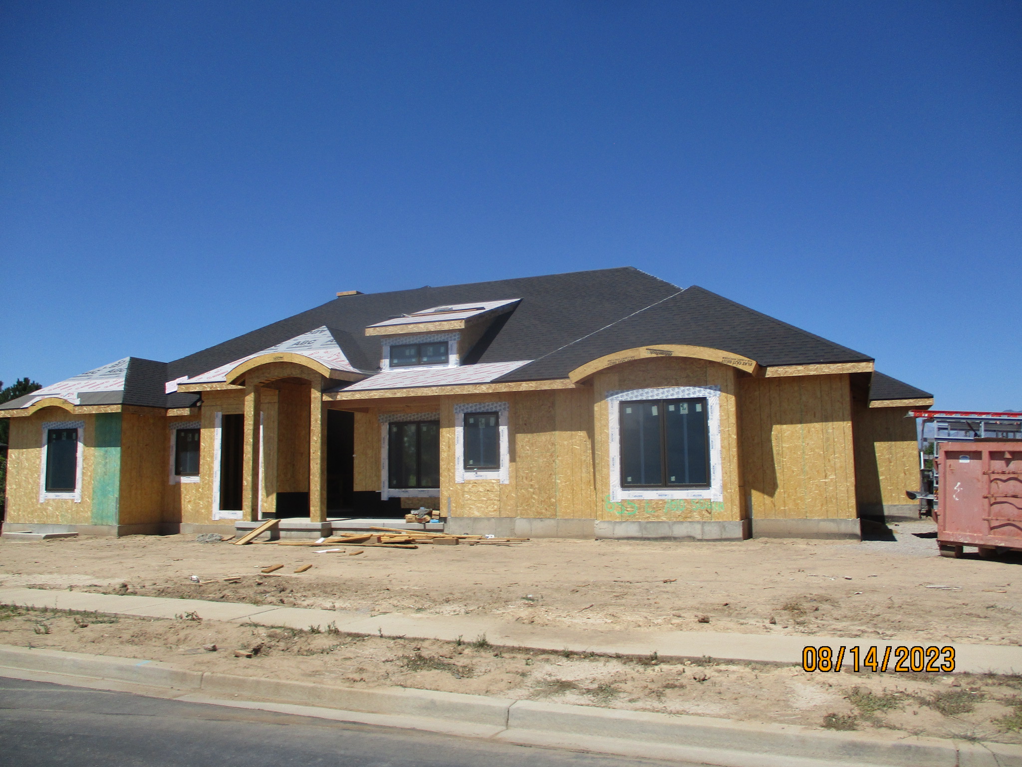
 Total Photos: 2
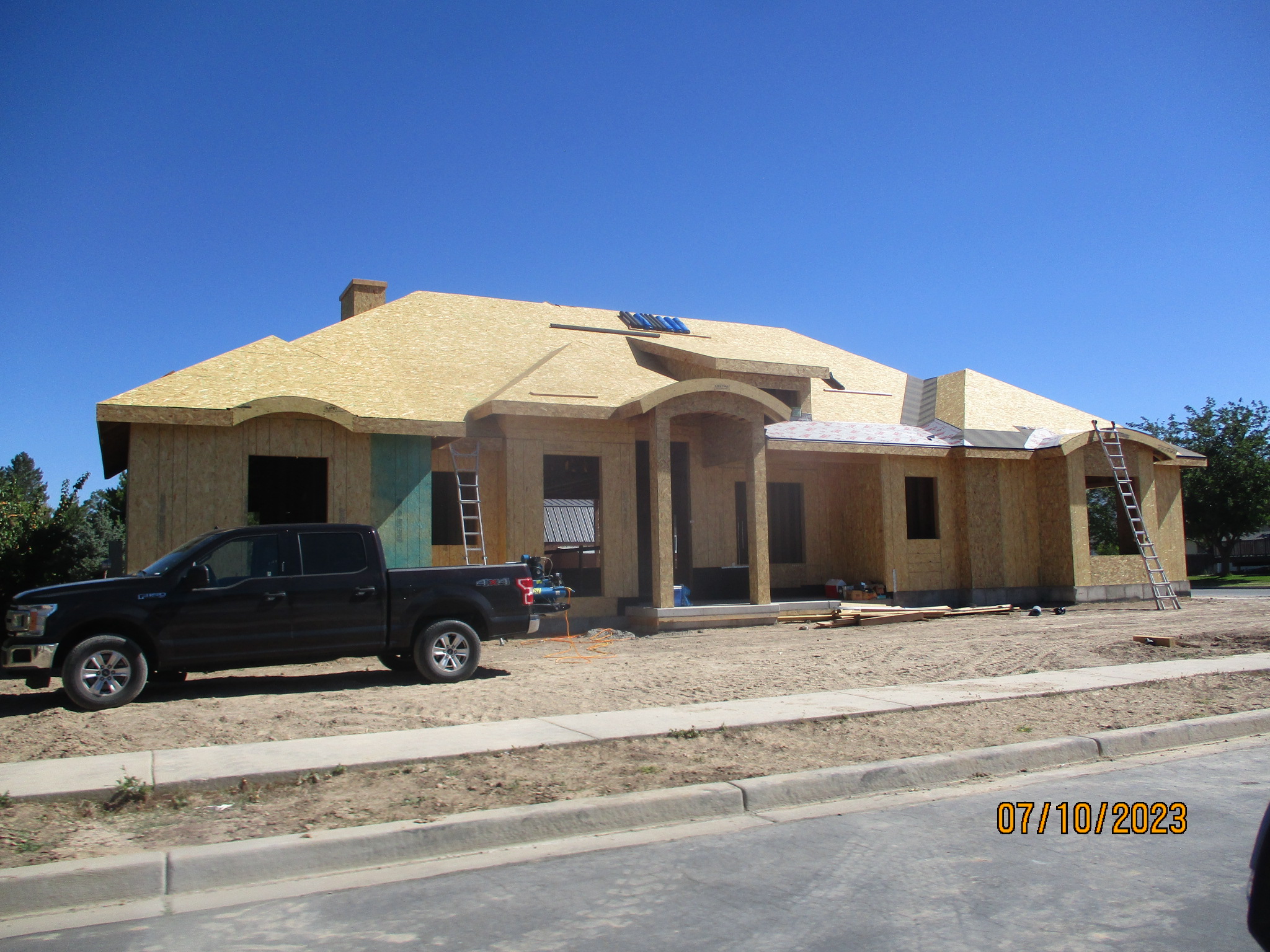
|
| |
|
|
| Property Address: 855 E 780 SOUTH - SPANISH FORK |
|
| Mailing Address: 1530 P B LN # A5003 WICHITA FALLS, TX 76302 |
|
| Acreage: 0.43918 |
|
| Last Document:
80440-2018
|
|
| Subdivision Map Filing |
|
| Taxing Description:
LOT 1, PLAT C, ORCHARD VIEW HEIGHTS SUB AREA 0.439 AC.
*Taxing description NOT FOR LEGAL DOCUMENTS
|
|
- Owner Names
- Value History
- Tax History
- Location
- Photos
- Documents
- Aerial Image
| |
----- Real Estate Values ----- |
---Improvements--- |
---Greenbelt--- |
Total |
| Year |
Com |
Res |
Agr |
Tot |
Com |
Res |
Agr |
Tot |
Land |
Homesite |
Tot |
Market Value |
| 2024 |
$0 |
$209,300 |
$0 |
$209,300 |
$0 |
$1,402,800 |
$0 |
$1,402,800 |
$0 |
$0 |
$0 |
$1,612,100 |
| 2023 |
$0 |
$209,200 |
$0 |
$209,200 |
$0 |
$13,300 |
$0 |
$13,300 |
$0 |
$0 |
$0 |
$222,500 |
| 2022 |
$0 |
$223,000 |
$0 |
$223,000 |
$0 |
$13,300 |
$0 |
$13,300 |
$0 |
$0 |
$0 |
$236,300 |
| 2021 |
$0 |
$131,200 |
$0 |
$131,200 |
$0 |
$12,100 |
$0 |
$12,100 |
$0 |
$0 |
$0 |
$143,300 |
| 2020 |
$0 |
$119,300 |
$0 |
$119,300 |
$0 |
$12,100 |
$0 |
$12,100 |
$0 |
$0 |
$0 |
$131,400 |
| 2019 |
$0 |
$112,600 |
$0 |
$112,600 |
$0 |
$12,100 |
$0 |
$12,100 |
$0 |
$0 |
$0 |
$124,700 |
| Year |
General Taxes |
Adjustments |
Net Taxes |
Fees |
Payments |
Tax Balance* |
Balance Due |
Tax District |
| 2025 |
$0.00 |
$0.00 |
$0.00 |
$0.00 |
|
$0.00
|
$0.00 |
150 - SPANISH FORK CITY |
| 2024 |
$0.00 |
$0.00 |
$0.00 |
$0.00 |
|
$0.00
|
$0.00 |
150 - SPANISH FORK CITY |
| 2023 |
$2,156.25 |
$0.00 |
$2,156.25 |
$0.00 |
|
$0.00
|
$0.00 |
150 - SPANISH FORK CITY |
| 2022 |
$2,334.88 |
$0.00 |
$2,334.88 |
$0.00 |
|
$0.00
|
$0.00 |
150 - SPANISH FORK CITY |
| 2021 |
$1,609.26 |
$0.00 |
$1,609.26 |
$0.00 |
|
$0.00
|
$0.00 |
150 - SPANISH FORK CITY |
| 2020 |
$1,517.80 |
$0.00 |
$1,517.80 |
$0.00 |
|
$0.00
|
$0.00 |
150 - SPANISH FORK CITY |
| 2019 |
$1,369.08 |
$0.00 |
$1,369.08 |
$0.00 |
|
$0.00
|
$0.00 |
150 - SPANISH FORK CITY |
* Note: Original tax amount (Does not include applicable interest and/or fees).
| Entry # |
Date |
Recorded |
Type |
Party1 (Grantor) |
Party2 (Grantee) |
| 78577-2023 |
11/13/2023 |
12/05/2023 |
AF |
ALLAN, FREDERICK JOHN & FREDERICK J |
WHOM OF INTEREST |
| 86250-2018 |
09/07/2018 |
09/10/2018 |
WD |
ALLAN, ABRAHAM N & MARY R TEE (ET AL) |
ALLAN, FREDRICK J & PAULA JO |
| 80440-2018 |
07/02/2018 |
08/23/2018 |
S PLAT |
ALLAN, ABRAHAM N & MARY R TEE (ET AL) |
ORCHARD VIEW HEIGHTS PLAT C |
Main Menu Comments or Concerns on Value/Appraisal - Assessor's Office
Documents/Owner/Parcel information - Recorder's Office
Address Change for Tax Notice
This page was created on 8/15/2024 7:28:12 PM |