UtahCounty.Gov - The Official Website of Utah County Government

Property Information

mobile view

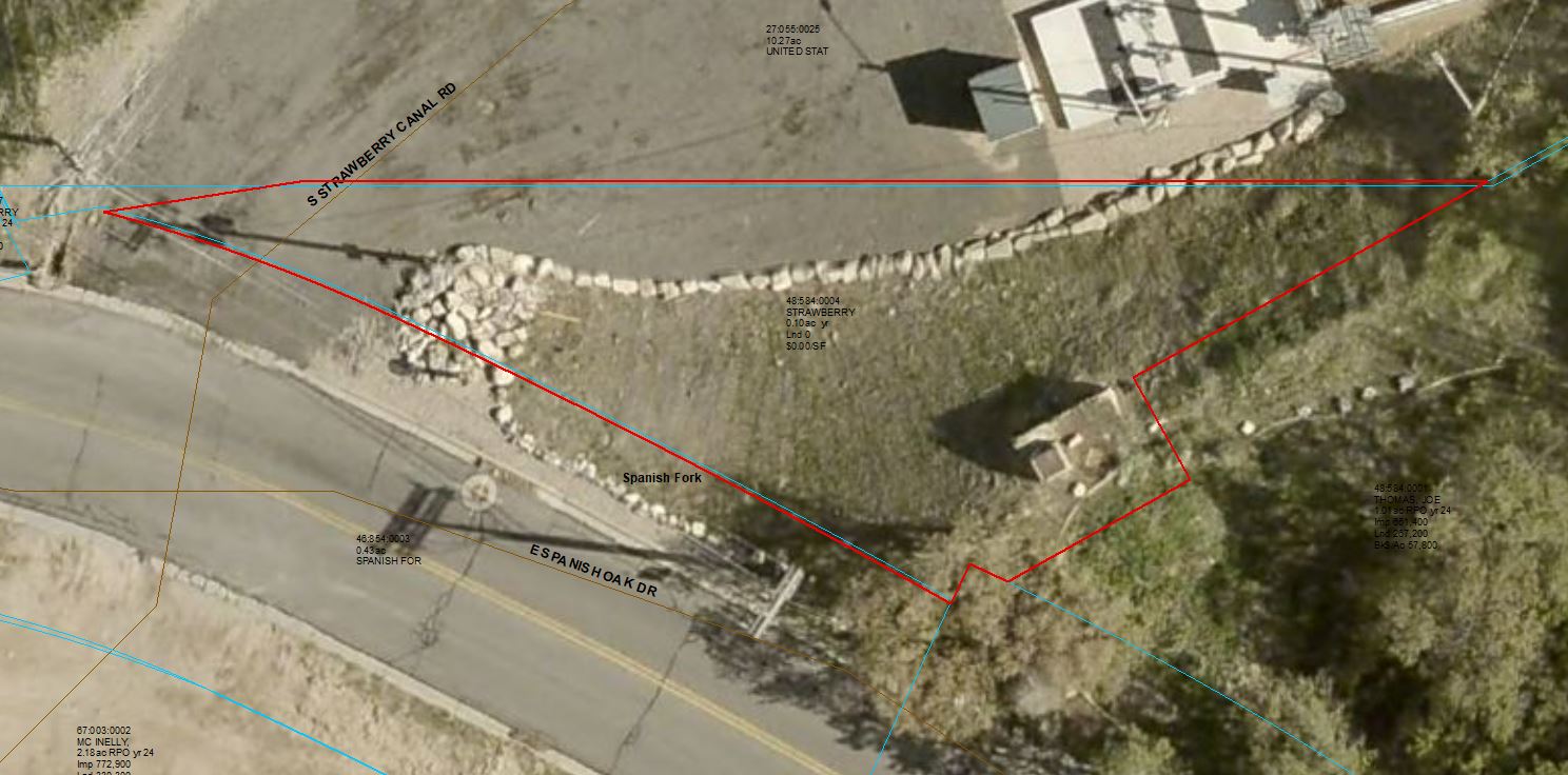
Serial Number: 48:584:0004 Serial Life: 2024...    
Parcel Photo
Total Photos: 1
     
Property Address:   
Mailing Address: 745 N 500 E PAYSON, UT 84651  
Acreage: 0.097985  
Last Document: 81947-2023  
Subdivision Map Filing   
Taxing Description:  PARCEL A, OAKS PLAT B LOTS 4 AND 5 AMENDED & EXTENDED SUB AREA 0.098 AC.

*Taxing description NOT FOR LEGAL DOCUMENTS


  • Owner Names
  • Value History
  • Tax History
  • Location
  • Photos
  • Documents
  • Aerial Image
 
----- Real Estate Values -----
---Improvements---
---Greenbelt---
Total
Year
Com
Res
Agr
Tot
Com
Res
Agr
Tot
Land
Homesite
Tot
    Market Value
2024
$8,000
$0
$0
$8,000
$0
$0
$0
$0
$0
$0
$0
$8,000
Year
General Taxes
Adjustments
Net Taxes
Fees
Payments
Tax Balance*
Balance Due
Tax District
2025
$0.00
$0.00
$0.00
$0.00
$0.00
$0.00     150 - SPANISH FORK CITY
2024
$0.00
$0.00
$0.00
$0.00
$0.00
$0.00     150 - SPANISH FORK CITY

* Note: Original tax amount (Does not include applicable interest and/or fees).
Parcel Photo
Entry # Date Recorded Type Party1 (Grantor) Party2 (Grantee)
81947-2023 12/20/2023 12/20/2023 QCD THOMAS, JOE L & SYDNEY W (ET AL) STRAWBERRY WATER USERS ASSOCIATION


Main Menu

Comments or Concerns on Value/Appraisal - Assessor's Office
Documents/Owner/Parcel information - Recorder's Office
Address Change for Tax Notice

This page was created on 9/30/2024 3:11:25 PM

× Large Image