Property Information
mobile view
| Serial Number: 49:229:0001 |
Serial Life: 1995-1998 |
|
|
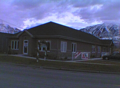 Total Photos: 1
|
| |
|
|
| Property Address: 487 S OREM BL - OREM |
|
| Mailing Address: 240 N OREM BLVD OREM, UT 84057-6601 |
|
| Acreage: 1.5 |
|
| Last Document:
87407-1997
|
|
| Subdivision Map Filing |
|
| Taxing Description:
PT LOT 1, PLAT A, PLATEAU SQUARE SUBDV. AREA 1.500 AC.
*Taxing description NOT FOR LEGAL DOCUMENTS
|
|
- Owner Names
- Value History
- Tax History
- Location
- Photos
- Documents
- Aerial Image
| 1999NV |
|
DAVIES, STEVE |
|
| 1999NV |
|
JACOBSON, GORDON |
|
| 1999NV |
|
MILLER, CRAIG L |
|
| 1999NV |
|
PARCELL, WALTER H |
|
| 1999NV |
|
TELLFORD, BILL |
|
| 1999NV |
|
DAVIES, STEVE |
|
| 1999NV |
|
JACOBSON, GORDON |
|
| 1999NV |
|
MILLER, CRIAG (SIC) L |
|
| 1999NV |
|
PARCELL, WALTER H |
|
| 1999NV |
|
TELLFORD, BILL |
|
| 1998 |
|
DAVIES, STEVE |
|
| 1998 |
|
JACOBSON, GORDON |
|
| 1998 |
|
MILLER, CRIAG (SIC) L |
|
| 1998 |
|
PARCELL, WALTER H |
|
| 1998 |
|
TELLFORD, BILL |
|
| 1998NV |
|
MURDOCH, DONNA |
|
| 1998NV |
|
YOUNG, SUSAN R |
|
| 1996-1997 |
|
BIGLER, THARIN J |
|
| 1996-1997 |
|
BIGLER, TWILA S |
|
| 1995 |
|
BIGLER, TWILA S |
|
| 1995 |
|
MURDOCH, DONNA |
|
| |
----- Real Estate Values ----- |
---Improvements--- |
---Greenbelt--- |
Total |
| Year |
Com |
Res |
Agr |
Tot |
Com |
Res |
Agr |
Tot |
Land |
Homesite |
Tot |
Market Value |
| 1998 |
$179,550 |
$0 |
$0 |
$179,550 |
$0 |
$0 |
$0 |
$0 |
$0 |
$0 |
$0 |
$179,550 |
| 1997 |
$179,550 |
$0 |
$0 |
$179,550 |
$0 |
$0 |
$0 |
$0 |
$0 |
$0 |
$0 |
$179,550 |
| 1996 |
$179,550 |
$0 |
$0 |
$179,550 |
$270,769 |
$0 |
$0 |
$270,769 |
$0 |
$0 |
$0 |
$450,319 |
| 1995 |
$179,550 |
$0 |
$0 |
$179,550 |
$75,000 |
$0 |
$0 |
$75,000 |
$0 |
$0 |
$0 |
$254,550 |
| Year |
General Taxes |
Adjustments |
Net Taxes |
Fees |
Payments |
Tax Balance* |
Balance Due |
Tax District |
| 1998 |
$1,860.86 |
$0.00 |
$1,860.86 |
$0.00 |
|
$0.00
|
$0.00 |
090 - OREM CITY |
| 1997 |
$1,853.14 |
$0.00 |
$1,853.14 |
$0.00 |
|
$0.00
|
$0.00 |
090 - OREM CITY |
| 1996 |
$4,246.06 |
($2,553.08) |
$1,692.98 |
$0.00 |
|
$0.00
|
$0.00 |
090 - OREM CITY |
| 1995 |
$2,716.05 |
($800.25) |
$1,915.80 |
$0.00 |
|
$0.00
|
$0.00 |
090 - OREM CITY |
* Note: Original tax amount (Does not include applicable interest and/or fees).
| Entry # |
Date |
Recorded |
Type |
Party1 (Grantor) |
Party2 (Grantee) |
| 18050-1998 |
02/13/1998 |
02/26/1998 |
C PLAT |
MILLER, CRAIG L (ET AL) |
WILLIAMSBURG SQUARE OFFICE CONDOMINIUMS |
| 3603-1998 |
01/12/1998 |
01/14/1998 |
QCD |
MILLER, CRAIG L & CRAIG L AKA |
MILLER, CRAIG L 20%INT |
| 3602-1998 |
01/12/1998 |
01/14/1998 |
QCD |
TELLFORD, BILL AKA (ET AL) |
TELFORD, BILL 20%INT |
| 96754-1997 |
12/04/1997 |
12/05/1997 |
REC |
FAR WEST BANK |
MURDOCH, DONNA (ET AL) |
| 87407-1997 |
11/03/1997 |
11/04/1997 |
WD |
BIGLER, THARIN L & TWILA S |
PARCELL, WALTER H 20%INT (ET AL) |
| 50116-1996 |
06/04/1996 |
06/17/1996 |
R ASLS |
FIRST SECURITY BANK OF UTAH |
WHOM OF INTEREST |
| 86817-1995 |
11/26/1995 |
12/14/1995 |
QCD |
MURDOCK, DONNA |
BIGLER, THARIN J & TWILA S |
| 96696-1994 |
12/02/1994 |
12/27/1994 |
R/W EAS |
MURDOCH, DONNA (ET AL) |
MOUNTAIN FUEL SUPPLY COMPANY |
| 76100-1994 |
02/02/1994 |
09/28/1994 |
S PLAT |
MURDOCH, DONNA (ET AL) |
PLATEAU SQUARE PLAT A |
Main Menu Comments or Concerns on Value/Appraisal - Assessor's Office
Documents/Owner/Parcel information - Recorder's Office
Address Change for Tax Notice
This page was created on 2/9/2025 9:54:53 AM |