Property Information
mobile view
| Serial Number: 49:783:0016 |
Serial Life: 2016... |
|
|

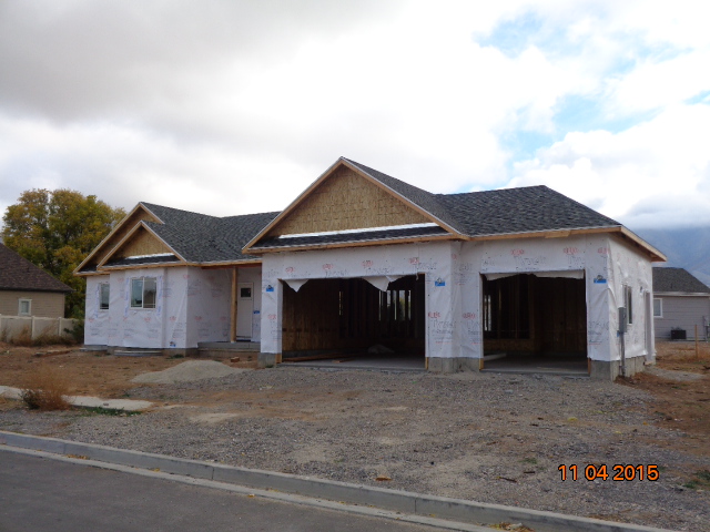
Total Photos: 2
|
| |
|
|
| Property Address: 1054 N 200 WEST - MAPLETON |
|
| Mailing Address: 1054 N 200 W MAPLETON, UT 84664 |
|
| Acreage: 0.332788 |
|
| Last Document:
9676-2015
|
|
| Subdivision Map Filing |
|
| Taxing Description:
LOT 16, PLAT A, PLUM CREEK ESTATES SUB AREA 0.333 AC.
*Taxing description NOT FOR LEGAL DOCUMENTS
|
|
- Owner Names
- Value History
- Tax History
- Location
- Photos
- Documents
- Aerial Image
| |
----- Real Estate Values ----- |
---Improvements--- |
---Greenbelt--- |
Total |
| Year |
Com |
Res |
Agr |
Tot |
Com |
Res |
Agr |
Tot |
Land |
Homesite |
Tot |
Market Value |
| 2024 |
$0 |
$276,700 |
$0 |
$276,700 |
$0 |
$357,000 |
$0 |
$357,000 |
$0 |
$0 |
$0 |
$633,700 |
| 2023 |
$0 |
$276,700 |
$0 |
$276,700 |
$0 |
$368,600 |
$0 |
$368,600 |
$0 |
$0 |
$0 |
$645,300 |
| 2022 |
$0 |
$295,000 |
$0 |
$295,000 |
$0 |
$326,600 |
$0 |
$326,600 |
$0 |
$0 |
$0 |
$621,600 |
| 2021 |
$0 |
$178,800 |
$0 |
$178,800 |
$0 |
$251,200 |
$0 |
$251,200 |
$0 |
$0 |
$0 |
$430,000 |
| 2020 |
$0 |
$158,200 |
$0 |
$158,200 |
$0 |
$241,500 |
$0 |
$241,500 |
$0 |
$0 |
$0 |
$399,700 |
| 2019 |
$0 |
$140,200 |
$0 |
$140,200 |
$0 |
$236,900 |
$0 |
$236,900 |
$0 |
$0 |
$0 |
$377,100 |
| 2018 |
$0 |
$133,000 |
$0 |
$133,000 |
$0 |
$236,900 |
$0 |
$236,900 |
$0 |
$0 |
$0 |
$369,900 |
| 2017 |
$0 |
$128,000 |
$0 |
$128,000 |
$0 |
$223,500 |
$0 |
$223,500 |
$0 |
$0 |
$0 |
$351,500 |
| 2016 |
$0 |
$118,600 |
$0 |
$118,600 |
$0 |
$162,700 |
$0 |
$162,700 |
$0 |
$0 |
$0 |
$281,300 |
| Year |
General Taxes |
Adjustments |
Net Taxes |
Fees |
Payments |
Tax Balance* |
Balance Due |
Tax District |
| 2025 |
$0.00 |
$0.00 |
$0.00 |
$0.00 |
|
$0.00
|
$0.00 |
140 - MAPLETON CITY |
| 2024 |
$0.00 |
$0.00 |
$0.00 |
$0.00 |
|
$0.00
|
$0.00 |
140 - MAPLETON CITY |
| 2023 |
$3,600.26 |
$0.00 |
$3,600.26 |
$0.00 |
|
$0.00
|
$0.00 |
140 - MAPLETON CITY |
| 2022 |
$3,507.35 |
$0.00 |
$3,507.35 |
$0.00 |
|
$0.00
|
$0.00 |
140 - MAPLETON CITY |
| 2021 |
$2,873.24 |
$0.00 |
$2,873.24 |
$0.00 |
|
$0.00
|
$0.00 |
140 - MAPLETON CITY |
| 2020 |
$2,761.13 |
$0.00 |
$2,761.13 |
$0.00 |
|
$0.00
|
$0.00 |
140 - MAPLETON CITY |
| 2019 |
$2,552.12 |
$0.00 |
$2,552.12 |
$0.00 |
|
$0.00
|
$0.00 |
140 - MAPLETON CITY |
| 2018 |
$2,629.73 |
$0.00 |
$2,629.73 |
$0.00 |
|
$0.00
|
$0.00 |
140 - MAPLETON CITY |
| 2017 |
$2,589.78 |
$0.00 |
$2,589.78 |
$0.00 |
|
$0.00
|
$0.00 |
140 - MAPLETON CITY |
| 2016 |
$2,084.94 |
$0.00 |
$2,084.94 |
$0.00 |
|
$0.00
|
$0.00 |
140 - MAPLETON CITY |
* Note: Original tax amount (Does not include applicable interest and/or fees).
| Entry # |
Date |
Recorded |
Type |
Party1 (Grantor) |
Party2 (Grantee) |
| 177721-2021 |
10/05/2021 |
10/19/2021 |
RSUBTEE |
MORTGAGE ELECTRONIC REGISTRATION SYSTEMS INC (ET AL) |
SANDERSON, MCKAY & KAMI |
| 167300-2021 |
09/17/2021 |
09/29/2021 |
D TR |
SANDERSON, MCKAY & KAMI |
NATIONSTAR MORTGAGE LLC DBA (ET AL) |
| 767-2021 |
12/24/2020 |
01/04/2021 |
RSUBTEE |
MORTGAGE ELECTRONIC REGISTRATION SYSTEMS INC (ET AL) |
SANDERSON, MCKAY & KAMI |
| 169625-2020 |
10/23/2020 |
10/28/2020 |
D TR |
SANDERSON, MCKAY & KAMI |
QUICKEN LOANS LLC |
| 104737-2019 |
10/10/2019 |
10/14/2019 |
RSUBTEE |
WELLS FARGO BANK (ET AL) |
SANDERSON, MCKAY & KAMI |
| 94327-2019 |
09/18/2019 |
09/23/2019 |
D TR |
SANDERSON, MCKAY & KAMI |
CITY CREEK MORTGAGE CORP |
| 116474-2016 |
11/15/2016 |
11/18/2016 |
AS |
FIRST COLONY MORTGAGE CORPORATION |
WELLS FARGO BANK |
| 55572-2016 |
06/14/2016 |
06/20/2016 |
REC |
BANK OF AMERICAN FORK TEE |
KNIGHT WEST CONSTRUCTION INC |
| 44341-2016 |
05/12/2016 |
05/19/2016 |
REC |
BANK OF AMERICAN FORK TEE |
KNIGHT WEST CONSTRUCTION INC |
| 38134-2016 |
04/28/2016 |
05/02/2016 |
D TR |
SANDERSON, MCKAY & KAMI |
FIRST COLONY MORTGAGE CORPORATION |
| 38133-2016 |
04/29/2016 |
05/02/2016 |
WD |
KNIGHT WEST CONSTRUCTION INC (ET AL) |
SANDERSON, MCKAY & KAMI |
| 4950-2016 |
01/13/2016 |
01/20/2016 |
P REC |
BANK OF AMERICAN FORK TEE |
KNIGHT WEST CONSTRUCTION INC |
| 82757-2015 |
05/07/2015 |
09/09/2015 |
GEO HAZ |
KNIGHT WEST CONSTRUCTION INC |
WHOM OF INTEREST |
| 73713-2015 |
08/10/2015 |
08/13/2015 |
D TR |
HALL, BENNIE REED & BEVERLY LAMOREAUX TEE (ET AL) |
BANK OF AMERICAN FORK |
| 9676-2015 |
07/01/2014 |
02/09/2015 |
S PLAT |
HALL, BENNIE REED & BEVERLY LAMOREAUX TEE (ET AL) |
PLUM CREEK ESTATES PLAT A |
Main Menu Comments or Concerns on Value/Appraisal - Assessor's Office
Documents/Owner/Parcel information - Recorder's Office
Address Change for Tax Notice
This page was created on 7/20/2024 2:17:56 AM |