Property Information
mobile view
| Serial Number: 50:031:0001 |
Serial Life: 1991... |
|
|
 Total Photos: 3
|
| |
|
|
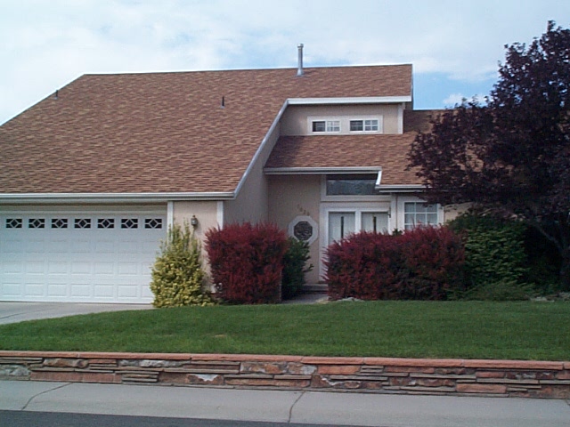
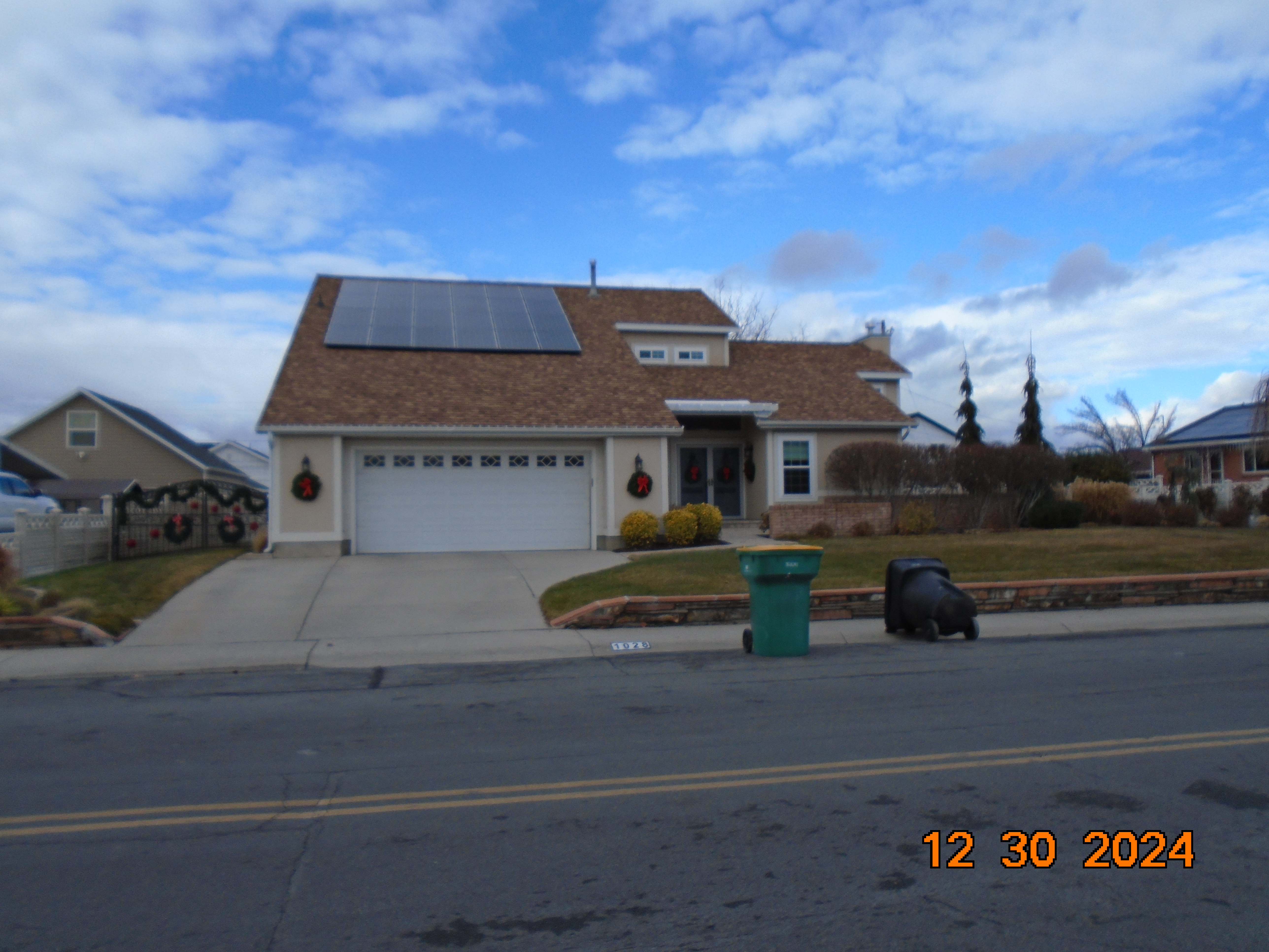
| Property Address: 1028 S 150 WEST - OREM |
|
| Mailing Address: 1028 S 150 W OREM, UT 84058-6826 |
|
| Acreage: 0.297845 |
|
| Last Document:
61972-2014
|
|
| Subdivision Map Filing |
|
| Taxing Description:
LOT 1, PLAT A, QUAIL ESTATES SUB AREA 0.298 AC.
*Taxing description NOT FOR LEGAL DOCUMENTS
|
|
- Owner Names
- Value History
- Tax History
- Location
- Photos
- Documents
- Aerial Image
| 2015... |
|
REID, GABRIELLA M |
|
| 2015... |
|
REID, SHAWN F |
|
| 2011-2014 |
|
REID, GABRIELLA M |
|
| 2011-2014 |
|
REID, SHAWN F |
|
| 1994-2010 |
|
REID, GABRIELLA M |
|
| 1994-2010 |
|
REID, SHAWN F |
|
| 1992-1993 |
|
REID, GABRIELLA |
|
| 1992-1993 |
|
REID, SHAWN F |
|
| 1992NV |
|
LOWE, STEVEN |
|
| 1991 |
|
REID, SHAWN FLETCHER |
|
| 1991NV |
|
LOWE, ROBERT D |
|
| 1991NV |
|
LOWE, STEVEN D |
|
| 1991NV |
|
LOWE, ROBERT D |
|
| 1991NV |
|
LOWE, ROBERT D |
|
| 1991NV |
|
OVESON, WILFORD VAL ETUX |
|
| |
----- Real Estate Values ----- |
---Improvements--- |
---Greenbelt--- |
Total |
| Year |
Com |
Res |
Agr |
Tot |
Com |
Res |
Agr |
Tot |
Land |
Homesite |
Tot |
Market Value |
| 2024 |
$0 |
$227,700 |
$0 |
$227,700 |
$0 |
$401,300 |
$0 |
$401,300 |
$0 |
$0 |
$0 |
$629,000 |
| 2023 |
$0 |
$227,700 |
$0 |
$227,700 |
$0 |
$404,400 |
$0 |
$404,400 |
$0 |
$0 |
$0 |
$632,100 |
| 2022 |
$0 |
$242,800 |
$0 |
$242,800 |
$0 |
$344,600 |
$0 |
$344,600 |
$0 |
$0 |
$0 |
$587,400 |
| 2021 |
$0 |
$186,800 |
$0 |
$186,800 |
$0 |
$269,200 |
$0 |
$269,200 |
$0 |
$0 |
$0 |
$456,000 |
| 2020 |
$0 |
$149,400 |
$0 |
$149,400 |
$0 |
$263,900 |
$0 |
$263,900 |
$0 |
$0 |
$0 |
$413,300 |
| 2019 |
$0 |
$137,900 |
$0 |
$137,900 |
$0 |
$263,900 |
$0 |
$263,900 |
$0 |
$0 |
$0 |
$401,800 |
| 2018 |
$0 |
$118,700 |
$0 |
$118,700 |
$0 |
$263,900 |
$0 |
$263,900 |
$0 |
$0 |
$0 |
$382,600 |
| 2017 |
$0 |
$99,600 |
$0 |
$99,600 |
$0 |
$225,000 |
$0 |
$225,000 |
$0 |
$0 |
$0 |
$324,600 |
| 2016 |
$0 |
$74,300 |
$0 |
$74,300 |
$0 |
$234,600 |
$0 |
$234,600 |
$0 |
$0 |
$0 |
$308,900 |
| 2015 |
$0 |
$74,300 |
$0 |
$74,300 |
$0 |
$224,500 |
$0 |
$224,500 |
$0 |
$0 |
$0 |
$298,800 |
| 2014 |
$0 |
$71,200 |
$0 |
$71,200 |
$0 |
$187,100 |
$0 |
$187,100 |
$0 |
$0 |
$0 |
$258,300 |
| 2013 |
$0 |
$50,100 |
$0 |
$50,100 |
$0 |
$187,100 |
$0 |
$187,100 |
$0 |
$0 |
$0 |
$237,200 |
| 2012 |
$0 |
$50,900 |
$0 |
$50,900 |
$0 |
$174,300 |
$0 |
$174,300 |
$0 |
$0 |
$0 |
$225,200 |
| 2011 |
$0 |
$54,000 |
$0 |
$54,000 |
$0 |
$178,100 |
$0 |
$178,100 |
$0 |
$0 |
$0 |
$232,100 |
| 2010 |
$0 |
$55,300 |
$0 |
$55,300 |
$0 |
$191,423 |
$0 |
$191,423 |
$0 |
$0 |
$0 |
$246,723 |
| 2009 |
$0 |
$55,300 |
$0 |
$55,300 |
$0 |
$200,200 |
$0 |
$200,200 |
$0 |
$0 |
$0 |
$255,500 |
| 2008 |
$0 |
$80,100 |
$0 |
$80,100 |
$0 |
$235,300 |
$0 |
$235,300 |
$0 |
$0 |
$0 |
$315,400 |
| 2007 |
$0 |
$83,400 |
$0 |
$83,400 |
$0 |
$245,100 |
$0 |
$245,100 |
$0 |
$0 |
$0 |
$328,500 |
| 2006 |
$0 |
$52,600 |
$0 |
$52,600 |
$0 |
$229,300 |
$0 |
$229,300 |
$0 |
$0 |
$0 |
$281,900 |
| 2005 |
$0 |
$50,048 |
$0 |
$50,048 |
$0 |
$218,345 |
$0 |
$218,345 |
$0 |
$0 |
$0 |
$268,393 |
| 2004 |
$0 |
$50,048 |
$0 |
$50,048 |
$0 |
$218,345 |
$0 |
$218,345 |
$0 |
$0 |
$0 |
$268,393 |
| 2003 |
$0 |
$50,048 |
$0 |
$50,048 |
$0 |
$218,345 |
$0 |
$218,345 |
$0 |
$0 |
$0 |
$268,393 |
| 2002 |
$0 |
$50,048 |
$0 |
$50,048 |
$0 |
$218,345 |
$0 |
$218,345 |
$0 |
$0 |
$0 |
$268,393 |
| 2001 |
$0 |
$50,048 |
$0 |
$50,048 |
$0 |
$218,345 |
$0 |
$218,345 |
$0 |
$0 |
$0 |
$268,393 |
| 2000 |
$0 |
$46,774 |
$0 |
$46,774 |
$0 |
$198,658 |
$0 |
$198,658 |
$0 |
$0 |
$0 |
$245,432 |
| 1999 |
$0 |
$43,714 |
$0 |
$43,714 |
$0 |
$185,662 |
$0 |
$185,662 |
$0 |
$0 |
$0 |
$229,376 |
| 1998 |
$0 |
$43,714 |
$0 |
$43,714 |
$0 |
$185,662 |
$0 |
$185,662 |
$0 |
$0 |
$0 |
$229,376 |
| 1997 |
$0 |
$43,714 |
$0 |
$43,714 |
$0 |
$185,662 |
$0 |
$185,662 |
$0 |
$0 |
$0 |
$229,376 |
| 1996 |
$0 |
$42,073 |
$0 |
$42,073 |
$0 |
$178,693 |
$0 |
$178,693 |
$0 |
$0 |
$0 |
$220,766 |
| 1995 |
$0 |
$38,248 |
$0 |
$38,248 |
$0 |
$178,693 |
$0 |
$178,693 |
$0 |
$0 |
$0 |
$216,941 |
| 1994 |
$0 |
$22,367 |
$0 |
$22,367 |
$0 |
$144,107 |
$0 |
$144,107 |
$0 |
$0 |
$0 |
$166,474 |
| 1993 |
$0 |
$22,367 |
$0 |
$22,367 |
$0 |
$144,107 |
$0 |
$144,107 |
$0 |
$0 |
$0 |
$166,474 |
| 1992 |
$0 |
$20,520 |
$0 |
$20,520 |
$0 |
$132,208 |
$0 |
$132,208 |
$0 |
$0 |
$0 |
$152,728 |
| 1991 |
$0 |
$18,000 |
$0 |
$18,000 |
$0 |
$0 |
$0 |
$0 |
$0 |
$0 |
$0 |
$18,000 |
| Year |
General Taxes |
Adjustments |
Net Taxes |
Fees |
Payments |
Tax Balance* |
Balance Due |
Tax District |
| 2025 |
$0.00 |
$0.00 |
$0.00 |
$0.00 |
|
$0.00
|
$0.00 |
090 - OREM CITY |
| 2024 |
$2,829.18 |
$0.00 |
$2,829.18 |
$0.00 |
|
$0.00
|
$0.00 |
090 - OREM CITY |
| 2023 |
$2,645.31 |
$0.00 |
$2,645.31 |
$0.00 |
|
$0.00
|
$0.00 |
090 - OREM CITY |
| 2022 |
$2,537.39 |
$0.00 |
$2,537.39 |
$0.00 |
|
$0.00
|
$0.00 |
090 - OREM CITY |
| 2021 |
$2,364.54 |
$0.00 |
$2,364.54 |
$0.00 |
|
$0.00
|
$0.00 |
090 - OREM CITY |
| 2020 |
$2,180.63 |
$0.00 |
$2,180.63 |
$0.00 |
|
$0.00
|
$0.00 |
090 - OREM CITY |
| 2019 |
$2,038.63 |
$0.00 |
$2,038.63 |
$0.00 |
|
$0.00
|
$0.00 |
090 - OREM CITY |
| 2018 |
$2,031.70 |
$0.00 |
$2,031.70 |
$0.00 |
|
$0.00
|
$0.00 |
090 - OREM CITY |
| 2017 |
$1,769.77 |
$0.00 |
$1,769.77 |
$0.00 |
|
$0.00
|
$0.00 |
090 - OREM CITY |
| 2016 |
$1,826.37 |
$0.00 |
$1,826.37 |
$0.00 |
|
$0.00
|
$0.00 |
090 - OREM CITY |
| 2015 |
$1,868.05 |
$0.00 |
$1,868.05 |
$0.00 |
|
$0.00
|
$0.00 |
090 - OREM CITY |
| 2014 |
$1,622.24 |
$0.00 |
$1,622.24 |
$0.00 |
|
$0.00
|
$0.00 |
090 - OREM CITY |
| 2013 |
$1,606.48 |
$0.00 |
$1,606.48 |
$0.00 |
|
$0.00
|
$0.00 |
090 - OREM CITY |
| 2012 |
$1,556.67 |
$0.00 |
$1,556.67 |
$0.00 |
|
$0.00
|
$0.00 |
090 - OREM CITY |
| 2011 |
$1,596.71 |
$0.00 |
$1,596.71 |
$0.00 |
|
$0.00
|
$0.00 |
090 - OREM CITY |
| 2010 |
$1,589.02 |
$0.00 |
$1,589.02 |
$0.00 |
|
$0.00
|
$0.00 |
090 - OREM CITY |
| 2009 |
$1,525.40 |
$0.00 |
$1,525.40 |
$0.00 |
|
$0.00
|
$0.00 |
090 - OREM CITY |
| 2008 |
$1,744.93 |
$0.00 |
$1,744.93 |
$0.00 |
|
$0.00
|
$0.00 |
090 - OREM CITY |
| 2007 |
$1,796.63 |
$0.00 |
$1,796.63 |
$0.00 |
|
$0.00
|
$0.00 |
090 - OREM CITY |
| 2006 |
$1,641.77 |
$0.00 |
$1,641.77 |
$0.00 |
|
$0.00
|
$0.00 |
090 - OREM CITY |
| 2005 |
$1,764.31 |
$0.00 |
$1,764.31 |
$0.00 |
|
$0.00
|
$0.00 |
090 - OREM CITY |
| 2004 |
$1,733.01 |
$0.00 |
$1,733.01 |
$0.00 |
|
$0.00
|
$0.00 |
090 - OREM CITY |
| 2003 |
$1,681.64 |
$0.00 |
$1,681.64 |
$0.00 |
|
$0.00
|
$0.00 |
090 - OREM CITY |
| 2002 |
$1,536.83 |
$0.00 |
$1,536.83 |
$0.00 |
|
$0.00
|
$0.00 |
090 - OREM CITY |
| 2001 |
$1,522.07 |
$0.00 |
$1,522.07 |
$0.00 |
|
$0.00
|
$0.00 |
090 - OREM CITY |
| 2000 |
$1,439.11 |
$0.00 |
$1,439.11 |
$0.00 |
|
$0.00
|
$0.00 |
090 - OREM CITY |
| 1999 |
$1,384.70 |
$0.00 |
$1,384.70 |
$0.00 |
|
$0.00
|
$0.00 |
090 - OREM CITY |
| 1998 |
$1,307.49 |
$0.00 |
$1,307.49 |
$0.00 |
|
$0.00
|
$0.00 |
090 - OREM CITY |
| 1997 |
$1,302.07 |
$0.00 |
$1,302.07 |
$0.00 |
|
$0.00
|
$0.00 |
090 - OREM CITY |
| 1996 |
$1,144.88 |
$0.00 |
$1,144.88 |
$0.00 |
|
$0.00
|
$0.00 |
090 - OREM CITY |
| 1995 |
$1,273.11 |
$0.00 |
$1,273.11 |
$0.00 |
|
$0.00
|
$0.00 |
090 - OREM CITY |
| 1994 |
$1,556.54 |
$0.00 |
$1,556.54 |
$0.00 |
|
$0.00
|
$0.00 |
090 - OREM CITY |
| 1993 |
$1,377.53 |
$0.00 |
$1,377.53 |
$0.00 |
|
$0.00
|
$0.00 |
090 - OREM CITY |
| 1992 |
$1,274.19 |
$0.00 |
$1,274.19 |
$0.00 |
|
$0.00
|
$0.00 |
090 - OREM CITY |
| 1991 |
$223.50 |
$0.00 |
$223.50 |
$0.00 |
|
$0.00
|
$0.00 |
090 - OREM CITY |
* Note: Original tax amount (Does not include applicable interest and/or fees).
| Entry # |
Date |
Recorded |
Type |
Party1 (Grantor) |
Party2 (Grantee) |
| 9149-2015 |
02/03/2015 |
02/05/2015 |
REC |
UTAH COMMUNITY CREDIT UNION TEE |
REID, SHAWN F & GABRIELLA M |
| 61972-2014 |
08/28/2014 |
08/29/2014 |
WD |
REID, SHAWN F & GABRIELLA M |
REID, SHAWN F & GABRIELLA M TEE |
| 70948-2001 |
07/09/2001 |
07/19/2001 |
EAS AGR |
REID, SHAWN F & GABRIELLA M |
CITY OF OREM |
| 59560-2000 |
07/31/2000 |
07/31/2000 |
D TR |
REID, SHAWN F & GABRIELLA M |
UNIVERSAL CAMPUS FEDERAL CREDIT UNION |
| 54722-1995 |
08/22/1995 |
08/22/1995 |
REC |
ACTION TITLE COMPANY TEE |
REID, SHAWN F & GABRIELLA M |
| 83046-1994 |
10/01/1994 |
10/27/1994 |
AS |
MVB MORTGAGE CORPORATION |
RESOURCE BANCSHARES MORTGAGE GROUP INC |
| 34378-1994 |
09/30/1993 |
04/25/1994 |
AS |
LIBERTY MORTGAGE COMPANY INC |
MVB MORTGAGE CORPORATION |
| 19188-1994 |
12/13/1993 |
03/08/1994 |
REC |
RIVERS, ROD SUBTEE |
REID, SHAWN F & GABRIELLA |
| 19187-1994 |
11/26/1993 |
03/08/1994 |
SUB TEE |
TROY & NICHOLS INC |
RIVERS, ROD SUBTEE |
| 72119-1993 |
10/12/1993 |
10/13/1993 |
AS |
COLONIAL MORTGAGE INC |
LIBERTY MORTGAGE COMPANY INC |
| 71605-1993 |
09/23/1993 |
10/12/1993 |
TR D |
REID, SHAWN F & GABRIELLA M |
COLONIAL MORTGAGE INC |
| 71604-1993 |
09/23/1993 |
10/12/1993 |
QCD |
REID, SHAWN F & GABRIELLA |
REID, SHAWN F & GABRIELLA M |
| 58019-1993 |
08/25/1993 |
08/25/1993 |
REC |
VALLEY TITLE COMPANY BY (ET AL) |
LOWE, ROBERT D |
| 35738-1992 |
07/06/1992 |
07/16/1992 |
REC |
WASATCH BANK TEE |
LOWE, ROBERT D & STEVEN D |
| 22252-1991 |
05/28/1991 |
06/10/1991 |
REC |
WASATCH BANK TEE |
REID, SHAWN FLETCHER |
| 19737-1991 |
05/23/1991 |
05/24/1991 |
AS |
FIRST COLONY MORTGAGE CORP |
TROY & NICHOLS INC |
| 19736-1991 |
05/23/1991 |
05/24/1991 |
TR D |
REID, SHAWN F & GABRIELLA |
FIRST COLONY MORTGAGE CORP |
| 19735-1991 |
05/23/1991 |
05/24/1991 |
WD |
LOWE, STEVEN |
REID, SHAWN F & GABRIELLA |
| 19277-1991 |
05/21/1991 |
05/22/1991 |
WD |
REID, SHAWN FLETCHER |
LOWE, STEVEN |
| 19222-1991 |
05/21/1991 |
05/21/1991 |
N EXT |
LOWE, ROBERT D & STEVEN D |
WASATCH BANK |
| 8086-1991 |
03/05/1991 |
03/05/1991 |
REC |
VALLEY TITLE COMPANY BY (ET AL) |
LOWE, ROBERT D |
| 3305-1991 |
12/14/1990 |
01/30/1991 |
REC |
FAR WEST BANK TEE |
LOWE, ROBERT D & STEVEN D |
| 39240-1990 |
11/27/1990 |
11/28/1990 |
P REC |
VALLEY TITLE COMPANY BY (ET AL) |
LOWE, ROBERT D |
| 38138-1990 |
11/15/1990 |
11/16/1990 |
D TR |
REID, SHAWN FLETCHER |
WASATCH BANK |
| 38137-1990 |
11/15/1990 |
11/16/1990 |
QCD |
LOWE, ROBERT D & STEVEN D |
REID, SHAWN FLETCHER |
| 38136-1990 |
11/15/1990 |
11/16/1990 |
D TR |
LOWE, ROBERT D & STEVEN D |
WASATCH BANK |
| 25777-1990 |
08/08/1990 |
08/10/1990 |
SUB AGR |
OVESON, LA VONNE H & LA VONNE H AKA |
FAR WEST BANK |
| 25362-1990 |
08/07/1990 |
08/08/1990 |
D TR |
LOWE, ROBERT D & STEVEN D |
FAR WEST BANK |
| 25361-1990 |
08/07/1990 |
08/08/1990 |
WD |
LOWE, ROBERT D |
LOWE, ROBERT D & STEVEN D |
| 25077-1990 |
06/11/1990 |
08/06/1990 |
TR D |
LOWE, ROBERT D |
OVESON, LA VONNE |
| 25076-1990 |
06/11/1990 |
08/06/1990 |
WD |
OVESON, LA VONNE |
LOWE, ROBERT D |
| 25075-1990 |
05/16/1990 |
08/06/1990 |
S PLAT |
LOWE, ROBERT D (ET AL) |
QUAIL ESTATES PLAT A |
Main Menu Comments or Concerns on Value/Appraisal - Assessor's Office
Documents/Owner/Parcel information - Recorder's Office
Address Change for Tax Notice
This page was created on 4/23/2025 8:17:29 AM |