Property Information
mobile view
| Serial Number: 52:322:0024 |
Serial Life: 1991... |
|
|
 Total Photos: 1
|
| |
|
|
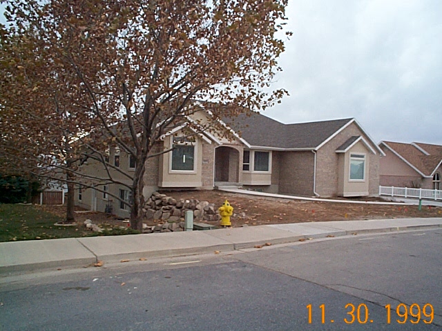
| Property Address: 668 E 2000 NORTH - OREM |
|
| Mailing Address: 668 E 2000 N OREM, UT 84097-7320 |
|
| Acreage: 0.3 |
|
| Last Document:
71392-1998
|
|
| Subdivision Map Filing |
|
| Taxing Description:
LOT 24, PLAT D, SKYLINE ESTATES SUB AREA 0.298 AC.
*Taxing description NOT FOR LEGAL DOCUMENTS
|
|
- Owner Names
- Value History
- Tax History
- Location
- Photos
- Documents
- Aerial Image
| 2012... |
|
CROOKSTON, BRENDA |
|
| 2012... |
|
CROOKSTON, CLARK |
|
| 2012NV |
|
CROOKSTON, BRENDA |
|
| 2012NV |
|
CROOKSTON, CLARK |
|
| 2012NV |
|
CROOKSTON, BRENDA |
|
| 2012NV |
|
CROOKSTON, CLARK |
|
| 2011 |
|
CROOKSTON, BRENDA |
|
| 2011 |
|
CROOKSTON, CLARK E |
|
| 2010 |
|
CROOKSTON, BRENDA |
|
| 2010 |
|
CROOKSTON, CLARK E |
|
| 2009 |
|
CROOKSTON, BRENDA |
|
| 2009 |
|
CROOKSTON, CLARK |
|
| 2006-2008 |
|
CROOKSTON, BRENDA |
|
| 2006-2008 |
|
CROOKSTON, CLARK E |
|
| 2005 |
|
CROOKSTON, BRENDA |
|
| 2005 |
|
CROOKSTON, CLARK E |
|
| 2005NV |
|
CROOKSTON, CLARK E |
|
| 1999-2004 |
|
STOOR, LEROY M |
|
| 1991-1998 |
|
GUSTMAN, GUY H |
|
| 1991NV |
|
SKYLINE ESTATES INC |
|
| 1991NV |
|
CHERAPLE FARMS |
|
| |
----- Real Estate Values ----- |
---Improvements--- |
---Greenbelt--- |
Total |
| Year |
Com |
Res |
Agr |
Tot |
Com |
Res |
Agr |
Tot |
Land |
Homesite |
Tot |
Market Value |
| 2024 |
$0 |
$248,800 |
$0 |
$248,800 |
$0 |
$498,200 |
$0 |
$498,200 |
$0 |
$0 |
$0 |
$747,000 |
| 2023 |
$0 |
$248,800 |
$0 |
$248,800 |
$0 |
$471,200 |
$0 |
$471,200 |
$0 |
$0 |
$0 |
$720,000 |
| 2022 |
$0 |
$265,300 |
$0 |
$265,300 |
$0 |
$499,500 |
$0 |
$499,500 |
$0 |
$0 |
$0 |
$764,800 |
| 2021 |
$0 |
$189,500 |
$0 |
$189,500 |
$0 |
$390,200 |
$0 |
$390,200 |
$0 |
$0 |
$0 |
$579,700 |
| 2020 |
$0 |
$164,800 |
$0 |
$164,800 |
$0 |
$371,600 |
$0 |
$371,600 |
$0 |
$0 |
$0 |
$536,400 |
| 2019 |
$0 |
$153,300 |
$0 |
$153,300 |
$0 |
$371,600 |
$0 |
$371,600 |
$0 |
$0 |
$0 |
$524,900 |
| 2018 |
$0 |
$153,300 |
$0 |
$153,300 |
$0 |
$330,400 |
$0 |
$330,400 |
$0 |
$0 |
$0 |
$483,700 |
| 2017 |
$0 |
$141,800 |
$0 |
$141,800 |
$0 |
$316,400 |
$0 |
$316,400 |
$0 |
$0 |
$0 |
$458,200 |
| 2016 |
$0 |
$140,200 |
$0 |
$140,200 |
$0 |
$295,800 |
$0 |
$295,800 |
$0 |
$0 |
$0 |
$436,000 |
| 2015 |
$0 |
$140,200 |
$0 |
$140,200 |
$0 |
$295,800 |
$0 |
$295,800 |
$0 |
$0 |
$0 |
$436,000 |
| 2014 |
$0 |
$130,300 |
$0 |
$130,300 |
$0 |
$257,200 |
$0 |
$257,200 |
$0 |
$0 |
$0 |
$387,500 |
| 2013 |
$0 |
$114,800 |
$0 |
$114,800 |
$0 |
$257,200 |
$0 |
$257,200 |
$0 |
$0 |
$0 |
$372,000 |
| 2012 |
$0 |
$82,700 |
$0 |
$82,700 |
$0 |
$258,000 |
$0 |
$258,000 |
$0 |
$0 |
$0 |
$340,700 |
| 2011 |
$0 |
$98,600 |
$0 |
$98,600 |
$0 |
$252,600 |
$0 |
$252,600 |
$0 |
$0 |
$0 |
$351,200 |
| 2010 |
$0 |
$103,330 |
$0 |
$103,330 |
$0 |
$269,957 |
$0 |
$269,957 |
$0 |
$0 |
$0 |
$373,287 |
| 2009 |
$0 |
$118,300 |
$0 |
$118,300 |
$0 |
$268,400 |
$0 |
$268,400 |
$0 |
$0 |
$0 |
$386,700 |
| 2008 |
$0 |
$153,600 |
$0 |
$153,600 |
$0 |
$285,800 |
$0 |
$285,800 |
$0 |
$0 |
$0 |
$439,400 |
| 2007 |
$0 |
$160,000 |
$0 |
$160,000 |
$0 |
$297,700 |
$0 |
$297,700 |
$0 |
$0 |
$0 |
$457,700 |
| 2006 |
$0 |
$65,600 |
$0 |
$65,600 |
$0 |
$289,100 |
$0 |
$289,100 |
$0 |
$0 |
$0 |
$354,700 |
| 2005 |
$0 |
$62,509 |
$0 |
$62,509 |
$0 |
$275,336 |
$0 |
$275,336 |
$0 |
$0 |
$0 |
$337,845 |
| 2004 |
$0 |
$62,509 |
$0 |
$62,509 |
$0 |
$275,336 |
$0 |
$275,336 |
$0 |
$0 |
$0 |
$337,845 |
| 2003 |
$0 |
$62,509 |
$0 |
$62,509 |
$0 |
$275,336 |
$0 |
$275,336 |
$0 |
$0 |
$0 |
$337,845 |
| 2002 |
$0 |
$62,509 |
$0 |
$62,509 |
$0 |
$275,336 |
$0 |
$275,336 |
$0 |
$0 |
$0 |
$337,845 |
| 2001 |
$0 |
$62,509 |
$0 |
$62,509 |
$0 |
$275,336 |
$0 |
$275,336 |
$0 |
$0 |
$0 |
$337,845 |
| 2000 |
$0 |
$58,420 |
$0 |
$58,420 |
$0 |
$242,608 |
$0 |
$242,608 |
$0 |
$0 |
$0 |
$301,028 |
| 1999 |
$0 |
$54,598 |
$0 |
$54,598 |
$0 |
$0 |
$0 |
$0 |
$0 |
$0 |
$0 |
$54,598 |
| 1998 |
$0 |
$54,598 |
$0 |
$54,598 |
$0 |
$0 |
$0 |
$0 |
$0 |
$0 |
$0 |
$54,598 |
| 1997 |
$0 |
$54,598 |
$0 |
$54,598 |
$0 |
$0 |
$0 |
$0 |
$0 |
$0 |
$0 |
$54,598 |
| 1996 |
$0 |
$53,759 |
$0 |
$53,759 |
$0 |
$0 |
$0 |
$0 |
$0 |
$0 |
$0 |
$53,759 |
| 1995 |
$0 |
$48,872 |
$0 |
$48,872 |
$0 |
$0 |
$0 |
$0 |
$0 |
$0 |
$0 |
$48,872 |
| 1994 |
$0 |
$28,580 |
$0 |
$28,580 |
$0 |
$0 |
$0 |
$0 |
$0 |
$0 |
$0 |
$28,580 |
| 1993 |
$0 |
$28,580 |
$0 |
$28,580 |
$0 |
$0 |
$0 |
$0 |
$0 |
$0 |
$0 |
$28,580 |
| 1992 |
$0 |
$26,220 |
$0 |
$26,220 |
$0 |
$0 |
$0 |
$0 |
$0 |
$0 |
$0 |
$26,220 |
| 1991 |
$0 |
$23,000 |
$0 |
$23,000 |
$0 |
$0 |
$0 |
$0 |
$0 |
$0 |
$0 |
$23,000 |
| Year |
General Taxes |
Adjustments |
Net Taxes |
Fees |
Payments |
Tax Balance* |
Balance Due |
Tax District |
| 2025 |
$0.00 |
$0.00 |
$0.00 |
$0.00 |
|
$0.00
|
$0.00 |
090 - OREM CITY |
| 2024 |
$3,359.93 |
$0.00 |
$3,359.93 |
$0.00 |
|
$0.00
|
$0.00 |
090 - OREM CITY |
| 2023 |
$3,013.16 |
$0.00 |
$3,013.16 |
$0.00 |
|
$0.00
|
$0.00 |
090 - OREM CITY |
| 2022 |
$3,303.71 |
$0.00 |
$3,303.71 |
$0.00 |
|
$0.00
|
$0.00 |
090 - OREM CITY |
| 2021 |
$3,005.98 |
$0.00 |
$3,005.98 |
$0.00 |
|
$0.00
|
$0.00 |
090 - OREM CITY |
| 2020 |
$2,830.13 |
$0.00 |
$2,830.13 |
$0.00 |
|
$0.00
|
$0.00 |
090 - OREM CITY |
| 2019 |
$2,663.21 |
$0.00 |
$2,663.21 |
$0.00 |
|
$0.00
|
$0.00 |
090 - OREM CITY |
| 2018 |
$2,568.57 |
$0.00 |
$2,568.57 |
$0.00 |
|
$0.00
|
$0.00 |
090 - OREM CITY |
| 2017 |
$2,498.18 |
$0.00 |
$2,498.18 |
$0.00 |
|
$0.00
|
$0.00 |
090 - OREM CITY |
| 2016 |
$2,577.85 |
$0.00 |
$2,577.85 |
$0.00 |
|
$0.00
|
$0.00 |
090 - OREM CITY |
| 2015 |
$2,725.81 |
$0.00 |
$2,725.81 |
$0.00 |
|
$0.00
|
$0.00 |
090 - OREM CITY |
| 2014 |
$2,433.67 |
$0.00 |
$2,433.67 |
$0.00 |
|
$0.00
|
$0.00 |
090 - OREM CITY |
| 2013 |
$2,519.44 |
$0.00 |
$2,519.44 |
$0.00 |
|
$0.00
|
$0.00 |
090 - OREM CITY |
| 2012 |
$2,355.05 |
$0.00 |
$2,355.05 |
$0.00 |
|
$0.00
|
$0.00 |
090 - OREM CITY |
| 2011 |
$2,416.05 |
$0.00 |
$2,416.05 |
$0.00 |
|
$0.00
|
$0.00 |
090 - OREM CITY |
| 2010 |
$2,404.16 |
$0.00 |
$2,404.16 |
$0.00 |
|
$0.00
|
$0.00 |
090 - OREM CITY |
| 2009 |
$2,308.70 |
$0.00 |
$2,308.70 |
$0.00 |
|
$0.00
|
$0.00 |
090 - OREM CITY |
| 2008 |
$2,430.96 |
$0.00 |
$2,430.96 |
$0.00 |
|
$0.00
|
$0.00 |
090 - OREM CITY |
| 2007 |
$2,503.25 |
$0.00 |
$2,503.25 |
$0.00 |
|
$0.00
|
$0.00 |
090 - OREM CITY |
| 2006 |
$2,065.76 |
$0.00 |
$2,065.76 |
$0.00 |
|
$0.00
|
$0.00 |
090 - OREM CITY |
| 2005 |
$2,220.86 |
$0.00 |
$2,220.86 |
$0.00 |
|
$0.00
|
$0.00 |
090 - OREM CITY |
| 2004 |
$2,181.47 |
$0.00 |
$2,181.47 |
$0.00 |
|
$0.00
|
$0.00 |
090 - OREM CITY |
| 2003 |
$2,116.80 |
$0.00 |
$2,116.80 |
$0.00 |
|
$0.00
|
$0.00 |
090 - OREM CITY |
| 2002 |
$1,934.52 |
$0.00 |
$1,934.52 |
$0.00 |
|
$0.00
|
$0.00 |
090 - OREM CITY |
| 2001 |
$1,915.94 |
$0.00 |
$1,915.94 |
$0.00 |
|
$0.00
|
$0.00 |
090 - OREM CITY |
| 2000 |
$1,765.09 |
$0.00 |
$1,765.09 |
$0.00 |
|
$0.00
|
$0.00 |
090 - OREM CITY |
| 1999 |
$599.27 |
$0.00 |
$599.27 |
$0.00 |
|
$0.00
|
$0.00 |
090 - OREM CITY |
| 1998 |
$565.85 |
$0.00 |
$565.85 |
$0.00 |
|
$0.00
|
$0.00 |
090 - OREM CITY |
| 1997 |
$563.51 |
$0.00 |
$563.51 |
$0.00 |
|
$0.00
|
$0.00 |
090 - OREM CITY |
| 1996 |
$506.89 |
$0.00 |
$506.89 |
$0.00 |
|
$0.00
|
$0.00 |
090 - OREM CITY |
| 1995 |
$521.46 |
$0.00 |
$521.46 |
$0.00 |
|
$0.00
|
$0.00 |
090 - OREM CITY |
| 1994 |
$392.98 |
$0.00 |
$392.98 |
$0.00 |
|
$0.00
|
$0.00 |
090 - OREM CITY |
| 1993 |
$335.45 |
$0.00 |
$335.45 |
$0.00 |
|
$0.00
|
$0.00 |
090 - OREM CITY |
| 1992 |
$311.39 |
$0.00 |
$311.39 |
$0.00 |
|
$0.00
|
$0.00 |
090 - OREM CITY |
| 1991 |
$285.58 |
$0.00 |
$285.58 |
$0.00 |
|
$0.00
|
$0.00 |
090 - OREM CITY |
* Note: Original tax amount (Does not include applicable interest and/or fees).
| Entry # |
Date |
Recorded |
Type |
Party1 (Grantor) |
Party2 (Grantee) |
| 106395-2020 |
07/23/2020 |
07/23/2020 |
WD |
CROOKSTON, CLARK E & BRENDA |
CROOKSTON, CLARK E & BRENDA TEE (ET AL) |
| 81403-2015 |
08/28/2015 |
09/04/2015 |
RSUBTEE |
MORTGAGE ELECTRONIC REGISTRATION SYSTEMS INC (ET AL) |
CROOKSTON, CLARK & BRENDA |
| 7609-2012 |
01/11/2012 |
01/31/2012 |
RSUBTEE |
WELLS FARGO BANK (ET AL) |
CROOKSTON, CLARK E & BRENDA |
| 91234-2011 |
12/14/2011 |
12/19/2011 |
WD |
CROOKSTON, CLARK & BRENDA |
CROOKSTON, CLARK & BRENDA TEE |
| 91233-2011 |
12/14/2011 |
12/19/2011 |
D TR |
CROOKSTON, CLARK & BRANDA |
DIRECT MORTGAGE CORP |
| 91232-2011 |
12/14/2011 |
12/19/2011 |
WD |
CROOKSTON, CLARK & BRENDA TEE (ET AL) |
CROOKSTON, CLARK & BRENDA |
| 18565-2011 |
10/08/2009 |
03/07/2011 |
WD |
CROOKSTON, CLARK E & BRENDA |
CROOKSTON, CLARK & BRENDA TEE |
| 8644-2010 |
01/25/2010 |
01/29/2010 |
REC |
WELLS FARGO FINANCIAL NATIONAL BANK TEE |
CROOKSTON, CLARK E |
| 8643-2010 |
01/25/2010 |
01/29/2010 |
SUB TEE |
MORTGAGE ELECTRONIC REGISTRATION SYSTEMS INC |
WELLS FARGO FINANCIAL NATIONAL BANK SUCTEE |
| 1961-2010 |
12/04/2009 |
01/11/2010 |
D TR |
CROOKSTON, CLARK E & BRENDA |
WELLS FARGO BANK |
| 107417-2009 |
10/08/2009 |
10/09/2009 |
WD |
CROOKSTON, CLARK & BRENDA TEE (ET AL) |
CROOKSTON, CLARK E & BRENDA |
| 37325-2009 |
03/18/2009 |
04/08/2009 |
RSUBTEE |
CHASE BANK USA (ET AL) |
CROOKSTON, CLARK E |
| 84077-2008 |
06/06/2008 |
07/28/2008 |
WD |
CROOKSTON, CLARK E & BRENDA |
CROOKSTON, CLARK & BRENDA TEE |
| 49994-2005 |
04/05/2005 |
05/10/2005 |
RSUBTEE |
CHASE HOME FINANCE LLC (ET AL) |
CROOKSTON, CLARK E |
| 34163-2005 |
03/25/2005 |
04/01/2005 |
REC |
BANK OF AMERICAN FORK TEE |
STOOR, LEROY M |
| 28834-2005 |
03/16/2005 |
03/21/2005 |
WD |
CROOKSTON, CLARK E |
CROOKSTON, CLARK E & BRENDA |
| 28828-2005 |
03/16/2005 |
03/21/2005 |
D TR |
CROOKSTON, CLARK E |
M & T MORTGAGE CORPORATION |
| 28827-2005 |
03/16/2005 |
03/21/2005 |
WD |
CROOKSTON, CLARK E & BRENDA |
CROOKSTON, CLARK E |
| 129546-2004 |
11/09/2004 |
11/16/2004 |
WD |
CROOKSTON, CLARK E |
CROOKSTON, CLARK E & BRENDA |
| 119832-2004 |
10/19/2004 |
10/21/2004 |
D TR |
CROOKSTON, CLARK E |
CHASE MANHATTAN MORTGAGE CORP |
| 119831-2004 |
10/19/2004 |
10/21/2004 |
D TR |
CROOKSTON, CLARK E |
CHASE MANHATTAN MORTGAGE CORP |
| 119830-2004 |
10/19/2004 |
10/21/2004 |
WD |
STOOR, LEROY M |
CROOKSTON, CLARK E |
| 50116-2003 |
04/01/2003 |
04/02/2003 |
N |
OREM CITY CORPORATION |
WHOM OF INTEREST |
| 45070-2003 |
02/07/2003 |
03/26/2003 |
REC |
RIVERS, ROD TEE |
STOOR, LEROY M |
| 45069-2003 |
01/22/2003 |
03/26/2003 |
SUB TEE |
GMAC MORTGAGE CORPORATION |
RIVERS, ROD SUCTEE |
| 43406-2003 |
03/20/2003 |
03/24/2003 |
AF |
OREM CITY |
WHOM OF INTEREST |
| 149909-2002 |
12/04/2002 |
12/09/2002 |
D TR |
STOOR, LEROY M |
BANK OF AMERICAN FORK |
| 74743-2000 |
09/06/2000 |
09/22/2000 |
TR D |
WAGNER, KENNETH & JOAN |
BENNETT TUELLER JOHNSON & DEERE PC |
| 27864-2000 |
10/18/1999 |
04/10/2000 |
AS |
ACCUBANC MORTGAGE CORPORATION |
GMAC MORTGAGE CORPORATION |
| 96088-1999 |
08/24/1999 |
08/30/1999 |
REC |
OREM COMMUNITY BANK TEE |
STOOR, LEROY M |
| 92950-1999 |
08/11/1999 |
08/19/1999 |
AS |
1ST HOME MORTGAGE CORPORATION |
ACCUBANC MORTGAGE CORPORATION DBA (ET AL) |
| 91463-1999 |
08/12/1999 |
08/16/1999 |
D TR |
STOOR, LEROY M |
1ST HOME MORTGAGE CORPORATION |
| 49505-1999 |
02/01/1999 |
04/29/1999 |
AF |
STOOR, LEE |
WHOM OF INTEREST |
| 132688-1998 |
12/17/1998 |
12/18/1998 |
D TR |
STOOR, LEROY M |
OREM COMMUNITY BANK |
| 71392-1998 |
07/16/1998 |
07/17/1998 |
WD |
GUSTMAN, GUY H |
STOOR, LEROY M |
| 63185-1994 |
08/02/1994 |
08/08/1994 |
REC |
CENTRAL BANK TEE |
GUSTMAN, GUY H |
| 62213-1994 |
07/22/1994 |
08/03/1994 |
REC |
CENTRAL BANK TEE |
GUSTMAN, GUY H |
| 20885-1991 |
05/24/1991 |
06/03/1991 |
REC |
ASSOCIATED TITLE COMPANY TEE |
SKYLINE ESTATES INC |
| 19720-1990 |
06/05/1990 |
06/21/1990 |
P REC |
ASSOCIATED TITLE COMPANY TEE |
SKYLINE ESTATES INC |
| 18056-1990 |
06/04/1990 |
06/07/1990 |
D TR |
GUSTMAN, GUY H |
CENTRAL BANK & TRUST |
| 18055-1990 |
05/29/1990 |
06/07/1990 |
WD |
SKYLINE ESTATES INC |
GUSTMAN, GUY H |
| 11925-1990 |
04/16/1990 |
04/18/1990 |
RES COV |
SKYLINE ESTATES INC |
WHOM OF INTEREST |
| 11297-1990 |
03/21/1990 |
04/12/1990 |
S PLAT |
SKYLINE ESTATES INC BY (ET AL) |
SKYLINE ESTATES PLAT D |
Main Menu Comments or Concerns on Value/Appraisal - Assessor's Office
Documents/Owner/Parcel information - Recorder's Office
Address Change for Tax Notice
This page was created on 4/6/2025 7:35:32 PM |